Welcome to Classical Images!
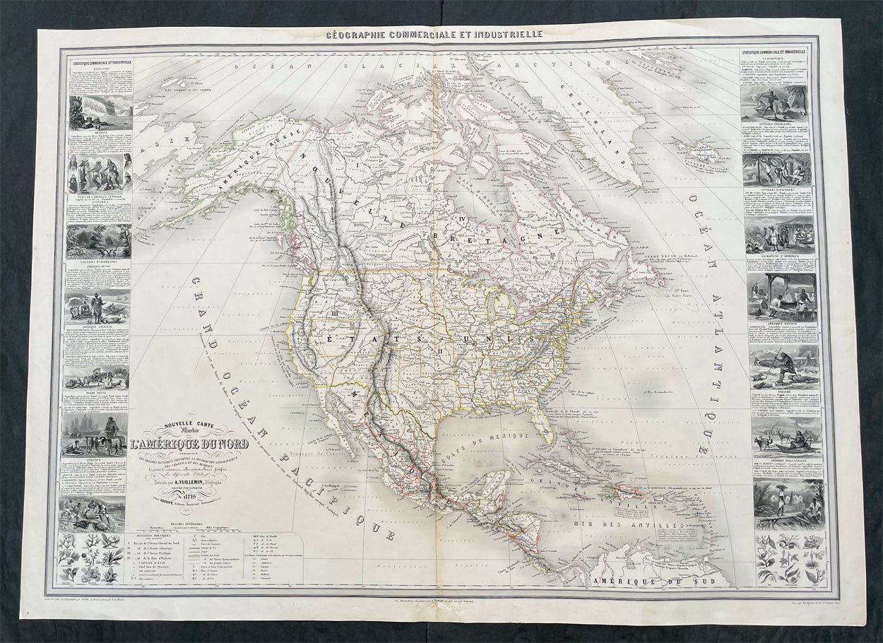
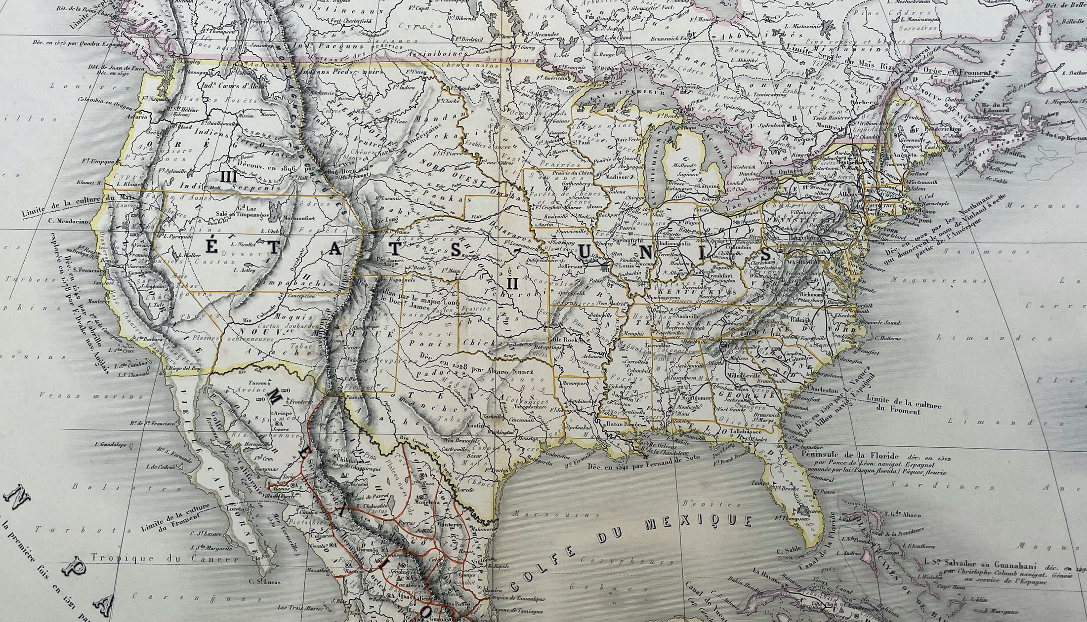
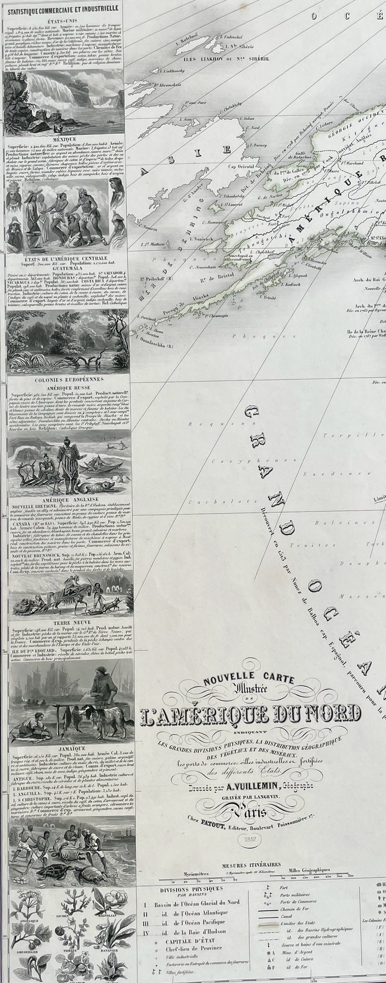
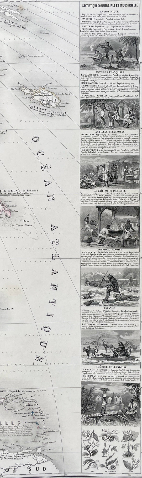
Description:This very large original hand coloured antique lithograph map of North America, with small vignettes of North American peoples surrounding the map, by Alexandre Vuillemin was engraved in 1857, dated in the title, and was published in the 1861 edition of Atlas de geographie commercial et industriel.This World atlas consisted of 8 double page color maps, dated 1857-1858 by A. Vuillemin, engraved by Langevin and printed by Fatout, Paris. The maps include views, statistical tables and legend. Showing political divisions, capitals, industrial cities, towns, the commercial ports, roads, railroads, canals, fortress and geographical distribution of plants and mineral. Relief shown by hachures and pictorially.
General Definitions:Paper thickness and quality: - Heavy and stablePaper color : - off whiteAge of map color: - OriginalColors used: - Yellow, green, blue, pinkGeneral color appearance: - AuthenticPaper size: - 35in x 25 1/2in (890mm x 650mm)Plate size: - 35in x 25 1/2in (890mm x 650mm)Margins: - Min 1/2in (12mm)
Imperfections:Margins: - Small repair to bottom marginPlate area: - NoneVerso: - None
Please note all items auctioned are genuine, we do not sell reproductions. A Certificate of Authenticity (COA) can be issued on request.