Welcome to Classical Images!
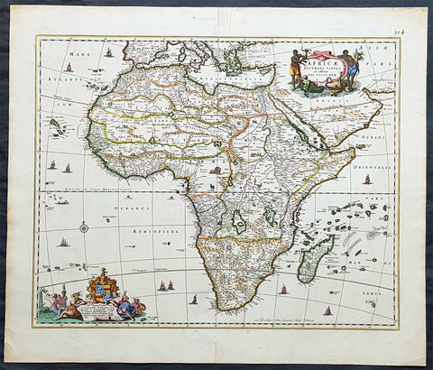
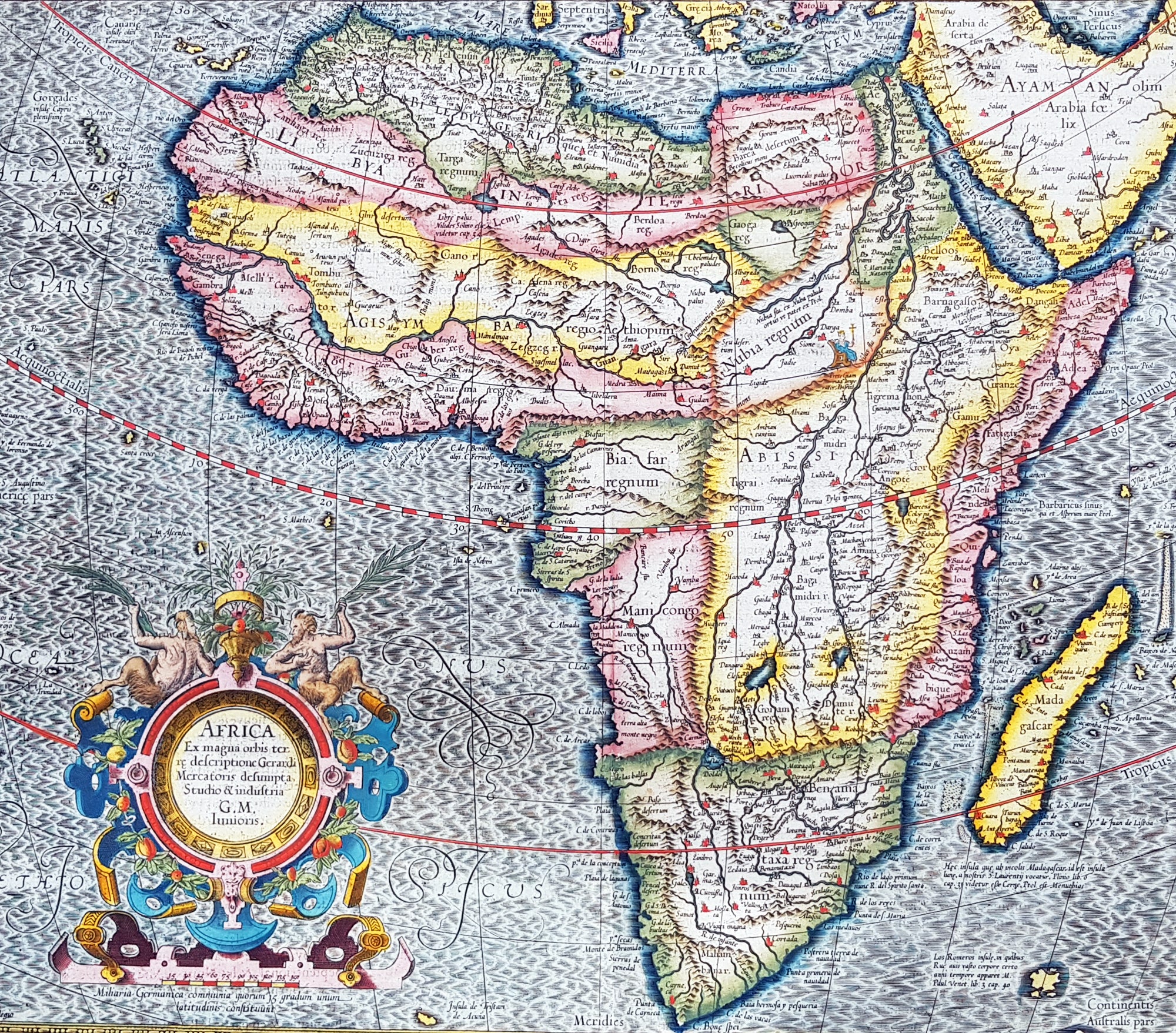
Description:This beautifully hand coloured original antique map of Africa by Gerard Mercator was published by Henricus Hondius in the 1613 French edition of Mercators Atlas, Atlas Sive Cosmographicae Meditationes Illustrissimi Ducis.This map is exceptional with original hand colour, heavy dark impression, clean heavy paper and original margins.As indicated in the title Cartouche, this map this is a reduction by Gerard Mercator Junior of Africa, compiled from Gerard Mercator\'s world map of 1569. This rendition was drawn by Mercator\'s grandson (also named Gerard) in 1595. The map is typical of 16th century cartography of Africa containing some fantastical detail especially in regards to the interior. The depiction of the Nile is based on Ptolemys geography with some complex modifications from various sources, including Abyssinian monks. The source of the Nile is shown as a series of lakes located in the Lune Montes just north of the Tropic of Capricorn. Another branch of the Nile flows from the west, with this system rambling through what is the Sahara Desert. Mercator adds a lake named Sac. Haf lac, from the 1507 Waldseemuller world map. This lake feeds both the Zambere River and the Nile. In Abissini, the legendary Christian King Prester John sits on his throne. The boldly engraved oceans, beautiful calligraphy, and strapwork cartouche (surmounted by two satyrs) make this a decorative masterpiece.
General Definitions:Paper thickness and quality: - Heavy and stablePaper color : - off whiteAge of map color: - OriginalColors used: - Yellow, green, blue, pinkGeneral color appearance: - AuthenticPaper size: - 22in x 18 3/4in (560mm x 475mm)Plate size: - 18 1/2in x 15in (470mm x 380mm)Margins: - Min 1in (25mm)
Imperfections:Margins: - NonePlate area: - NoneVerso: - None
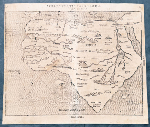
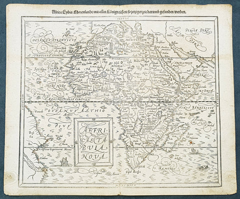
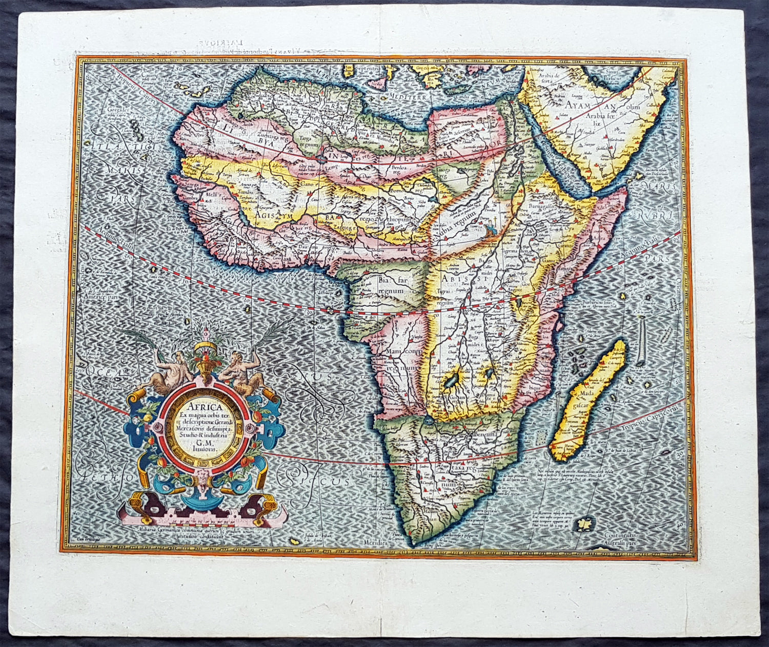
Background: Being part of the Mediterranean world, the northern coasts of the African continent as far as the Straits of Gibraltar and even round to the area of the Fortunate Isles (the Canaries) were reasonably well known and quite accurately mapped from ancient times. In particular, Egypt and the Nile Valley were well defined and the Nile itself was, of course, one of the rivers separating the continents in medieval T-O maps. Through Arab traders the shape of the east coast, down the Red Sea as far as the equator, was also known but detail shown in the interior faded into deserts with occasional mountain ranges and mythical rivers. The southern part of the continent, in the Ptolemaic tradition, was assumed to curve to the east to form a land-locked Indian Ocean. The voyages of the Portuguese, organized by Henry the Navigator in the fifteenth century, completely changed the picture and by the end of the century Vasco da Gama had rounded the Cape enabling cartographers to draw a quite presentable coastal outline of the whole continent, even if the interior was to remain largely unknown for the next two or three centuries.The first separately printed map of Africa (as with the other known continents) appeared in Munster\'s Geographia from 1540 onwards and the first atlas devoted to Africa only was published in 1588 in Venice by Livio Sanuto, but the finest individual map of the century was that engraved on 8 sheets by Gastaldi, published in Venice in 1564. Apart from maps in sixteenth-century atlases generally there were also magnificent marine maps of 1596 by Jan van Linschoten (engraved by van Langrens) of the southern half of the continent with highly imaginative and decorative detail in the interior. In the next century there were many attractive maps including those of Mercator/Hondius (1606), Speed (1627), Blaeu (1 630), Visscher (1636), de Wit (c. 1670), all embellished with vignettes of harbours and principal towns and bordered with elaborate and colourful figures of their inhabitants, but the interior remained uncharted with the exception of that part of the continent known as Ethiopia, the name which was applied to a wide area including present-day Abyssinia. Here the legends of Prester John lingered on and, as so often happened in other remote parts of the world, the only certain knowledge of the region was provided by Jesuit missionaries. Among these was Father Geronimo Lobo (1595-1678), whose work A Voyage to Abyssinia was used as the basis for a remarkably accurate map published by a German scholar, Hiob Ludolf in 1683. Despite the formidable problems which faced them, the French cartographers G. Delisle (c. 1700-22), J. B. B. d\'Anville (1727-49) and N. Bellin (1754) greatly improved the standards of mapping of the continent, improvements which were usually, although not always, maintained by Homann, Seutter, de Ia Rochette, Bowen, Faden and many others in the later years of the century.