Welcome to Classical Images!
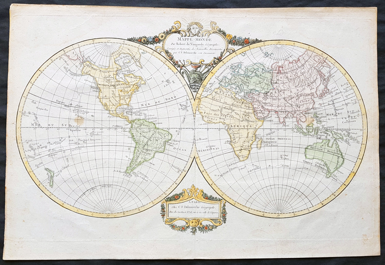
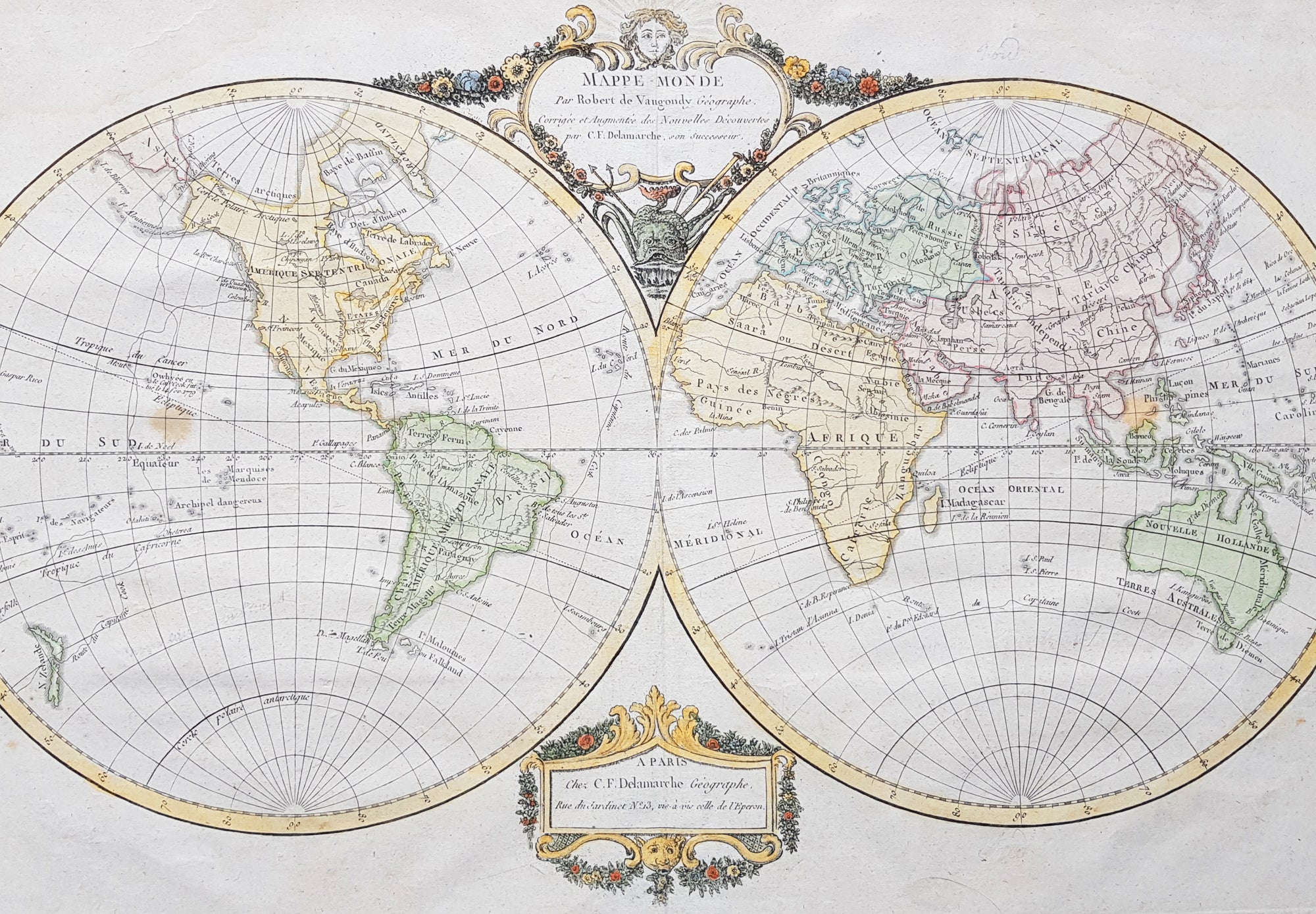
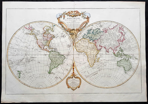
Description:This beautifully hand coloured original copper-plate engraved antique Twin Hemisphere World Map by Robert De Vaugondy was published by Charles Francois Delamarche, De Vaugondy\'s successor, in 1799.
General Definitions:Paper thickness and quality: - Heavy and stablePaper color : - off whiteAge of map color: - OriginalColors used: - Yellow, green, blue, pinkGeneral color appearance: - AuthenticPaper size: - 18in x 12 1/2in (460mm x 310mm)Plate size: - 17 1/2in x 10 3/4in (445mm x 275mm)Margins: - Min 1/2in (12mm)
Imperfections:Margins: - Light age toning in marginsPlate area: - 2 light spots in Pacific & SE AsiaVerso: - None
Background: Fine twin hemisphere world map illustrating the known world at the end of the 18th century. Although almost complete there are a few regions of uncertainty. The route taken by Cook on his final voyage is included which reaches from Australia, New Zealand to Hawaii and the very northern reaches of western North America which were surveyed and mapped by Cook extensively. The recent discovery of Bass Strait separating Tasmania from the mainland of Australia is named and although there is some indication of a northern Arctic region there is no mention of the great southern Antarctica regions. A great map showing the world at the beginning of modern transformation. (Ref: Tooley; M&B)