Welcome to Classical Images!
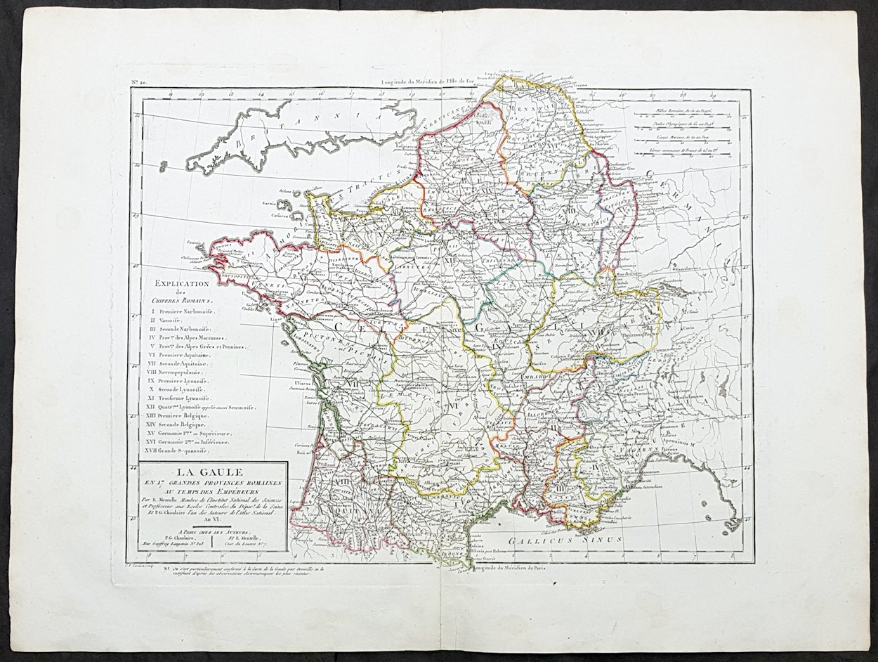
Description:This large original hand coloured antique map of France by Edme Mentelle was engraved by Pierre Tardieu and was published in the 1797 edition of Mentelles Atlas Universal. (Ref: Tooley; M&B)
General Definitions:Paper thickness and quality: - Heavy and stablePaper color : - off whiteAge of map color: - OriginalColors used: - Yellow, green, blue, pinkGeneral color appearance: - AuthenticPaper size: - 23in x 17in (590mm x 435mm)Plate size: - 17 1/2in x 14in (435mm x 355mm)Margins: - Min 1in (25mm)
Imperfections:Margins: - NonePlate area: - NoneVerso: - None
Mentelle, Edme 1730 - 1816Mentelle was a French geographer.Student of Jean-Baptiste Louis Crévier at the Collège de Beauvais (at the time a constituent college of the University of Paris), he found employment with the Ferme générale.The poems and comedic plays he published early in his career were not successful. He turned to the study of geography and taught geography at the École Militaire during the 1760s. During the 1780s he taught geography to the royal household and in 1786 designed a globe, which is still on display in the Dauphins apartments at the Palace of Versailles.A supporter of the French Revolution, he taught at the Écoles centrales and at the École Normale Supérieure. He was elected to the Institut de France in 1795.