Welcome to Classical Images!
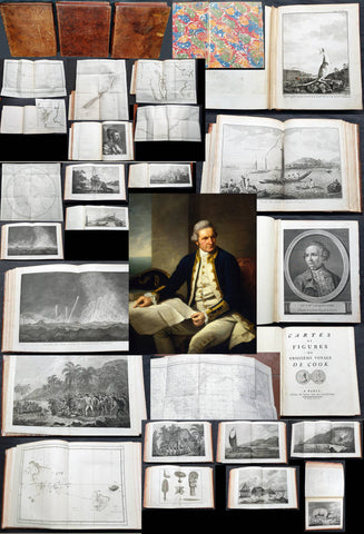
Description:This is an original set of seventeen large first-edition antique prints (Plates #11, 13, 14, 15, 16, 17, 18, 20, 21, 22, 23, 25, 26, 27, 28, 29, 31) a complete visual record of Captain James Cooks third and final visit to the South Pacific, from the Cook islands to the Society Islands, in 1777. The original drawings by John Webber (Cooks official onboard artist) were expertly engraved by William Sharp, William Byrne, James Heath, Isaac Taylor, William Sharp, William Sharp, James hall, William Sharp, William Ellis, Samuel Middleman & James Hall, James Hall, William Woollett, William Byrne, Francesco Bartolozzi, John Keyse Sherwin, Jon Keyse Sherwin, William Byre respectively, for the official, British Admiralty-sanctioned First edition account of Cooks third voyage of discovery: "A Voyage to the Pacific Ocean... In Three Volumes. Vol. I & II and Atlas, written by James Cook & Capt J Clerk, F.R.S. Vol. III in London, 1784.
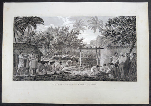
In 1777 Captain James Cook sailed the Resolution and Discovery from New Zealand into the heart of Polynesia, with the artist John Webber recording each landfall. This set of seventeen engravings follows the voyage island by island.At Mangaia in the Cook Islands, reef and surf kept the ships offshore, and only a boat party, including the Tahitian Omai, made contact with the islanders, giving us Plate 11, A Man of Mangea.From April to July the ships stayed in Tonga. At Nomuka the crews traded iron and beads for food, filled the water casks and set up an observatory (Plate 13, A View at Anamooka). At Lifuka the chief Finau welcomed them with a formal reception, boxing matches and night dances by men and by women, which Cook answered with gifts and fireworks (Plates 14 to 17). On Tongatapu Cook spent several weeks in the company of Poulaho, paramount chief of Tonga, who appears in Plate 18 and in Plate 20 drinking kava. Cook visited the sacred burial ground at Mu'a (Plate 21, A Fiatooka) and watched the Natche, a ceremony honoring Poulaho's son (Plate 22), while the ships were repaired and restocked. A short visit to neighboring Eua produced Plate 23, A Woman of Eaoo.In August the ships reached Tahiti, where the crews rested and traded at Matavai Bay. Webber drew the human sacrifice that Cook found so disturbing (Plate 25), the preserved body of the chief Tee (Plate 26), and the dances and portraits of Plates 27 to 29.The voyage closes in October at Huahine, where Cook settled Omai in a house built by the crews, with a garden, livestock and gifts. Plate 31, A View of Huaheine, is the final image in the set.
Together these plates are an eyewitness record of Pacific peoples, ceremonies and landscapes at the moment of first sustained European contact, and a rewarding collection for the historian, university, museum or library. Exceptional and highly sought-after large museum quality prints, perfect for collectors of Captain Cook history, maritime art, and early Australian, Pacific, American & Polar exploration.
General Definitions:Paper thickness and quality: - Heavy and stablePaper color : - off whiteAge of map color: - Colors used: - General color appearance: - Paper size: - 21in x 15 1/2in (535mm x 395mm)Plate size: - Various sizes.Margins: - Min 2in (50mm)
Imperfections:Margins: - Light spotting pl. 11, 29; crease & small repair bottom left margin pl. 23; Plate area: - NoneVerso: - None
Background:Captain James Cook's third and final voyage (1776–1780) set out from Plymouth to search for a Northwest Passage between the Pacific and Atlantic, sailing via the Cape of Good Hope and the Kerguelen Islands before visiting Tasmania and New Zealand and threading through the Pacific islands — Cook Islands, Tonga, Tahiti, and the Society Islands — over the course of 1777. In January 1778 Cook became the first European to reach the Hawaiian Islands, which he named the Sandwich Islands, and from there sailed to the west coast of North America, charting the coastline from Oregon up through Nootka Sound, Unalaska (Alaska), and the Bering Strait into the Arctic Ocean, where pack ice forced him to turn back in August 1778. He wintered in Hawaii, anchoring at Kealakekua Bay in January 1779, where a dispute with islanders turned violent and Cook was killed on 14 February 1779. Command passed to Charles Clerke, who made one more unsuccessful attempt at the Northwest Passage before the expedition sailed home via Kamchatka Peninsula (Russia) , Macau, and the Cape of Good Hope, finally reaching England in October 1780.
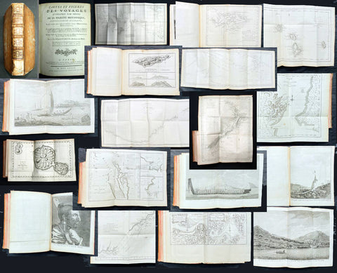
Captain James Cook's third and final voyage A Voyage to the Pacific Ocean... In Three Volumes. Vol. I & II and Atlas, was illustrated in the original 1784/5 atlas containing 2 maps and 61 prints, engraved after John Webber's drawings (Cooks official artist on the voyage) by various engravers. Below is each location visited by Cook and later Capt. Clerk with the dates and corresponding prints.
Kerguelen Islands (Christmas Harbour) — 25 December 1776 • Plate 4 — A View of Christmas Harbour, in Kerguelen's Land
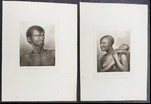
Van Diemen's Land (Tasmania), Adventure Bay — January 1777 • Plate 6 — A man of Van Diemen's Land • Plate 7 — A woman of Van Diemen's Land • Plate 8 — An opossum of Van Diemen's Land
Queen Charlotte Sound, New Zealand — February 1777 • Plate 10 — The Inside of a Hippah in New Zeeland
Mangaia, Cook Islands — March–April 1777 • Plate 11 — A man of Mangea
Tongan (Friendly) Islands — April–July 1777 • Plate 13 — A view at Anamooka • Plate 14 — The reception of Captain Cook, in Hapaee • Plate 15 — A boxing match, in Hapaee • Plate 16 — A night dance by men, in Hapaee • Plate 17 — A night dance by women, in Hapaee • Plate 18 — Poulaho, King of the Friendly Islands • Plate 20 — Poulaho, King of the Friendly Islands, drinking kava • Plate 21 — A Fiatooka (Morai), in Tongataboo • Plate 22 — The Natche, a ceremony in Tongataboo • Plate 23 — A woman of Eaoo
Tahiti (Otaheite) — August 1777• Plate 25 — A human sacrifice, in a marai • Plate 26 — The body of Tee, a chief, as preserved after death • Plate 27 — A young woman of Otaheite, bringing a present • Plate 28 — A dance in Otaheite • Plate 29 — A young woman of Otaheite, dancing
Huahine, Society Islands — October–November 1777 • Plate 31 — A view of Huaheine
Christmas Island (Kiritimati) — December 1777 • Discovered on this leg of the voyage; not separately plated
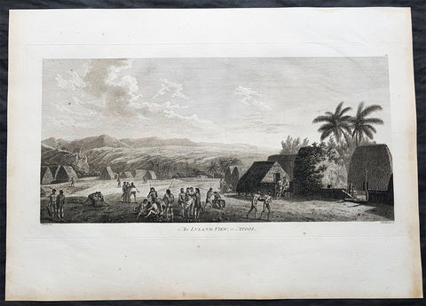
Kauai (Atooi), Hawaiian Islands — January 1778 (first European landfall in Hawaii) • Plate 33 — A Morai, in Atooi • Plate34 — The inside of the house, in the Morai • Plate 35 — An inland view, in Atooi
Nootka Sound, Vancouver Island — March–April 1778 • Plate 38 — A man of Nootka Sound • Plate 39 — A woman of Nootka Sound • Plate 40 — Various articles, at Nootka Sound • Plate 41 — A view of the habitation in Nootka Sound • Plate 42 — The inside of a house in Nootka Sound • Plate 43 — A sea otter
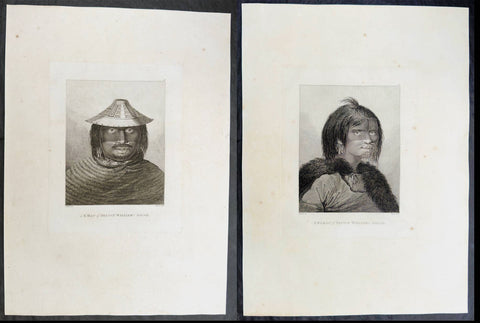
Prince William Sound, Alaska — May 1778• Plate 45 — A view of Snug Corner, in Prince William Sound • Plate 46 — A man of Prince William Sound • Plate 47 — A woman of Prince William Sound
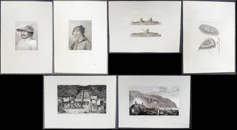
Unalaska (Oonalashka) — June and October 1778 • Plate 48 — A man of Oonalashka • Plate 49 — A woman of Oonalashka • Plate 50 — Canoes of Oonalashka • Plate 56 — Caps of the natives of Oonalashka • Plate 57 — Natives of Oonalashka, and their habitations • Plate 58 — The inside of a house, in Oonalashka
Norton Sound and the Chukchi Coast, Siberia — August 1778 • Plate 51 — The Tschuktschi, and their habitations • Plate 54 — Inhabitants of Norton Sound and their habitations
Arctic Ocean, near the Bering Strait — August 1778 (Cook turned back by ice) • Plate 52 — Sea horses (walruses)
Kealakekua Bay, Hawaii (Owyhee) — January–February 1779 (Cook killed 14 February 1779) • Plate 60 — An offering before Captain Cook, in the Sandwich Islands • Plate 61 — Tereoboo, King of Owyhee, bringing presents to Captain Cook • Plate 62 — A man of the Sandwich Islands, dancing • Plate 63 — A young woman of the Sandwich Islands • Plate 64 — A man of the Sandwich Islands, with his helmet • Plate 65 — A canoe of the Sandwich Islands, the rowers masked • Plate 66 — A man of the Sandwich Islands, in a mask • Plate 67 — Various articles, at the Sandwich Islands • Plate 68 — A view of Karakakooa, in Owyhee
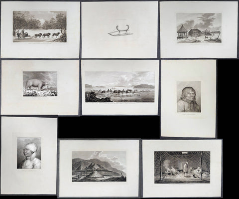
Kamchatka, St Peter and St Paul Harbour (Petropavlovsk) — spring and summer 1779 • Plate 70 — A man of Kamtschatka, travelling in winter - 16in x 10in (405mm x 255mm)• Plate 71 — A sledge of Kamtschatka - 10in x 7 1/2in (255mm x 190mm)• Plate 72 — A view at Bolcheretzkoi, in Kamtschatka - 13 1/2in x 9 1/2in (345mm x 240mm)• Plate 73 — A white bear - 10 1/2in x 8 1/2in (265mm x 215mm)• Plate 74 — A view of the town and harbour of St Peter and St Paul - 20 1/2in x 10in (520mm x 255mm)• Plate 75 — A man of Kamtschatka - 12in x 9 1/2in (305mm x 240mm)• Plate 76 — A woman of Kamtschatka - 12in x 9 1/2in (305mm x 240mm)• Plate 77 — Summer and winter habitations, in Kamtschatka - 16in x 9 1/2in (405mm x 240mm)• Plate 78 — The inside of a winter habitation in Kamtschatka - 16 1/2in x 10in (420mm x 255mm)
Return to England — October 1780John Webber (1751–1793) was a Swiss-born British artist who served as the official expedition artist on Cook's third voyage, tasked with visually documenting the peoples, landscapes, and events the ships encountered. His drawings — later engraved as the 61 plates in the atlas accompanying the 1784 official account — provided some of the first detailed European depictions of Hawaii, the Pacific Northwest coast, and other Pacific and Arctic locales, including the scene of Cook's death at Kealakekua Bay. Webber was elected a full Royal Academician in 1791 and continued to exhibit landscape work until his death in 1793.