Welcome to Classical Images!
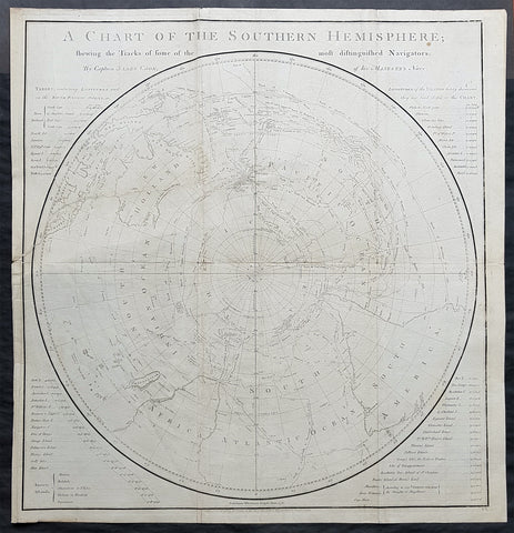
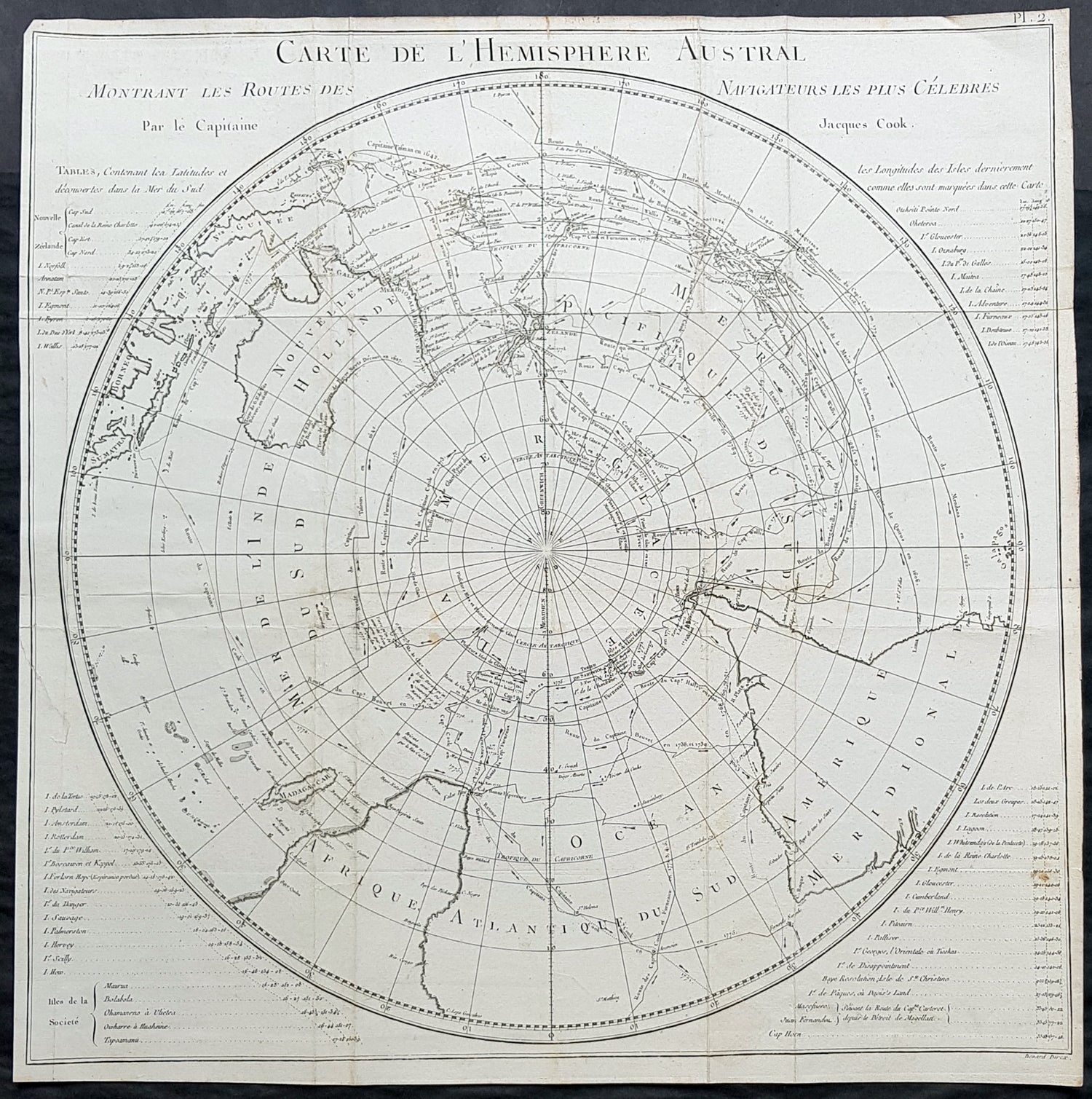
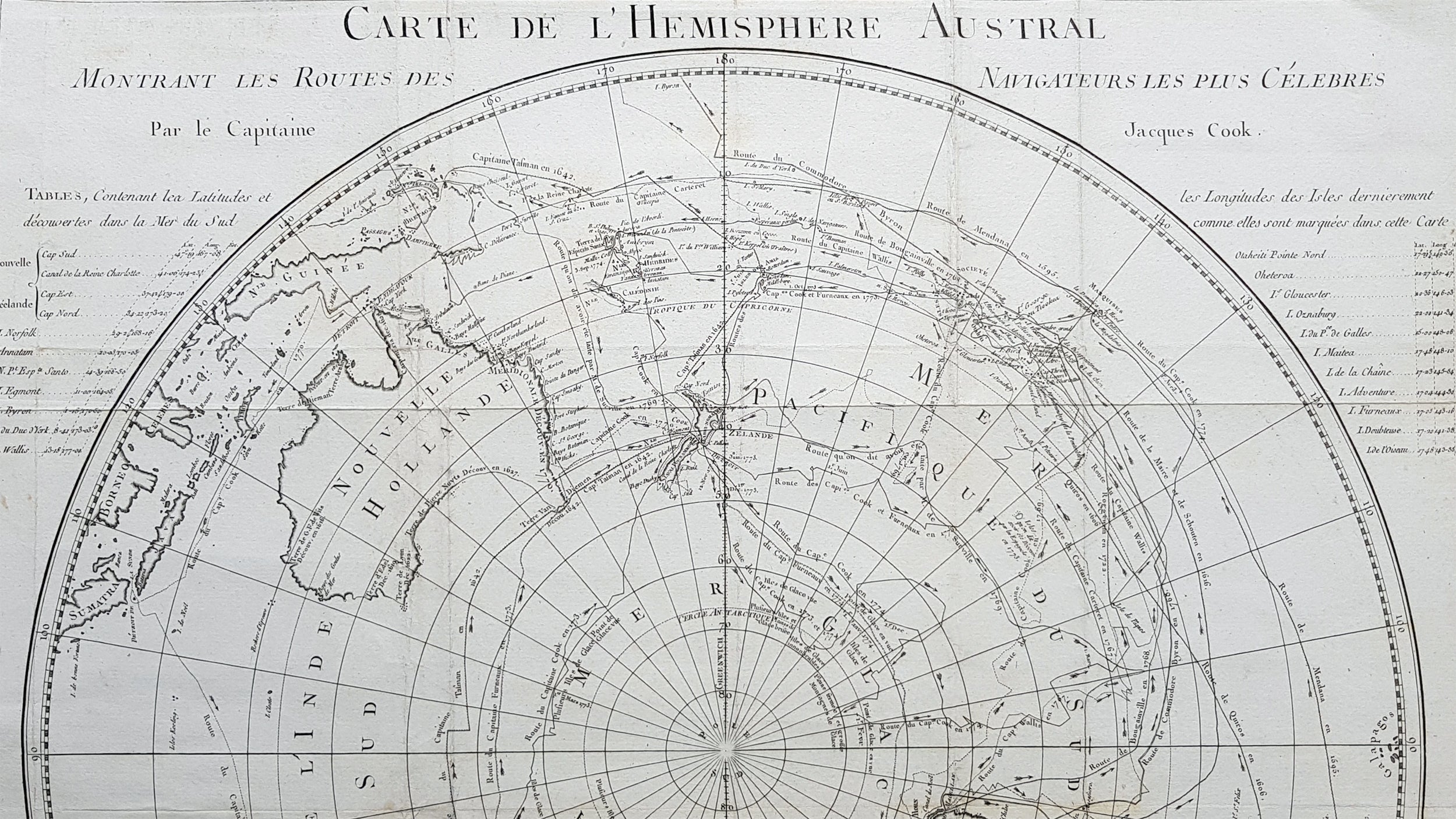
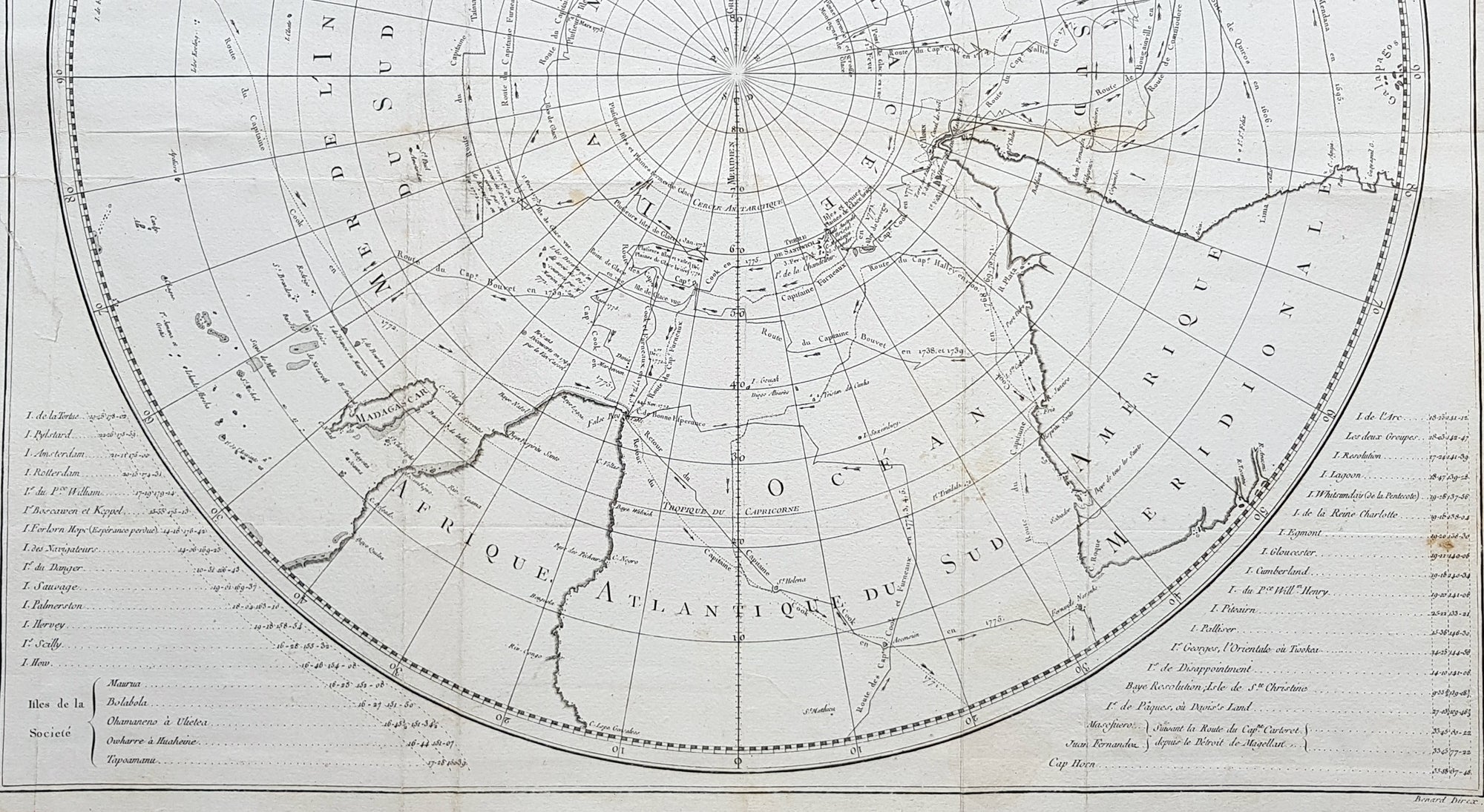
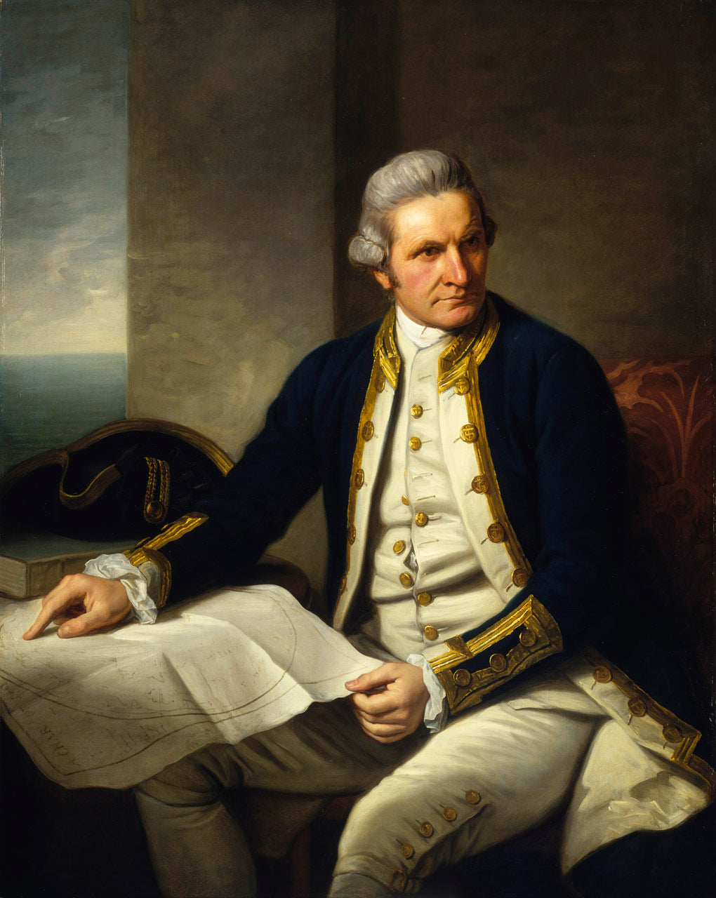
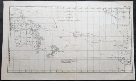
Description:This fine original copper-plate engraved, antique map, a chart of the Southern Hemisphere, was engraved by Robert Benard and is dedicated to the discoveries in the South Seas and Antarctic Regions of Captain James Cook during his second Voyage of Discovery between 1772 & 1775. By comparison the tracks of 11 other explorers are included, from the 16th to the 18th centuries. The map by Captain James Cook was published in the 1778 French edition of A voyage towards the South Pole, and round the World. Performed in His Majestys ships the Resolution and Adventure, in the years 1772, 1773, 1774, and 1775..... Paris : Hotel de Thou ......1778This map is unique in another way, as the English edition of this map was used as a prop, by Nathaniel Dance, in his 1776 portrait of Captain James Cook. Please also see above for the portrait. The 11 other explorers and their tracks around the Southern Hemisphere are;1. Mendana in 15952. Quiros in 16063. Le Maire & Schouten in 16164. Tasman in 16425. Halley in 17006. Roggewein in 17227. Bouvet in 1738-398. Byron in 17659. Wallis in 176710. Bougainville in 176811. Surville in 176912. Cooks first and second voyages.
General Definitions:Paper thickness and quality: - Heavy and stablePaper color : - off whiteAge of map color: -Colors used: -General color appearance: -Paper size: - 22in x 21 1/2in (560mm x 545mm)Plate size: - 22in x 21 1/2in (560mm x 545mm)Margins: - Min 1/2in (12mm)
Imperfections:Margins: - Repair without loss to left of imagePlate area: - Folds as issued, light creasing along foldsVerso: - Folds as issued, light creasing along folds
Background: This map by James Cook, was published as the premier map of his second voyage to the Southern Hemisphere, dispelling forever the myth of the Great Southern Land and showing the true cartographic nature of the southern hemisphere dominated by Australia & New Zealand. The map on a South Polar Projection also shows South America, the South Atlantic Ocean, South Africa, Madagascar, Australia - with Tasmania still joined to the mainland - New Zealand and the southern Pacific Ocean with islands.Engraved within the explorer\\\'s tracks are the dates of their voyages and ships tracks are particularly noted around the Antarctic Circle with notations of ice fields seen during the voyages.John Hawkesworth An English writer and journalist, Hawkesworth was commissioned by the British Admiralty to edit for publication the narratives of its officers’ circumnavigations. He was given full access to the journals of the commanders and the freedom to adapt and re-tell them in the first person. Cook was already on his way back from his second Pacific voyage, temporarily docked at Cape Town (South Africa), when he first saw the published volumes: he was mortified and furious to find that Hawkesworth claimed in the introduction that Cook had seen and blessed (with slight corrections) the resulting manuscript. (In his defense, Hawkesworth also had been a victim of misunderstanding.) Cook had trouble recognizing himself. Moreover, the work was full of errors and commentary introduced by Hawkesworth and, in Cook’s view, too full of Banks, who had promoted himself and the publication. Still, the work was popular; the first edition sold out in several months.Robert Bénard 1734 – 1777 was an 18th-century French engraver.Specialized in the technique of engraving, Robert Ménard is mainly famous for having supplied a significant amount of plates (at least 1,800) to the Encyclopédie by Diderot & d Alembert from 1751.Later, publisher Charles-Joseph Panckoucke reused many of his productions to illustrate the works of his catalog.