Welcome to Classical Images!
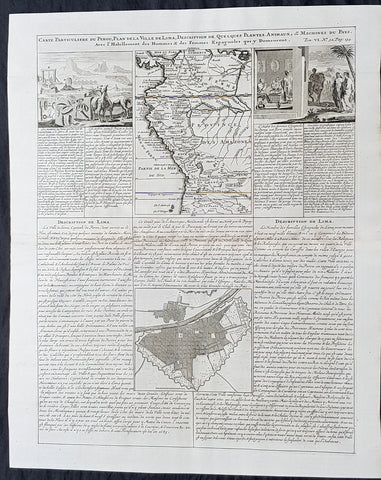
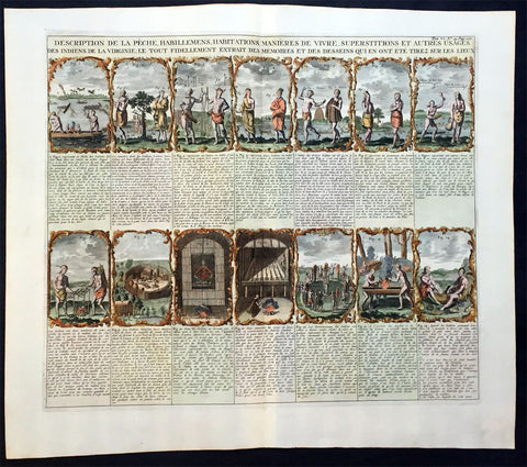
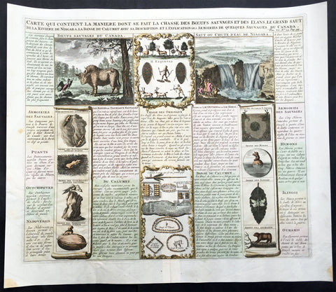
Description: This finely engraved hand coloured original antique map, view & plan of Lima, Peru, Colombia and central South America was published as part of Henri AbrahamChatelain's 1719 edition of Atlas Historique. As with all Chatelain's maps & views this is finely engraved with a large amount of topographical, political and historical detail.
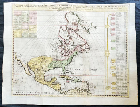
The Atlas Historique published by Henri Chatelain was part of a major work of its time, an encyclopedia in seven volumes, including geography as one of its main subjects. The text was by Nicholas Gueudeville and the maps by Chatelain. The Atlas included one of the finest map of America (four sheets) surrounded by vignettes and decorative insets.The Atlas Historique was completed between 1705 and 1720, further issues were published up to 1739. The series was published in Amsterdam, with Chatelain’s maps based on those of G. Delisle. (Ref: M&B; Tooley)
General Description: Paper thickness and quality: - Heavy and stable Paper color: - White Age of map color: - later Colors used: - Yellow, green, blue, pink General color appearance: - Authentic Paper size: - 21in x 17in (535mm x 430m) Plate size: - 19 1/2in x 15in (490mm x 380mm) Margins: - min. 1in (25mm) Imperfections: Margins: - None Plate area: - None Verso: - None