Welcome to Classical Images!
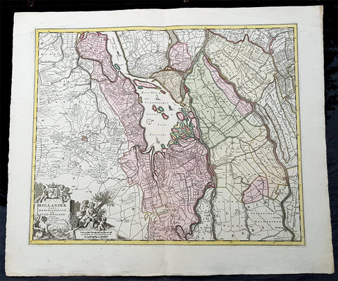
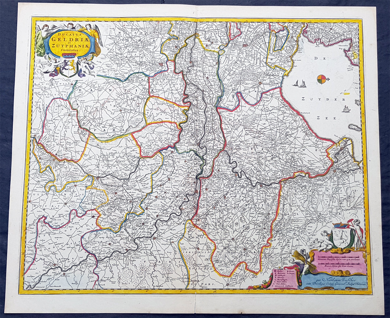
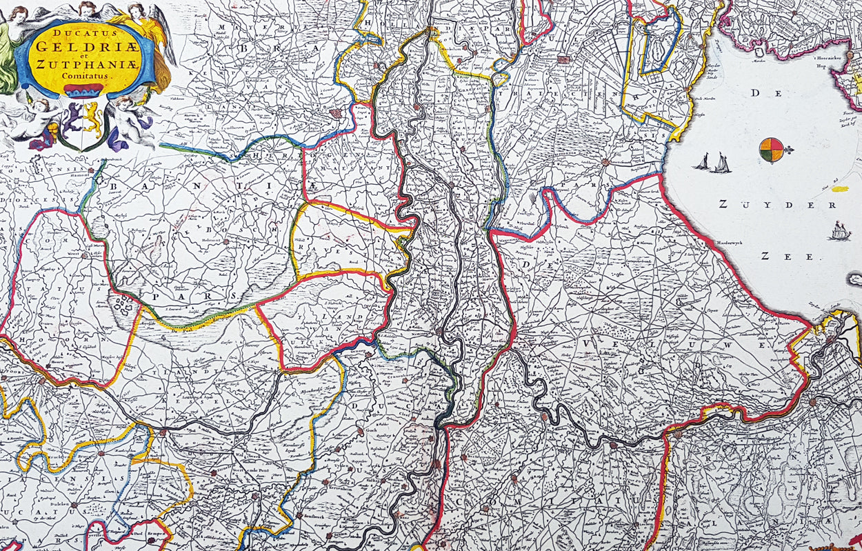
Description:This large rare hand coloured original antique map of the Duchy of Guelders and the County of Zutphen was published by Nicholas Visscher II in the 1690 edition of Atlas minor sive totius orbis terrarum contracta delinea ex conatibus Nico. Visscher.A rare and decorative map of Geldern oriented to the west, covering an area from Amsterdam to the west to Vreden in the east and from Montfoort in the south to Campden in the north.
General Definitions:Paper thickness and quality: - Heavy and stablePaper color : - off whiteAge of map color: - OriginalColors used: - Yellow, green, blue, pinkGeneral color appearance: - AuthenticPaper size: - 24in x 20 1/2in (610mm x 520mm)Plate size: - 22 1/2in x 18 1/2in (565mm x 470mm)Margins: - Min 1/2in (12mm)
Imperfections:Margins: - NonePlate area: - NoneVerso: - None
Background:Guelders or Gueldres is a historical county, later duchy of the Holy Roman Empire, located in the Low Countries.The County of Zutphen, located in modern-day Gelderland, a province of the Netherlands, was formed in the eleventh century as a fief of the Bishop of Utrecht. It was ruled by the Counts of Zutphen between 1018 and 1182, and then formed a personal union with Guelders. Later, it became one of the 4 quarters of Guelders. The name Graafschap (county) is still used for the Achterhoek, the region east of Zutphen, and for the football club De Graafschap from this region.