Welcome to Classical Images!
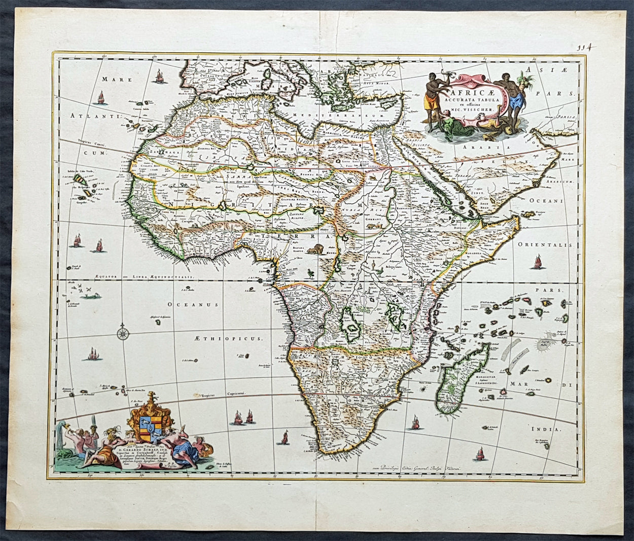
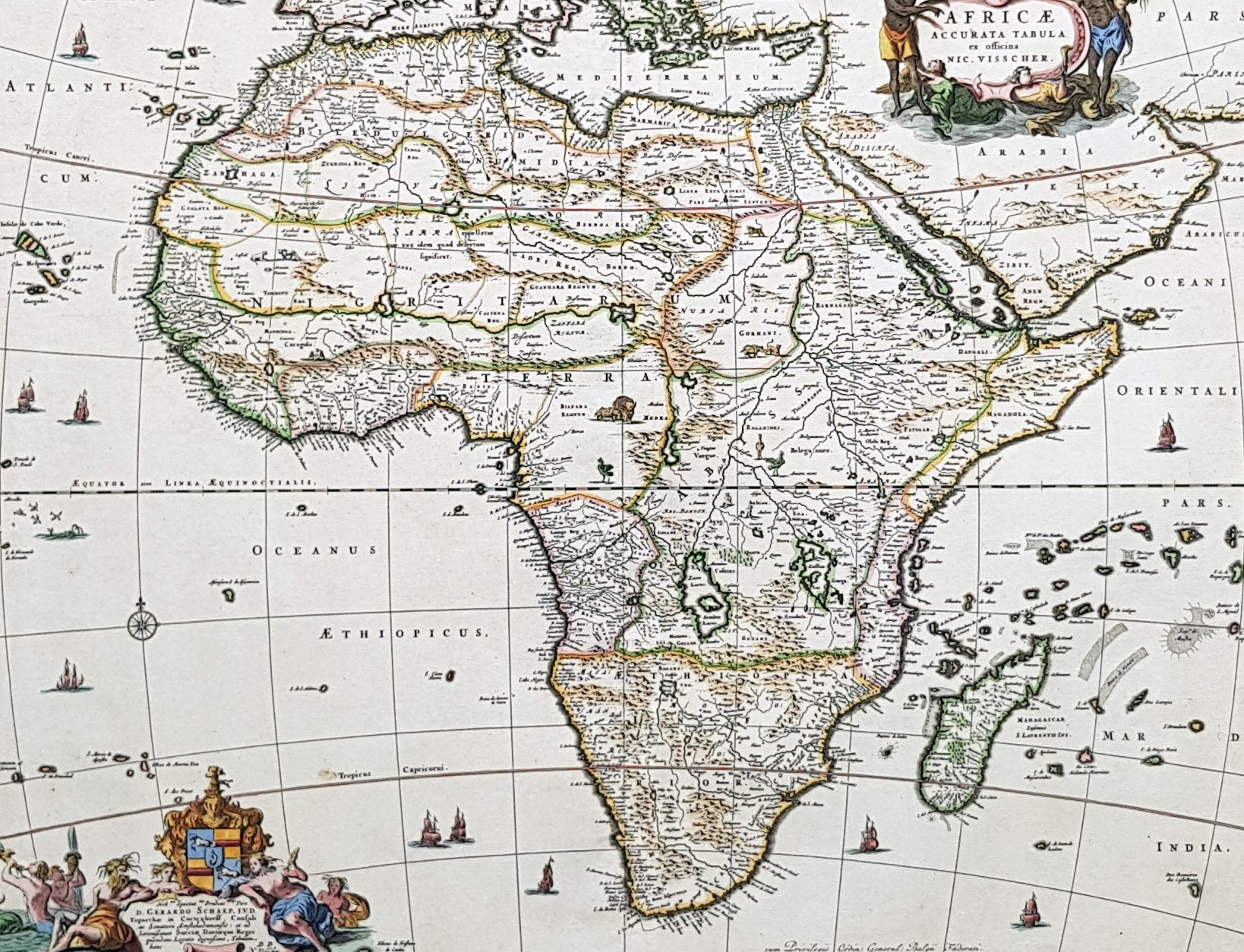
Description: This large beautifully hand coloured original antique map of Africa was published by Nicholas Visscher in 1690. This is a fine map with beautiful hand colouring on strong sturdy paper with original margins & a fresh deep impression denoting an early pressing.
General Description: Paper thickness and quality: - Heavy and stable Paper color: - off white Age of map color: - Original Colors used: - Red, yellow, green, blue General color appearance: - Authentic Paper size: - 24 1/2in x 21in (620mm x 535mm) Plate size: - 21 1/2in x 17 1/4in (540mm x 435mm) Margins: - Min 1in (25mm)
Imperfections: Margins: - Top margin repair, no loss Plate area: - None Verso: - Old tape top & bottom margin not affecting the image
Background: The first separately printed map of Africa (as with the other known continents) appeared in Munster's Geographia from 1540 onwards and the first atlas devoted to Africa only was published in 1588 in Venice by Livio Sanuto, but the finest individual map of the century was that engraved on 8 sheets by Gastaldi, published in Venice in 1564. Apart from maps in sixteenth-century atlases generally there were also magnificent marine maps of 1596 by Jan van Linschoten (engraved by van Langrens) of the southern half of the continent with highly imaginative and decorative detail in the interior. In the next century there were many attractive maps including those of Mercator/Hondius (1606), Speed (1627), Blaeu (1 630), Visscher (1636), de Wit (c. 1670), all embellished with vignettes of harbours and principal towns and bordered with elaborate and colourful figures of their inhabitants, but the interior remained uncharted with the exception of that part of the continent known as Ethiopia, the name which was applied to a wide area including present-day Abyssinia. Here the legends of Prester John lingered on and, as so often happened in other remote parts of the world, the only certain knowledge of the region was provided by Jesuit missionaries. Among these was Father Geronimo Lobo (1595-1678), whose work A Voyage to Abyssinia was used as the basis for a remarkably accurate map published by a German scholar, Hiob Ludolf in 1683. Despite the formidable problems which faced them, the French cartographers G. Delisle (c. 1700-22), J. B. B. d'Anville (1727-49) and N. Bellin (1754) greatly improved the standards of mapping of the continent, improvements which were usually, although not always, maintained by Homann, Seutter, de Ia Rochette, Bowen, Faden and many others in the later years of the century. (M&B; Tooley)