Welcome to Classical Images!
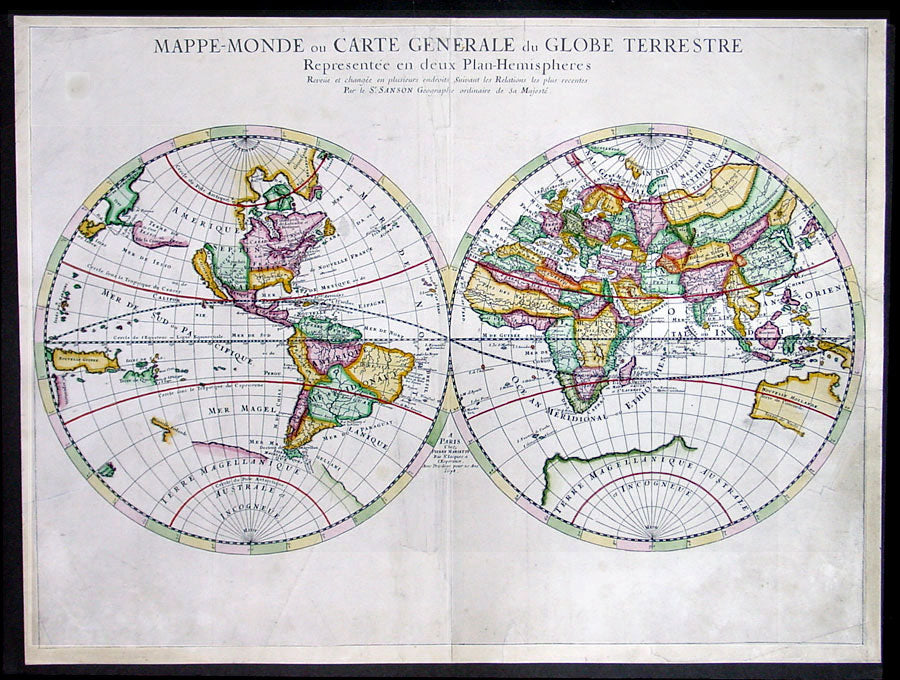
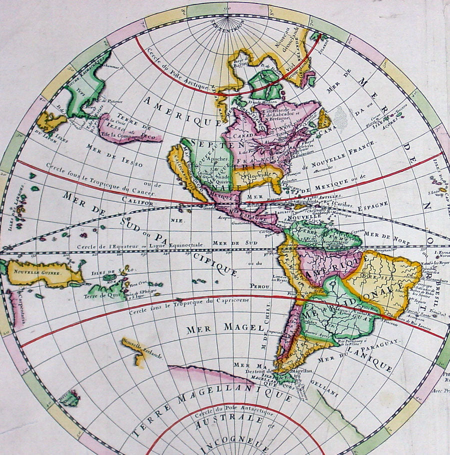
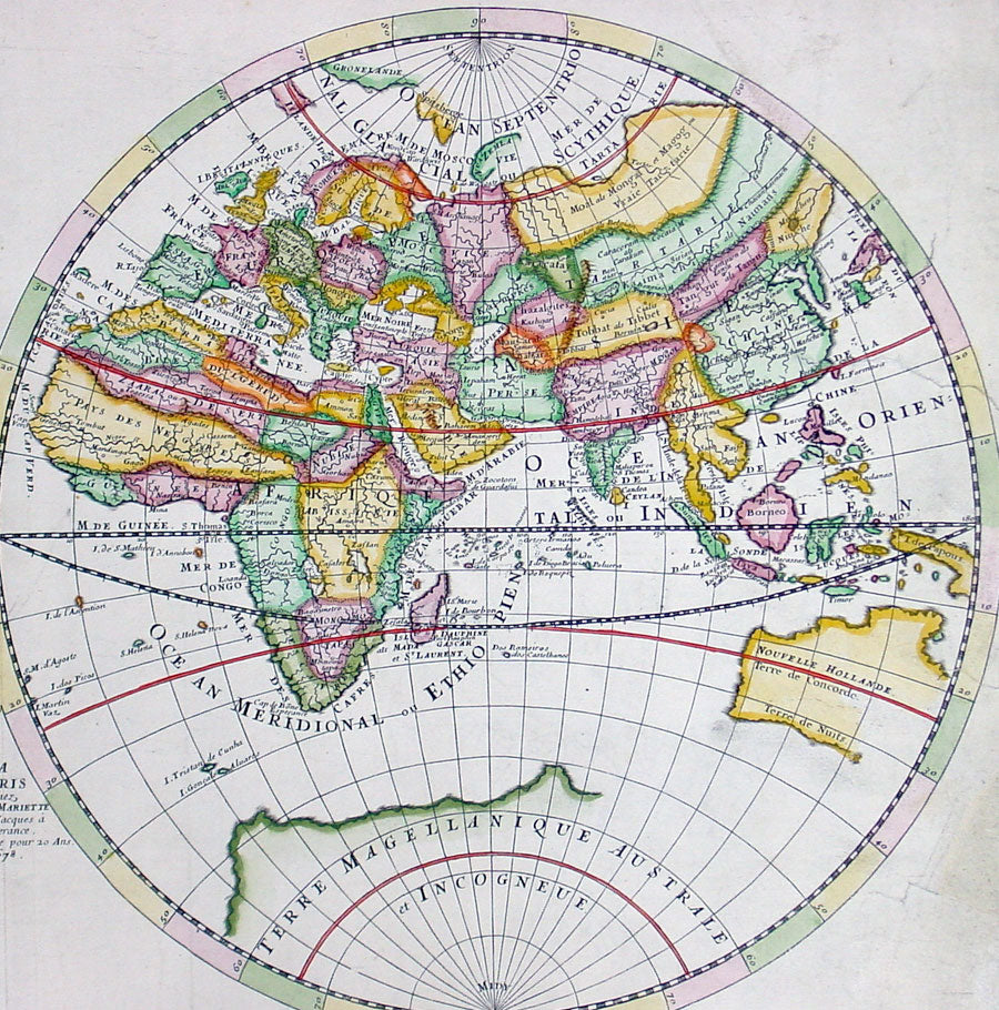
Description: This large beautifully hand coloured originalantique Twin Hemisphere World Map was engraved by Pierre Mariette and published by Guillaume Sanson in 1678 - dated. This elegant map is a progression of Nicolas Sanson's Twin Hemisphere World map of 1651. Nicolas drew this map for his 1660 atlas, and after his death in 1667, his sons Guillaume and Adrien used it in their atlases of 1669 and 1678. This edition shows Australia with more definition, this along with Tasmania's coast and a small portion of New Zealand's coastline.
Background: This map is the first to indicate N. Danemarckwest of the Hudson Bay, here named Mer Christiane. California is shown as an island, and Acoma and Santa Fe are noted in the Southwest, with Acoma shown correctly atop a mesa. The coastline of Asia is shown with the discoveries of the De Vries noted, including Terre de Iesso or Ieco, and a land called Yupi. The Great Lakes are not updated from the 1651 version, and do not show all five lakes. The map is typical of Sanson's "scientific" style of cartography with no decorative elements. It was published in conjunction with Pierre Mariette (father and son), who published many of Sanson's works after 1645. (Ref: Shirley; Tooley; Koeman)
General Description: Paper thickness and quality: - Heavy and stable Paper color: - White Age of map color: - Early Colors used: - Yellow, green, pink General color appearance: - Authentic Paper size: - 23 1/2in x 17 1/2in (600mm x 445mm) Plate size: - 23 1/2in x 15 1/2in (600mm x 395mm) Margins: - Min 1/2in (12mm)
Imperfections: Margins: - Light soiling Plate area: - Light soiling, professional repair to & adjacent to centerfold Verso: - None