Welcome to Classical Images!
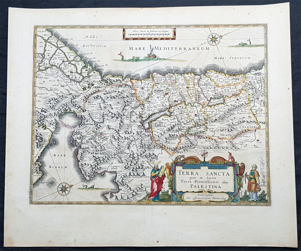
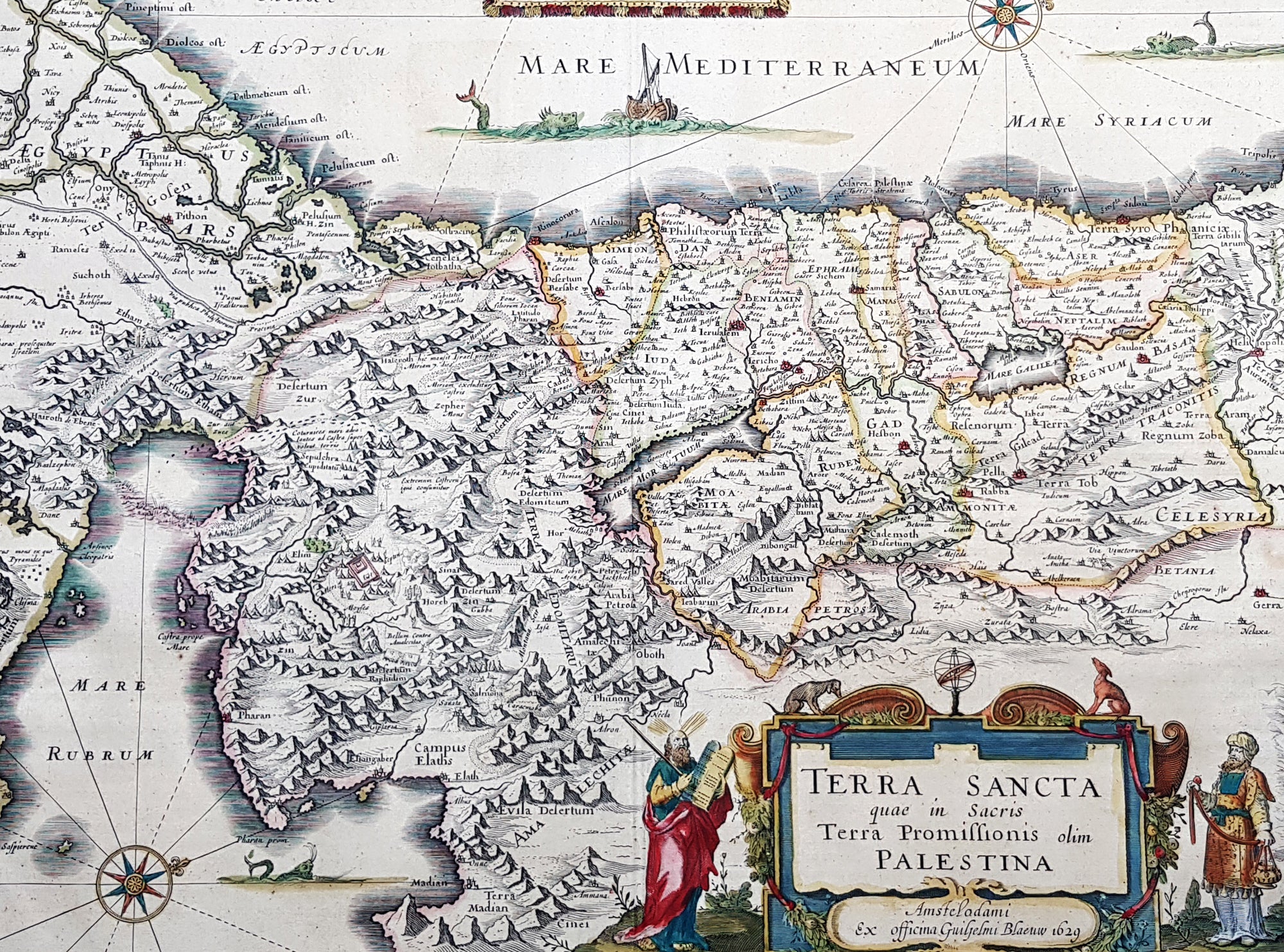
Description:This magnificent original copper plate engraved antique map of the Holy Land, Terra Sancta, Palestine was one of the very few dated maps printed by Willem Blaeu. The map was engraved by Jodocus Hondius the younger and published by Willem Blaeu in the 1643 French edition of Atlas Novus.
General Definitions:Paper thickness and quality: - Heavy and stablePaper color : - off whiteAge of map color: - OriginalColors used: - Blue, pink, red, green, yellowGeneral color appearance: - AuthenticPaper size: - 23 1/2in x 20in (590mm x 495mm)Plate size: - 20in x 15 1/4in (505mm x 384mm)Margins: - Min 1in (25mm)
Imperfections:Margins: - NonePlate area: - NoneVerso: - None
Background:This is one of the very few maps published in Blaeus Atlas that bears a date. It was actually made by Jodocus Hondius the younger in 1629, but was not printed until after the plate was purchased by Willem Blaeu (who added his imprint in the lower part of the cartouche)At this time, many of the maps of Palestine were oriented to show the east at the top to focus on Jerusalem. Here, the orientation is inverted so that Blaeus map shows Palestine as it might have been viewed by Moses from the top of Mt Pisgah. The decorative features are Old Testament in inspiration: Moses holding the Tablets of the Law, stands to the left of the cartouche, Aaron to the right, while in the Mediterranean Jonah is about to be swallowed by the whale and in the Sinai is shown the route of the Exodus. In the Red Sea at Yam Suf, Pharaohs armies are shown drowning. The lands of the Twelve Tribes are shown straddling both banks of the Jordan and the city of Jerusalem can be seen occupying a place of honour in the upper centre of the map.The geographical detail of the map is taken from an large inset on a large map of Palestine by the traveller Pieter Laicksteen and the mapmaker to Phillip II of Spain, Christian s Grooten, published at Antwerp in 1570. This inset map, its importance recognised by Hondius and by Blaeu, was unorthodox in its treatment of the outline of the Red Sea and its triangular outline for the Sinai peninsula - lone before either was finally admitted by mapmakers as more accurate than traditionally accepted versions.The Blaeus retained this map for all editions of the firms atlas for more than thirty years from 1630, even though the rival publisher Johannes Jansson issued a more detailed seven sheet map of the region in his own atlas.