Welcome to Classical Images!
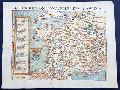
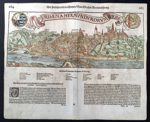
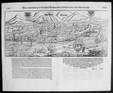
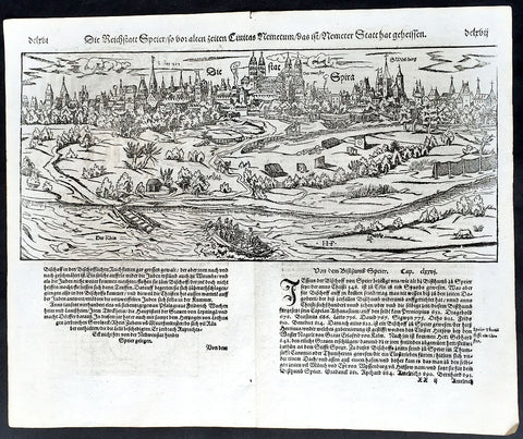
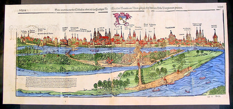
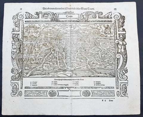
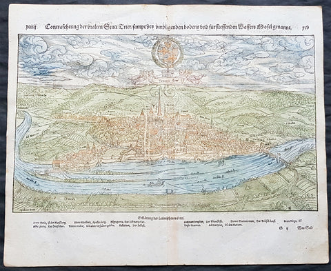
Description:This fine original wood block engraved antique map a birds eye view of the French city of Lyon in the Auvergne-Rhône-Alpes region was published in the French Section of Sebastian Munsters 1628 edition of Cosmographia, Das ist: Beschreibung der gantzen Welt, Darinnen Aller Monarchien Keyserthumben, Königreichen, Fürstenthumben, Graff- und Herrschafften, Länderen, Stätten und Gemeinden.Ursprung (Cosmographia, that is: description of the whole world, in it all monarchies Keyser thumben, kingdoms, prince thumben, graff and herrschafften, countries, places and municipalities.)Lyon is the third-largest city and second-largest urban area of France. It is located in the country\'s east-central part at the confluence of the rivers Rhône and Saône, about 470 km south from Paris, 320 km north from Marseille and 56 km northeast from Saint-Étienne.Fernand Braudel remarked, Historians of Lyon are not sufficiently aware of the bi-polarity between Paris and Lyon, which is a constant structure in French development...from the late Middle Ages to the Industrial Revolution. In the late 15th century, the fairs introduced by Italian merchants made Lyon the economic counting house of France. Even the Bourse (treasury), built in 1749, resembled a public bazaar where accounts were settled in the open air. When international banking moved to Genoa, then Amsterdam, Lyon remained the banking centre of France.During the Renaissance, the citys development was driven by the silk trade, which strengthened its ties to Italy. Italian influence on Lyon\'s architecture is still visible among historic buildings. In the later 1400s and 1500s Lyon was also a key centre of literary activity and book publishing, both of French writers (such as Maurice Scève, Antoine Heroet, and Louise Labé) and of Italians in exile (such as Luigi Alamanni and Gian Giorgio Trissino).In 1572, Lyon was a scene of mass violence by Catholics against Protestant Huguenots in the St. Bartholomews Day Massacre. Two centuries later, Lyon was again convulsed by violence when, during the French Revolution, the citizenry rose up against the National Convention and supported the Girondins. The city was besieged by Revolutionary armies for over two months before surrendering in October 1793. Many buildings were destroyed, especially around the Place Bellecour, while Jean-Marie Collot d Herbois and Joseph Fouché administered the execution of more than 2,000 people. The Convention ordered that its name be changed to Liberated City and a plaque was erected that proclaimed Lyons made war on Liberty; Lyons no longer exists. A decade later, Napoleon ordered the reconstruction of all the buildings demolished during this period.The city became an important industrial town during the 19th century. In 1831 and 1834, the canuts (silk workers) of Lyon staged two major uprisings for better working conditions and pay. In 1862, the first of Lyons extensive network of funicular railways began operation.
General Definitions:Paper thickness and quality: - Heavy and stablePaper color : - off whiteAge of map color: -Colors used: -General color appearance: -Paper size: - 17in x 15in (435mm x 380mm)Plate size: - 17in x 15in (435mm x 380mm)Margins: - Min 1/2in (10mm)
Imperfections:Margins: - NonePlate area: - NoneVerso: - None
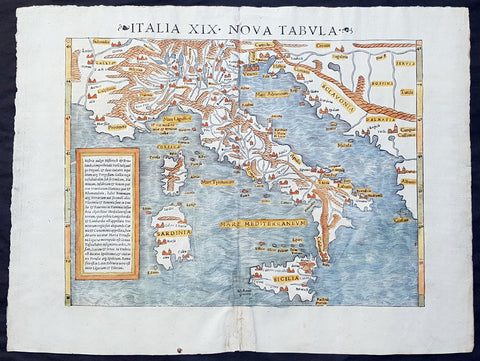
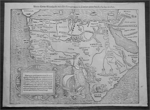
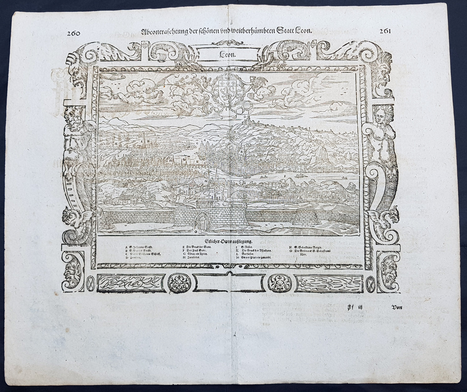
Background: Cosmographia, Das ist: Beschreibung der gantzen Welt, Darinnen Aller Monarchien Keyserthumben, Königreichen, Fürstenthumben, Graff- und Herrschafften, Länderen, Stätten und Gemeinden.Ursprung, Regiment, Reichthumb, Gewalt und.Beschaffenheit. Dessgleichen Aller deren, beyder Ständen, Regenten: Keysern, Königen, Bäpsten, Bischoffen.Genealogien und Stammbäumen.zusammen getragen. by Sebastian Münster was first published in 1544 and is the earliest German-language description of the world. It had numerous editions in different languages including Latin, French (translated by François de Belleforest), Italian, English, and Czech. The last German edition was published in 1628, long after Munsters death. The Cosmographia was one of the most successful and popular books of the 16th century. It passed through 24 editions in 100 years. This success was due to the notable woodcuts (some by Hans Holbein the Younger, Urs Graf, Hans Rudolph Manuel Deutsch, and David Kandel). It was most important in reviving geography in 16th-century Europe. Among the notable maps within Cosmographia is the map Tabula novarum insularum, which is credited as the first map to show the American continents as geographically discrete.Munsters earlier geographic works were Germania descriptio (1530) and Mappa Europae (1536). In 1540, he published a Latin edition of Ptolemys Geographia with illustrations.