Welcome to Classical Images!
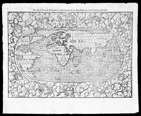
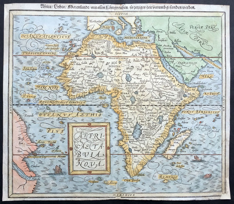
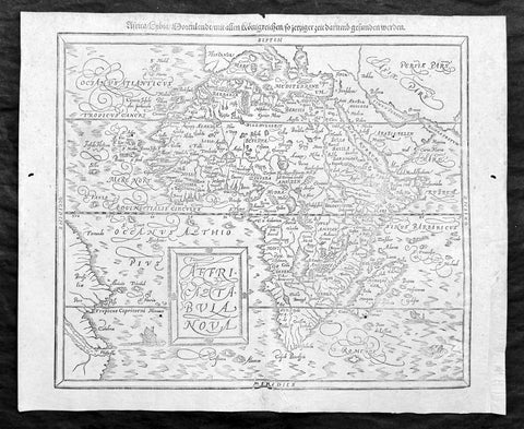
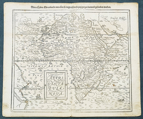
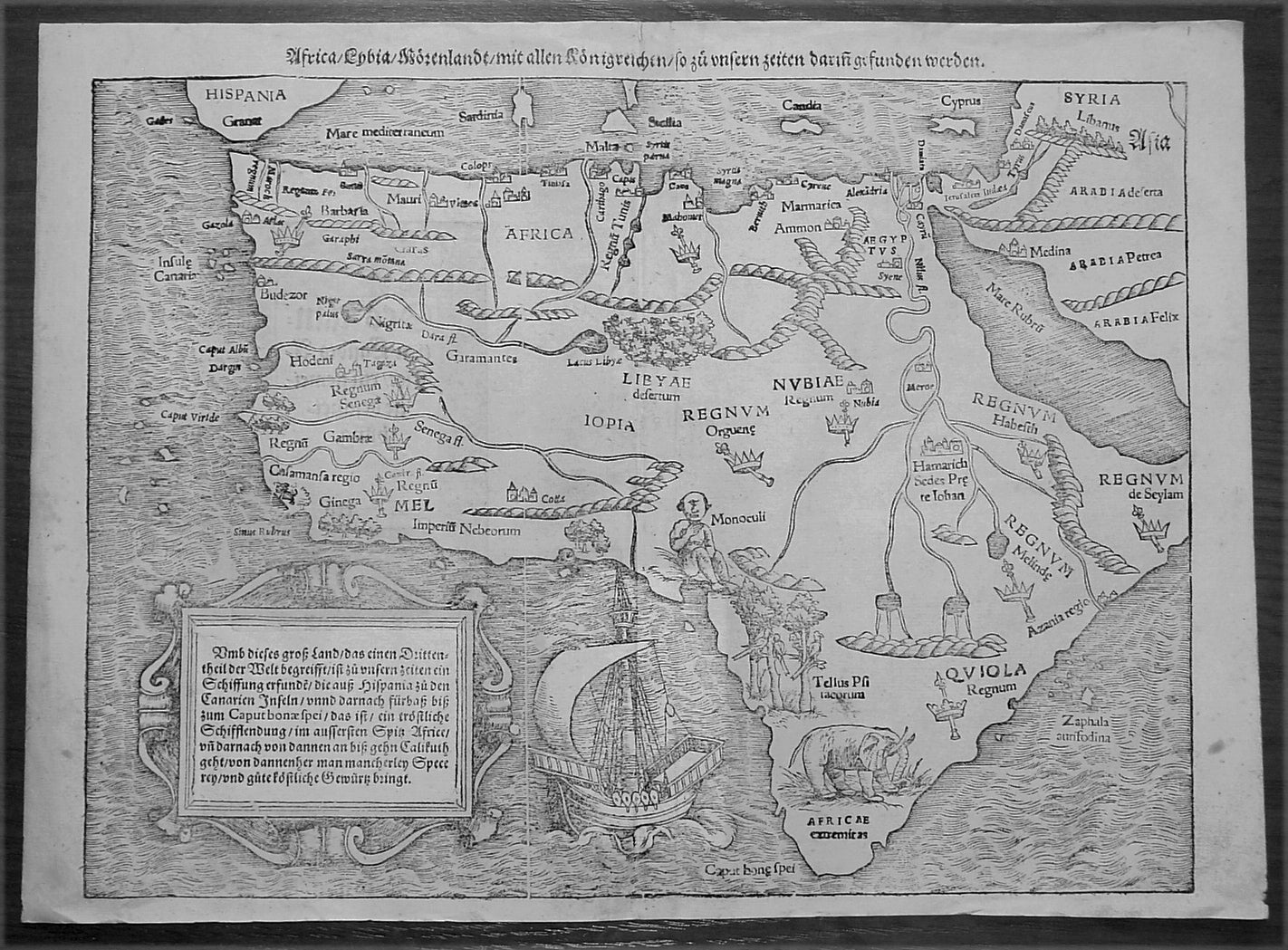
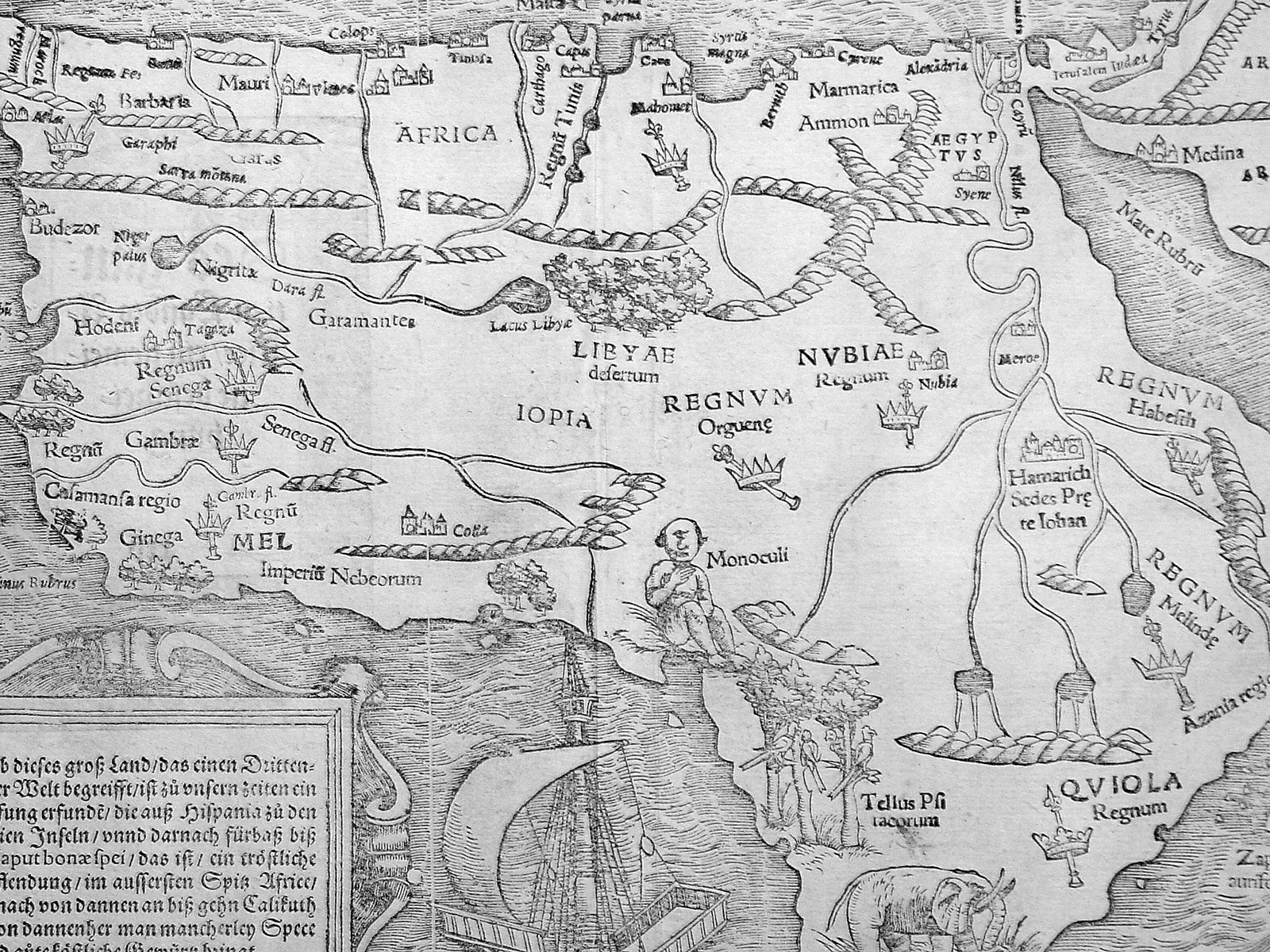
Description: A great example of the first map of the whole continent of Africa published in the 1560 edition of Sebastian Munster'sCosmographia.This woodblock map is instantly recognisable, first published in 1540, by its illustrations of the 'Monoculi' (a one-eyed man), an impressive sailing ship, and a large elephant in southern Africa.In The Mapping Of Africa Richard Betz identifies 15 variant states of this map. With German text and the image of a Phoenix rising from the sun to the verso, this example most closely resembles Betz's variant 15. However, our example has only "IOPIA" present in the word Aethiopia in the centre of the continent, not corresponding to any listed in Betz, and appears therefore to be a previously unrecorded variant of this early and important map.Sales data: There have been 9 recorded sales of this map since 1985 cumulating in a top price of $1897US achieved in 2010 for this scarce edition. (Ref AMPR)
Background: The first separately printed map of Africa (as with the other known continents) appeared in Munster's Geographia from 1540 onwards and the first atlas devoted to Africa only was published in 1588 in Venice by Livio Sanuto, but the finest individual map of the century was that engraved on 8 sheets by Gastaldi, published in Venice in 1564. Apart from maps in sixteenth-century atlases generally there were also magnificent marine maps of 1596 by Jan van Linschoten (engraved by van Langrens) of the southern half of the continent with highly imaginative and decorative detail in the interior. In the next century there were many attractive maps including those of Mercator/Hondius (1606), Speed (1627), Blaeu (1 630), Visscher (1636), de Wit (c. 1670), all embellished with vignettes of harbours and principal towns and bordered with elaborate and colourful figures of their inhabitants, but the interior remained uncharted with the exception of that part of the continent known as Ethiopia, the name which was applied to a wide area including present-day Abyssinia. Here the legends of Prester John lingered on and, as so often happened in other remote parts of the world, the only certain knowledge of the region was provided by Jesuit missionaries. Among these was Father Geronimo Lobo (1595-1678), whose work A Voyage to Abyssinia was used as the basis for a remarkably accurate map published by a German scholar, Hiob Ludolf in 1683. Despite the formidable problems which faced them, the French cartographers G. Delisle(c. 1700-22), J. B. B. d'Anville (1727-49) and N. Bellin (1754) greatly improved the standards of mapping of the continent, improvements which were usually, although not always, maintained by Homann, Seutter, de Ia Rochette, Bowen, Faden and many others in the later years of the century. Sebastian Petri re-release of Cosomgraphia in 1588 produced some fine woodcut maps in the "copperplate style". The maps in this release were more sophisticated than with earlier publications of Cosomgraphia and were based on the 1570 release of Abraham Ortelius monumental work Theatrum Orbis Terrarum. (Ref: M&B;Tooley)
General Description: Paper thickness and quality: - Light and stable Paper color: - off white Age of map color: - Colors used: - General color appearance: - Paper size: - 15in x 11 1/2in (385mm x 290mm) Plate size: - 15in x 11 1/2in (385mm x 290mm) Margins: - 1/2in (12mm) Imperfections: Margins: - None Plate area: - 4 small worm holes repaired adjacent to centerfold Verso: - None