Welcome to Classical Images!
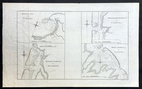
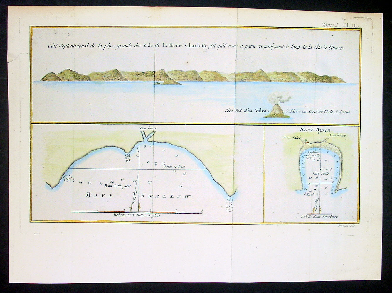
Description:This fine original copper-plate engraved antique nautical chart & coastal view of the Island of Nendo (then called Lord Egmonts Island or New Guernsey) along with inset maps of Swallow Bay & Byrons Harbour on Nendo and a view of the nearby volcanic island of Nupani was drawn by Captain Phillip Carteret in July-August 1767 aboard his ship Swallow, accompanying Captain Samuel Wallis during his circumnavigation of the world, was published in the 1774 French edition of John Hawkesworths An Account of the Voyages Undertaken by the Order of His Present Majesty for Making Discoveries in the Southern Hemisphere and Successively Performed by Commodore Byron, Captain Wallis, Captain Carteret, and Captain Cook, in the Dolphin, the Swallow, and the Endeavor, Drawn Up from the Journals Which Were Kept by the Several Commanders, and from the Papers of Joseph Banks, Esq. Paris 1774
General Definitions:Paper thickness and quality: - Heavy and stablePaper color : - off whiteAge of map color: - OriginalColors used: - Yellow, green, blue, pinkGeneral color appearance: - AuthenticPaper size: - 13in x 9in (330mm x 230mm)Plate size: - 12in x 7 1/2in (305mm x 190mm)Margins: - Min 1/2in (12mm)
Imperfections:Margins: - NonePlate area: - Folds as issuedVerso: - None
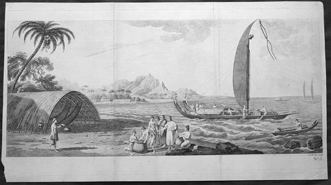
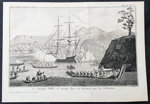
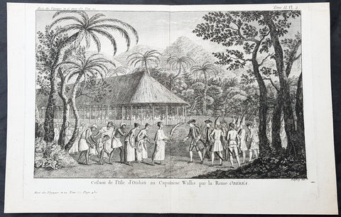
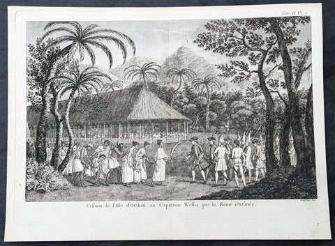
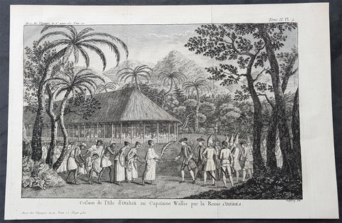
Background: Samuel Wallis 1728 – 1795was a British naval officer and explorer of the Pacific Ocean.Wallis was born near Camelford, Cornwall. He served under John Byron, and in 1766 was promoted to captain and was given the command of HMS Dolphin (1751) as part of an expedition led by Philip Carteret in the Swallow with an assignment to circumnavigate the globe. The two ships were parted by a storm shortly after sailing through the Strait of Magellan, Wallis continuing to Tahiti, which he named King George the Thirds Island in honour of the King (June 1767). Wallis himself was ill and remained in his cabin: lieutenant Tobias Furneaux was the first to set foot, hoisting a pennant and turning a turf, taking possession in the name of His Majesty. Dolphin stayed in Matavai Bay in Tahiti for over a month. Wallis went on to name or rename five more islands in the Society Islands and six atolls in the Tuamotu Islands, as well as confirming the locations of Rongerik and Rongelap in the Marshall Islands. He renamed the Polynesian island of Uvea as Wallis after himself, before reaching Tinian in the Mariana Islands. He continued to Batavia, where many of the crew died from dysentery, then via the Cape of Good Hope to England, arriving in May 1768. He was able to pass on useful information to James Cook who was due to depart shortly for the Pacific, and some of the crew from the Dolphin sailed with Cook. In 1780 Wallis was appointed Commissioner of the Admiralty.Capt. Philip Carteret (1733-1796)was a British naval officer and explorer who participated in two of the Royal Navy\\\\\\\'s circumnavigation expeditions in 1764-66 and 1766-69.Carteret entered the Navy in 1747, serving aboard the Salisbury, and then under Captain John Byron from 1751 to 1755. Between 1757 and 1758 he was in the Guernsey on the Mediterranean Station. As a lieutenant in the Dolphin he accompanied Byron during his voyage of circumnavigation, from June 1764 to May 1766.In 1766 he was made a commander and given the command of the Swallow to circumnavigate the world, as consort to the Dolphin under the command of Samuel Wallis. The two ships were parted shortly after sailing through the Strait of Magellan, Carteret discovering Pitcairn Island and the Carteret Islands, which were subsequently named after him. In 1767, he also discovered a new archipelago inside Saint George\\\\\\\'s Channel between New Ireland and New Britain Islands (Papua New Guinea) and named it Duke of York Islands, as well as rediscovered the Solomon Islands first sighted by the Mendana in 1568, and the Juan Fernandez Islands first discovered by Juan Fernandez in 1574. He arrived back in England, at Spithead, on 20 March 1769.He was promoted to post captain in 1771.Nendo is the largest of the Santa Cruz Islands, located in the Temotu province of the Solomon Islands. The island is also known as Santa Cruz, Ndeni, Nitendi or Ndende. The name Santa Cruz was given to the island in 1595 by the Spanish navigator Alvaro de Mendaña, who unsuccessfully started a colony there.The Nupani Atoll is located about 65 km to the West of the main group of the Reef Islands.