Welcome to Classical Images!
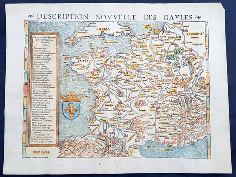
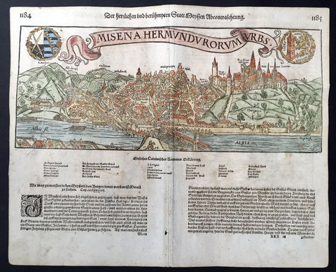
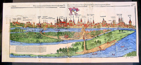
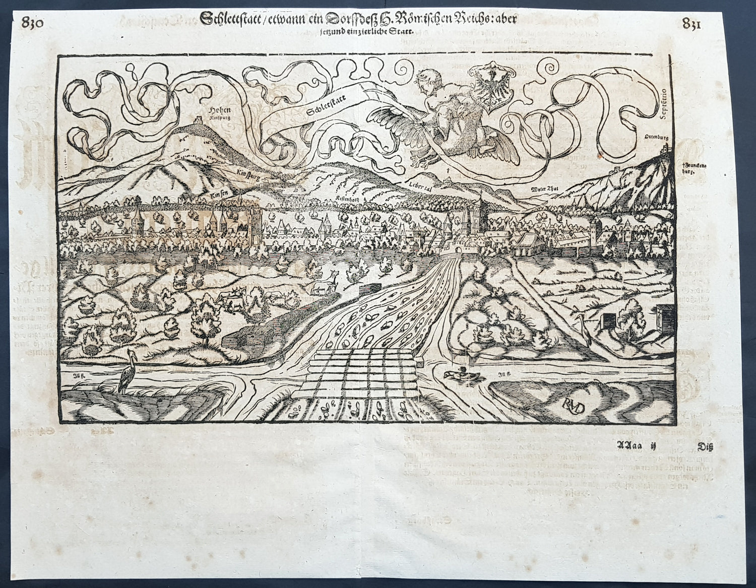
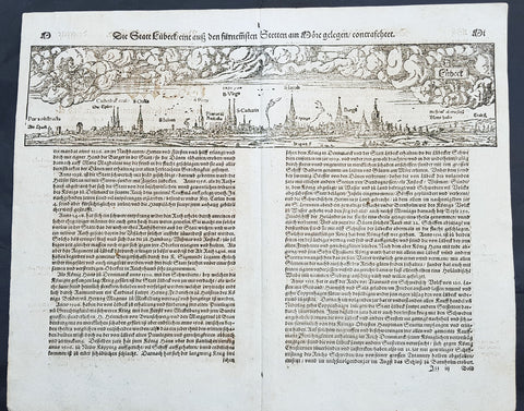
Description:This fine original wood block engraved antique map a birds eye view of the French town of Selestat, formally Schlettstadt under German rule, in the Bas-Rhin in the Grand Est region was engraved by Hans Rudolf Manuel Deutsch (RMD) and published in the German Section of Sebastian Munsters 1628 edition of Cosmographia, Das ist: Beschreibung der gantzen Welt, Darinnen Aller Monarchien Keyserthumben, Königreichen, Fürstenthumben, Graff- und Herrschafften, Länderen, Stätten und Gemeinden.Ursprung (Cosmographia, that is: description of the whole world, in it all monarchies Keyser thumben, kingdoms, prince thumben, graff and herrschafften, countries, places and municipalities.)Hans Rudolf Manuel Deutsch (1525–1571) was a Swiss artist. He made several of the woodcuts for De re metallica (the metals and mining treatise by Georgius Agricola, the father of mineralogy) and for Sebastian Münsters Cosmographia. Deutschs father, Niklaus Manuel Deutsch (the Elder), and Deutsch\'s brother, Niklaus Manuel Deutsch the Younger, were also artists. The elder Niklaus had taken the last name Manuel, but all three also commonly used Deutsch as part of their names and signed their paintings with initials ending in D.Sélestat, German Schlettstadt , is a town in the department of Bas-Rhin in the Grand Est region (until the end of 2015 Alsace ) about 40 km southwest of Strasbourg and about 40 km northwest of Freiburg located in Breisgau on the Ill . The city is the seat of the sub-prefecture of the Arrondissement Sélestat-Erstein.While Strasbourg is known for having erected the first whole Christmas tree on a public square in the city for the whole of the Advent season, Sélestat is considered the birthplace of the Christmas tree. An entry in a Humanist Library accounting book dates from 1521: Item IIII shill pay the forester meyen to sanct Thomas day (4 shillings to pay for the forester to guard the trees from St. Thomas\'s Day) ). Although this entry documents for the first time the passage between decorated hanging pine branches and the whole Christmas tree in private homes, it does not quite prove that Sélestat introduced this custom. This new practice probably originated in the more global context of opposition between the established Catholic Church and the 16th-century Lutherans in the Lower Alsace area between Strasbourg and Schlettstadt. In addition, the imperial city flourished in many areas in this century and its population was certainly susceptible to social-religious innovations.It is documented in many places in Alsace that arrangements and wall or door decorations made of evergreen plants were considered by the Catholic Church extremely bad, since they were known to be introduced by the Protestants. In particular, Johann Geiler von Kaysersberg , preacher of the Strasbourg Cathedral denounced these customs, because he feared the return of pagan customs. In Alsace, people traditionally celebrated the feast of St. Nicholas and therefore organized Nicholas markets. As in the other Protestant imperial territories, the Lutherans also wanted to celebrate Christmas in Alsace: at first a whole fir was hanging from the ceiling of the room, then it was placed in a bucket full of sand. The village chaplains were to reveal abuses in the stately forests nine days before and nine after Christmas. By the end of the 16th century, whole firs were first in the Alsatian guild houses, then relatively early in all more or less noble family houses.Vauban built new fortifications and the city became the site of a French garrison. It regained some prosperity, but its growth remained low compared to other Alsatian cities. With the administrative reforms of the French Revolution, Schlettstadt became part of the Bas-Rhin département .During the affiliation of the city to the German Empire (1871-1918), the city was the seat of the district Schlettstadt in the district Unterelsaß . 1876/80, the King Karl barracks was built here. In 1914, the Rheinische Jäger Battalion No. 8 was stationed there. Between 1918 and 1940 she was occupied as Caserne Schweisguth by the French army.
General Definitions:Paper thickness and quality: - Heavy and stablePaper color : - off whiteAge of map color: - Colors used: - General color appearance: - Paper size: - 15in x 12in (380mm x 305mm)Plate size: - 15in x 12in (380mm x 305mm)Margins: - Min 1/2in (10mm)
Imperfections:Margins: - Light offsetting, margins croppedPlate area: - Light offsettingVerso: - Offsetting
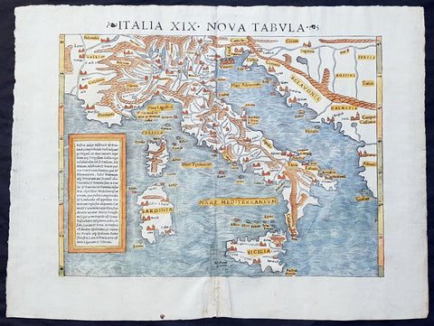
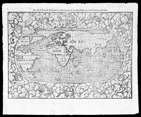
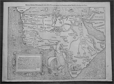
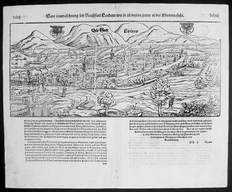
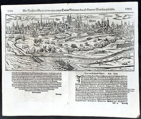
ackground: Cosmographia, Das ist: Beschreibung der gantzen Welt, Darinnen Aller Monarchien Keyserthumben, Königreichen, Fürstenthumben, Graff- und Herrschafften, Länderen, Stätten und Gemeinden.Ursprung, Regiment, Reichthumb, Gewalt und.Beschaffenheit. Dessgleichen Aller deren, beyder Ständen, Regenten: Keysern, Königen, Bäpsten, Bischoffen.Genealogien und Stammbäumen.zusammen getragen. by Sebastian Münster was first published in 1544 and is the earliest German-language description of the world. It had numerous editions in different languages including Latin, French (translated by François de Belleforest), Italian, English, and Czech. The last German edition was published in 1628, long after Munsters death. The Cosmographia was one of the most successful and popular books of the 16th century. It passed through 24 editions in 100 years. This success was due to the notable woodcuts (some by Hans Holbein the Younger, Urs Graf, Hans Rudolph Manuel Deutsch, and David Kandel). It was most important in reviving geography in 16th-century Europe. Among the notable maps within Cosmographia is the map Tabula novarum insularum, which is credited as the first map to show the American continents as geographically discrete.Munsters earlier geographic works were Germania descriptio (1530) and Mappa Europae (1536). In 1540, he published a Latin edition of Ptolemys Geographia with illustrations.