Welcome to Classical Images!
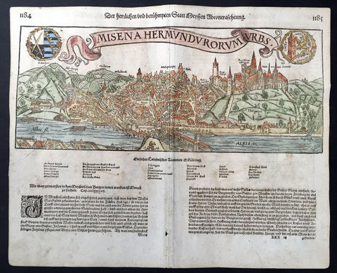
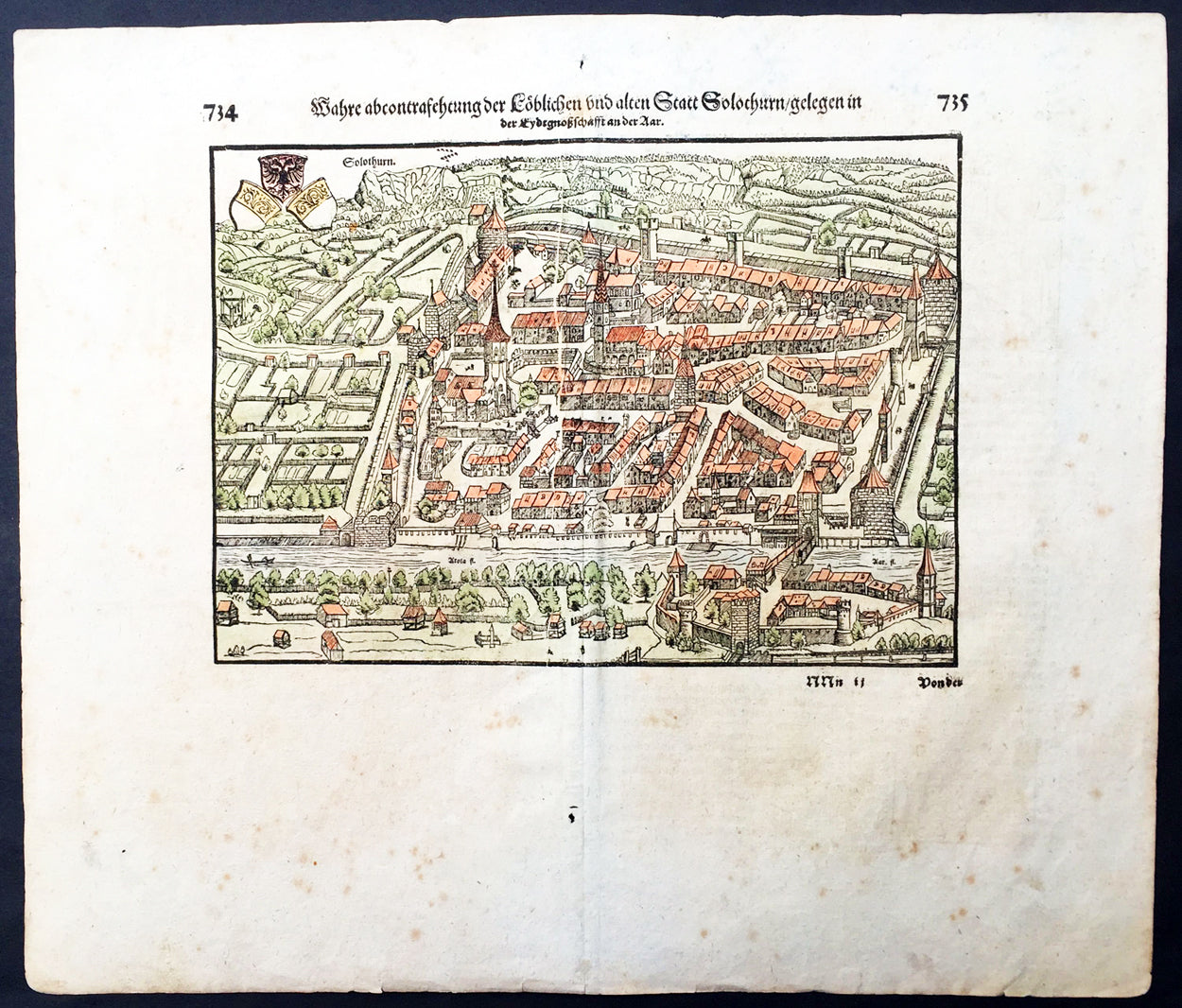
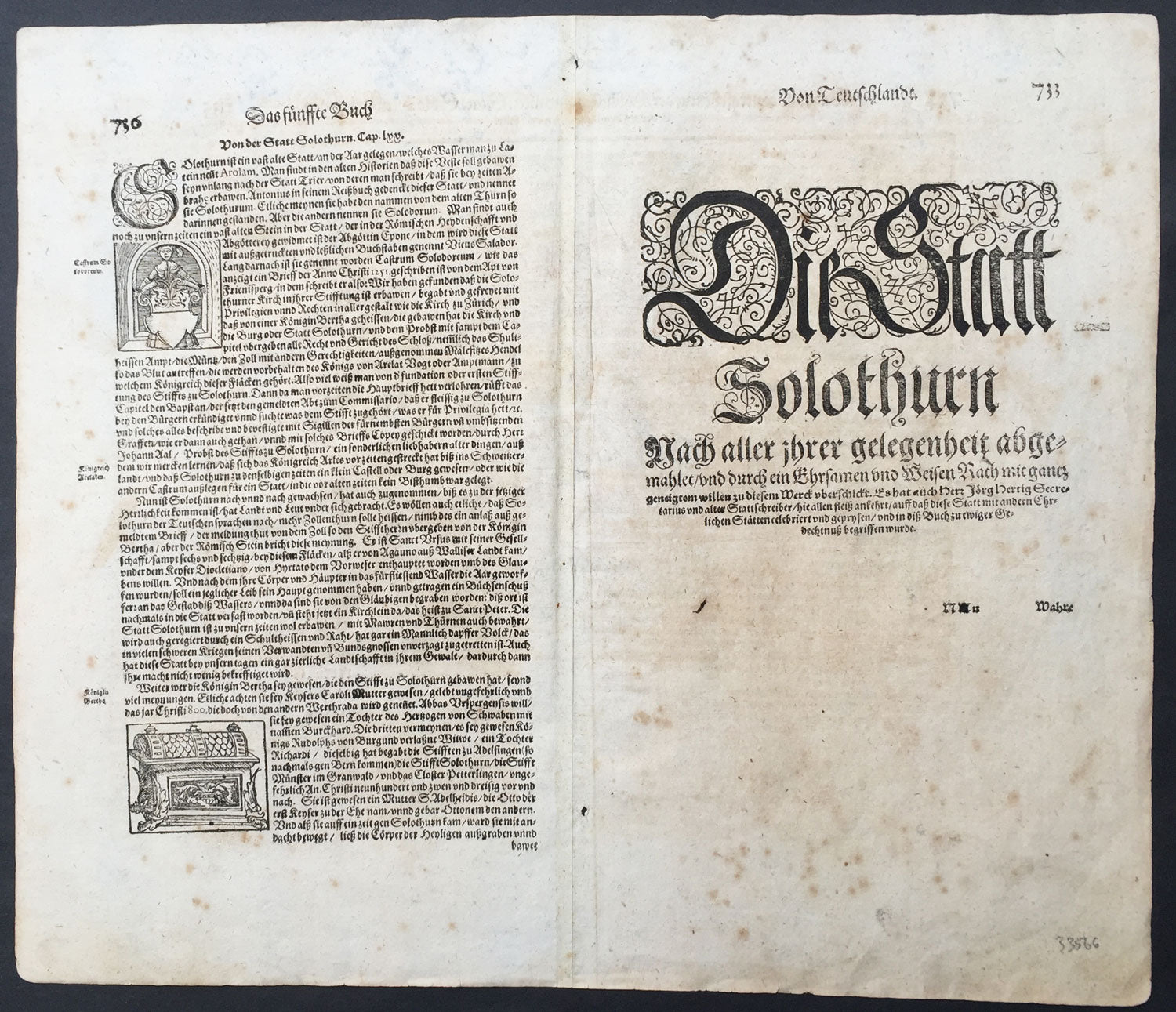
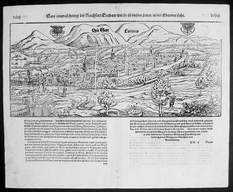
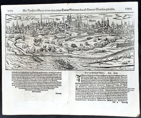
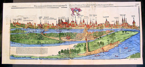
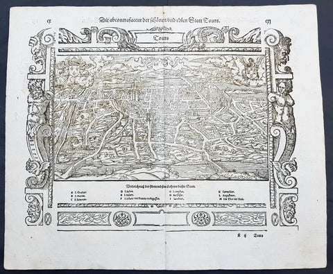
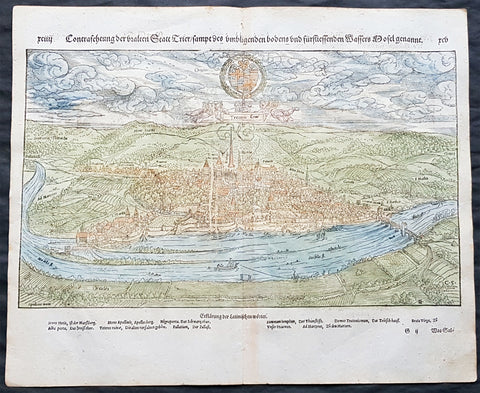
Description: This finely engraved hand coloured original antique print* a view of the Swiss City of Solothurn was published in the last 1628 release of Sebastian Munsters Cosmographia published by Sebastian Petri, Basle.
Background: During the Early Middle Ages, Solothurn was part of the Kingdom of Lotharingia (Lorraine). After the collapse of Lotharingia, it became part of the Second Kingdom of Burgundy. In 1033, the Kingdom of Burgundy became part of the Holy Roman Empire and Solothurn gained some independence. In 1038, Emperor Conrad II held court at Solothurn and there crowned his son, Henry III King of Burgundy. The royal court resided in Solothurn on several occasions until 1052, however, there is no evidence of a permanent royal palace. In 1127, it was acquired by the dukes of Zähringen. Under the rule of the Zähringens, in 1146, Solothurn's coins are first mentioned. In 1182, causidicus or Zähringen appointed judges first appeared in Solothurn. After the extinction of the Zähringer line in 1218 it became a free imperial city under the Holy Roman Emperor. In 1252, the town council andSchultheiss or mayor became mostly independent and had their own town seals. In 1251 it was mentioned as saluerre and in 1275 as Solotren. Starting around 1200, there was a council of nobles in the town. In 1252, a group of nobles that could witness and support deeds, known as consuls et cives Solodorenses, first appears in the town. Initially the nobles exercised power over the entire town. However, the guild movement of the 14th Century resulted in a reduction in the power of the nobles and also a restricted guild system in Solothurn. By around 1350, an eleven-member Altrat (Council of Elders) and a 22-member Jungrat (Younger Council) existed in the city. Each of the eleven guilds were represented by a member of the Altrat and two members of the Jungrat. These 33 councillors exercised, together with the mayor, the power of government and helped appoint law makers. The members of the two councils were elected each year by the citizens of the city, after which the councils and mayor appointed many of the government officials. The noble families retained some power as the guilds became part of the town council. However, in 1459 the last noble family died out and positions on the council fell to wealthy farmers, butchers and millers. Until the pogrom on 1348 during an outbreak of the plague, there was a small Jewish community in Solothurn. Over the 13th to 15th centuries, the citizens of the city slowly emancipated themselves from the higher nobility. In 1276 and 1280 Emperor Rudolf I codified the previously poorly defined rights of the city and granted it the privilege de non Evocando or the right that their citizens were protected from trial in foreign courts. In 1344 Solothurn acquired the right to appoint their own Schultheiss from the Count of Buchegg, which was confirmed by Emperor Charles IV in 1360. In 1409, Emperor Ruprecht extended the de non Evocando privilege to include the royal High Court as well. As the city grew in power, it bound the Monastery of St. Ursus more closely to the city. In 1251 the city defeated claims made by the Monastery on the right to appoint the Schultheiss. Shortly after the acquisition of the right to the Schultheiss office in 1344, the city came into possession of the vogt right over the Monastery by granting citizenship rights to the former vogt (bailiff), Burkhard Senn the Elder. In 1512-20 the city received the right to appoint canons and provosts from the Pope. After the alliance with Bern in 1295, it became part of the Swiss Confederation. In 1382 the Habsburgs attacked the city, involving Solothurn in the Battle of Sempach. By the treaty of two years later, the Habsburgs renounced all claims to the territory of the city. The latter was expanded by acquisition of neighbouring lands in the 15th century, roughly up to the today's canton area. In 1481, it obtained full membership in the Swiss Confederation. From 1530 to 1792 it was the seat of the French ambassador to Switzerland.
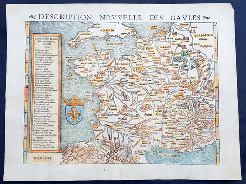
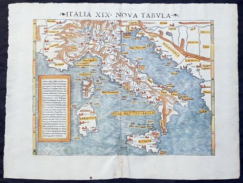
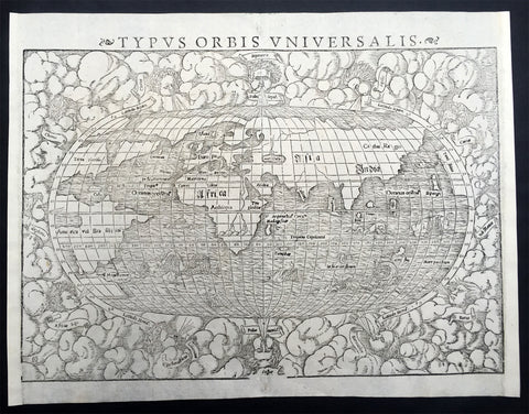
Sebastian Petri re-release of Cosomgraphia in 1588 produced some fine woodcut maps in the "copperplate style". The maps in this release were more sophisticated than with earlier publications of Cosomgraphia and were based on the 1570 release of Abraham Ortelius monumental work Theatrum Orbis Terrarum.For a variety of reasons town plans were comparatively latecomers in the long history of cartography. Few cities in Europe in the middle ages had more than 20,00 inhabitants and even London in the late Elizabethan period had only 100-150,000 people which in itself was probably 10 times that of any other English city. The Nuremberg Chronicle in 1493 included one of the first town views of Jerusalem, thereafter, for most of the sixteenth century, German cartographers led the way in producing town plans in a modern sense. In 1544 Sebastian Munster issued in Basle his Cosmographia containing roughly sixty-six plans and views, some in the plan form, but many in the old panorama or birds eye view. (Ref: Tooley; M&B)
General Description: Paper thickness and quality: - Light and stable Paper color: - White Age of map color: - Early Colors used: - Blue, green, red, brown General color appearance: - Authentic Paper size: - 17in x 15in (435mm x 380mm) Margins: - Min ½in (12mm) Imperfections: Margins: - Light age toning Plate area: - Light age toning Verso: - Light age toning