Welcome to Classical Images!
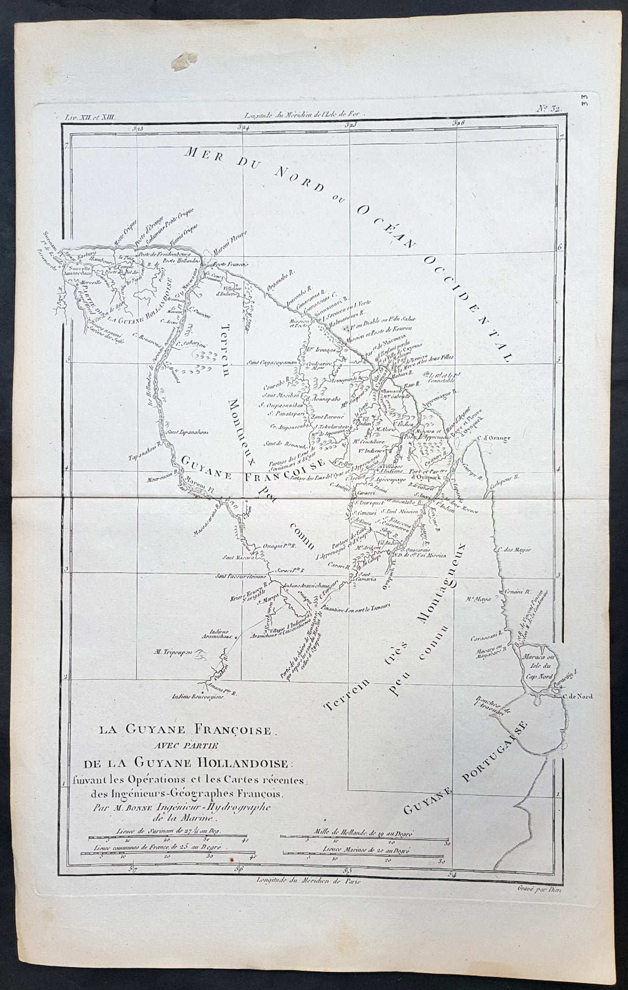
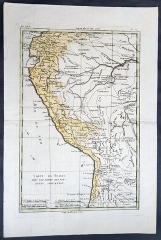
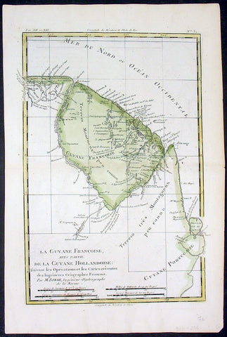
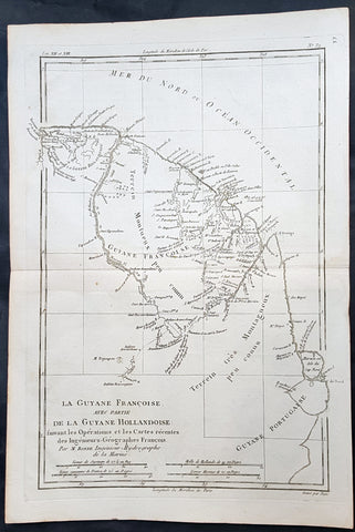
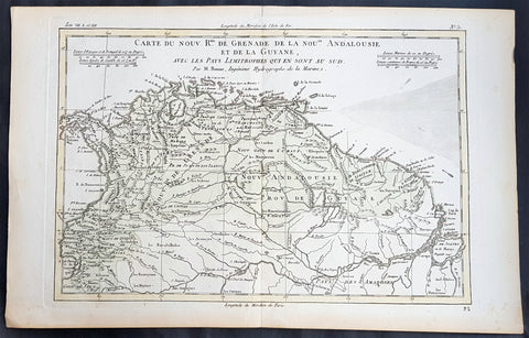
Description:This fine original copper plate engraved antique map of Guyana, Suriname & French Guiana, South America by Rigobert Bonne was published in the 1780 edition of Atlas des toutes les parties connues du globe terrestre by Guillaume Raynal.
General Definitions:Paper thickness and quality: - Heavy and stablePaper color : - off whiteAge of map color: -Colors used: -General color appearance: -Paper size: - 15in x 10in (385mm x 255mm)Plate size: - 13in x 9in (330mm x 230mm)Margins: - Min 1/2in (12mm)
Imperfections:Margins: - NonePlate area: - NoneVerso: - None
Background: Guyana officially the Co-operative Republic of Guyana, is a country on the northern mainland of South America. It is, however, often considered part of the Caribbean region because of its strong cultural, historical, and political ties with other Anglo-Caribbean countries and the Caribbean Community.The region known as the Guianas consists of the large shield landmass north of the Amazon River and east of the Orinoco River known as the \"land of many waters. Originally inhabited by many indigenous groups, Guyana was settled by the Dutch before coming under British control in the late 18th century. It was governed as British Guiana, with a mostly plantation-style economy until the 1950s.Suriname officially known as the Republic of Suriname is a country on the northeastern Atlantic coast of South America. It is bordered by the Atlantic Ocean to the north, French Guiana to the east, Guyana to the west and Brazil to the south.Suriname was long inhabited by various indigenous people before being invaded and contested by European powers from the 16th century, eventually coming under Dutch rule in the late 17th century. During the Dutch colonial period, it was primarily a plantation economy dependent on African slaves and, following the abolition of slavery, indentured servants from Asia.French Guiana is an overseas department and region of France, on the north Atlantic coast of South America in the Guyanas. It borders Brazil to the east and south and Suriname to the west.Before European contact, the territory was originally inhabited by Native Americans, most speaking the Arawak language, of the Arawakan language family. The people identified as Lokono. The first French establishment is recorded in 1503, but France did not establish a durable presence until colonists founded Cayenne in 1643. Guiana was developed as a slave society, where planters imported Africans as enslaved laborers on large sugar and other plantations in such number as to increase the population. Slavery was abolished in the colonies at the time of the French Revolution. Guiana was designated as a French department in 1797. But, after France gave up its territory in North America, it developed Guiana as a penal colony, establishing a network of camps and penitentiaries along the coast where prisoners from metropolitan France were sentenced to forced labor.