Welcome to Classical Images!
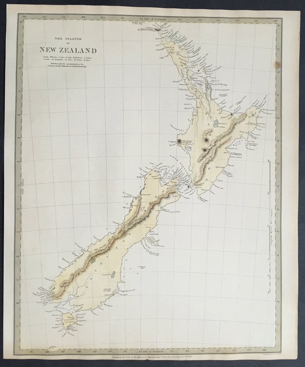
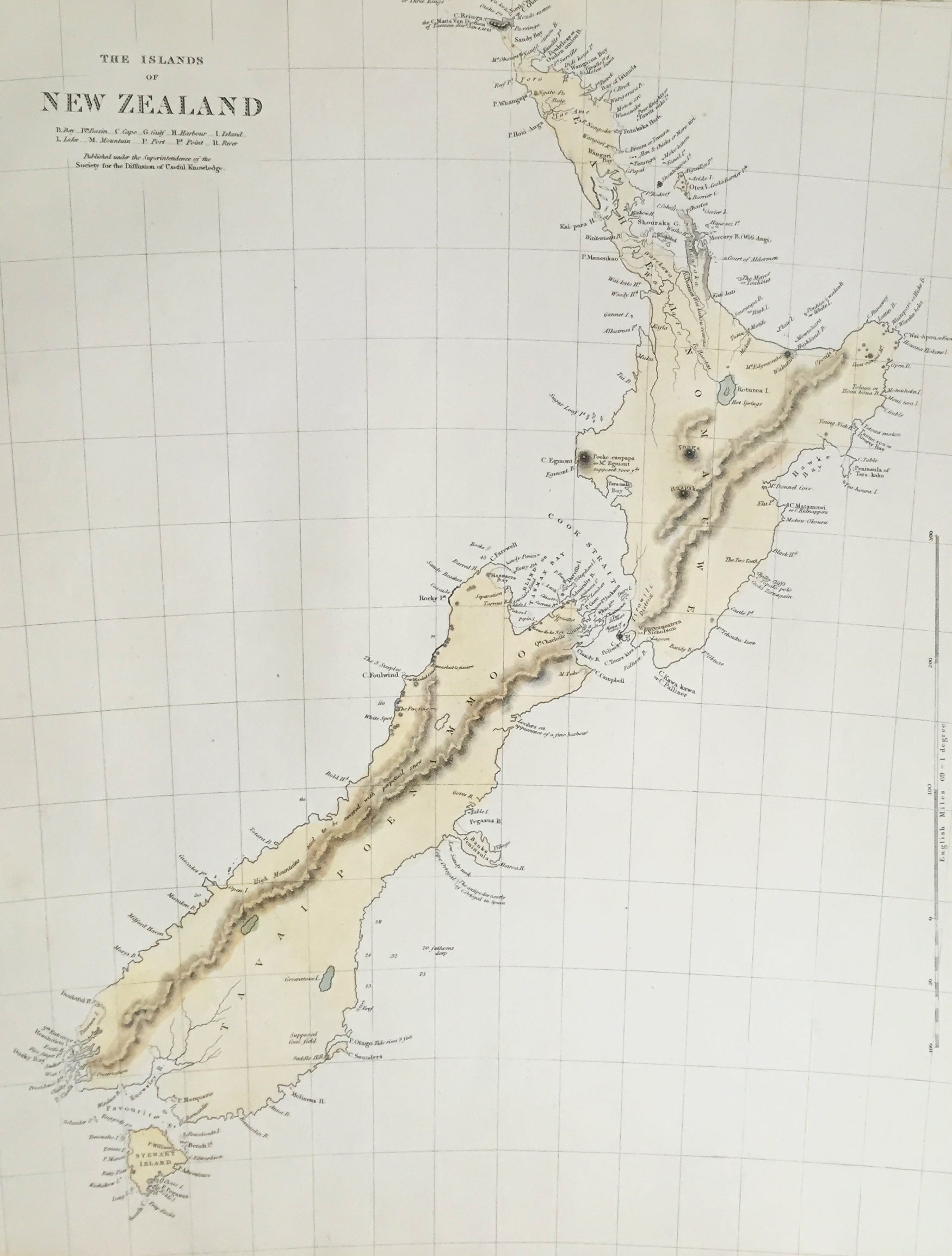
Description: This fine original hand coloured antique map* of New Zealand was engraved in 1838 (1st edition) - dated at the bottom of the map - by J & C W Walker and was published in the Baldwin & Cradock edition of theSociety For the Diffusion of Useful Knowledge (SDUK) Atlas.
Background: The map covers the entire island country from Cape Reinga (C. Maria Van Diemen) to Stewart Island. Various cities, towns, rivers, mountains, bays and several other topographical details are noted with relief shown by hachure. In 1840, after the signing of the Treaty of Waitangi, the British annexed New Zealand as part of the Australian colony of New South Wales. However, it separated from New South Wales to become a colony in its own right in 1841. This map was originally copyrighted in 1838, but was issued in Volume two of Chapman and Hall's 1844 edition of Maps of the Society for the Diffusion of Useful Knowledge
The SDUK produced two landmark volumes in cartography in the first half of the 19th century. The first volume concentrated on areas of the old world, Europe, Africa, Great Britain etc. The second volume contained maps of the new world, America, South Asia, including US state maps, colonies of Australia, South Africa, South America etc. Also included were some of the finest engraved town and city plans published at that time. The SDUK was published in its entirety or in part by many publishers including Baldwin and Cradock 1829-32, Chapman & Hall in 1844, Charles Knight & co. 1846 – 1852. G. Cox published the SDUK between 1852-3, Stanford 1857-70 and later revised edition were also published after Stanford. This is a finely engraved map with beautiful original colour t on strong, clean paper. (Ref: Tooley, M&B)
General Description: Paper thickness and quality: - Heavy and stable Paper color: - white Age of map color: - Early Colors used: - Yellow, blue General color appearance: - Authentic Paper size: - 16in x 13in (400mm x 330mm) Margins: - min. 1in (25mm) Imperfections: Margins: - Light age toning in margins Plate area: - None Verso: - None