Welcome to Classical Images!
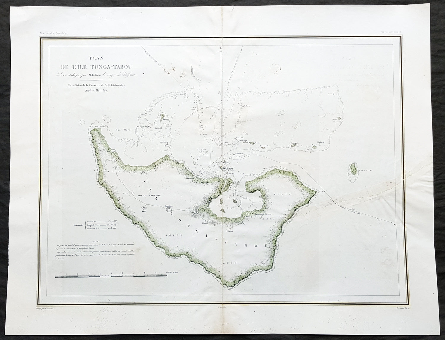
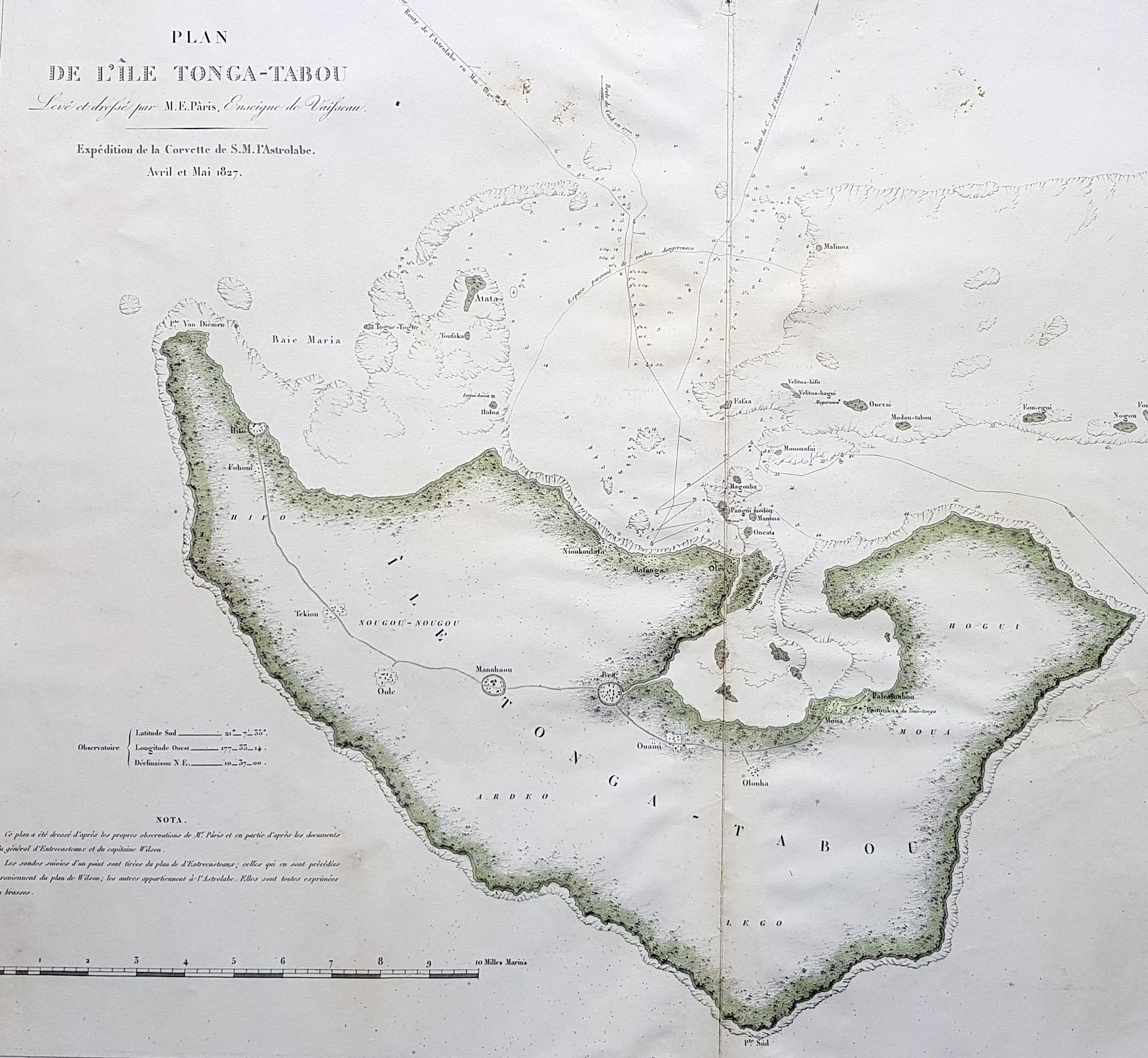
Description:This magnificent large original & scarce lithograph antique map of the largest island in the Tonga Isalnd group, Tongatapu, by Dumont D Urville and Lieutenant Victor Lottin, aboard the ship The Astrolabe during the first D Urville voyage to the South Seas 1826 - 1829, was engraved by Alphonse Chassant, 1808-1907 and published in the 1836 edition of Dumont d Urvilles Voyage de la corvette L Astrolabe: exécuté par ordre du roi, pendant les années 1826-1827-1828-1829......
General Definitions:Paper thickness and quality: - Heavy and stablePaper color : - off whiteAge of map color: - OriginalColors used: - Green, yellowGeneral color appearance: - AuthenticPaper size: - 26 1/2in x 20 1/2in (675mm x 520mm)Plate size: - 26 1/2in x 20 1/2in (675mm x 520mm)Margins: - Min 2in (50mm)
Imperfections:Margins: - NonePlate area: - Centerfold re-joined, left side of image re-joined, no lossVerso: - Repairs as noted above
Background: This map illustrates the route taken by the ship The Astrolabe and Dumont D Urville & crew after leaving New Zealand in March 1827. D Urville extensively surveyed Tongatapu and nearby island between April & May 1827.