Welcome to Classical Images!
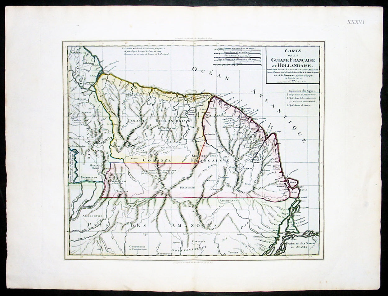
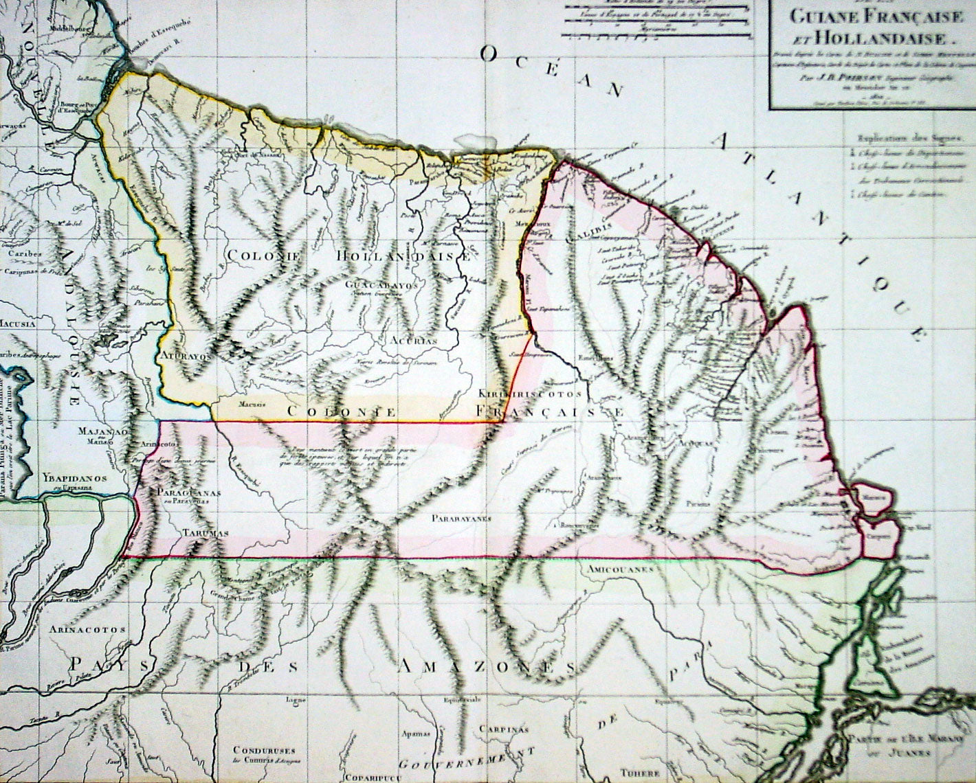
Description: This large beautifully hand coloured original antique map of French & Dutch Guyana, South America, was engraved by Jean Baptiste Poirson in 1802 - the date is engraved in the Title.
J.B. Poirson (1760-1831) was a French geographer & engineer who published a number of Atlases - including the Malte-Brun Atlas - between 1790 & 1830. (Ref: M&B; Tooley)
General Description: Paper thickness and quality: - Heavy & stable Paper color: - White Age of map color: - Original Colors used: - Pink, green, yellow General color appearance: - Authentic Paper size: - 23in x 18in (585mm x 460mm) Plate size: - 19 1/2in x 15 1/2in (500mm x 395mm) Margins: - Min 1in (25mm)
Imperfections: Margins: - None Plate area: - None Verso: - None