Welcome to Classical Images!
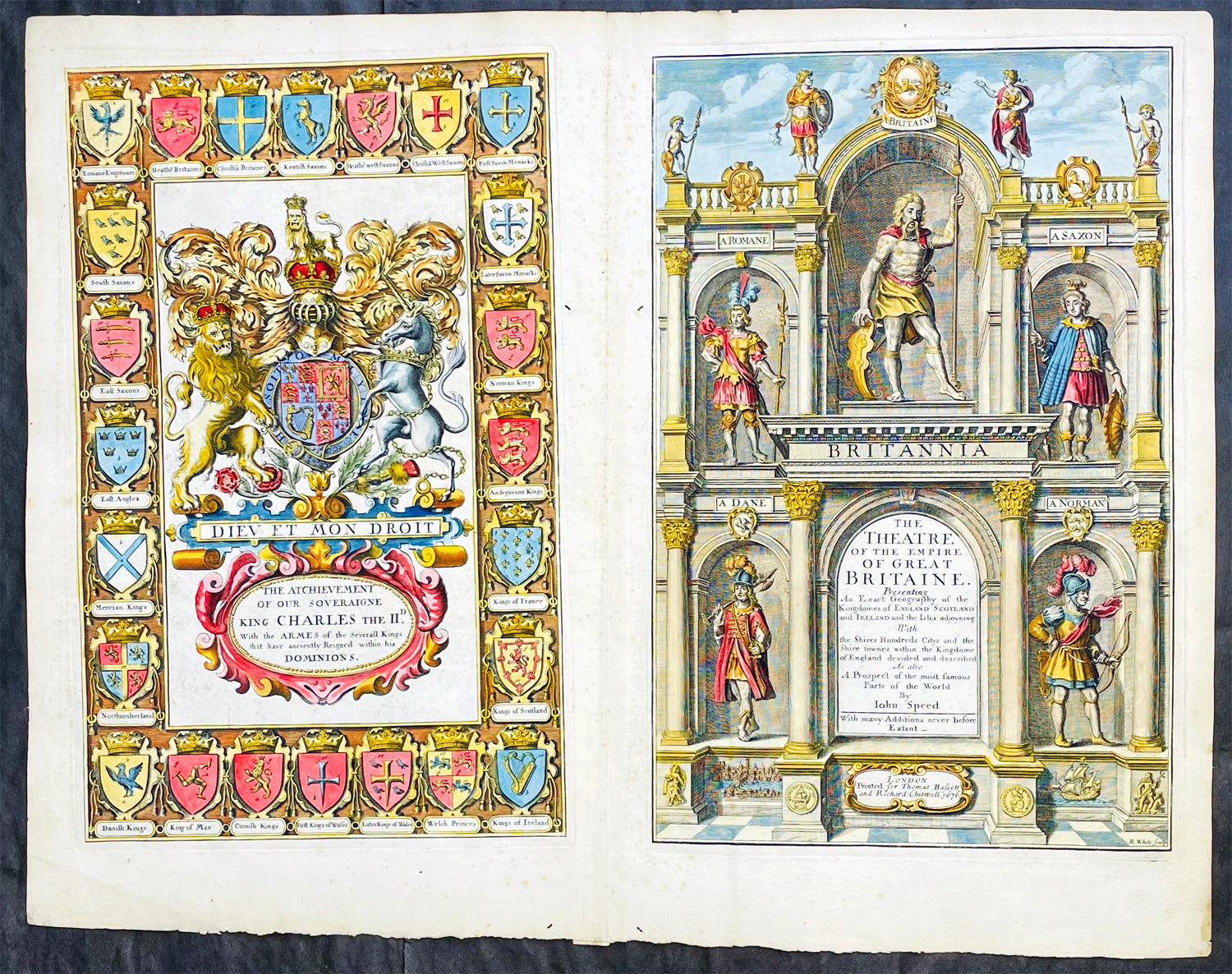
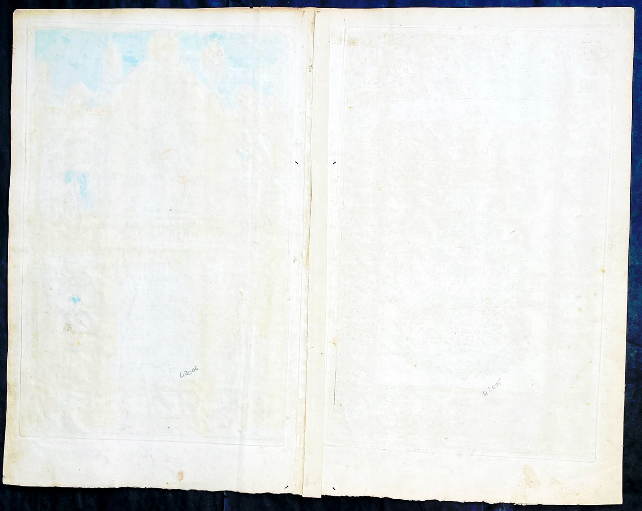
Description:This original beautifully hand coloured, copper plate engraved antique Title and Dedication Pages was published for the 1676 edition of John Speeds double atlas The Theatre of the Empire of Great Britaine & Atlas A Prospect of the most Famous Parts of the World printed by Thomas Bassett and Richard Chiswell, London.
General Definitions:Paper thickness and quality: - Heavy and stablePaper color : - off whiteAge of map color: - LaterColors used: - Yellow, green, blue, pinkGeneral color appearance: - AuthenticPaper size: - 22 1/2in x 17 1/2in (570mm x 445mm)Plate size: - 15 1/4in x 9 3/4in (385mm x 250mm) eachMargins: - Min 1/2in (12mm)
Imperfections:Margins: - Light age toningPlate area: - Light age toningVerso: - Light age toning
Background:John Speeds The Theatre of the Empire of Great Britaine was published in 1610/11 by John Sudbury and George Humble, and contained the first set of individual county maps of England and Wales besides maps of Ireland and a general map of Scotland. Most, but not all, of the county maps have town plans on them; those showing a Scale of Passes being the places he had mapped himself. The county maps were the first consistent attempt to show territorial divisions, such as boundaries of hundreds, but it was Speed’s town plans that were a major innovation and probably his greatest contribution to British cartography. The Theatre was an immediate success: the first print run of around 500 copies must have sold quickly because many editions followed. Sudbury and Humble realized, given the increasing popularity of both county and world atlases and in the light of the success of Abraham Ortelius’s Theatrum Orbis Terrarum, the potential demand for an English world atlas.In 1627, two years before his death, Speed published Prospect of the Most Famous Parts of the World with 21 finely engraved maps, which was the first world atlas produced by an Englishman. There is a fascinating text describing the areas shown on the back of the maps in English, although a rare edition of 1616 of the British maps has a Latin text – this is believed to have been produced for the Continental market. Its maps are famous for their bordering panels of national characters in local costume and panoramic views depicting the areas of major towns and cities. Much of the engraving was done in Amsterdam at the workshop of Jodocus Hondius. The maps of the world and America show California as an island and are amongst the earliest ever printed to depict this seventeenth-century cartographic myth.