Welcome to Classical Images!
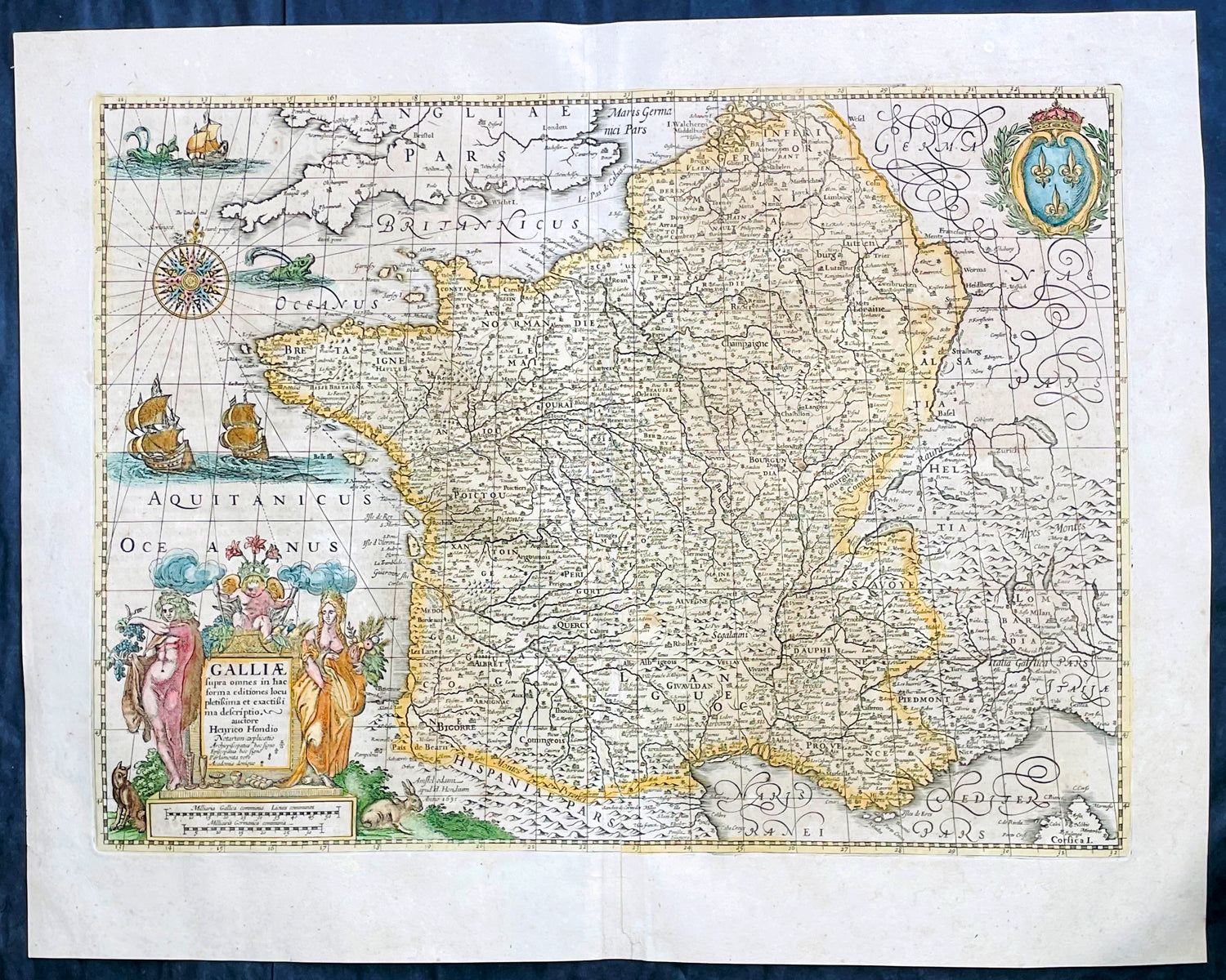
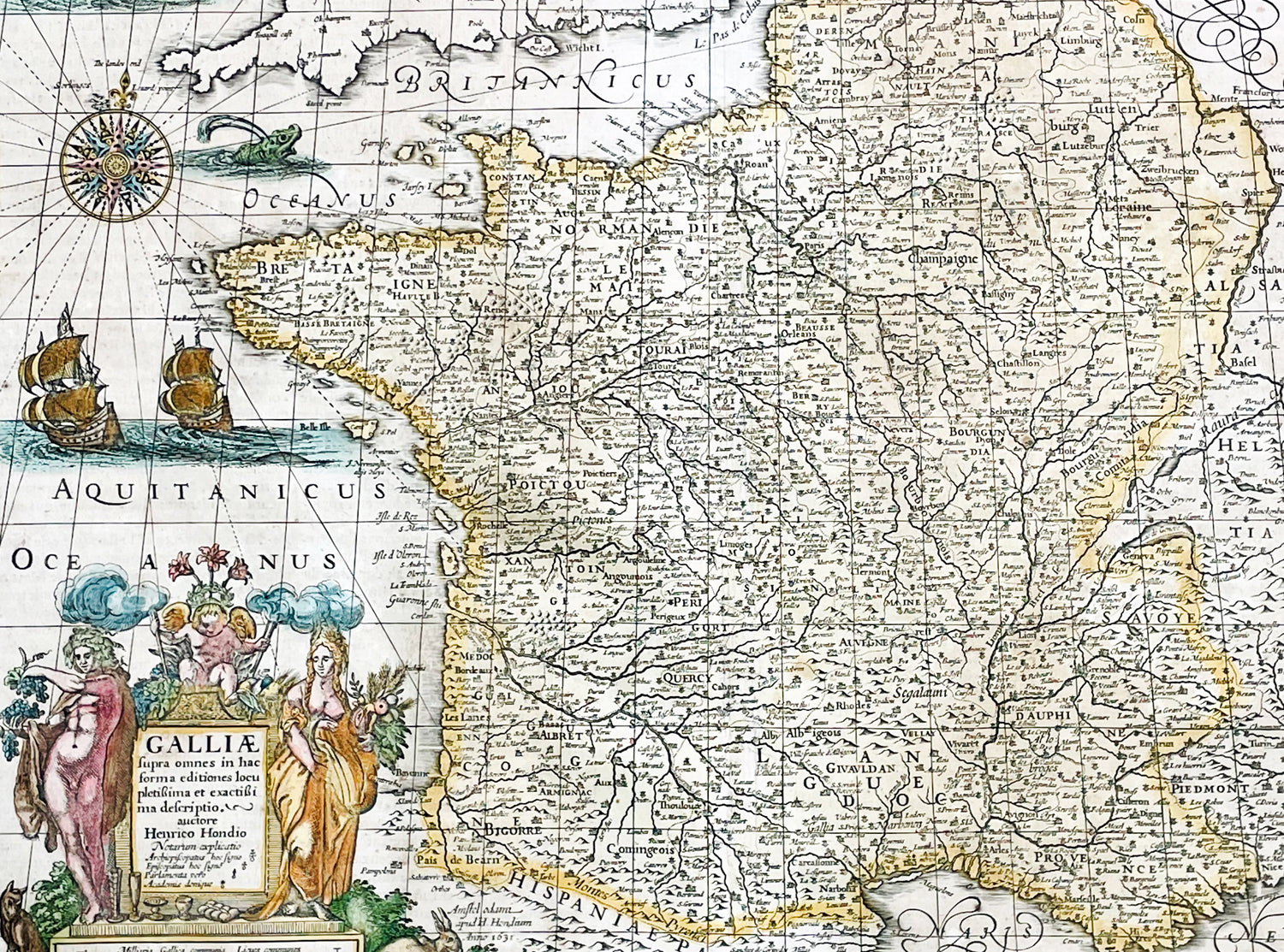
Description:This original hand coloured copper plate engraved antique map of France was published by Henricus Hondius & Jan Jansson in the 1639 French edition of Gerard Mercators Atlas.
General Definitions:Paper thickness and quality: - Heavy and stablePaper color : - off whiteAge of map color: - OriginalColors used: - Pink, blue, green, yellowGeneral color appearance: - AuthenticPaper size: - 22 1/2in x 18in (570mm x 455mm)Plate size: - 19 1/2in x 14 1/2in (500mm x 375mm)Margins: - Min 1in (25mm)
Imperfections:Margins: - NonePlate area: - NoneVerso: - None