Welcome to Classical Images!
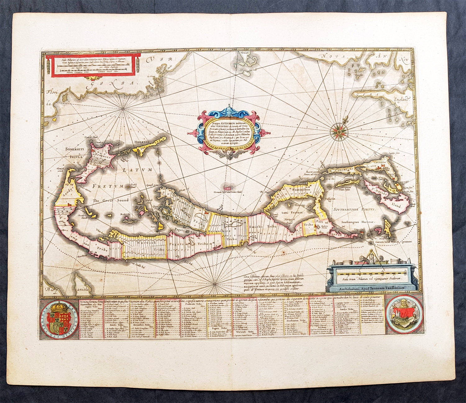
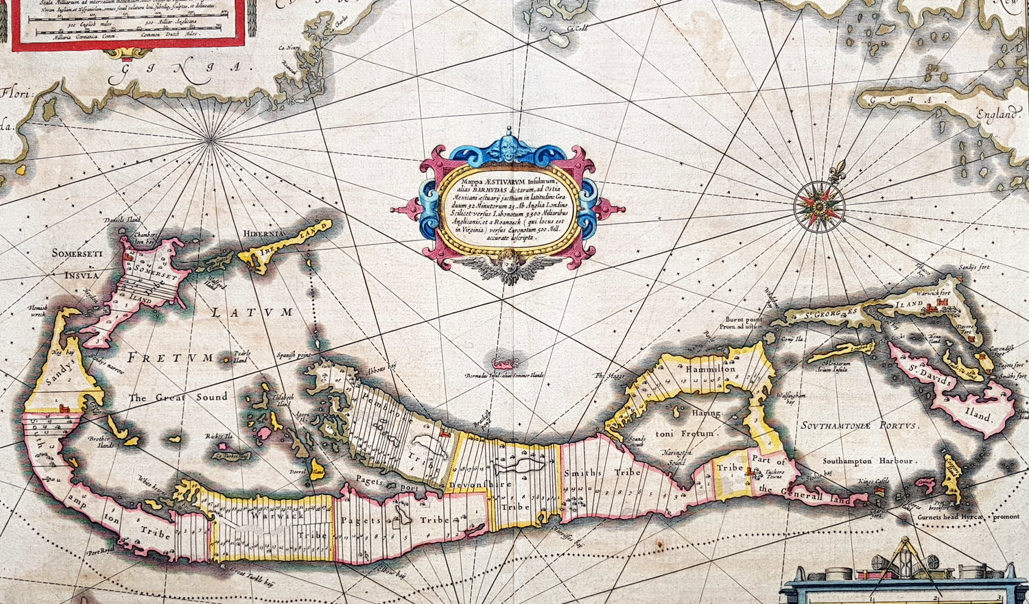
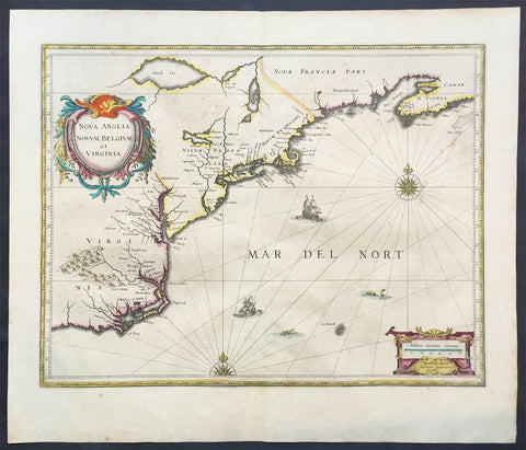
Description: This fine beautifully hand coloured original antique map of the Island of Bermuda by Jan Jansson was published in the 1646 Latin of Mercators Atlas by Henricus Hondius & Janson. One of the best examples of this map we have had in some time with original hand colouring, original margins heavy paper and a heavy impression, beautiful map.A much sought after map of Bermuda, with decorative cartouche, compass rose with the Island divided into lots and tribes, listed at the base of the map.
Condition Report Paper thickness and quality: - Heavy and stable Paper color: - off white Age of map color: - Original Colors used: - Red, yellow, green General color appearance: - Authentic Paper size: - 23 1/2in x 20in (595mm x 510mm) Plate size: - 20 1/2in x 15 3/4in (520mm x 400mm) Margins: - Min 1in (25mm)
Imperfections: Margins: - Light age toning Plate area: - Light age toning Verso: - Light age toning
Background: Like all 17th century maps of Bermuda this map is based ultimately on the survey made by John Norwood of the Bermuda Company in 1618 in the form as published by the English map-maker John Speed in 1627. Although discovered in 1515 by Spaniard Juan de Bermudez, after whom the island is supposedly named, it was the shipwreck of a party of Virginia colonists in 1610 led by Sir George Somers that gave Bermuda its first known inhabitants. The Latin title reflects this fact, for Aestivarum Insularum means summers (or Somers) Islands. The experience of Somers and his men inspired William Shakespeare, who dispatched Ariel to "fetch dew from the still-vext Bermoothes" and populated the islands with the cast of The Tempest.
The place names and the list of Proprietors given below the map itself all recall the original members of the Bermuda Company, the latter being listed as eight tribes (or parishes). In 1610, the Virginia Company, in a True Declaration of the Estate of the Colonie of Virginia, said of Bermuda: These Islands of Bermudos, have evere beene accounted as an inchaunted pile of rocks, and a desert inhabitation for Divels; but all the Faities of the rockes were but flocks of Birds, and all the Divels that haunted the woods, were but heards of Swine. In the upper left-hand and right-hand corners of the map appear the adjacent coasts of the North American colonies of Virginia and New England with, just below the cartouche a tiny outline of Bermuda itself, intended to show its correct proportion and position against the mainland.(Ref Tooley M&B)