Welcome to Classical Images!
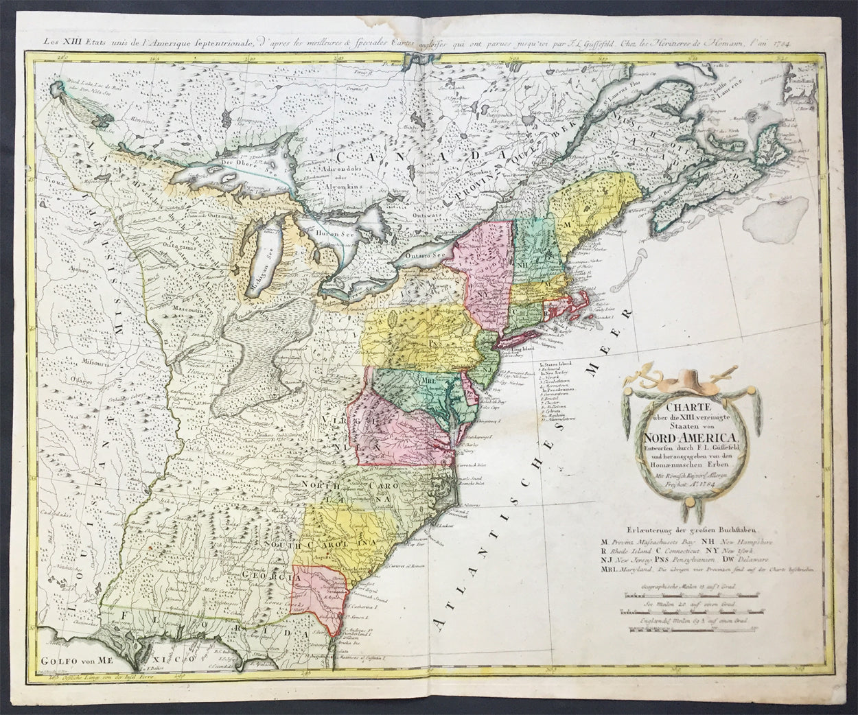
Description: This large important & scarce fine beautifully hand coloured original antique map of the United States just after the War of Independence was engraved by F.J. Guttefeld in 1784 - dated - and published by the famous German firm of Homann Heirs. Also known as the Stetson map, after the Stetson engraved in the title cartouche, this is one of the earliest maps to recognised the newly independent United States after the revolutionary war of Independence.
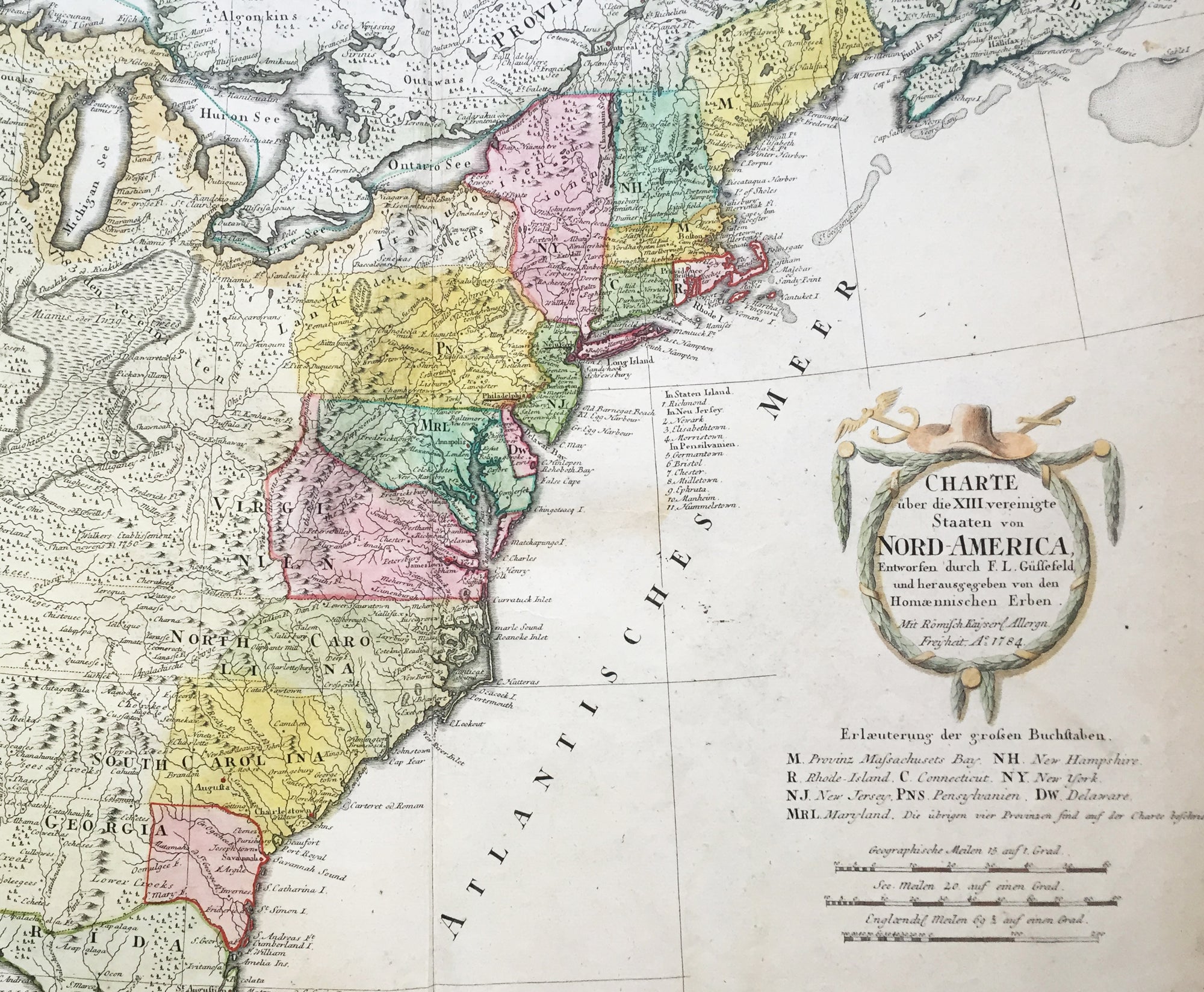
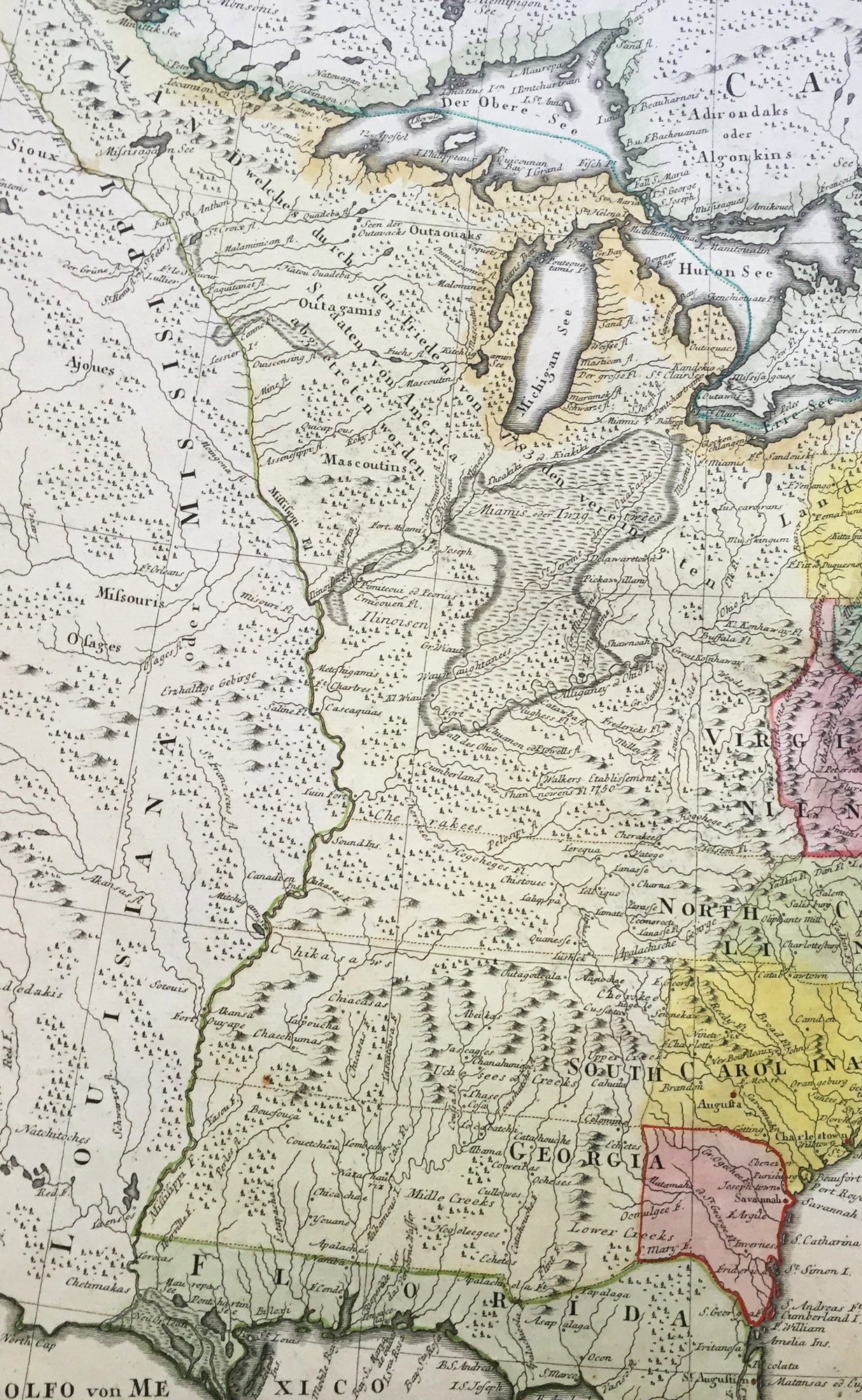
Background: An early and large map of the newly formed United States delineating all 13 states. The map extends west past the Mississippi River and north to the southern tip of Hudson Bay. The southern states are shown with their western boundaries on the Mississippi River, although the coloring shows only regions east of the Appalachians as being organized. As with many German maps of the period, there are some incorrect state boundaries; Vermont is shown as part of New Hampshire, and Maryland includes much of northern Virginia. A list of the principal German communities in New York, New Jersey and Pennsylvania are listed. The interior regions are shown with considerable topographical detail, locating numerous Indian tribes, topography, and watershed. The uncolored garland-style title cartouche is topped with a hat and crossed swords.
Each state is colored in a contrasting pastel and the states in the northern part are named by way of a lettered key given just below the attractive title cartouche. The treatment of the lands to the west of the Appalachian Mountains and up to the Mississippi River is quite interesting. This area is indicated as lands that came to the United States by the Treaty of 1783.French title outside top neat-line: Les XIII Etats Unis de l' Amerique Septentrionale. Ref: Tooley; M&B)
General Description: Paper thickness and quality: - Heavy and stable Paper color: - off white Age of map color: - Original Colors used: - Yellow, green, blue, pink General color appearance: - Authentic Paper size: - 23 1/4in x 19 1/4in (590mm x 490mm) Plate size: - 23in x 18 1/4in (685mm x 465mm) Margins: - Min 1/2in (12mm)
Imperfections: Margins: - Light soiling in top margin, Plate area: - Light creasing along centerfold, light soiling Verso: - Re-enforced along centerfold