Products
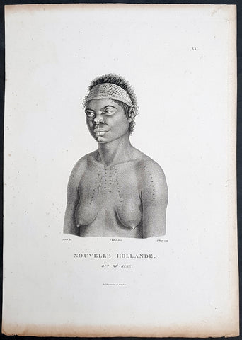
1807 Baudin & Petit Antique Print Sydney Aboriginal Wárrgan, Bennelong's Sister
- Title : Nouvelle-Hollande. Oui-re-kine
- Size: 14in x 10in (355mm x 255mm)
- Condition: (A+) Fine Condition
- Date : 1807
- Ref #: 91238
Description:
This exquisite, rare original copper-plate engraved antique print, of the (half) sister of the famous Port Jackson Aborginal leader Bennelong, Oui-ré-kine – Wárrgan (Crow), also referred to as Worogan, was engraved by Barthélemy Roger, after the 1802 drawing by Nicolas-Martin Petit, and was published by Francois Peron (1775 - 1810) in the 1st edition atlas of Nicolas Thomas Baudins expedition to Australia Voyage de découvertes aux Terres Australes
This is a wonderful original stipple point engraving by Petit & Roger bringing to life this wonderful 1st Australian.
The sitter – identified by artist Nicolas-Martin Petit as Oui-ré-kine – Wárrgan (Crow), also referred to as Worogan. In his writings about the Eora people he knew, astronomer and collector of Sydney languages William Dawes counted Wárrgan with Bennelongs sisters, although she might have been a half-sister or other relative of Bennelongs. Her husband Yeranibe (Euranabie) was the son of Maugoran, a leader of the Burramattagal clan, making Wárrgan a sister-in-law to Bidgee Bidgee, another of Petits Sydney sitters. In 1801, Wárrgan and Yeranibe joined the Lady Nelson which, under the command of James Grant, voyaged to Jervis Bay before making a survey of Bass Strait. In The Narrative of a Voyage of Discovery performed in His Majestys vessel the Lady Nelson (1803–1804), Grant related an incident wherein Wárrgan demonstrated the use of a waddy and a woomera, and how incisions were made on the body using a shell. Both Wárrgan and Yeranibe spoke English, and acted as Grant’s interpreters.
General Definitions:
Paper thickness and quality: - Heavy and stable
Paper color : - off white
Age of map color: -
Colors used: -
General color appearance: -
Paper size: - 14in x 10in (355mm x 255mm)
Plate size: - 12 1/2in x 9 1/2in (320mm x 240mm)
Margins: - Min 1/2in (12mm)
Imperfections:
Margins: - Light age toning to outer margins
Plate area: - None
Verso: - None
Background:
The Baudin Expedition of 1800 to 1803 was a French expedition to map the coast of New Holland, Australia. The expedition started with two ships, Géographe, captained by Baudin, and Naturaliste captained by Jacques Hamelin, and was accompanied by nine zoologists and botanists, including Jean-Baptiste Leschenault de la Tour, François Péron and Charles-Alexandre Lesueur as well as the geographer Pierre Faure.
The Baudin expedition departed Le Havre, France, on 19 October 1800. Because of delays in receiving his instructions and problems encountered in Isle de France (now Mauritius) they did not reach Cape Leeuwin on the south-west corner of Australia until May 1801. Upon rounding Cape Naturaliste, they entered Geographe Bay. They then sailed north, but the ships became separated and did not meet again until they reached Timor. On their journeys the Géographe and the Naturaliste surveyed large stretches of the north-western coast. The expedition was severely affected by dysentery and fever, but sailed from Timor on 13 November 1801, back down the north-west and west coast, then across the Great Australian Bight, reaching Tasmania on 13 January 1802. They charted the whole length of Tasmanias east coast and there were extensive interactions with the Indigenous Tasmanians, with whom they had peaceful relationships. They notably produced precious ethnological studies of Indigenous Tasmanians.
The expedition then began surveying the south coast of Australia, but then Captain Jacques Felix Emmanuel Hamelin in Naturaliste decided to make for Port Jackson (Sydney) as he was running short of food and water, and in need of anchors. En route, in April 1802, Hamelin explored the area of Western Port, Victoria, and gave names to places, a number of which have survived, for example, Ile des Français is now called French Island.
Meanwhile, Baudin in the Géographe continued westward, and in April 1802 encountered the British ship Investigator commanded by Matthew Flinders, also engaged in charting the coastline, at Encounter Bay in what is now South Australia. Flinders informed Baudin of his discovery of Kangaroo Island, St. Vincents and Spencers Gulfs. Baudin sailed on to the Nuyts Archipelago, the point reached by t Gulden Zeepaert in 1627 before heading for Port Jackson as well for supplies.
In late 1802 the expedition was at Port Jackson, where the government sold 60 casks of flour and 25 casks of salt meat to Baudin to resupply his two vessels. The supplies permitted Naturaliste to return to France and Géographe to continue her explorations of the Australian coast. Naturaliste took with her the Colonys staff surgeon, Mr. James Thomson, whom Governor Philip Gidley King had given permission to return to England.
Before resuming the voyage Baudin purchased a 30 ton schooner, which he named the Casuarina, a smaller vessel which could conduct close inshore survey work. He sent the larger Naturaliste under Hamelin back to France with all the specimens that had been collected by Baudin and his crew. As the voyage had progressed Louis de Freycinet, now a Lieutenant, had shown his talents as an officer and a hydrographer and so was given command of the Casuarina. The expedition then headed for Tasmania and conducted further charting of Bass Strait before sailing west, following the west coast northward, and after another visit to Timor, undertook further exploration along the north coast of Australia. Plagued by contrary winds, ill health, and because the quadrupeds and emus were very sick, it was decided on 7 July 1803 to return to France. On the return voyage, the ships stopped in Mauritius, where Baudin died of tuberculosis on 16 September 1803. The expedition finally reached France on 24 March 1804.
The scientific expedition was considered a great success, with more than 2500 new species discovered.
Nicolas-Martin Petit 1777 – 1804
Nicholas-Martin Petit was born in Paris, the son of a fan maker, and learned graphic art in the studio of Jacques Louis David. He avoided conscription into Napoleons armies, but wanting to travel, signed up with post Captain Nicholas Baudin on a voyage to the antipodes sponsored by the French government. Petit and fellow artist Charles-Alexandre Lesueur were enlisted directly by Baudin (as 4th class gunners mates) while the two official artists were hired by the organisers of the expedition. Baudin set off in two lavishly equipped vessels, the Géographe and the Naturaliste on 19 October 1800. By the time the expedition reached Mauritius the official artists had quit. Petit and Lesueur took over their duties, but as neither was trained in scientific method or presentation, the value of their work was primarily aesthetic. The French were at this time developing a new scientific field - anthropology. The Society of the Observers of Man was founded in 1799 for this purpose. The study of Man formed part of the background for Petits sensitive drawings and paintings of the indigenous people of Van Diemens Land, Port Jackson and Western Australia. Lesueur focused on the depiction of animals. The expedition charted the coast of Western Australia and Van Diemens land but was plagued by scurvy. On 20 June 1802 the two ships limped into Port Jackson and stayed for five months to refit, during which time Petit completed a number of portraits of Sydney Indigenous people, including the two images of the Eora men, Cour-rou-bari-gal and Y-erren-gou-la-ga. Petit eventually returned to France in 1804. However, before he was well enough to complete the drawings from the expedition he was hurt in a street accident, and he died at the age of 28. Petits unfinished work was first published in 1807 in the Atlas of the Voyage de découvertes aux terres australes and as discrete prints.
Baudin, Nicolas Thomas 1754 – 1803
Baudin was a French explorer, cartographer, naturalist and hydrographer. Born a commoner in Saint-Martin-de-Ré on the Île de Ré on 17 February 1754 Baudin joined the merchant navy at the age of 15 and the French East India Company at the age of 20.
Baudin then joined the La Marine Royale (French Navy) in 1774 and served in the Caribbean as an officier bleu during the American War of Independence of 1775–1783.
In 1785 Baudin and his brother Alexandre were respectively masters of the St Remy and Caroline, taking Acadian settlers from Nantes to La Nouvelle Orléans. In New Orleans local merchants contracted him to take a cargo of wood, salted meat, cod and flour to Isle de France (now Mauritius), which he did in Josephine (also called Pepita), departing New Orleans on 14 July 1786 and arriving at Isle de France on 27 March 1787. In the course of the voyage, Josephine had called at Cap‑Français in Haiti to make a contract to transport slaves there from Madagascar; while in Haiti he also encountered the Austrian botanist Franz Josef Maerter, who apparently informed him that another Austrian botanist, Franz Boos, was at the Cape of Good Hope awaiting a ship to take him to Mauritius. Josephine called at the Cape and took Boos on board. At Mauritius, Boos chartered Baudin to transport him and the collection of plant specimens he had gathered there and at the Cape back to Europe, which Baudin did, Josephine arriving at Trieste on 18 June 1788. The Imperial government in Vienna was contemplating organizing another natural-history expedition, to which Boos would be appointed, in which two ships would be sent to the Malabar and Coromandel coasts of India, the Persian Gulf, Bengal, Ceylon, Sumatra, Java, Borneo, Cochin China, Tongking, Japan and China. Baudin had been given reason to hope that he would be given command of the ships of this expedition.
Later in 1788 Baudin sailed on a commercial voyage from Trieste to Canton in Jardiniere. He apparently arrived at Canton from Mauritius under the flag of the United States of America, probably to avoid the possibility of having his ship seized by the Chinese for payment of the debts owed them by the Imperial Asiatic Company of Trieste. From there, he sent Jardiniere under her second captain on a fur-trading venture to the north-west coast of America, but the ship foundered off Asuncion Island in the Marianas in late 1789.
Baudin made his way to Mauritius, where he purchased a replacement ship, Jardiniere II, but this vessel was wrecked in a cyclone that struck Port Louis on 15 December 1789. Baudin embarked on the Spanish Royal Philippines Company ship, Placeres, which sailed from Port Louis for Cadiz in August 1790. Placeres called at the Cape of Good Hope where it took on board the large number of plant and animal specimens collected in South Africa for the Imperial palace at Schönbrunn by Georg Scholl, the assistant of Franz Boos. Because of the poor condition of the ship, Placeres had to put in at the island of Trinidad in the West Indies, where Scholls collection of specimens was deposited.
Baudin proceeded to Martinique, from where he addressed an offer to the Imperial government in Vienna to conduct to Canton commissioners who would be empowered to negotiate with the Chinese merchants there a settlement of the debts incurred by the Imperial Asiatic Company, which would enable the company to renew its trade with China. On its return voyage from Canton, the proposed expedition would call at the Cape of Good Hope to pick up Scholl and the remainder of his natural-history collection for conveyance to Schönbrunn.
After returning to Vienna in September 1791, Baudin continued to press his case for an expedition under the Imperial flag to the Indian Ocean and China, and in January 1792 he was granted a commission of captain in the Imperial navy for this purpose. A ship, called Jardiniere, was acquired and the botanists Franz Bredemeyer and Joseph van der Schot appointed to the expedition. After delays caused by the outbreak of war between France and Austria (April 1792), Jardiniere departed from the Spanish port of Málaga on 1 October 1792. From the Cape of Good Hope Jardiniere sailed across the Indian Ocean to the coast of New Holland (Australia), but two consecutive cyclones prevented the expedition from doing any work there and forced Baudin to take the ship to Bombay for repairs.
From Bombay the expedition proceeded to the Persian Gulf, the Red Sea and the east coast of Africa, where it gathered botanical and zoological collections. The expedition came to an abrupt end in June 1794 when Jardiniere went aground in a storm while attempting to enter Table Bay at the Cape of Good Hope. Baudin survived the wreck and made his way to the United States, from where he went to France. He managed to send Jardinieres cargo of natural history specimens to the island of Trinidad.
In Paris, Baudin visited Antoine de Jussieu at the Museum National dHistoire Naturelle in March 1796 to suggest a botanical voyage to the Caribbean, during which he would recover the collection of specimens he had left in Trinidad. The Museum and the French government accepted the proposal, and Baudin was appointed commander of an expedition in the ship Belle Angélique, with four assigned botanists: René Maugé, André Pierre Ledru, Anselme Riedlé and Stanislas Levillain. Belle Angélique cleared Le Havre on 30 September 1796 for the Canary Islands, where the ship was condemned as unseaworthy. The expedition sailed from the Canaries in a replacement vessel, Fanny, and reached Trinidad in April 1797. The British, who had just captured the island from the Spanish in February 1797, refused to allow Baudin to recover the collection of natural-history specimens. Baudin took Fanny to St. Thomas and St. Croix, and then to Puerto Rico, specimens being collected in all three islands. At St Croix, Fanny was replaced by a newly purchased ship, renamed Belle Angelique. The expedition returned to France in June 1798 with a large collection of plants, birds and insects, which was incorporated into Napoleon Bonapartes triumphal procession celebrating his recent Italian victories.
On 24 July 1798, at the suggestion of the Ministry of Marine, Baudin presented to the Assembly of Professors and Administrators of the National Museum of Natural History a plan for a hydrographic-survey expedition to the South Seas, which would include a search for fauna and flora that could be brought back for cultivation in France. The expedition would also have the aim of promoting the economic and commercial interests of France in the regions to be visited. The expedition would require two well-equipped ships, which would carry a team of astronomers, naturalists and scientific draughtsmen over whom Baudin as commander would have absolute authority. The first part of the voyage would be devoted to a thorough exploration of the coast of Chile and the collection of animal, bird and plant specimens suitable for acclimatization in France, followed by a survey of the coasts from Peru to Mexico. The expedition would then continue into the Pacific Ocean, including a visit to Tahiti and the Society Islands, and would be completed with a survey of the yet unexplored south-west coast of New Holland (Australia). After considering this extensive proposal, the French government decided to proceed with an expedition confined to a survey of western and southern New Holland (as Australia was called at the time).
In October 1800 Baudin was selected to lead what has become known as the Baudin expedition to map the coast of Australia (New Holland). He had two ships, Géographe and Naturaliste captained by Hamelin, and a suite of nine zoologists and botanists, including Jean Baptiste Leschenault de la Tour. He reached Australia in May 1801, and would explore and map the western coast and a part of the little-known southern coast of the continent. The scientific expedition proved a great success, with more than 2500 new species discovered. The French also met Aboriginal peoples and treated them with great respect.
In April 1802 Baudin met Matthew Flinders, also engaged in charting the coastline, in Encounter Bay in present-day South Australia. Baudin then stopped at the British colony at Sydney for supplies. In Sydney he bought a new ship — Casuarina — named after the wood it was made from. From there he sent home Naturaliste, which had on board all of the specimens that had been discovered by Baudin and his crew. He then headed for Tasmania, before continuing north to Timor. Baudin then sailed for home, stopping at Mauritius.
According to recent researches by academics from the University of Adelaide, during Baudins expedition, François Péron, who had become the chief zoologist and intellectual leader of the mission, wrote a report for Napoleon on ways to invade and capture the British colony at Sydney Cove.
Baudin died of tuberculosis at Mauritius on 16 September 1803, at the age of 49, apparently in the home of Madame Alexandrine Kerivel. Baudins exact resting place is not known, but the historian Auguste Toussaint believed that he was interred in the Kerivel family vault. However, the historian Edward Duyker likes to think that Baudin was buried in Le Cimetière de lOuest in the district of Port Louis just a few hundred metres from the explorers certain love: the sea.
Please note all items auctioned are genuine, we do not sell reproductions. A Certificate of Authenticity (COA) can be issued on request.
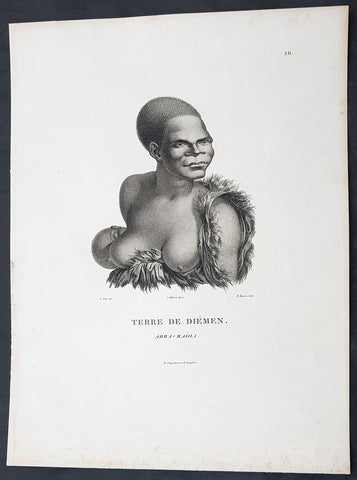
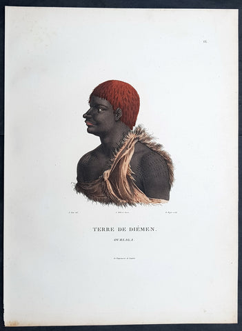
1807 Nicolas Baudin & N M Petit Antique Print of Tasmanian Aboriginal Arra Maida
Antique Map
- Title : Terre De Diemen Arra Maida
- Size: 13in x 10in (330mm x 255mm)
- Condition: (A+) Fine Condition
- Date : 1807
- Ref #: 93085
Description:
This exquisite, rare original copper-plate engraved antique print of Tasmanian Aboriginal Arra Maida, visited by the Baudin Expedition to Australia in Feb. 1802, was engraved by Barthélemy Roger, after Nicolas-Martin Petit (the offical artist on the ship Géographe) and was published by Francois Peron (1775 - 1810) in the 1st edition atlas of Nicolas Thomas Baudins expedition to Australia Voyage de découvertes aux Terres Australes
Nicholas Martin Petit sailed with Nicolas Baudin on the expedition of the Géographe and the Naturaliste in late 1800. The scientific field of anthropology was in its infancy – the French had founded the Society of the Observers of Man in 1799. Having embarked as a fourth-class gunner’s mate, Petit, who had had some graphic arts training, became one of the expeditions two illustrators when the official artists quit. From June to November 1802, the expedition was delayed in Sydney while its two ships were repaired. During this time Petit completed portraits of people of the Cadigal, Dharawal, Gweagal, Kurringai and Darug language groups of the Sydney Harbour region. While the sitters names appear to be noted on the works, it is possible that the inscriptions merely reflect French misinterpretation of the Aborigines communications with them.
The portrait of Nourou-gal-derri is pictured advancing for battle.
General Definitions:
Paper thickness and quality: - Heavy and stable
Paper color : - off white
Age of map color: -
Colors used: -
General color appearance: -
Paper size: - 14in x 10in (355mm x 255mm)
Plate size: - 14in x 10in (355mm x 255mm)
Margins: - Min 1/2in (12mm)
Imperfections:
Margins: - None
Plate area: - None
Verso: - None
Background:
The Baudin Expedition of 1800 to 1803 was a French expedition to map the coast of New Holland, Australia. The expedition started with two ships, Géographe, captained by Baudin, and Naturaliste captained by Jacques Hamelin, and was accompanied by nine zoologists and botanists, including Jean-Baptiste Leschenault de la Tour, François Péron and Charles-Alexandre Lesueur as well as the geographer Pierre Faure.
The Baudin expedition departed Le Havre, France, on 19 October 1800. Because of delays in receiving his instructions and problems encountered in Isle de France (now Mauritius) they did not reach Cape Leeuwin on the south-west corner of Australia until May 1801. Upon rounding Cape Naturaliste, they entered Geographe Bay. They then sailed north, but the ships became separated and did not meet again until they reached Timor. On their journeys the Géographe and the Naturaliste surveyed large stretches of the north-western coast. The expedition was severely affected by dysentery and fever, but sailed from Timor on 13 November 1801, back down the north-west and west coast, then across the Great Australian Bight, reaching Tasmania on 13 January 1802. They charted the whole length of Tasmanias east coast and there were extensive interactions with the Indigenous Tasmanians, with whom they had peaceful relationships. They notably produced precious ethnological studies of Indigenous Tasmanians.
The expedition then began surveying the south coast of Australia, but then Captain Jacques Felix Emmanuel Hamelin in Naturaliste decided to make for Port Jackson (Sydney) as he was running short of food and water, and in need of anchors. En route, in April 1802, Hamelin explored the area of Western Port, Victoria, and gave names to places, a number of which have survived, for example, Ile des Français is now called French Island.
Meanwhile, Baudin in the Géographe continued westward, and in April 1802 encountered the British ship Investigator commanded by Matthew Flinders, also engaged in charting the coastline, at Encounter Bay in what is now South Australia. Flinders informed Baudin of his discovery of Kangaroo Island, St. Vincents and Spencers Gulfs. Baudin sailed on to the Nuyts Archipelago, the point reached by t Gulden Zeepaert in 1627 before heading for Port Jackson as well for supplies.
In late 1802 the expedition was at Port Jackson, where the government sold 60 casks of flour and 25 casks of salt meat to Baudin to resupply his two vessels. The supplies permitted Naturaliste to return to France and Géographe to continue her explorations of the Australian coast. Naturaliste took with her the Colonys staff surgeon, Mr. James Thomson, whom Governor Philip Gidley King had given permission to return to England.
Before resuming the voyage Baudin purchased a 30 ton schooner, which he named the Casuarina, a smaller vessel which could conduct close inshore survey work. He sent the larger Naturaliste under Hamelin back to France with all the specimens that had been collected by Baudin and his crew. As the voyage had progressed Louis de Freycinet, now a Lieutenant, had shown his talents as an officer and a hydrographer and so was given command of the Casuarina. The expedition then headed for Tasmania and conducted further charting of Bass Strait before sailing west, following the west coast northward, and after another visit to Timor, undertook further exploration along the north coast of Australia. Plagued by contrary winds, ill health, and because the quadrupeds and emus were very sick, it was decided on 7 July 1803 to return to France. On the return voyage, the ships stopped in Mauritius, where Baudin died of tuberculosis on 16 September 1803. The expedition finally reached France on 24 March 1804.
The scientific expedition was considered a great success, with more than 2500 new species discovered.
Nicolas-Martin Petit 1777 – 1804
Nicholas-Martin Petit was born in Paris, the son of a fan maker, and learned graphic art in the studio of Jacques Louis David. He avoided conscription into Napoleons armies, but wanting to travel, signed up with post Captain Nicholas Baudin on a voyage to the antipodes sponsored by the French government. Petit and fellow artist Charles-Alexandre Lesueur were enlisted directly by Baudin (as 4th class gunners mates) while the two official artists were hired by the organisers of the expedition. Baudin set off in two lavishly equipped vessels, the Géographe and the Naturaliste on 19 October 1800. By the time the expedition reached Mauritius the official artists had quit. Petit and Lesueur took over their duties, but as neither was trained in scientific method or presentation, the value of their work was primarily aesthetic. The French were at this time developing a new scientific field - anthropology. The Society of the Observers of Man was founded in 1799 for this purpose. The study of Man formed part of the background for Petits sensitive drawings and paintings of the indigenous people of Van Diemens Land, Port Jackson and Western Australia. Lesueur focused on the depiction of animals. The expedition charted the coast of Western Australia and Van Diemens land but was plagued by scurvy. On 20 June 1802 the two ships limped into Port Jackson and stayed for five months to refit, during which time Petit completed a number of portraits of Sydney Indigenous people, including the two images of the Eora men, Cour-rou-bari-gal and Y-erren-gou-la-ga. Petit eventually returned to France in 1804. However, before he was well enough to complete the drawings from the expedition he was hurt in a street accident, and he died at the age of 28. Petits unfinished work was first published in 1807 in the Atlas of the Voyage de découvertes aux terres australes and as discrete prints.
Baudin, Nicolas Thomas 1754 – 1803
Baudin was a French explorer, cartographer, naturalist and hydrographer. Born a commoner in Saint-Martin-de-Ré on the Île de Ré on 17 February 1754 Baudin joined the merchant navy at the age of 15 and the French East India Company at the age of 20.
Baudin then joined the La Marine Royale (French Navy) in 1774 and served in the Caribbean as an officier bleu during the American War of Independence of 1775–1783.
In 1785 Baudin and his brother Alexandre were respectively masters of the St Remy and Caroline, taking Acadian settlers from Nantes to La Nouvelle Orléans. In New Orleans local merchants contracted him to take a cargo of wood, salted meat, cod and flour to Isle de France (now Mauritius), which he did in Josephine (also called Pepita), departing New Orleans on 14 July 1786 and arriving at Isle de France on 27 March 1787. In the course of the voyage, Josephine had called at Cap‑Français in Haiti to make a contract to transport slaves there from Madagascar; while in Haiti he also encountered the Austrian botanist Franz Josef Maerter, who apparently informed him that another Austrian botanist, Franz Boos, was at the Cape of Good Hope awaiting a ship to take him to Mauritius. Josephine called at the Cape and took Boos on board. At Mauritius, Boos chartered Baudin to transport him and the collection of plant specimens he had gathered there and at the Cape back to Europe, which Baudin did, Josephine arriving at Trieste on 18 June 1788. The Imperial government in Vienna was contemplating organizing another natural-history expedition, to which Boos would be appointed, in which two ships would be sent to the Malabar and Coromandel coasts of India, the Persian Gulf, Bengal, Ceylon, Sumatra, Java, Borneo, Cochin China, Tongking, Japan and China. Baudin had been given reason to hope that he would be given command of the ships of this expedition.
Later in 1788 Baudin sailed on a commercial voyage from Trieste to Canton in Jardiniere. He apparently arrived at Canton from Mauritius under the flag of the United States of America, probably to avoid the possibility of having his ship seized by the Chinese for payment of the debts owed them by the Imperial Asiatic Company of Trieste. From there, he sent Jardiniere under her second captain on a fur-trading venture to the north-west coast of America, but the ship foundered off Asuncion Island in the Marianas in late 1789.
Baudin made his way to Mauritius, where he purchased a replacement ship, Jardiniere II, but this vessel was wrecked in a cyclone that struck Port Louis on 15 December 1789. Baudin embarked on the Spanish Royal Philippines Company ship, Placeres, which sailed from Port Louis for Cadiz in August 1790. Placeres called at the Cape of Good Hope where it took on board the large number of plant and animal specimens collected in South Africa for the Imperial palace at Schönbrunn by Georg Scholl, the assistant of Franz Boos. Because of the poor condition of the ship, Placeres had to put in at the island of Trinidad in the West Indies, where Scholls collection of specimens was deposited.
Baudin proceeded to Martinique, from where he addressed an offer to the Imperial government in Vienna to conduct to Canton commissioners who would be empowered to negotiate with the Chinese merchants there a settlement of the debts incurred by the Imperial Asiatic Company, which would enable the company to renew its trade with China. On its return voyage from Canton, the proposed expedition would call at the Cape of Good Hope to pick up Scholl and the remainder of his natural-history collection for conveyance to Schönbrunn.
After returning to Vienna in September 1791, Baudin continued to press his case for an expedition under the Imperial flag to the Indian Ocean and China, and in January 1792 he was granted a commission of captain in the Imperial navy for this purpose. A ship, called Jardiniere, was acquired and the botanists Franz Bredemeyer and Joseph van der Schot appointed to the expedition. After delays caused by the outbreak of war between France and Austria (April 1792), Jardiniere departed from the Spanish port of Málaga on 1 October 1792. From the Cape of Good Hope Jardiniere sailed across the Indian Ocean to the coast of New Holland (Australia), but two consecutive cyclones prevented the expedition from doing any work there and forced Baudin to take the ship to Bombay for repairs.
From Bombay the expedition proceeded to the Persian Gulf, the Red Sea and the east coast of Africa, where it gathered botanical and zoological collections. The expedition came to an abrupt end in June 1794 when Jardiniere went aground in a storm while attempting to enter Table Bay at the Cape of Good Hope. Baudin survived the wreck and made his way to the United States, from where he went to France. He managed to send Jardinieres cargo of natural history specimens to the island of Trinidad.
In Paris, Baudin visited Antoine de Jussieu at the Museum National dHistoire Naturelle in March 1796 to suggest a botanical voyage to the Caribbean, during which he would recover the collection of specimens he had left in Trinidad. The Museum and the French government accepted the proposal, and Baudin was appointed commander of an expedition in the ship Belle Angélique, with four assigned botanists: René Maugé, André Pierre Ledru, Anselme Riedlé and Stanislas Levillain. Belle Angélique cleared Le Havre on 30 September 1796 for the Canary Islands, where the ship was condemned as unseaworthy. The expedition sailed from the Canaries in a replacement vessel, Fanny, and reached Trinidad in April 1797. The British, who had just captured the island from the Spanish in February 1797, refused to allow Baudin to recover the collection of natural-history specimens. Baudin took Fanny to St. Thomas and St. Croix, and then to Puerto Rico, specimens being collected in all three islands. At St Croix, Fanny was replaced by a newly purchased ship, renamed Belle Angelique. The expedition returned to France in June 1798 with a large collection of plants, birds and insects, which was incorporated into Napoleon Bonapartes triumphal procession celebrating his recent Italian victories.
On 24 July 1798, at the suggestion of the Ministry of Marine, Baudin presented to the Assembly of Professors and Administrators of the National Museum of Natural History a plan for a hydrographic-survey expedition to the South Seas, which would include a search for fauna and flora that could be brought back for cultivation in France. The expedition would also have the aim of promoting the economic and commercial interests of France in the regions to be visited. The expedition would require two well-equipped ships, which would carry a team of astronomers, naturalists and scientific draughtsmen over whom Baudin as commander would have absolute authority. The first part of the voyage would be devoted to a thorough exploration of the coast of Chile and the collection of animal, bird and plant specimens suitable for acclimatization in France, followed by a survey of the coasts from Peru to Mexico. The expedition would then continue into the Pacific Ocean, including a visit to Tahiti and the Society Islands, and would be completed with a survey of the yet unexplored south-west coast of New Holland (Australia). After considering this extensive proposal, the French government decided to proceed with an expedition confined to a survey of western and southern New Holland (as Australia was called at the time).
In October 1800 Baudin was selected to lead what has become known as the Baudin expedition to map the coast of Australia (New Holland). He had two ships, Géographe and Naturaliste captained by Hamelin, and a suite of nine zoologists and botanists, including Jean Baptiste Leschenault de la Tour. He reached Australia in May 1801, and would explore and map the western coast and a part of the little-known southern coast of the continent. The scientific expedition proved a great success, with more than 2500 new species discovered. The French also met Aboriginal peoples and treated them with great respect.
In April 1802 Baudin met Matthew Flinders, also engaged in charting the coastline, in Encounter Bay in present-day South Australia. Baudin then stopped at the British colony at Sydney for supplies. In Sydney he bought a new ship — Casuarina — named after the wood it was made from. From there he sent home Naturaliste, which had on board all of the specimens that had been discovered by Baudin and his crew. He then headed for Tasmania, before continuing north to Timor. Baudin then sailed for home, stopping at Mauritius.
According to recent researches by academics from the University of Adelaide, during Baudins expedition, François Péron, who had become the chief zoologist and intellectual leader of the mission, wrote a report for Napoleon on ways to invade and capture the British colony at Sydney Cove.
Baudin died of tuberculosis at Mauritius on 16 September 1803, at the age of 49, apparently in the home of Madame Alexandrine Kerivel. Baudins exact resting place is not known, but the historian Auguste Toussaint believed that he was interred in the Kerivel family vault. However, the historian Edward Duyker likes to think that Baudin was buried in Le Cimetière de lOuest in the district of Port Louis just a few hundred metres from the explorers certain love: the sea.
Please note all items auctioned are genuine, we do not sell reproductions. A Certificate of Authenticity (COA) can be issued on request.
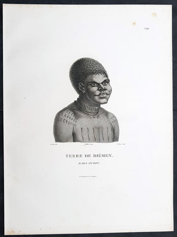
1807 Nicolas Baudin & N M Petit Antique Print of Tasmanian Aboriginal Bara-Ourou
Antique Map
- Title : Terre De Diemen Bara-Ourou
- Size: 13in x 10in (330mm x 255mm)
- Condition: (A+) Fine Condition
- Date : 1807
- Ref #: 93088
Description:
This exquisite, rare original copper-plate engraved antique print of Tasmanian Bara-Ourou, portrait of a young man 28-30 years of age, visited by Baudin Expedition to Australia in Feb. 1802, was engraved by Barthélemy Roger, after Nicolas-Martin Petit (the offical artist on the ship Géographe) and was published by Francois Peron (1775 - 1810) in the 1st edition atlas of Nicolas Thomas Baudins expedition to Australia Voyage de découvertes aux Terres Australes
Nicholas Martin Petit sailed with Nicolas Baudin on the expedition of the Géographe and the Naturaliste in late 1800. The scientific field of anthropology was in its infancy – the French had founded the Society of the Observers of Man in 1799. Having embarked as a fourth-class gunner’s mate, Petit, who had had some graphic arts training, became one of the expeditions two illustrators when the official artists quit. From June to November 1802, the expedition was delayed in Sydney while its two ships were repaired. During this time Petit completed portraits of people of the Cadigal, Dharawal, Gweagal, Kurringai and Darug language groups of the Sydney Harbour region. While the sitters names appear to be noted on the works, it is possible that the inscriptions merely reflect French misinterpretation of the Aborigines communications with them.
The portrait of Nourou-gal-derri is pictured advancing for battle.
General Definitions:
Paper thickness and quality: - Heavy and stable
Paper color : - off white
Age of map color: -
Colors used: -
General color appearance: -
Paper size: - 14in x 10in (355mm x 255mm)
Plate size: - 14in x 10in (355mm x 255mm)
Margins: - Min 1/2in (12mm)
Imperfections:
Margins: - None
Plate area: - None
Verso: - None
Background:
The Baudin Expedition of 1800 to 1803 was a French expedition to map the coast of New Holland, Australia. The expedition started with two ships, Géographe, captained by Baudin, and Naturaliste captained by Jacques Hamelin, and was accompanied by nine zoologists and botanists, including Jean-Baptiste Leschenault de la Tour, François Péron and Charles-Alexandre Lesueur as well as the geographer Pierre Faure.
The Baudin expedition departed Le Havre, France, on 19 October 1800. Because of delays in receiving his instructions and problems encountered in Isle de France (now Mauritius) they did not reach Cape Leeuwin on the south-west corner of Australia until May 1801. Upon rounding Cape Naturaliste, they entered Geographe Bay. They then sailed north, but the ships became separated and did not meet again until they reached Timor. On their journeys the Géographe and the Naturaliste surveyed large stretches of the north-western coast. The expedition was severely affected by dysentery and fever, but sailed from Timor on 13 November 1801, back down the north-west and west coast, then across the Great Australian Bight, reaching Tasmania on 13 January 1802. They charted the whole length of Tasmanias east coast and there were extensive interactions with the Indigenous Tasmanians, with whom they had peaceful relationships. They notably produced precious ethnological studies of Indigenous Tasmanians.
The expedition then began surveying the south coast of Australia, but then Captain Jacques Felix Emmanuel Hamelin in Naturaliste decided to make for Port Jackson (Sydney) as he was running short of food and water, and in need of anchors. En route, in April 1802, Hamelin explored the area of Western Port, Victoria, and gave names to places, a number of which have survived, for example, Ile des Français is now called French Island.
Meanwhile, Baudin in the Géographe continued westward, and in April 1802 encountered the British ship Investigator commanded by Matthew Flinders, also engaged in charting the coastline, at Encounter Bay in what is now South Australia. Flinders informed Baudin of his discovery of Kangaroo Island, St. Vincents and Spencers Gulfs. Baudin sailed on to the Nuyts Archipelago, the point reached by t Gulden Zeepaert in 1627 before heading for Port Jackson as well for supplies.
In late 1802 the expedition was at Port Jackson, where the government sold 60 casks of flour and 25 casks of salt meat to Baudin to resupply his two vessels. The supplies permitted Naturaliste to return to France and Géographe to continue her explorations of the Australian coast. Naturaliste took with her the Colonys staff surgeon, Mr. James Thomson, whom Governor Philip Gidley King had given permission to return to England.
Before resuming the voyage Baudin purchased a 30 ton schooner, which he named the Casuarina, a smaller vessel which could conduct close inshore survey work. He sent the larger Naturaliste under Hamelin back to France with all the specimens that had been collected by Baudin and his crew. As the voyage had progressed Louis de Freycinet, now a Lieutenant, had shown his talents as an officer and a hydrographer and so was given command of the Casuarina. The expedition then headed for Tasmania and conducted further charting of Bass Strait before sailing west, following the west coast northward, and after another visit to Timor, undertook further exploration along the north coast of Australia. Plagued by contrary winds, ill health, and because the quadrupeds and emus were very sick, it was decided on 7 July 1803 to return to France. On the return voyage, the ships stopped in Mauritius, where Baudin died of tuberculosis on 16 September 1803. The expedition finally reached France on 24 March 1804.
The scientific expedition was considered a great success, with more than 2500 new species discovered.
Nicolas-Martin Petit 1777 – 1804
Nicholas-Martin Petit was born in Paris, the son of a fan maker, and learned graphic art in the studio of Jacques Louis David. He avoided conscription into Napoleons armies, but wanting to travel, signed up with post Captain Nicholas Baudin on a voyage to the antipodes sponsored by the French government. Petit and fellow artist Charles-Alexandre Lesueur were enlisted directly by Baudin (as 4th class gunners mates) while the two official artists were hired by the organisers of the expedition. Baudin set off in two lavishly equipped vessels, the Géographe and the Naturaliste on 19 October 1800. By the time the expedition reached Mauritius the official artists had quit. Petit and Lesueur took over their duties, but as neither was trained in scientific method or presentation, the value of their work was primarily aesthetic. The French were at this time developing a new scientific field - anthropology. The Society of the Observers of Man was founded in 1799 for this purpose. The study of Man formed part of the background for Petits sensitive drawings and paintings of the indigenous people of Van Diemens Land, Port Jackson and Western Australia. Lesueur focused on the depiction of animals. The expedition charted the coast of Western Australia and Van Diemens land but was plagued by scurvy. On 20 June 1802 the two ships limped into Port Jackson and stayed for five months to refit, during which time Petit completed a number of portraits of Sydney Indigenous people, including the two images of the Eora men, Cour-rou-bari-gal and Y-erren-gou-la-ga. Petit eventually returned to France in 1804. However, before he was well enough to complete the drawings from the expedition he was hurt in a street accident, and he died at the age of 28. Petits unfinished work was first published in 1807 in the Atlas of the Voyage de découvertes aux terres australes and as discrete prints.
Baudin, Nicolas Thomas 1754 – 1803
Baudin was a French explorer, cartographer, naturalist and hydrographer. Born a commoner in Saint-Martin-de-Ré on the Île de Ré on 17 February 1754 Baudin joined the merchant navy at the age of 15 and the French East India Company at the age of 20.
Baudin then joined the La Marine Royale (French Navy) in 1774 and served in the Caribbean as an officier bleu during the American War of Independence of 1775–1783.
In 1785 Baudin and his brother Alexandre were respectively masters of the St Remy and Caroline, taking Acadian settlers from Nantes to La Nouvelle Orléans. In New Orleans local merchants contracted him to take a cargo of wood, salted meat, cod and flour to Isle de France (now Mauritius), which he did in Josephine (also called Pepita), departing New Orleans on 14 July 1786 and arriving at Isle de France on 27 March 1787. In the course of the voyage, Josephine had called at Cap‑Français in Haiti to make a contract to transport slaves there from Madagascar; while in Haiti he also encountered the Austrian botanist Franz Josef Maerter, who apparently informed him that another Austrian botanist, Franz Boos, was at the Cape of Good Hope awaiting a ship to take him to Mauritius. Josephine called at the Cape and took Boos on board. At Mauritius, Boos chartered Baudin to transport him and the collection of plant specimens he had gathered there and at the Cape back to Europe, which Baudin did, Josephine arriving at Trieste on 18 June 1788. The Imperial government in Vienna was contemplating organizing another natural-history expedition, to which Boos would be appointed, in which two ships would be sent to the Malabar and Coromandel coasts of India, the Persian Gulf, Bengal, Ceylon, Sumatra, Java, Borneo, Cochin China, Tongking, Japan and China. Baudin had been given reason to hope that he would be given command of the ships of this expedition.
Later in 1788 Baudin sailed on a commercial voyage from Trieste to Canton in Jardiniere. He apparently arrived at Canton from Mauritius under the flag of the United States of America, probably to avoid the possibility of having his ship seized by the Chinese for payment of the debts owed them by the Imperial Asiatic Company of Trieste. From there, he sent Jardiniere under her second captain on a fur-trading venture to the north-west coast of America, but the ship foundered off Asuncion Island in the Marianas in late 1789.
Baudin made his way to Mauritius, where he purchased a replacement ship, Jardiniere II, but this vessel was wrecked in a cyclone that struck Port Louis on 15 December 1789. Baudin embarked on the Spanish Royal Philippines Company ship, Placeres, which sailed from Port Louis for Cadiz in August 1790. Placeres called at the Cape of Good Hope where it took on board the large number of plant and animal specimens collected in South Africa for the Imperial palace at Schönbrunn by Georg Scholl, the assistant of Franz Boos. Because of the poor condition of the ship, Placeres had to put in at the island of Trinidad in the West Indies, where Scholls collection of specimens was deposited.
Baudin proceeded to Martinique, from where he addressed an offer to the Imperial government in Vienna to conduct to Canton commissioners who would be empowered to negotiate with the Chinese merchants there a settlement of the debts incurred by the Imperial Asiatic Company, which would enable the company to renew its trade with China. On its return voyage from Canton, the proposed expedition would call at the Cape of Good Hope to pick up Scholl and the remainder of his natural-history collection for conveyance to Schönbrunn.
After returning to Vienna in September 1791, Baudin continued to press his case for an expedition under the Imperial flag to the Indian Ocean and China, and in January 1792 he was granted a commission of captain in the Imperial navy for this purpose. A ship, called Jardiniere, was acquired and the botanists Franz Bredemeyer and Joseph van der Schot appointed to the expedition. After delays caused by the outbreak of war between France and Austria (April 1792), Jardiniere departed from the Spanish port of Málaga on 1 October 1792. From the Cape of Good Hope Jardiniere sailed across the Indian Ocean to the coast of New Holland (Australia), but two consecutive cyclones prevented the expedition from doing any work there and forced Baudin to take the ship to Bombay for repairs.
From Bombay the expedition proceeded to the Persian Gulf, the Red Sea and the east coast of Africa, where it gathered botanical and zoological collections. The expedition came to an abrupt end in June 1794 when Jardiniere went aground in a storm while attempting to enter Table Bay at the Cape of Good Hope. Baudin survived the wreck and made his way to the United States, from where he went to France. He managed to send Jardinieres cargo of natural history specimens to the island of Trinidad.
In Paris, Baudin visited Antoine de Jussieu at the Museum National dHistoire Naturelle in March 1796 to suggest a botanical voyage to the Caribbean, during which he would recover the collection of specimens he had left in Trinidad. The Museum and the French government accepted the proposal, and Baudin was appointed commander of an expedition in the ship Belle Angélique, with four assigned botanists: René Maugé, André Pierre Ledru, Anselme Riedlé and Stanislas Levillain. Belle Angélique cleared Le Havre on 30 September 1796 for the Canary Islands, where the ship was condemned as unseaworthy. The expedition sailed from the Canaries in a replacement vessel, Fanny, and reached Trinidad in April 1797. The British, who had just captured the island from the Spanish in February 1797, refused to allow Baudin to recover the collection of natural-history specimens. Baudin took Fanny to St. Thomas and St. Croix, and then to Puerto Rico, specimens being collected in all three islands. At St Croix, Fanny was replaced by a newly purchased ship, renamed Belle Angelique. The expedition returned to France in June 1798 with a large collection of plants, birds and insects, which was incorporated into Napoleon Bonapartes triumphal procession celebrating his recent Italian victories.
On 24 July 1798, at the suggestion of the Ministry of Marine, Baudin presented to the Assembly of Professors and Administrators of the National Museum of Natural History a plan for a hydrographic-survey expedition to the South Seas, which would include a search for fauna and flora that could be brought back for cultivation in France. The expedition would also have the aim of promoting the economic and commercial interests of France in the regions to be visited. The expedition would require two well-equipped ships, which would carry a team of astronomers, naturalists and scientific draughtsmen over whom Baudin as commander would have absolute authority. The first part of the voyage would be devoted to a thorough exploration of the coast of Chile and the collection of animal, bird and plant specimens suitable for acclimatization in France, followed by a survey of the coasts from Peru to Mexico. The expedition would then continue into the Pacific Ocean, including a visit to Tahiti and the Society Islands, and would be completed with a survey of the yet unexplored south-west coast of New Holland (Australia). After considering this extensive proposal, the French government decided to proceed with an expedition confined to a survey of western and southern New Holland (as Australia was called at the time).
In October 1800 Baudin was selected to lead what has become known as the Baudin expedition to map the coast of Australia (New Holland). He had two ships, Géographe and Naturaliste captained by Hamelin, and a suite of nine zoologists and botanists, including Jean Baptiste Leschenault de la Tour. He reached Australia in May 1801, and would explore and map the western coast and a part of the little-known southern coast of the continent. The scientific expedition proved a great success, with more than 2500 new species discovered. The French also met Aboriginal peoples and treated them with great respect.
In April 1802 Baudin met Matthew Flinders, also engaged in charting the coastline, in Encounter Bay in present-day South Australia. Baudin then stopped at the British colony at Sydney for supplies. In Sydney he bought a new ship — Casuarina — named after the wood it was made from. From there he sent home Naturaliste, which had on board all of the specimens that had been discovered by Baudin and his crew. He then headed for Tasmania, before continuing north to Timor. Baudin then sailed for home, stopping at Mauritius.
According to recent researches by academics from the University of Adelaide, during Baudins expedition, François Péron, who had become the chief zoologist and intellectual leader of the mission, wrote a report for Napoleon on ways to invade and capture the British colony at Sydney Cove.
Baudin died of tuberculosis at Mauritius on 16 September 1803, at the age of 49, apparently in the home of Madame Alexandrine Kerivel. Baudins exact resting place is not known, but the historian Auguste Toussaint believed that he was interred in the Kerivel family vault. However, the historian Edward Duyker likes to think that Baudin was buried in Le Cimetière de lOuest in the district of Port Louis just a few hundred metres from the explorers certain love: the sea.
Please note all items auctioned are genuine, we do not sell reproductions. A Certificate of Authenticity (COA) can be issued on request.
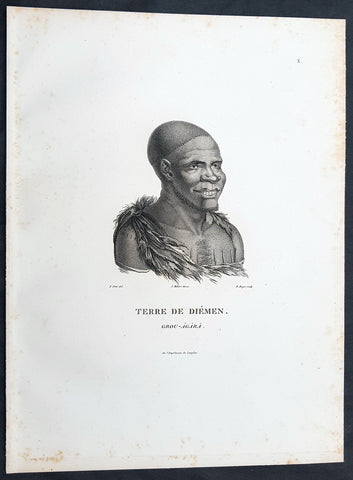
1807 Nicolas Baudin & N M Petit Antique Print of Tasmanian Aboriginal Grou Agara
Antique Map
- Title : Terre De Diemen Grou Agara
- Size: 13in x 10in (330mm x 255mm)
- Condition: (A+) Fine Condition
- Date : 1807
- Ref #: 93086
Description:
This exquisite, rare original copper-plate engraved antique print of Tasmanian Aboriginal Grou Agara, visited by the Baudin Expedition to Australia in Feb. 1802, was engraved by Barthélemy Roger, after Nicolas-Martin Petit (the offical artist on the ship Géographe) and was published by Francois Peron (1775 - 1810) in the 1st edition atlas of Nicolas Thomas Baudins expedition to Australia Voyage de découvertes aux Terres Australes
Nicholas Martin Petit sailed with Nicolas Baudin on the expedition of the Géographe and the Naturaliste in late 1800. The scientific field of anthropology was in its infancy – the French had founded the Society of the Observers of Man in 1799. Having embarked as a fourth-class gunner’s mate, Petit, who had had some graphic arts training, became one of the expeditions two illustrators when the official artists quit. From June to November 1802, the expedition was delayed in Sydney while its two ships were repaired. During this time Petit completed portraits of people of the Cadigal, Dharawal, Gweagal, Kurringai and Darug language groups of the Sydney Harbour region. While the sitters names appear to be noted on the works, it is possible that the inscriptions merely reflect French misinterpretation of the Aborigines communications with them.
The portrait of Nourou-gal-derri is pictured advancing for battle.
General Definitions:
Paper thickness and quality: - Heavy and stable
Paper color : - off white
Age of map color: -
Colors used: -
General color appearance: -
Paper size: - 14in x 10in (355mm x 255mm)
Plate size: - 14in x 10in (355mm x 255mm)
Margins: - Min 1/2in (12mm)
Imperfections:
Margins: - None
Plate area: - None
Verso: - None
Background:
The Baudin Expedition of 1800 to 1803 was a French expedition to map the coast of New Holland, Australia. The expedition started with two ships, Géographe, captained by Baudin, and Naturaliste captained by Jacques Hamelin, and was accompanied by nine zoologists and botanists, including Jean-Baptiste Leschenault de la Tour, François Péron and Charles-Alexandre Lesueur as well as the geographer Pierre Faure.
The Baudin expedition departed Le Havre, France, on 19 October 1800. Because of delays in receiving his instructions and problems encountered in Isle de France (now Mauritius) they did not reach Cape Leeuwin on the south-west corner of Australia until May 1801. Upon rounding Cape Naturaliste, they entered Geographe Bay. They then sailed north, but the ships became separated and did not meet again until they reached Timor. On their journeys the Géographe and the Naturaliste surveyed large stretches of the north-western coast. The expedition was severely affected by dysentery and fever, but sailed from Timor on 13 November 1801, back down the north-west and west coast, then across the Great Australian Bight, reaching Tasmania on 13 January 1802. They charted the whole length of Tasmanias east coast and there were extensive interactions with the Indigenous Tasmanians, with whom they had peaceful relationships. They notably produced precious ethnological studies of Indigenous Tasmanians.
The expedition then began surveying the south coast of Australia, but then Captain Jacques Felix Emmanuel Hamelin in Naturaliste decided to make for Port Jackson (Sydney) as he was running short of food and water, and in need of anchors. En route, in April 1802, Hamelin explored the area of Western Port, Victoria, and gave names to places, a number of which have survived, for example, Ile des Français is now called French Island.
Meanwhile, Baudin in the Géographe continued westward, and in April 1802 encountered the British ship Investigator commanded by Matthew Flinders, also engaged in charting the coastline, at Encounter Bay in what is now South Australia. Flinders informed Baudin of his discovery of Kangaroo Island, St. Vincents and Spencers Gulfs. Baudin sailed on to the Nuyts Archipelago, the point reached by t Gulden Zeepaert in 1627 before heading for Port Jackson as well for supplies.
In late 1802 the expedition was at Port Jackson, where the government sold 60 casks of flour and 25 casks of salt meat to Baudin to resupply his two vessels. The supplies permitted Naturaliste to return to France and Géographe to continue her explorations of the Australian coast. Naturaliste took with her the Colonys staff surgeon, Mr. James Thomson, whom Governor Philip Gidley King had given permission to return to England.
Before resuming the voyage Baudin purchased a 30 ton schooner, which he named the Casuarina, a smaller vessel which could conduct close inshore survey work. He sent the larger Naturaliste under Hamelin back to France with all the specimens that had been collected by Baudin and his crew. As the voyage had progressed Louis de Freycinet, now a Lieutenant, had shown his talents as an officer and a hydrographer and so was given command of the Casuarina. The expedition then headed for Tasmania and conducted further charting of Bass Strait before sailing west, following the west coast northward, and after another visit to Timor, undertook further exploration along the north coast of Australia. Plagued by contrary winds, ill health, and because the quadrupeds and emus were very sick, it was decided on 7 July 1803 to return to France. On the return voyage, the ships stopped in Mauritius, where Baudin died of tuberculosis on 16 September 1803. The expedition finally reached France on 24 March 1804.
The scientific expedition was considered a great success, with more than 2500 new species discovered.
Nicolas-Martin Petit 1777 – 1804
Nicholas-Martin Petit was born in Paris, the son of a fan maker, and learned graphic art in the studio of Jacques Louis David. He avoided conscription into Napoleons armies, but wanting to travel, signed up with post Captain Nicholas Baudin on a voyage to the antipodes sponsored by the French government. Petit and fellow artist Charles-Alexandre Lesueur were enlisted directly by Baudin (as 4th class gunners mates) while the two official artists were hired by the organisers of the expedition. Baudin set off in two lavishly equipped vessels, the Géographe and the Naturaliste on 19 October 1800. By the time the expedition reached Mauritius the official artists had quit. Petit and Lesueur took over their duties, but as neither was trained in scientific method or presentation, the value of their work was primarily aesthetic. The French were at this time developing a new scientific field - anthropology. The Society of the Observers of Man was founded in 1799 for this purpose. The study of Man formed part of the background for Petits sensitive drawings and paintings of the indigenous people of Van Diemens Land, Port Jackson and Western Australia. Lesueur focused on the depiction of animals. The expedition charted the coast of Western Australia and Van Diemens land but was plagued by scurvy. On 20 June 1802 the two ships limped into Port Jackson and stayed for five months to refit, during which time Petit completed a number of portraits of Sydney Indigenous people, including the two images of the Eora men, Cour-rou-bari-gal and Y-erren-gou-la-ga. Petit eventually returned to France in 1804. However, before he was well enough to complete the drawings from the expedition he was hurt in a street accident, and he died at the age of 28. Petits unfinished work was first published in 1807 in the Atlas of the Voyage de découvertes aux terres australes and as discrete prints.
Baudin, Nicolas Thomas 1754 – 1803
Baudin was a French explorer, cartographer, naturalist and hydrographer. Born a commoner in Saint-Martin-de-Ré on the Île de Ré on 17 February 1754 Baudin joined the merchant navy at the age of 15 and the French East India Company at the age of 20.
Baudin then joined the La Marine Royale (French Navy) in 1774 and served in the Caribbean as an officier bleu during the American War of Independence of 1775–1783.
In 1785 Baudin and his brother Alexandre were respectively masters of the St Remy and Caroline, taking Acadian settlers from Nantes to La Nouvelle Orléans. In New Orleans local merchants contracted him to take a cargo of wood, salted meat, cod and flour to Isle de France (now Mauritius), which he did in Josephine (also called Pepita), departing New Orleans on 14 July 1786 and arriving at Isle de France on 27 March 1787. In the course of the voyage, Josephine had called at Cap‑Français in Haiti to make a contract to transport slaves there from Madagascar; while in Haiti he also encountered the Austrian botanist Franz Josef Maerter, who apparently informed him that another Austrian botanist, Franz Boos, was at the Cape of Good Hope awaiting a ship to take him to Mauritius. Josephine called at the Cape and took Boos on board. At Mauritius, Boos chartered Baudin to transport him and the collection of plant specimens he had gathered there and at the Cape back to Europe, which Baudin did, Josephine arriving at Trieste on 18 June 1788. The Imperial government in Vienna was contemplating organizing another natural-history expedition, to which Boos would be appointed, in which two ships would be sent to the Malabar and Coromandel coasts of India, the Persian Gulf, Bengal, Ceylon, Sumatra, Java, Borneo, Cochin China, Tongking, Japan and China. Baudin had been given reason to hope that he would be given command of the ships of this expedition.
Later in 1788 Baudin sailed on a commercial voyage from Trieste to Canton in Jardiniere. He apparently arrived at Canton from Mauritius under the flag of the United States of America, probably to avoid the possibility of having his ship seized by the Chinese for payment of the debts owed them by the Imperial Asiatic Company of Trieste. From there, he sent Jardiniere under her second captain on a fur-trading venture to the north-west coast of America, but the ship foundered off Asuncion Island in the Marianas in late 1789.
Baudin made his way to Mauritius, where he purchased a replacement ship, Jardiniere II, but this vessel was wrecked in a cyclone that struck Port Louis on 15 December 1789. Baudin embarked on the Spanish Royal Philippines Company ship, Placeres, which sailed from Port Louis for Cadiz in August 1790. Placeres called at the Cape of Good Hope where it took on board the large number of plant and animal specimens collected in South Africa for the Imperial palace at Schönbrunn by Georg Scholl, the assistant of Franz Boos. Because of the poor condition of the ship, Placeres had to put in at the island of Trinidad in the West Indies, where Scholls collection of specimens was deposited.
Baudin proceeded to Martinique, from where he addressed an offer to the Imperial government in Vienna to conduct to Canton commissioners who would be empowered to negotiate with the Chinese merchants there a settlement of the debts incurred by the Imperial Asiatic Company, which would enable the company to renew its trade with China. On its return voyage from Canton, the proposed expedition would call at the Cape of Good Hope to pick up Scholl and the remainder of his natural-history collection for conveyance to Schönbrunn.
After returning to Vienna in September 1791, Baudin continued to press his case for an expedition under the Imperial flag to the Indian Ocean and China, and in January 1792 he was granted a commission of captain in the Imperial navy for this purpose. A ship, called Jardiniere, was acquired and the botanists Franz Bredemeyer and Joseph van der Schot appointed to the expedition. After delays caused by the outbreak of war between France and Austria (April 1792), Jardiniere departed from the Spanish port of Málaga on 1 October 1792. From the Cape of Good Hope Jardiniere sailed across the Indian Ocean to the coast of New Holland (Australia), but two consecutive cyclones prevented the expedition from doing any work there and forced Baudin to take the ship to Bombay for repairs.
From Bombay the expedition proceeded to the Persian Gulf, the Red Sea and the east coast of Africa, where it gathered botanical and zoological collections. The expedition came to an abrupt end in June 1794 when Jardiniere went aground in a storm while attempting to enter Table Bay at the Cape of Good Hope. Baudin survived the wreck and made his way to the United States, from where he went to France. He managed to send Jardinieres cargo of natural history specimens to the island of Trinidad.
In Paris, Baudin visited Antoine de Jussieu at the Museum National dHistoire Naturelle in March 1796 to suggest a botanical voyage to the Caribbean, during which he would recover the collection of specimens he had left in Trinidad. The Museum and the French government accepted the proposal, and Baudin was appointed commander of an expedition in the ship Belle Angélique, with four assigned botanists: René Maugé, André Pierre Ledru, Anselme Riedlé and Stanislas Levillain. Belle Angélique cleared Le Havre on 30 September 1796 for the Canary Islands, where the ship was condemned as unseaworthy. The expedition sailed from the Canaries in a replacement vessel, Fanny, and reached Trinidad in April 1797. The British, who had just captured the island from the Spanish in February 1797, refused to allow Baudin to recover the collection of natural-history specimens. Baudin took Fanny to St. Thomas and St. Croix, and then to Puerto Rico, specimens being collected in all three islands. At St Croix, Fanny was replaced by a newly purchased ship, renamed Belle Angelique. The expedition returned to France in June 1798 with a large collection of plants, birds and insects, which was incorporated into Napoleon Bonapartes triumphal procession celebrating his recent Italian victories.
On 24 July 1798, at the suggestion of the Ministry of Marine, Baudin presented to the Assembly of Professors and Administrators of the National Museum of Natural History a plan for a hydrographic-survey expedition to the South Seas, which would include a search for fauna and flora that could be brought back for cultivation in France. The expedition would also have the aim of promoting the economic and commercial interests of France in the regions to be visited. The expedition would require two well-equipped ships, which would carry a team of astronomers, naturalists and scientific draughtsmen over whom Baudin as commander would have absolute authority. The first part of the voyage would be devoted to a thorough exploration of the coast of Chile and the collection of animal, bird and plant specimens suitable for acclimatization in France, followed by a survey of the coasts from Peru to Mexico. The expedition would then continue into the Pacific Ocean, including a visit to Tahiti and the Society Islands, and would be completed with a survey of the yet unexplored south-west coast of New Holland (Australia). After considering this extensive proposal, the French government decided to proceed with an expedition confined to a survey of western and southern New Holland (as Australia was called at the time).
In October 1800 Baudin was selected to lead what has become known as the Baudin expedition to map the coast of Australia (New Holland). He had two ships, Géographe and Naturaliste captained by Hamelin, and a suite of nine zoologists and botanists, including Jean Baptiste Leschenault de la Tour. He reached Australia in May 1801, and would explore and map the western coast and a part of the little-known southern coast of the continent. The scientific expedition proved a great success, with more than 2500 new species discovered. The French also met Aboriginal peoples and treated them with great respect.
In April 1802 Baudin met Matthew Flinders, also engaged in charting the coastline, in Encounter Bay in present-day South Australia. Baudin then stopped at the British colony at Sydney for supplies. In Sydney he bought a new ship — Casuarina — named after the wood it was made from. From there he sent home Naturaliste, which had on board all of the specimens that had been discovered by Baudin and his crew. He then headed for Tasmania, before continuing north to Timor. Baudin then sailed for home, stopping at Mauritius.
According to recent researches by academics from the University of Adelaide, during Baudins expedition, François Péron, who had become the chief zoologist and intellectual leader of the mission, wrote a report for Napoleon on ways to invade and capture the British colony at Sydney Cove.
Baudin died of tuberculosis at Mauritius on 16 September 1803, at the age of 49, apparently in the home of Madame Alexandrine Kerivel. Baudins exact resting place is not known, but the historian Auguste Toussaint believed that he was interred in the Kerivel family vault. However, the historian Edward Duyker likes to think that Baudin was buried in Le Cimetière de lOuest in the district of Port Louis just a few hundred metres from the explorers certain love: the sea.
Please note all items auctioned are genuine, we do not sell reproductions. A Certificate of Authenticity (COA) can be issued on request.
1807 Nicolas Baudin & N M Petit Antique Print of Tasmanian Aboriginal, Ourlaga
Antique Map
- Title : Terre De Diemen Ourlaga
- Size: 14in x 10in (355mm x 255mm)
- Condition: (A+) Fine Condition
- Date : 1807
- Ref #: 93089
Description:
This exquisite, rare original hand coloured copper-plate engraved antique print of Tasmanian Ourlaga, visited by Baudin Expedition to Australia in Feb. 1802, was engraved by Barthélemy Roger, after Nicolas-Martin Petit (the offical artist on the ship Géographe) and was published by Francois Peron (1775 - 1810) in the 1st edition atlas of Nicolas Thomas Baudins expedition to Australia Voyage de découvertes aux Terres Australes
General Definitions:
Paper thickness and quality: - Heavy and stable
Paper color : - off white
Age of map color: - Original
Colors used: - Yellow, green, blue, pink
General color appearance: - Authentic
Paper size: - 14in x 10in (355mm x 255mm)
Plate size: - 14in x 10in (355mm x 255mm)
Margins: - Min 1/2in (12mm)
Imperfections:
Margins: - None
Plate area: - None
Verso: - None
Background:
The Baudin Expedition of 1800 to 1803 was a French expedition to map the coast of New Holland, Australia. The expedition started with two ships, Géographe, captained by Baudin, and Naturaliste captained by Jacques Hamelin, and was accompanied by nine zoologists and botanists, including Jean-Baptiste Leschenault de la Tour, François Péron and Charles-Alexandre Lesueur as well as the geographer Pierre Faure.
The Baudin expedition departed Le Havre, France, on 19 October 1800. Because of delays in receiving his instructions and problems encountered in Isle de France (now Mauritius) they did not reach Cape Leeuwin on the south-west corner of Australia until May 1801. Upon rounding Cape Naturaliste, they entered Geographe Bay. They then sailed north, but the ships became separated and did not meet again until they reached Timor. On their journeys the Géographe and the Naturaliste surveyed large stretches of the north-western coast. The expedition was severely affected by dysentery and fever, but sailed from Timor on 13 November 1801, back down the north-west and west coast, then across the Great Australian Bight, reaching Tasmania on 13 January 1802. They charted the whole length of Tasmanias east coast and there were extensive interactions with the Indigenous Tasmanians, with whom they had peaceful relationships. They notably produced precious ethnological studies of Indigenous Tasmanians.
The expedition then began surveying the south coast of Australia, but then Captain Jacques Felix Emmanuel Hamelin in Naturaliste decided to make for Port Jackson (Sydney) as he was running short of food and water, and in need of anchors. En route, in April 1802, Hamelin explored the area of Western Port, Victoria, and gave names to places, a number of which have survived, for example, Ile des Français is now called French Island.
Meanwhile, Baudin in the Géographe continued westward, and in April 1802 encountered the British ship Investigator commanded by Matthew Flinders, also engaged in charting the coastline, at Encounter Bay in what is now South Australia. Flinders informed Baudin of his discovery of Kangaroo Island, St. Vincents and Spencers Gulfs. Baudin sailed on to the Nuyts Archipelago, the point reached by t Gulden Zeepaert in 1627 before heading for Port Jackson as well for supplies.
In late 1802 the expedition was at Port Jackson, where the government sold 60 casks of flour and 25 casks of salt meat to Baudin to resupply his two vessels. The supplies permitted Naturaliste to return to France and Géographe to continue her explorations of the Australian coast. Naturaliste took with her the Colonys staff surgeon, Mr. James Thomson, whom Governor Philip Gidley King had given permission to return to England.
Before resuming the voyage Baudin purchased a 30 ton schooner, which he named the Casuarina, a smaller vessel which could conduct close inshore survey work. He sent the larger Naturaliste under Hamelin back to France with all the specimens that had been collected by Baudin and his crew. As the voyage had progressed Louis de Freycinet, now a Lieutenant, had shown his talents as an officer and a hydrographer and so was given command of the Casuarina. The expedition then headed for Tasmania and conducted further charting of Bass Strait before sailing west, following the west coast northward, and after another visit to Timor, undertook further exploration along the north coast of Australia. Plagued by contrary winds, ill health, and because the quadrupeds and emus were very sick, it was decided on 7 July 1803 to return to France. On the return voyage, the ships stopped in Mauritius, where Baudin died of tuberculosis on 16 September 1803. The expedition finally reached France on 24 March 1804.
The scientific expedition was considered a great success, with more than 2500 new species discovered.
Nicolas-Martin Petit 1777 – 1804
Nicholas-Martin Petit was born in Paris, the son of a fan maker, and learned graphic art in the studio of Jacques Louis David. He avoided conscription into Napoleons armies, but wanting to travel, signed up with post Captain Nicholas Baudin on a voyage to the antipodes sponsored by the French government. Petit and fellow artist Charles-Alexandre Lesueur were enlisted directly by Baudin (as 4th class gunners mates) while the two official artists were hired by the organisers of the expedition. Baudin set off in two lavishly equipped vessels, the Géographe and the Naturaliste on 19 October 1800. By the time the expedition reached Mauritius the official artists had quit. Petit and Lesueur took over their duties, but as neither was trained in scientific method or presentation, the value of their work was primarily aesthetic. The French were at this time developing a new scientific field - anthropology. The Society of the Observers of Man was founded in 1799 for this purpose. The study of Man formed part of the background for Petits sensitive drawings and paintings of the indigenous people of Van Diemens Land, Port Jackson and Western Australia. Lesueur focused on the depiction of animals. The expedition charted the coast of Western Australia and Van Diemens land but was plagued by scurvy. On 20 June 1802 the two ships limped into Port Jackson and stayed for five months to refit, during which time Petit completed a number of portraits of Sydney Indigenous people, including the two images of the Eora men, Cour-rou-bari-gal and Y-erren-gou-la-ga. Petit eventually returned to France in 1804. However, before he was well enough to complete the drawings from the expedition he was hurt in a street accident, and he died at the age of 28. Petits unfinished work was first published in 1807 in the Atlas of the Voyage de découvertes aux terres australes and as discrete prints.
Baudin, Nicolas Thomas 1754 – 1803
Baudin was a French explorer, cartographer, naturalist and hydrographer. Born a commoner in Saint-Martin-de-Ré on the Île de Ré on 17 February 1754 Baudin joined the merchant navy at the age of 15 and the French East India Company at the age of 20.
Baudin then joined the La Marine Royale (French Navy) in 1774 and served in the Caribbean as an officier bleu during the American War of Independence of 1775–1783.
In 1785 Baudin and his brother Alexandre were respectively masters of the St Remy and Caroline, taking Acadian settlers from Nantes to La Nouvelle Orléans. In New Orleans local merchants contracted him to take a cargo of wood, salted meat, cod and flour to Isle de France (now Mauritius), which he did in Josephine (also called Pepita), departing New Orleans on 14 July 1786 and arriving at Isle de France on 27 March 1787. In the course of the voyage, Josephine had called at Cap‑Français in Haiti to make a contract to transport slaves there from Madagascar; while in Haiti he also encountered the Austrian botanist Franz Josef Maerter, who apparently informed him that another Austrian botanist, Franz Boos, was at the Cape of Good Hope awaiting a ship to take him to Mauritius. Josephine called at the Cape and took Boos on board. At Mauritius, Boos chartered Baudin to transport him and the collection of plant specimens he had gathered there and at the Cape back to Europe, which Baudin did, Josephine arriving at Trieste on 18 June 1788. The Imperial government in Vienna was contemplating organizing another natural-history expedition, to which Boos would be appointed, in which two ships would be sent to the Malabar and Coromandel coasts of India, the Persian Gulf, Bengal, Ceylon, Sumatra, Java, Borneo, Cochin China, Tongking, Japan and China. Baudin had been given reason to hope that he would be given command of the ships of this expedition.
Later in 1788 Baudin sailed on a commercial voyage from Trieste to Canton in Jardiniere. He apparently arrived at Canton from Mauritius under the flag of the United States of America, probably to avoid the possibility of having his ship seized by the Chinese for payment of the debts owed them by the Imperial Asiatic Company of Trieste. From there, he sent Jardiniere under her second captain on a fur-trading venture to the north-west coast of America, but the ship foundered off Asuncion Island in the Marianas in late 1789.
Baudin made his way to Mauritius, where he purchased a replacement ship, Jardiniere II, but this vessel was wrecked in a cyclone that struck Port Louis on 15 December 1789. Baudin embarked on the Spanish Royal Philippines Company ship, Placeres, which sailed from Port Louis for Cadiz in August 1790. Placeres called at the Cape of Good Hope where it took on board the large number of plant and animal specimens collected in South Africa for the Imperial palace at Schönbrunn by Georg Scholl, the assistant of Franz Boos. Because of the poor condition of the ship, Placeres had to put in at the island of Trinidad in the West Indies, where Scholls collection of specimens was deposited.
Baudin proceeded to Martinique, from where he addressed an offer to the Imperial government in Vienna to conduct to Canton commissioners who would be empowered to negotiate with the Chinese merchants there a settlement of the debts incurred by the Imperial Asiatic Company, which would enable the company to renew its trade with China. On its return voyage from Canton, the proposed expedition would call at the Cape of Good Hope to pick up Scholl and the remainder of his natural-history collection for conveyance to Schönbrunn.
After returning to Vienna in September 1791, Baudin continued to press his case for an expedition under the Imperial flag to the Indian Ocean and China, and in January 1792 he was granted a commission of captain in the Imperial navy for this purpose. A ship, called Jardiniere, was acquired and the botanists Franz Bredemeyer and Joseph van der Schot appointed to the expedition. After delays caused by the outbreak of war between France and Austria (April 1792), Jardiniere departed from the Spanish port of Málaga on 1 October 1792. From the Cape of Good Hope Jardiniere sailed across the Indian Ocean to the coast of New Holland (Australia), but two consecutive cyclones prevented the expedition from doing any work there and forced Baudin to take the ship to Bombay for repairs.
From Bombay the expedition proceeded to the Persian Gulf, the Red Sea and the east coast of Africa, where it gathered botanical and zoological collections. The expedition came to an abrupt end in June 1794 when Jardiniere went aground in a storm while attempting to enter Table Bay at the Cape of Good Hope. Baudin survived the wreck and made his way to the United States, from where he went to France. He managed to send Jardinieres cargo of natural history specimens to the island of Trinidad.
In Paris, Baudin visited Antoine de Jussieu at the Museum National dHistoire Naturelle in March 1796 to suggest a botanical voyage to the Caribbean, during which he would recover the collection of specimens he had left in Trinidad. The Museum and the French government accepted the proposal, and Baudin was appointed commander of an expedition in the ship Belle Angélique, with four assigned botanists: René Maugé, André Pierre Ledru, Anselme Riedlé and Stanislas Levillain. Belle Angélique cleared Le Havre on 30 September 1796 for the Canary Islands, where the ship was condemned as unseaworthy. The expedition sailed from the Canaries in a replacement vessel, Fanny, and reached Trinidad in April 1797. The British, who had just captured the island from the Spanish in February 1797, refused to allow Baudin to recover the collection of natural-history specimens. Baudin took Fanny to St. Thomas and St. Croix, and then to Puerto Rico, specimens being collected in all three islands. At St Croix, Fanny was replaced by a newly purchased ship, renamed Belle Angelique. The expedition returned to France in June 1798 with a large collection of plants, birds and insects, which was incorporated into Napoleon Bonapartes triumphal procession celebrating his recent Italian victories.
On 24 July 1798, at the suggestion of the Ministry of Marine, Baudin presented to the Assembly of Professors and Administrators of the National Museum of Natural History a plan for a hydrographic-survey expedition to the South Seas, which would include a search for fauna and flora that could be brought back for cultivation in France. The expedition would also have the aim of promoting the economic and commercial interests of France in the regions to be visited. The expedition would require two well-equipped ships, which would carry a team of astronomers, naturalists and scientific draughtsmen over whom Baudin as commander would have absolute authority. The first part of the voyage would be devoted to a thorough exploration of the coast of Chile and the collection of animal, bird and plant specimens suitable for acclimatization in France, followed by a survey of the coasts from Peru to Mexico. The expedition would then continue into the Pacific Ocean, including a visit to Tahiti and the Society Islands, and would be completed with a survey of the yet unexplored south-west coast of New Holland (Australia). After considering this extensive proposal, the French government decided to proceed with an expedition confined to a survey of western and southern New Holland (as Australia was called at the time).
In October 1800 Baudin was selected to lead what has become known as the Baudin expedition to map the coast of Australia (New Holland). He had two ships, Géographe and Naturaliste captained by Hamelin, and a suite of nine zoologists and botanists, including Jean Baptiste Leschenault de la Tour. He reached Australia in May 1801, and would explore and map the western coast and a part of the little-known southern coast of the continent. The scientific expedition proved a great success, with more than 2500 new species discovered. The French also met Aboriginal peoples and treated them with great respect.
In April 1802 Baudin met Matthew Flinders, also engaged in charting the coastline, in Encounter Bay in present-day South Australia. Baudin then stopped at the British colony at Sydney for supplies. In Sydney he bought a new ship — Casuarina — named after the wood it was made from. From there he sent home Naturaliste, which had on board all of the specimens that had been discovered by Baudin and his crew. He then headed for Tasmania, before continuing north to Timor. Baudin then sailed for home, stopping at Mauritius.
According to recent researches by academics from the University of Adelaide, during Baudins expedition, François Péron, who had become the chief zoologist and intellectual leader of the mission, wrote a report for Napoleon on ways to invade and capture the British colony at Sydney Cove.
Baudin died of tuberculosis at Mauritius on 16 September 1803, at the age of 49, apparently in the home of Madame Alexandrine Kerivel. Baudins exact resting place is not known, but the historian Auguste Toussaint believed that he was interred in the Kerivel family vault. However, the historian Edward Duyker likes to think that Baudin was buried in Le Cimetière de lOuest in the district of Port Louis just a few hundred metres from the explorers certain love: the sea.
Please note all items auctioned are genuine, we do not sell reproductions. A Certificate of Authenticity (COA) can be issued on request.
1808 Wilkinson Antique Map of East Coast of Australia, New Zealand, inset Sydney
- Title : New South Wales New Zealand New Hebrides...Published Dec 12th 1808
- Ref #: 9003
- Size: 13in x 11in (330mm x 280mm)
- Date : 1808
- Condition: (A+) Fine Condition
Description:
This fine beautifully hand coloured original antique map of the east coast of Australia, New Zealand and the Solomon Islands - with inset maps of Lord Howe Island, Norfolk Island & Port Jackson - was published in 1808 by Robert Wilkinson - the date is included in the title - in his wideley acclaimed General Atlas of the World published between 1794 and 1816.
This is a finely engraved copper-plate map with beautiful original hand colouring on strong stable paper. (Ref: Tooley; M&B)
General Description:
Paper thickness and quality: - Heavy and stable
Paper color: - off white
Age of map color: - Original
Colors used: - Yellow, green, pink, blue
General color appearance: - Authentic
Paper size: - 13in x 11in (330mm x 280mm)
Plate size: - 12 1/2in x 10in (320mm x 255mm)
Margins: - Min 1/2in (12mm)
Imperfections:
Margins: - None
Plate area: - None
Verso: - None
1815 Swoboda & Hartl Antique Early Map of New Holland Australia, Ulimaroa Scarce
Antique Map
- Title : Generalcharte von Australien nach dem entwurfe des H.Joseph Marx Freiherrn v. Liechtenstern
- Date : 1815
- Condition: (A+) Fine Condition
- Ref: 16258
- Size: 27 1/4in x 22in (695mm x 560mm)
Description:
This large beautifully hand coloured original & scarce antique map of New Holland also named Ulimaroa, New Zealand and the South Pacific by Franz Swoboda and Martin Hartl was published in Vienna in 1815 - dated.
General Description:
Paper thickness and quality: - Heavy & stable
Paper color: - White
Age of map color: - Original
Colors used: - Red, yellow
General color appearance: - Authentic
Paper size: - 27 1/4in x 22in (695mm x 560mm)
Paper size: - 27in x 20 3/4in (685mm x 525mm)
Margins: - Min 1/4in (7mm)
Imperfections:
Margins: - None
Plate area: - Vertical crease right image
Verso: - None
This map is typical of the affect of Cooks discoveries on European cartography. Australia regularly became a focus on regional maps. The name "Ulimaroa" was often used, mainly by German & Austrian cartographers, at this time. It was term Cook learned from the New Zealand Maoris before discovering the east coast of Australia during his first voyage of discovery. When this map was printed there was a strong belief that the Australian continent was possibly divided by an internal sea strait, separating the east from the west coasts. It was explorers such as Flinders and Baudin who set out to find this elusive passage and if so the possible point at which a ship could enter.
Only a few years before in 1798 Flinders and Bass had proved that there was a strait dividing Van Diemen’s Land (Tasmania) from the rest of the continent so now the race was on to find the other passage. On Swoboda’s map a line has been drawn from the bottom of Carpentaria to the eastern part of present day Victoria. This line represented two things, the potential shape of the eastern landmass split by the sea and the extent to English territory in the newly settled colonies, only 17 years old. The Southern Coastline is not shown as even though Flinders had by 1803 mapped the entire region he was in 1805 still under house arrest on the islands of Mauritius by the French, he would not publish his discoveries until 1814. Therefore this map shows Australia at a pivotal point in its history when most of the continent was still open for settlement by other nations and the coastlines and mysteries were still to be confirmed. (Ref: Clancy; M&B; Tooley)

1817 John Thomson Large Antique Map of Asia, New Holland, Australia, New Zealand
- Title : Asia
- Date : 1817
- Size: 28in x 21in (710mm x 535mm)
- Condition: (A+) Fine Condition
- Ref: 92965
Description:
This large magnificent original hand coloured copper-plate engraved antique map of Asia, Australia, New Zealand & The South Pacific by John Thomson was published in the 1817 edition of Thomsons General Atlas
General Definitions:
Paper thickness and quality: - Heavy and stable
Paper color : - off white
Age of map color: - Original
Colors used: - Yellow, green, blue, pink
General color appearance: - Authentic
Paper size: - 28in x 21in (710mm x 535mm)
Plate size: - 22in x 19in (560mm x 485mm)
Margins: - Min 2in (50mm)
Imperfections:
Margins: - None
Plate area: - None
Verso: - None
Background:
The first recorded European sighting of the Australian mainland, and the first recorded European landfall on the Australian continent (in 1606), are attributed to the Dutch. The first ship and crew to chart the Australian coast and meet with Aboriginal people was the Duyfken captained by Dutch navigator, Willem Janszoon. He sighted the coast of Cape York Peninsula in early 1606, and made landfall on 26 February at the Pennefather River near the modern town of Weipa on Cape York. The Dutch charted the whole of the western and northern coastlines and named the island continent New Holland during the 17th century, but made no attempt at settlement. William Dampier, an English explorer and privateer, landed on the north-west coast of New Holland in 1688 and again in 1699 on a return trip. In 1770, James Cook sailed along and mapped the east coast, which he named New South Wales and claimed for Great Britain.
With the loss of its American colonies in 1783, the British Government sent a fleet of ships, the First Fleet, under the command of Captain Arthur Phillip, to establish a new penal colony in New South Wales. A camp was set up and the flag raised at Sydney Cove, Port Jackson, on 26 January 1788, a date which became Australias national day, Australia Day. A British settlement was established in Van Diemens Land, now known as Tasmania, in 1803, and it became a separate colony in 1825. The United Kingdom formally claimed the western part of Western Australia (the Swan River Colony) in 1828. Separate colonies were carved from parts of New South Wales: South Australia in 1836, Victoria in 1851, and Queensland in 1859. The Northern Territory was founded in 1911 when it was excised from South Australia. South Australia was founded as a free province—it was never a penal colony. Victoria and Western Australia were also founded free, but later accepted transported convicts. A campaign by the settlers of New South Wales led to the end of convict transportation to that colony; the last convict ship arrived in 1848.
The indigenous population, estimated to have been between 750,000 and 1,000,000 in 1788, declined for 150 years following settlement, mainly due to infectious disease. Thousands more died as a result of frontier conflict with settlers. A government policy of assimilation beginning with the Aboriginal Protection Act 1869 resulted in the removal of many Aboriginal children from their families and communities—often referred to as the Stolen Generations—a practice which may also have contributed to the decline in the indigenous population. As a result of the 1967 referendum, the Federal governments power to enact special laws with respect to a particular race was extended to enable the making of laws with respect to Aborigines.[68] Traditional ownership of land (native title) was not recognised in law until 1992, when the High Court of Australia held in Mabo v Queensland (No 2) that the legal doctrine that Australia had been terra nullius (land belonging to no one) did not apply to Australia at the time of British settlement.
A gold rush began in Australia in the early 1850s and the Eureka Rebellion against mining licence fees in 1854 was an early expression of civil disobedience. Between 1855 and 1890, the six colonies individually gained responsible government, managing most of their own affairs while remaining part of the British Empire. The Colonial Office in London retained control of some matters, notably foreign affairs, defence and international shipping.
1825 Philippe Vandermaelen Large Antique Map The Gulf of Carpentaria, Australia
Antique Map
- Title : Partie De La Nlle. Hollande
- Size: 28 1/2in x 21in (725mm x 550mm)
- Condition: (A+) Fine Condition
- Date : 1825
- Ref #: 93125
Description:
This very large original hand coloured antique lithograph map of the Gulf of Carpentaria was published by Philippe Vandermaelen in his revolutionary 1825 Atlas universel de geographie physique, politique, statistique et mineralogique.
Until the publication of this atlas, large detailed maps of this region of remote Australia were uncommon. The clean detailed lines and added hand colouring make this one of the most desirable early maps of northern Queensland and the NT.
General Definitions:
Paper thickness and quality: - Heavy and stable
Paper color : - off white
Age of map color: - Original
Colors used: - Yellow, green, blue, pink
General color appearance: - Authentic
Paper size: - 28 1/2in x 21in (725mm x 550mm)
Plate size: - 28 1/2in x 21in (725mm x 550mm)
Margins: - Min 1in (25mm)
Imperfections:
Margins: - None
Plate area: - None
Verso: - None
Background:
The first European explorer to visit the region (and Australia) was the Dutch Willem Janszoon (whose name is also written as Jansz) in 1605–6. His fellow countryman, Jan Carstenszoon (or Carstensz), visited in 1623 and named the gulf in honour of Pieter de Carpentier, at that time the Governor-General of the Dutch East Indies. Abel Tasman also explored the coast in 1644. The region was later explored and charted by Matthew Flinders in 1802 and 1803.
The first overland expedition to reach the Gulf was the Burke and Wills expedition, led by Robert O Hara Burke and William John Wills which left Melbourne, Victoria in August 1860 and reached the mouth of the Bynoe River in February 1861.
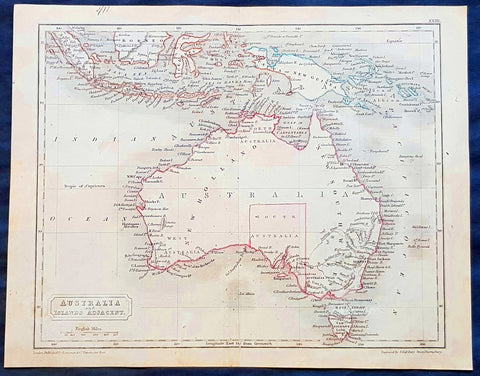
1830 Sydney Hall Antique Map of Australia, New Holland, Swan River Settlement
- Title : Australia & Islands Adjacent
- Ref #: 35074
- Size: 10 1/2in x 8 1/2in (265mm x 210mm)
- Date : 1830
- Condition: (A) Very Good Condition
Description:
This original hand coloured copper-plate original antique map by Sydney Hall was published in the 1830 edition of Halls General Atlas published by Longman & co., London. (Ref: Tooley; M&B)
General Definitions:
Paper thickness and quality: - Heavy and stable
Paper color : - off white
Age of map color: -
Colors used: -
General color appearance: -
Paper size: - 10 1/2in x 8 1/2in (265mm x 210mm)
Plate size: - 10 1/2in x 8 1/2in (265mm x 210mm)
Margins: - Min 1/2in (12mm)
Imperfections:
Margins: - None
Plate area: - Folds as issued
Verso: - None
Background:
The first recorded European sighting of the Australian mainland, and the first recorded European landfall on the Australian continent (in 1606), are attributed to the Dutch. The first ship and crew to chart the Australian coast and meet with Aboriginal people was the Duyfken captained by Dutch navigator, Willem Janszoon. He sighted the coast of Cape York Peninsula in early 1606, and made landfall on 26 February at the Pennefather River near the modern town of Weipa on Cape York. The Dutch charted the whole of the western and northern coastlines and named the island continent New Holland during the 17th century, but made no attempt at settlement. William Dampier, an English explorer and privateer, landed on the north-west coast of New Holland in 1688 and again in 1699 on a return trip. In 1770, James Cook sailed along and mapped the east coast, which he named New South Wales and claimed for Great Britain.
With the loss of its American colonies in 1783, the British Government sent a fleet of ships, the First Fleet, under the command of Captain Arthur Phillip, to establish a new penal colony in New South Wales. A camp was set up and the flag raised at Sydney Cove, Port Jackson, on 26 January 1788, a date which became Australia\'s national day, Australia Day. A British settlement was established in Van Diemens Land, now known as Tasmania, in 1803, and it became a separate colony in 1825. The United Kingdom formally claimed the western part of Western Australia (the Swan River Colony) in 1828. Separate colonies were carved from parts of New South Wales: South Australia in 1836, Victoria in 1851, and Queensland in 1859. The Northern Territory was founded in 1911 when it was excised from South Australia. South Australia was founded as a free province—it was never a penal colony. Victoria and Western Australia were also founded free, but later accepted transported convicts. A campaign by the settlers of New South Wales led to the end of convict transportation to that colony; the last convict ship arrived in 1848.
1831 SDUK Antique Gnomonic Map of Western Australia & The Indian Ocean, SE Asia
- Title : Published by Baldwin & Craddock...June 1831
- Size: 16in x 14in (410mm x 355m)
- Condition: (A+) Fine Condition
- Date : 1831
- Ref #: 32534
Description:
This original steel-plate engraved antique Gnomonic Map of Western Australia & The Indian Ocean was engraved by J & C Walker, in 1831 - dated at the foot of the map - and was published in the Baldwin & Craddock edition of the Society For the Diffusion of Useful Knowledge (SDUK) Atlas.
A gnomonic map projection displays all great circles as straight lines, resulting in any line segment on a gnomonic map showing a geodesic, the shortest route between the segment\'s two endpoints. This is achieved by casting surface points of the sphere onto a tangent plane, each landing where a ray from the center of the sphere passes through the point on the surface and then on to the plane. No distortion occurs at the tangent point, but distortion increases rapidly away from it. Less than half of the sphere can be projected onto a finite map. Consequently a rectilinear photographic lens cannot image more than 180 degrees.
General Definitions:
Paper thickness and quality: - Heavy and stable
Paper color : - off white
Age of map color: -
Colors used: -
General color appearance: -
Paper size: - 16in x 14in (410mm x 355m)
Plate size: - 16in x 14in (410mm x 355m)
Margins: - Min 1/4in (5mm)
Imperfections:
Margins: - None
Plate area: - Blind Library stamp
Verso: - None
Background:
The SDUK produced two landmark volumes of cartography in the first half of the 19th century. The first volume concentrated on areas of the old world, Europe, Africa, Great Britain etc. The second volume contained maps of the new world, America, South Asia, including US state maps, colonies of Australia, South Africa, South America etc. Also included were some of the finest engraved town and city plans published at that time.
The SDUK was published in its entirety or in part by many publishers including Baldwin and Cradock 1829-32, Chapman & Hall in 1844, Charles Knight & co. 1846 – 1852. G. Cox published the SDUK between 1852-3, Stanford 1857-70 and later revised edition were also published after Stanford. (Ref: Tooley, M&B)
1833 SDUK Antique Map of New South Wales w/ inset Map of Sydney Town, Australia
- Title : New South Wales...Sydney from the New South Wales Almanack...Sep 1833
- Size: 16in x 14in (410mm x 355m)
- Condition: (A) Very Good Condition
- Date : 1833
- Ref #: 32681
Description:
This fine original antique map of New South Wales, Australia - with an inset plan of Sydney Town - was engraved by J & C Walker, in 1833 - the date is engraved at the foot of the map - and was published in the Baldwin & Craddock edition of the Society For the Diffusion of Useful Knowledge (SDUK) Atlas.
General Definitions:
Paper thickness and quality: - Heavy and stable
Paper color : - off white
Age of map color: -
Colors used: -
General color appearance: -
Paper size: - 16in x 14in (410mm x 355m)
Plate size: - 16in x 14in (410mm x 355m)
Margins: - Min 1/4in (5mm)
Imperfections:
Margins: - Light age toning, left T&B corners cropped
Plate area: - Blind Library stamp
Verso: - Re-enforced on verso along margins
Background:
The SDUK produced two landmark volumes of cartography in the first half of the 19th century. The first volume concentrated on areas of the old world, Europe, Africa, Great Britain etc. The second volume contained maps of the new world, America, South Asia, including US state maps, colonies of Australia, South Africa, South America etc. Also included were some of the finest engraved town and city plans published at that time.
The SDUK was published in its entirety or in part by many publishers including Baldwin and Cradock 1829-32, Chapman & Hall in 1844, Charles Knight & co. 1846 – 1852. G. Cox published the SDUK between 1852-3, Stanford 1857-70 and later revised edition were also published after Stanford. (Ref: Tooley, M&B)
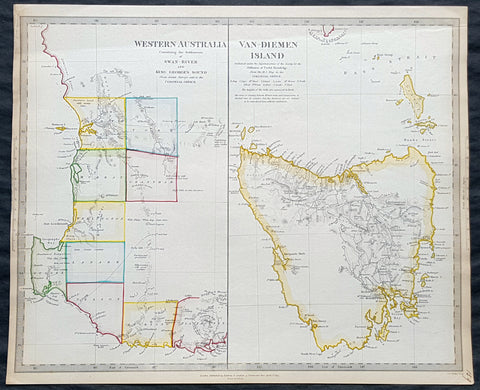
1833 SDUK Antique Map of Western Australia, Swan River Colony & Van Diemens Land
- Title : Western Australia containing the settlment of Swan River and King Georges Sound; Van-Diemens Land
- Size: 16in x 14in (410mm x 355m)
- Condition: (A+) Fine Condition
- Date : 1833
- Ref #: 31974
Description:
This fine hand coloured original antique map of Western Australia - only 4 years after the first British settlement on the Swan river & Van Diemens Land or Tasmania was engraved by J & C Walker, in 1833 - the date is engraved at the foot of the map - and was published in the Baldwin & Craddock edition of the Society For the Diffusion of Useful Knowledge (SDUK) Atlas.
General Definitions:
Paper thickness and quality: - Heavy and stable
Paper color : - off white
Age of map color: - Original
Colors used: - Red, pink
General color appearance: - Authentic
Paper size: - 16in x 14in (410mm x 355m)
Plate size: - 16in x 14in (410mm x 355m)
Margins: - Min 1/2in (10mm)
Imperfections:
Margins: - Light age toning
Plate area: - None
Verso: - None
Background:
The SDUK produced two landmark volumes of cartography in the first half of the 19th century. The first volume concentrated on areas of the old world, Europe, Africa, Great Britain etc. The second volume contained maps of the new world, America, South Asia, including US state maps, colonies of Australia, South Africa, South America etc. Also included were some of the finest engraved town and city plans published at that time.
The SDUK was published in its entirety or in part by many publishers including Baldwin and Cradock 1829-32, Chapman & Hall in 1844, Charles Knight & co. 1846 – 1852. G. Cox published the SDUK between 1852-3, Stanford 1857-70 and later revised edition were also published after Stanford. (Ref: Tooley, M&B)
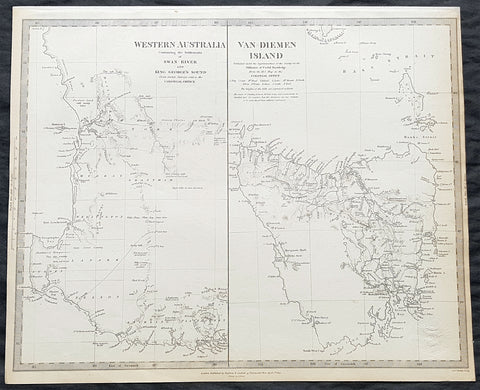
1833 SDUK Antique Map of Western Australia, Swan River Colony & Van Diemens Land
- Title : Western Australia containing the settlment of Swan River and King Georges Sound; Van-Diemens Land
- Size: 16in x 14in (410mm x 355m)
- Condition: (A) Very Good Condition
- Date : 1833
- Ref #: 32682
Description:
This original antique map of Western Australia - only 4 years after the first British settlement on the Swan river & Van Diemens Land or Tasmania was engraved by J & C Walker, in 1833 - the date is engraved at the foot of the map - and was published in the Baldwin & Craddock edition of the Society For the Diffusion of Useful Knowledge (SDUK) Atlas.
General Definitions:
Paper thickness and quality: - Heavy and stable
Paper color : - off white
Age of map color: -
Colors used: -
General color appearance: -
Paper size: - 16in x 14in (410mm x 355m)
Plate size: - 16in x 14in (410mm x 355m)
Margins: - Min 1/4in (5mm)
Imperfections:
Margins: - Light age toning
Plate area: - Blind Library stamp
Verso: - Re-enforced on verso along margins
Background:
The SDUK produced two landmark volumes of cartography in the first half of the 19th century. The first volume concentrated on areas of the old world, Europe, Africa, Great Britain etc. The second volume contained maps of the new world, America, South Asia, including US state maps, colonies of Australia, South Africa, South America etc. Also included were some of the finest engraved town and city plans published at that time.
The SDUK was published in its entirety or in part by many publishers including Baldwin and Cradock 1829-32, Chapman & Hall in 1844, Charles Knight & co. 1846 – 1852. G. Cox published the SDUK between 1852-3, Stanford 1857-70 and later revised edition were also published after Stanford. (Ref: Tooley, M&B)
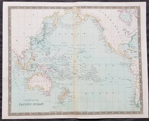
1834 Henry Teesdale Antique Map The Pacific, Australia, New Zealand, Nth America
- Title : Chart of The Pacific Ocean.....London Published by Henry Teesdale & co. High Holborn March 1834
- Ref #: 50303
- Size: 17 1/2in x 14in (445mm x 355mm)
- Date : 1834
- Condition: (A+) Fine Condition
Description:
This beautifully hand coloured original copper-plate engraved antique map of the Pacific Ocean, Australia, New Zealand, to North & South America by John Dower was engraved in 1834 - the date is engraved at the foot of the map - and was published in the 1835 edition of Henry Teesdales A New General Atlas of the World. (Ref: M&B; Tooley)
General Definitions:
Paper thickness and quality: - Heavy and stable
Paper color : - off white
Age of map color: - Original
Colors used: - Yellow, green, blue, pink
General color appearance: - Authentic
Paper size: - 19in x 15 1/2in (485mm x 395mm)
Plate size: - 17 1/2in x 14 1/2in (445mm x 370mm)
Margins: - Min 1in (25mm)
Imperfections:
Margins: - None
Plate area: - None
Verso: - None
Teesdale & co., Henry fl 1828-1843
Teesdale was a prominent London publisher and founding fellow of the Royal Geographical Society. He produced large-scale maps and charts and a number of fine atlases in the early part of the nineteenth century. He employed the most skilled draftsmen and engravers and his maps are renowned for precise detail and fine coloring
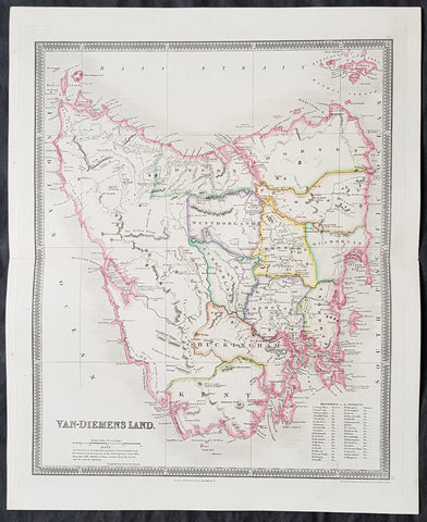
1835 Henry Teesdale Large Antique Map of Van Diemens Land, Tasmania, Australia
- Title : Van-Diemens Land
- Ref #: 80010
- Size: 19in x 15 1/2in (485mm x 395mm)
- Date : 1834
- Condition: (A+) Fine Condition
Description:
This fine beautifully hand coloured original antique map of Tasmania, Van-Diemens Land with the original 11 counties - was engraved by John Dower in 1834 and was published in the 1835 edition of Henry Teesdale's A New General Atlas of the World.
As with all the maps published by Teesdale this one is of the highest quality on strong clean & sturdy paper with beautiful original hand colouring. (Ref: M&B; Tooley)
General Definitions:
Paper thickness and quality: - Heavy and stable
Paper color : - off white
Age of map color: - Original
Colors used: - Yellow, green, blue, pink
General color appearance: - Authentic
Paper size: - 19in x 15 1/2in (485mm x 395mm)
Plate size: - 17 1/2in x 14 1/2in (445mm x 370mm)
Margins: - Min 1in (25mm)
Imperfections:
Margins: - None
Plate area: - None
Verso: - None
Background:
The first reported sighting of Tasmania by a European was on 24 November 1642 by the Dutch explorer Abel Tasman, who named the island Anthoonij van Diemenslandt, after his sponsor, the Governor of the Dutch East Indies. The name was later shortened to Van Diemen's Land by the British. In 1772, a French expedition led by Marc-Joseph Marion du Fresne landed on the island. Captain James Cook also sighted the island in 1777, and numerous other European seafarers made landfalls, adding a colourful array to the names of topographical features.
The first settlement was by the British at Risdon Cove on the eastern bank of the Derwent estuary in 1803, by a small party sent from Sydney, under Lt. John Bowen. An alternative settlement was established by Capt. David Collins 5 km to the south in 1804 in Sullivans Cove on the western side of the Derwent, where fresh water was more plentiful. The latter settlement became known as Hobart Town, later shortened to Hobart, after the British Colonial Secretary of the time, Lord Hobart. The settlement at Risdon was later abandoned.
Teesdale & co., Henry fl 1828-1843
Teesdale was a prominent London publisher and founding fellow of the Royal Geographical Society. He produced large-scale maps and charts and a number of fine atlases in the early part of the nineteenth century. He employed the most skilled draftsmen and engravers and his maps are renowned for precise detail and fine coloring
1835 Joseph Meyer Antique Print Early View of The Rocks Sydney, Australia
- Title : Sydney in New South Wales
- Ref #: 50668
- Size: 10in x 7 1/2in (255mm x 190mm)
- Date : 1835
- Condition: (A+) Fine Condition
Description:
This fine steel-plate engraved original antique print an early view of The Rocks in Sydney Australia by Joseph Meyer was published in the 1835 edition of Meyers Universum
These are beautiful steel-plate engraved prints, with a high level of detail along with beautifully executed artistry.
General Definitions:
Paper thickness and quality: - Heavy and stable
Paper color : - off white
Age of map color: -
Colors used: -
General color appearance: -
Paper size: - 10in x 7 1/2in (255mm x 190mm)
Plate size: - 10in x 7 1/2in (255mm x 190mm)
Margins: - Min 1/2in (12mm)
Imperfections:
Margins: - None
Plate area: - None
Verso: - None
Background:
The History of Sydney begins in prehistoric times with the occupation of the district by Australian Aborigines, whose ancestors came to Sydney in the Upper Paleolithic period. The modern history of the city began with the arrival of a First Fleet of British ships in 1788 and the foundation of a penal colony by Great Britain.
From 1788 to 1900 Sydney was the capital of the British colony of New South Wales. An elected city council was established in 1840. In 1900, Sydney became a state capital, when New South Wales voted to join the Australian Federation. Sydney today is Australia\'s largest city and a major international capital of culture and finance. The city has played host to many international events, including the 2000 Summer Olympics.
Meyer, Joseph 1796 - 1856
Meyer was a German industrialist and publisher, most noted for his encyclopedia, Meyers Konversations-Lexikon.
Meyer was born at Gotha, Germany, and was educated as a merchant in Frankfurt am Main. He went to London in 1816, but returned to Germany in 1820 after business adventures and stock speculations fell through. Here he invested in enterprises like textile-trade (1820–24). Soon after the first steam-hauled railway had started in December 1835, Meyer started to make business plans how to start the first railways. He also bought some concessions for iron mining. In 1845, he founded the Deutsche Eisenbahnschienen-Compagnie auf Actien (German Railway Rail joint stock company).
Meyer operated very successfully as a publisher, employing a system of serial subscription to publications, which was new at that time. To this end he founded a company, Bibliographisches Institut, in Gotha in 1826. It published several editions of the Bible, works of classical literature (Miniatur-Bibliothek der deutschen Classiker, Groschen-Bibliothek), atlases, the world in pictures on steel engravings Meyers Universum, 1833–61, 17 volumes in 12 languages with 80,000 subscribers all over Europe), and an encyclopaedia, (das Grosse Conversations-Lexikon für die gebildeten Stände;). His company grew substantially, and in 1828 he moved it from Gotha to Hildburghausen, where he died thirty years later.
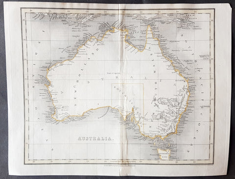
1837 John Dower Original Antique Map of Australia - New Holland
- Title : Australia
- Date : 1837
- Size: 12in x 9 1/2in (305mm x 240mm)
- Ref #: 70704
- Condition: (B) Good Condition
Description:
This fine steel-plate engraved original hand coloured antique map of Australia by John Dower was published by Orr & Smith, London in 1837. (Ref Tooley M&B)
General Definitions:
Paper thickness and quality: - Heavy and stable
Paper color : - off white
Age of map color: - Original
Colors used: - Yellow
General color appearance: - Authentic
Paper size: - 12in x 9 1/2in (305mm x 240mm)
Plate size: - 12in x 9 1/2in (305mm x 240mm)
Margins: - Min 1/2in (12mm)
Imperfections:
Margins: - None
Plate area: - Browning & weak along centerfold
Verso: - Strengthened along centerold
Background:
Interesting early map of Australia with only the state of South Australia delineated. The whole of the east coast is named New South Wales, the city of Melbourne was not noted, few internal details are noted. Western Australia shows significant coastal details but is still named "New Holland"
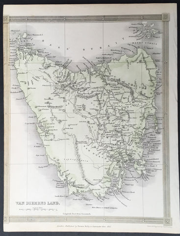
1837 Thomas Kelly Antique Map of Van Diemens Land - Tasmania, Australia
- Title : Van Diemens Land
- Ref #: 91205
- Size: 10 1/2in x 8 1/2in (265mm x 215mm)
- Date : 1837
- Condition: (A) Very Good Condition
Description:
This fine large original detailed antique map of Van Diemens Land or Tasmania, Australia was engraved in 1837 - dated at the foot of the map - and was published by Thomas Kelly for Barclays English Dictionary. (Ref: M&B; Tooley)
General Description:
Paper thickness and quality: - Light & stable
Paper color: - White
Age of map color: - Early
Colors used: - Green, yellow,
General color appearance: - Authentic
Paper size: - 10 1/2in x 8 1/2in (265mm x 215mm)
Plate size: - 10 1/2in x 8 1/2in (265mm x 215mm)
Margins: - Min 1/2in (10mm)
Imperfections:
Margins: - Left margin cropped to border
Plate area: - None
Verso: - None
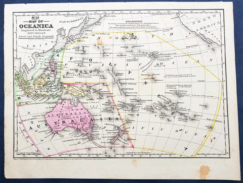
1839 Samuel Augustus Mitchell Antique Map of New Holland, New Zealand & Oceania
- Title : No 18 Map of Oceania...Entered according to Act of Congress in the year 1839 by S Augustus Mitchell
- Date : 1839
- Condition: (A) Very Good Condition
- Ref: 32148
- Size: 12in x 9in (305mm x 230mm)
Description:
This detailed original hand coloured copper-plate engraved antique map of New Holland - Australia, New Zealand, Polynesia & Micronesia, Oceania by Samuel Augustus Mitchell in 1839 - dated - was published in Mitchells School and Family Geography
General Definitions:
Paper thickness and quality: - Heavy and stable
Paper color : - off white
Age of map color: - Original
Colors used: - Yellow, green, blue, pink
General color appearance: - Authentic
Paper size: - 12in x 9in (305mm x 230mm)
Plate size: - 12in x 9in (305mm x 230mm)
Margins: - Min 1/2in (12mm)
Imperfections:
Margins: - Light soiling
Plate area: - Light soiling
Verso: - Light soiling
Background:
Early map of Australia and Oceania, the east coast is still referred to as NSW, with no sign of development of Melbourne or Victoria with New Zealand listing early Cook & Maori place names.
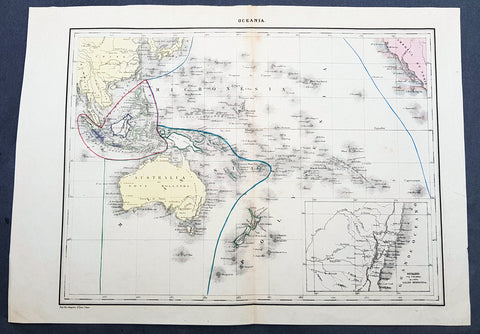
1840 P & A Lapie Antique Map of New Holland, New Zealand & Central Coast of NSW
- Title : Oceania
- Date : 1840
- Condition: (A+) Fine Condition
- Ref: 21425
- Size: 17in x 12in (430mm x 305mm)
Description:
This detailed original hand coloured lithograph map of Australia, New Zealand, Polynesia & Micronesia - Oceania - with an inset map of part of the coast of Sydney, NSW from Double Bay to Shoal Bay by Pierre & Alexandrie Lapie was published as a single map Kaeppelin & Co. in 1840.
General Definitions:
Paper thickness and quality: - Heavy and stable
Paper color : - off white
Age of map color: - Original
Colors used: - Yellow, green, blue, pink
General color appearance: - Authentic
Paper size: - 17in x 12in (430mm x 305mm)
Plate size: - 17in x 12in (430mm x 305mm)
Margins: - Min 1/2in (12mm)
Imperfections:
Margins: - None
Plate area: - None
Verso: - None
Background:
Early map of Australia and Oceania, the east coast is still referred to as NSW, with no sign of development of Melbourne or Victoria with New Zealand listing early Cook & Maori place names. The inset map of the central NSW coast is still largely lacking in detail past Bathurst, with Australia Felix noted in the south.
Lapie, Pierre & Alexandre
Pierre M. Lapie 1779 - 1850 and his son Alexandre Emile Lapie 1809 - 1850 were French cartographers and engravers active in the early part of the 19th century. The Lapies were commissioned officers in the French army holding the ranks of Colonel and Captain, respectively. Alexander enjoyed the title of First Geographer to the King, and this title appears on several of his atlases. Both father and son were exceptional engravers and fastidious cartographers. Working separately and jointly they published four important atlases, an 1811 Atlas of the French Empire (Alexander), the 1812 Atlas Classique et Universel (Pierre), the Atlas Universel de Geographie Ancienne et Modern (joint issue), and the 1848 Atlas Militaire (Alexander). They also issued many smaller maps and independent issues. All of these are products of exceptional beauty and detail. Despite producing many beautiful maps and atlases, the work of the Lapie family remains largely underappreciated by most modern collectors and map historians. The later 19th century cartographer A. H. Dufour claimed to be a student of Lapie, though it is unclear if he was referring to the father or the son. The work of the Lapie firm, with its precise engraving and informational density, strongly influenced the mid-19th century German commercial map publishers whose maps would eventually dominate the continental market.
1840 SDUK Antique Gnomonic Map East Australia, New Zealand South Pacific
- Title : Published by the Society for the Diffusion of Useful Knowledge
- Size: 16in x 14in (410mm x 355m)
- Condition: (A+) Fine Condition
- Date : 1840
- Ref #: 24676-1
Description:
This hand coloured original steel-plate engraved antique Gnomonic Map of eastern Australia, New Zealand & The South Pacific was engraved by J & C Walker, in 1840 and was published in the Chapman & Hall edition of the Society For the Diffusion of Useful Knowledge (SDUK) Atlas.
A gnomonic map projection displays all great circles as straight lines, resulting in any line segment on a gnomonic map showing a geodesic, the shortest route between the segment\'s two endpoints. This is achieved by casting surface points of the sphere onto a tangent plane, each landing where a ray from the center of the sphere passes through the point on the surface and then on to the plane. No distortion occurs at the tangent point, but distortion increases rapidly away from it. Less than half of the sphere can be projected onto a finite map. Consequently a rectilinear photographic lens cannot image more than 180 degrees.
General Definitions:
Paper thickness and quality: - Heavy and stable
Paper color : - off white
Age of map color: - Original
Colors used: - Yellow, pink, green, blue
General color appearance: - Authentic
Paper size: - 16in x 14in (410mm x 355m)
Plate size: - 16in x 14in (410mm x 355m)
Margins: - Min 1/4in (5mm)
Imperfections:
Margins: - Light age toning
Plate area: - None
Verso: - None
Background:
The SDUK produced two landmark volumes of cartography in the first half of the 19th century. The first volume concentrated on areas of the old world, Europe, Africa, Great Britain etc. The second volume contained maps of the new world, America, South Asia, including US state maps, colonies of Australia, South Africa, South America etc. Also included were some of the finest engraved town and city plans published at that time.
The SDUK was published in its entirety or in part by many publishers including Baldwin and Cradock 1829-32, Chapman & Hall in 1844, Charles Knight & co. 1846 – 1852. G. Cox published the SDUK between 1852-3, Stanford 1857-70 and later revised edition were also published after Stanford. (Ref: Tooley, M&B)
1840 SDUK Antique Gnomonic Map East Australia, New Zealand South Pacific
- Title : Published by the Society for the Diffusion of Useful Knowledge
- Size: 16in x 14in (410mm x 355m)
- Condition: (A+) Fine Condition
- Date : 1840
- Ref #: 11-0974
Description:
This hand coloured original steel-plate engraved antique Gnomonic Map of eastern Australia, New Zealand & The South Pacific was engraved by J & C Walker, in 1840 and was published in the Chapman & Hall edition of the Society For the Diffusion of Useful Knowledge (SDUK) Atlas.
A gnomonic map projection displays all great circles as straight lines, resulting in any line segment on a gnomonic map showing a geodesic, the shortest route between the segment\'s two endpoints. This is achieved by casting surface points of the sphere onto a tangent plane, each landing where a ray from the center of the sphere passes through the point on the surface and then on to the plane. No distortion occurs at the tangent point, but distortion increases rapidly away from it. Less than half of the sphere can be projected onto a finite map. Consequently a rectilinear photographic lens cannot image more than 180 degrees.
General Definitions:
Paper thickness and quality: - Heavy and stable
Paper color : - off white
Age of map color: - Original
Colors used: - Yellow, pink, green, blue
General color appearance: - Authentic
Paper size: - 16in x 14in (410mm x 355m)
Plate size: - 16in x 14in (410mm x 355m)
Margins: - Min 1/4in (5mm)
Imperfections:
Margins: - Light age toning
Plate area: - None
Verso: - None
Background:
The SDUK produced two landmark volumes of cartography in the first half of the 19th century. The first volume concentrated on areas of the old world, Europe, Africa, Great Britain etc. The second volume contained maps of the new world, America, South Asia, including US state maps, colonies of Australia, South Africa, South America etc. Also included were some of the finest engraved town and city plans published at that time.
The SDUK was published in its entirety or in part by many publishers including Baldwin and Cradock 1829-32, Chapman & Hall in 1844, Charles Knight & co. 1846 – 1852. G. Cox published the SDUK between 1852-3, Stanford 1857-70 and later revised edition were also published after Stanford. (Ref: Tooley, M&B)
1840 SDUK Antique Map of The Pacific Ocean, North America, Japan, Australia, New Zealand
- Title : The Pacific Ocean.....Published by Chapman & Hall...May 15th 1840
- Size: 16in x 14in (410mm x 355m)
- Condition: (A+) Fine Condition
- Date : 1840
- Ref #: 11-0944
Description:
This hand coloured original steel-plate engraved antique map of The Pacific Ocean from North America, Japan, Australia & New Zealand was engraved by J & C Walker, in 1840 - the date is engraved at the foot of the map - and was published in the Chapman & Hall edition of the Society For the Diffusion of Useful Knowledge (SDUK) Atlas.
General Definitions:
Paper thickness and quality: - Heavy and stable
Paper color : - off white
Age of map color: - Original
Colors used: - Yellow, pink, green, blue
General color appearance: - Authentic
Paper size: - 16in x 14in (410mm x 355m)
Plate size: - 16in x 14in (410mm x 355m)
Margins: - Min 1/4in (5mm)
Imperfections:
Margins: - Light age toning
Plate area: - None
Verso: - None
Background:
The SDUK produced two landmark volumes of cartography in the first half of the 19th century. The first volume concentrated on areas of the old world, Europe, Africa, Great Britain etc. The second volume contained maps of the new world, America, South Asia, including US state maps, colonies of Australia, South Africa, South America etc. Also included were some of the finest engraved town and city plans published at that time.
The SDUK was published in its entirety or in part by many publishers including Baldwin and Cradock 1829-32, Chapman & Hall in 1844, Charles Knight & co. 1846 – 1852. G. Cox published the SDUK between 1852-3, Stanford 1857-70 and later revised edition were also published after Stanford. (Ref: Tooley, M&B)
1840 SDUK Antique Map of The Pacific Ocean, North America, Japan, Australia, New Zealand
- Title : The Pacific Ocean.....Published by Chapman & Hall...May 15th 1840
- Size: 16in x 14in (410mm x 355m)
- Condition: (A+) Fine Condition
- Date : 1840
- Ref #: 24668
Description:
This hand coloured original steel-plate engraved antique map of The Pacific Ocean from North America, Japan, Australia & New Zealand was engraved by J & C Walker, in 1840 - the date is engraved at the foot of the map - and was published in the Chapman & Hall edition of the Society For the Diffusion of Useful Knowledge (SDUK) Atlas.
General Definitions:
Paper thickness and quality: - Heavy and stable
Paper color : - off white
Age of map color: - Original
Colors used: - Yellow, pink, green, blue
General color appearance: - Authentic
Paper size: - 16in x 14in (410mm x 355m)
Plate size: - 16in x 14in (410mm x 355m)
Margins: - Min 1/4in (5mm)
Imperfections:
Margins: - Light age toning
Plate area: - None
Verso: - None
Background:
The SDUK produced two landmark volumes of cartography in the first half of the 19th century. The first volume concentrated on areas of the old world, Europe, Africa, Great Britain etc. The second volume contained maps of the new world, America, South Asia, including US state maps, colonies of Australia, South Africa, South America etc. Also included were some of the finest engraved town and city plans published at that time.
The SDUK was published in its entirety or in part by many publishers including Baldwin and Cradock 1829-32, Chapman & Hall in 1844, Charles Knight & co. 1846 – 1852. G. Cox published the SDUK between 1852-3, Stanford 1857-70 and later revised edition were also published after Stanford. (Ref: Tooley, M&B)
1840 SDUK Antique Map of The Pacific Ocean, North America, Japan, Australia, New Zealand
- Title : The Pacific Ocean.....Published by Chapman & Hall...May 15th 1840
- Size: 16in x 14in (410mm x 355m)
- Condition: (A+) Fine Condition
- Date : 1840
- Ref #: 11-0954-1
Description:
This hand coloured original steel-plate engraved antique map of The Pacific Ocean from North America, Japan, Australia & New Zealand was engraved by J & C Walker, in 1840 - the date is engraved at the foot of the map - and was published in the Chapman & Hall edition of the Society For the Diffusion of Useful Knowledge (SDUK) Atlas.
General Definitions:
Paper thickness and quality: - Heavy and stable
Paper color : - off white
Age of map color: - Original
Colors used: - Yellow, pink, green, blue
General color appearance: - Authentic
Paper size: - 16in x 14in (410mm x 355m)
Plate size: - 16in x 14in (410mm x 355m)
Margins: - Min 1/4in (5mm)
Imperfections:
Margins: - Light age toning
Plate area: - None
Verso: - None
Background:
The SDUK produced two landmark volumes of cartography in the first half of the 19th century. The first volume concentrated on areas of the old world, Europe, Africa, Great Britain etc. The second volume contained maps of the new world, America, South Asia, including US state maps, colonies of Australia, South Africa, South America etc. Also included were some of the finest engraved town and city plans published at that time.
The SDUK was published in its entirety or in part by many publishers including Baldwin and Cradock 1829-32, Chapman & Hall in 1844, Charles Knight & co. 1846 – 1852. G. Cox published the SDUK between 1852-3, Stanford 1857-70 and later revised edition were also published after Stanford. (Ref: Tooley, M&B)
1840 SDUK Antique Map of The Pacific Ocean, North America, Japan, Australia, New Zealand
- Title : The Pacific Ocean.....Published by Chapman & Hall...May 15th 1840
- Size: 16in x 14in (410mm x 355m)
- Condition: (A+) Fine Condition
- Date : 1840
- Ref #: 11-0964
Description:
This hand coloured original steel-plate engraved antique map of The Pacific Ocean from North America, Japan, Australia & New Zealand was engraved by J & C Walker, in 1840 - the date is engraved at the foot of the map - and was published in the Chapman & Hall edition of the Society For the Diffusion of Useful Knowledge (SDUK) Atlas.
General Definitions:
Paper thickness and quality: - Heavy and stable
Paper color : - off white
Age of map color: - Original
Colors used: - Yellow, pink, green, blue
General color appearance: - Authentic
Paper size: - 16in x 14in (410mm x 355m)
Plate size: - 16in x 14in (410mm x 355m)
Margins: - Min 1/4in (5mm)
Imperfections:
Margins: - Light age toning
Plate area: - None
Verso: - None
Background:
The SDUK produced two landmark volumes of cartography in the first half of the 19th century. The first volume concentrated on areas of the old world, Europe, Africa, Great Britain etc. The second volume contained maps of the new world, America, South Asia, including US state maps, colonies of Australia, South Africa, South America etc. Also included were some of the finest engraved town and city plans published at that time.
The SDUK was published in its entirety or in part by many publishers including Baldwin and Cradock 1829-32, Chapman & Hall in 1844, Charles Knight & co. 1846 – 1852. G. Cox published the SDUK between 1852-3, Stanford 1857-70 and later revised edition were also published after Stanford. (Ref: Tooley, M&B)
1840 SDUK Antique Map of The Pacific Ocean, North America, Japan, Australia, New Zealand
- Title : The Pacific Ocean.....Published by Chapman & Hall...May 15th 1840
- Size: 16in x 14in (410mm x 355m)
- Condition: (A+) Fine Condition
- Date : 1840
- Ref #: 91362
Description:
This hand coloured original steel-plate engraved antique map of The Pacific Ocean from North America, Japan, Australia & New Zealand was engraved by J & C Walker, in 1840 - the date is engraved at the foot of the map - and was published in the Chapman & Hall edition of the Society For the Diffusion of Useful Knowledge (SDUK) Atlas.
General Definitions:
Paper thickness and quality: - Heavy and stable
Paper color : - off white
Age of map color: - Original
Colors used: - Yellow, pink, green, blue
General color appearance: - Authentic
Paper size: - 16in x 14in (410mm x 355m)
Plate size: - 16in x 14in (410mm x 355m)
Margins: - Min 1/4in (5mm)
Imperfections:
Margins: - Light age toning
Plate area: - None
Verso: - None
Background:
The SDUK produced two landmark volumes of cartography in the first half of the 19th century. The first volume concentrated on areas of the old world, Europe, Africa, Great Britain etc. The second volume contained maps of the new world, America, South Asia, including US state maps, colonies of Australia, South Africa, South America etc. Also included were some of the finest engraved town and city plans published at that time.
The SDUK was published in its entirety or in part by many publishers including Baldwin and Cradock 1829-32, Chapman & Hall in 1844, Charles Knight & co. 1846 – 1852. G. Cox published the SDUK between 1852-3, Stanford 1857-70 and later revised edition were also published after Stanford. (Ref: Tooley, M&B)
1840 SDUK Antique Map of The Pacific Ocean, North America, Japan, Australia, New Zealand
- Title : The Pacific Ocean.....Published by Chapman & Hall...May 15th 1840
- Size: 16in x 14in (410mm x 355m)
- Condition: (A+) Fine Condition
- Date : 1840
- Ref #: 31980
Description:
This hand coloured original steel-plate engraved antique map of The Pacific Ocean from North America, Japan, Australia & New Zealand was engraved by J & C Walker, in 1840 - the date is engraved at the foot of the map - and was published in the Chapman & Hall edition of the Society For the Diffusion of Useful Knowledge (SDUK) Atlas.
General Definitions:
Paper thickness and quality: - Heavy and stable
Paper color : - off white
Age of map color: - Original
Colors used: - Yellow, pink, green, blue
General color appearance: - Authentic
Paper size: - 16in x 14in (410mm x 355m)
Plate size: - 16in x 14in (410mm x 355m)
Margins: - Min 1/4in (5mm)
Imperfections:
Margins: - Light age toning
Plate area: - None
Verso: - None
Background:
The SDUK produced two landmark volumes of cartography in the first half of the 19th century. The first volume concentrated on areas of the old world, Europe, Africa, Great Britain etc. The second volume contained maps of the new world, America, South Asia, including US state maps, colonies of Australia, South Africa, South America etc. Also included were some of the finest engraved town and city plans published at that time.
The SDUK was published in its entirety or in part by many publishers including Baldwin and Cradock 1829-32, Chapman & Hall in 1844, Charles Knight & co. 1846 – 1852. G. Cox published the SDUK between 1852-3, Stanford 1857-70 and later revised edition were also published after Stanford. (Ref: Tooley, M&B)
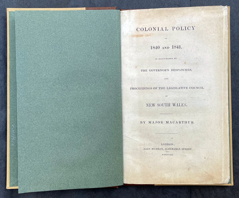
1841 Macarthur Antique Octavo Book on Colonial Policy in Australia, Map of NSW
Antique Map
- Title : Colonial Policy of 1840 and 1841, as illustrated by the Governor's Despatches, and Proceedings of the Legislative Council of New South Wales. By Major Macarthur.
- Ref #: 17045
- Size: Octavo
- Date : 1841
- Condition: (A+) Fine Condition
Description:
Fine original antique Octavo book with 79 pages and a single lithographed hand coloured map of eastern Australia & Van Diemens Land; uncut copy in half calf with gilt lettering by Edward Macarthur, advocating for immigration and trade for the colony of Australia, published by John Murray, London in 1841, dated.
This is the first of two books by Sir Edward Macarthurs advocating immigration to the colony of Australia. The eldest son of John and Elizabeth, Edward Macarthur was born at Bath in 1789, and accompanied his parents to New South Wales in 1790. As one of the first free settlers in the colony, he was a strong advocate of immigration, and served as Thomas Macqueens agent in arranging the first shipment of free immigrants in 1824, which gave great stimulus to agriculture.
The map illustrates a division of New South Wales and the subsequent creation of a smaller colony. Titled Eastern Australia or Territory of New South Wales, the map is captioned 'territory to which the Colony might be reduced by Bill of the last session' with reference debate in the House of Commons knocked down by Sir Robert Peel.
General Definitions:
Paper thickness and quality: - Heavy and stable
Paper color : - off white
Age of map color: - Original
Colors used: - Yellow
General color appearance: - Authentic
Paper size: - Octavo
Plate size: - Octavo
Margins: - Octavo
Imperfections:
Margins: - None
Plate area: - None
Verso: - None
Background:
Sir Edward Macarthur (1789-1872), soldier, was born on 16 March 1789 at Bath, England, the eldest son of Captain John Macarthur and his wife Elizabeth. He went to Sydney with his parents in 1790 and spent his boyhood there and at Elizabeth Farm, Parramatta. Sent to England in 1799 to be educated he returned to Sydney in 1806. With his father he took part in the deposition of Governor William Bligh in 1808. He soon left for London taking his father's version of the rebellion and the first bale of merino wool to be exported from the colony. He obtained a commission in the 60th Regiment and served at Corunna and in Sicily. As a lieutenant in the 39th Regiment he took part in Wellington's campaigns of 1812-14 and was present at Vittoria, the Pyrénées and the battles in southern France. After brief service in Canada he joined the army of occupation in France.
In 1824 Macarthur went to New South Wales as the agent of T. P. Macqueen. He was impressed by the dispersion of the garrison from Moreton Bay to Hobart Town in the face of runaway convicts and 'hostile tribes'. In London he placed detailed proposals for a colonial militia before Under-Secretary Horton but the plan was rejected by Governor (Sir) Ralph Darling in 1827. Macarthur competently represented Australian interests in London. He presented a petition from New South Wales in 1840. He advocated emigration in two small books, Colonial Policy of 1840 and 1841, as Illustrated by the Governor's Despatches, and the Proceedings of the Legislative Council of New South Wales (London, 1841) and Brief Remarks on Colonization (London, 1846). He personally arranged the migration of German vinedressers to the Macarthur properties at Camden and also sought to develop coastal steamship services. After serving as secretary in the Lord Chamberlain's Office in 1843-46 he was on the military staff in Ireland. In 1851 he was posted to Sydney as deputy adjutant general. Promoted colonel in 1854, he moved with the headquarters to Melbourne. He accompanied the commander-in-chief, Major-General Sir Robert Nickle, to Eureka on 5 December. They talked freely with the miners and as a result of their investigations Nickle advised that martial law be withdrawn.
After Nickle died in May 1855 and Governor Hotham in December, Macarthur took over command of the forces and became administrator. He inherited a confused political situation and was coolly received by the press. However, his impartiality and his willingness to leave things to his ministers helped him, and when he handed over to Sir Henry Barkly on 23 December 1856 he had won the esteem of parliament and the people of Melbourne. Emily, wife of Hugh Childers, described him as 'if not a brilliant statesman, an industrious, kind-hearted, Christian gentleman'. In 1858 Macarthur chaired a royal commission on the defences of the colony. In 1860 he returned to England and was appointed K.C.B. in 1862. In that year he married Sarah (d.1889), daughter of Lieutenant-Colonel W. S. Neill. Promoted lieutenant-general in 1866, he died childless in London on 4 January 1872 and was buried in the Brompton cemetery. He was survived by his wife. His goods were valued for probate at £4000.
Macarthur, Edward (1789 - 1872)
Macarthur was a lieutenant-general in the British Army, Commander-in-chief of British forces in Australia from 1855, and an administrator of the Colony of Victoria for 12 months, following the death of the Governor, Sir Charles Hotham.
Macarthur was the eldest son of John Macarthur, and his wife Elizabeth (née Veal). He was born at Bath, Somerset, England, and arrived at Sydney with his parents in the ships Neptune and Scarborough in 1790, part of the Second Fleet. Edward Macarthur is believed to be the only passenger on those ships of whom a photograph exists, although taken later in life. In 1799, the young Edward was sent to England to be educated.
Macarthur returned to Australia in 1806 and took part with his father in the deposing of Governor William Bligh. Bligh, in his dispatch to Viscount Castlereagh of 30 April 1808, requested that two of the rebels Charles Grimes and Edward Macarthur who have gone home in the Dart may be secured, in order to be tried in due time. On Macarthurs arrival in England, he entered the army as an ensign in the 60th regiment, serving at Corunna and in Sicily. In 1809, he was promoted to the rank of lieutenant. As part of the 39th Regiment he took part in the Duke of Wellingtons campaigns in the Peninsular War and in France. In 1820 or 1829 he became a captain. In 1824 he paid a visit of 10 months to Australia as an agent of Thomas Potter Macqueen. After Macarthurs return to England, he was for some years secretary to the Lord Chamberlain. In 1826 he was promoted to the rank of major and in 1837 he was on the staff in Ireland.
Macarthur retained his interest in Australia. On 3 July 1839, he addressed a long communication to the Right Hon. Henry Labouchère, suggesting that regular lines of steamers should be established in Australia to trade between the various ports. That was referred to the governor, Sir George Gipps who, in May 1840, replied that government aid was unnecessary, because a large company had been formed to establish a line of steamers, of which James Macarthur (Edwards brother) was chairman. Edward Macarthur also promoted emigration in two small books: Colonial Policy of 1840 and 1841, as Illustrated by the Governors Despatches, and the Proceedings of the Legislative Council of New South Wales (London, 1841) and Brief Remarks on Colonization (London, 1846).
In August 1840, Macarthur protested against the regulations that people wanting to take up land in the Port Phillip district should have to proceed to Melbourne where all charts of land were kept for public inspection. He was made a Lieutenant-Colonel in 1841, and afterwards went to New South Wales as deputy adjutant-general. He was promoted to colonel in 1854.
On 5 December 1854, Macarthur travelled with the commander-in-chief of British forces in Australia, Major-General Sir Robert Nickle, to the site of the Eureka Rebellion. There they talked with the miners openly and, as a result of their investigations, Nickle advised the withdrawal of martial law. Macarthur was appointed commander-in-chief of British forces in Australia in 1855, to replace Nickle. On 1 January 1856, after the death of Governor of Victoria, Sir Charles Hotham, Macarthur was administrator of the colony of Victoria for 12 months.
Macarthur returned to London in 1860. In 1862, he was created a Knight Commander of the KCB and, in the same year, was given the colonelcy of the 100th (Prince of Waless Royal Canadian) Regiment of Foot, a position he held until his death.
He died in London on 4 January 1872 and was buried in Brompton Cemetery. In 1862, at the age of 73, he had married Sarah (daughter of Lieutenant-Colonel W. S. Neill), who survived him. There were no children.
Please note all items auctioned are genuine, we do not sell reproductions. A Certificate of Authenticity (COA) can be issued on request.
1844 Hughes Antique Australian Map of the States of Victoria & NSW
- Title : Victoria New South Wales and South Australia
- Ref #: 91204
- Size: 17in x 11 1/4in (430mm x 285mm)
- Date : 1844
- Condition: (A+) Fine Condition
Description:
This finely engraved original antique map of the Australian States of NSW, Vic & part of SA was engraved by William Hughes and published by A&C Black in 1844. (Ref: Tooley; M&B)
General Description:
Paper thickness and quality: - Light and stable
Paper color: - off white
Age of map color: -
Colors used: -
General color appearance: -
Paper size: - 17in x 11 1/4in (430mm x 285mm)
Plate size: - 17in x 11 1/4in (430mm x 285mm)
Margins: - Min 1/2in (12mm)
Imperfections:
Margins: - None
Plate area: - None
Verso: - None
1844 W & AK Johnston Large Antique Map of Australia - South Australia Settlement
- Title : Australia
- Date : 1844
- Condition: (A+) Fine Condition
- Ref: 23806
- Size: 25in x 21in (635mm x 535mm)
Description:
This large fine hand coloured original steel-plate engraved antique map of Australia - with coloured outlines to the counties in NSW & WA - was published by W & AK Johnston in General Atlas,1844.
At the bottom of the map is a text box outlining the period of settlements in Australia from Botany Bay in 1788, WA 1829, SA 1836 & the colony of Victoria begun some 8 years earlier in 1838.
Johnston was one of the master publishers of fine engraved and lithographed maps during the 19th century, this large map is no exception. (Ref: Tooley; M&B)
General Description:
Paper thickness and quality: - Heavy and stable
Paper color: - off white
Age of map color: - Original
Colors used: - Red, green, yellow
General color appearance: - Authentic
Paper size: - 25in x 21in (635mm x 535mm)
Plate size: - 25in x 21in (635mm x 535mm)
Margins: - Min 1/2in (12mm)
Imperfections:
Margins: - Light age toning
Plate area: - None
Verso: - None
1844 W & AK Johnston Large Early Antique Map of Australia
Antique Map
- Title : Australia
- Date : 1844
- Condition: (A+) Fine Condition
- Ref: 30143
- Size: 25in x 21in (635mm x 535mm)
Description:
This large fine hand coloured original antique lithograph map of Australia - with coloured outlines to the counties in NSW & WA - was published by W & AK Johnston in General Atlas,1844.
At the bottom of the map is atext box outlining the period of settlements in Australia from Botany Bay in 1788, WA 1829, SA 1836 & the colony of Victoria begun some 8 years ealier in 1838.
Johnston was one of the master publishers of fine engraved and lithographed maps during the 19th century, this large map is no exception. (Ref: Tooley; M&B)
General Description:
Paper thickness and quality: - Heavy and stable
Paper color: - off white
Age of map color: - Original
Colors used: - Red, green, yellow
General color appearance: - Authentic
Paper size: - 25in x 21in (635mm x 535mm)
Plate size: - 25in x 21in (635mm x 535mm)
Margins: - Min 1/2in (12mm)
Imperfections:
Margins: - Light age toning
Plate area: - None
Verso: - None
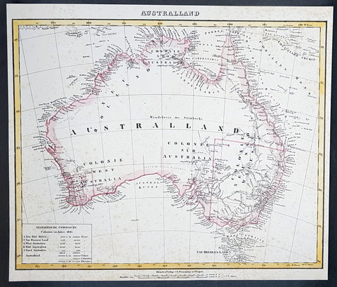
1845 Handtke & Flemming Large Antique Map of Australia - Population of 213,500
- Title : Australland...1841
- Date : 1845
- Condition: (A) Very Good Condition
- Ref: 31977
- Size: 16in x 14in (405mm x 355mm)
Description:
This hand coloured original steel-plate engraved antique highly detailed map of Australia, with a population census of the entire country in 1841, by Friedrich Handtke in 1845, was published in the Complete hand atlas of the recent description of the earth over all parts of the earth, Carl Flemming, Glougau.
General Definitions:
Paper thickness and quality: - Heavy and stable
Paper color : - off white
Age of map color: - Original
Colors used: - Yellow, red
General color appearance: - Authentic
Paper size: - 16in x 14in (405mm x 355mm)
Plate size: - 16in x 14in (405mm x 355mm)
Margins: - Min 1/2in (12mm)
Imperfections:
Margins: - Age toning & spotting
Plate area: - Age toning & spotting
Verso: - Age toning & spotting
Background:
Australia is a sovereign country comprising the mainland of the Australian continent, the island of Tasmania and numerous smaller islands. It is the largest country in Oceania and the world\'s sixth-largest country by total area. The neighbouring countries are Papua New Guinea, Indonesia and East Timor to the north; the Solomon Islands and Vanuatu to the north-east; and New Zealand to the south-east. The population of 25 million is highly urbanised and heavily concentrated on the eastern seaboard. Australias capital is Canberra, and its largest city is Sydney. The country\'s other major metropolitan areas are Melbourne, Brisbane, Perth and Adelaide.
Australia was inhabited by indigenous Australians for about 60,000 years before the first British settlement in the late 18th century. It is documented that Aborigines spoke languages that can be classified into about 250 groups. After the European discovery of the continent by Dutch explorers in 1606, who named it New Holland, Australia\'s eastern half was claimed by Great Britain in 1770 and initially settled through penal transportation to the colony of New South Wales from 26 January 1788, a date which became Australia\'s national day. The population grew steadily in subsequent decades, and by the 1850s most of the continent had been explored and an additional five self-governing crown colonies established. On 1 January 1901, the six colonies federated, forming the Commonwealth of Australia. Australia has since maintained a stable liberal democratic political system that functions as a federal parliamentary constitutional monarchy comprising six states and ten territories.
Being the oldest, flattest and driest inhabited continent, with the least fertile soils, Australia has a landmass of 7,617,930 square kilometres. A megadiverse country, its size gives it a wide variety of landscapes, with deserts in the centre, tropical rainforests in the north-east and mountain ranges in the south-east. A gold rush began in Australia in the early 1850s, which boosted the population of the country. Nevertheless, its population density, 2.8 inhabitants per square kilometre, remains among the lowest in the world. Australia generates its income from various sources including mining-related exports, telecommunications, banking and manufacturing. Indigenous Australian rock art is the oldest and richest in the world, dating as far back as 60,000 years and spread across hundreds of thousands of sites.
The first recorded European sighting of the Australian mainland, and the first recorded European landfall on the Australian continent (in 1606), are attributed to the Dutch. The first ship and crew to chart the Australian coast and meet with Aboriginal people was the Duyfken captained by Dutch navigator, Willem Janszoon. He sighted the coast of Cape York Peninsula in early 1606, and made landfall on 26 February at the Pennefather River near the modern town of Weipa on Cape York. The Dutch charted the whole of the western and northern coastlines and named the island continent New Holland during the 17th century, but made no attempt at settlement. William Dampier, an English explorer and privateer, landed on the north-west coast of New Holland in 1688 and again in 1699 on a return trip. In 1770, James Cook sailed along and mapped the east coast, which he named New South Wales and claimed for Great Britain.
With the loss of its American colonies in 1783, the British Government sent a fleet of ships, the First Fleet, under the command of Captain Arthur Phillip, to establish a new penal colony in New South Wales. A camp was set up and the flag raised at Sydney Cove, Port Jackson, on 26 January 1788, a date which became Australia\'s national day, Australia Day. A British settlement was established in Van Diemens Land, now known as Tasmania, in 1803, and it became a separate colony in 1825. The United Kingdom formally claimed the western part of Western Australia (the Swan River Colony) in 1828. Separate colonies were carved from parts of New South Wales: South Australia in 1836, Victoria in 1851, and Queensland in 1859. The Northern Territory was founded in 1911 when it was excised from South Australia. South Australia was founded as a free province—it was never a penal colony. Victoria and Western Australia were also founded free, but later accepted transported convicts. A campaign by the settlers of New South Wales led to the end of convict transportation to that colony; the last convict ship arrived in 1848.
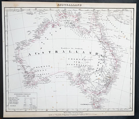
1845 Handtke & Flemming Large Antique Map of Australia - Population of 213,500
- Title : Australland...1841
- Date : 1845
- Condition: (A+) Fine Condition
- Ref: 40972
- Size: 16in x 14in (405mm x 355mm)
Description:
This hand coloured original steel-plate engraved antique highly detailed map of Australia, with a population census of the entire country in 1841, by Friedrich Handtke in 1845, was published in the Complete hand atlas of the recent description of the earth over all parts of the earth, Carl Flemming, Glougau.
General Definitions:
Paper thickness and quality: - Heavy and stable
Paper color : - off white
Age of map color: - Original
Colors used: - Yellow, red
General color appearance: - Authentic
Paper size: - 16in x 14in (405mm x 355mm)
Plate size: - 16in x 14in (405mm x 355mm)
Margins: - Min 1/2in (12mm)
Imperfections:
Margins: - Light spotting
Plate area: - Light spotting
Verso: - Light spotting
Background:
Australia is a sovereign country comprising the mainland of the Australian continent, the island of Tasmania and numerous smaller islands. It is the largest country in Oceania and the world\'s sixth-largest country by total area. The neighbouring countries are Papua New Guinea, Indonesia and East Timor to the north; the Solomon Islands and Vanuatu to the north-east; and New Zealand to the south-east. The population of 25 million is highly urbanised and heavily concentrated on the eastern seaboard. Australias capital is Canberra, and its largest city is Sydney. The country\'s other major metropolitan areas are Melbourne, Brisbane, Perth and Adelaide.
Australia was inhabited by indigenous Australians for about 60,000 years before the first British settlement in the late 18th century. It is documented that Aborigines spoke languages that can be classified into about 250 groups. After the European discovery of the continent by Dutch explorers in 1606, who named it New Holland, Australia\'s eastern half was claimed by Great Britain in 1770 and initially settled through penal transportation to the colony of New South Wales from 26 January 1788, a date which became Australia\'s national day. The population grew steadily in subsequent decades, and by the 1850s most of the continent had been explored and an additional five self-governing crown colonies established. On 1 January 1901, the six colonies federated, forming the Commonwealth of Australia. Australia has since maintained a stable liberal democratic political system that functions as a federal parliamentary constitutional monarchy comprising six states and ten territories.
Being the oldest, flattest and driest inhabited continent, with the least fertile soils, Australia has a landmass of 7,617,930 square kilometres. A megadiverse country, its size gives it a wide variety of landscapes, with deserts in the centre, tropical rainforests in the north-east and mountain ranges in the south-east. A gold rush began in Australia in the early 1850s, which boosted the population of the country. Nevertheless, its population density, 2.8 inhabitants per square kilometre, remains among the lowest in the world. Australia generates its income from various sources including mining-related exports, telecommunications, banking and manufacturing. Indigenous Australian rock art is the oldest and richest in the world, dating as far back as 60,000 years and spread across hundreds of thousands of sites.
The first recorded European sighting of the Australian mainland, and the first recorded European landfall on the Australian continent (in 1606), are attributed to the Dutch. The first ship and crew to chart the Australian coast and meet with Aboriginal people was the Duyfken captained by Dutch navigator, Willem Janszoon. He sighted the coast of Cape York Peninsula in early 1606, and made landfall on 26 February at the Pennefather River near the modern town of Weipa on Cape York. The Dutch charted the whole of the western and northern coastlines and named the island continent New Holland during the 17th century, but made no attempt at settlement. William Dampier, an English explorer and privateer, landed on the north-west coast of New Holland in 1688 and again in 1699 on a return trip. In 1770, James Cook sailed along and mapped the east coast, which he named New South Wales and claimed for Great Britain.
With the loss of its American colonies in 1783, the British Government sent a fleet of ships, the First Fleet, under the command of Captain Arthur Phillip, to establish a new penal colony in New South Wales. A camp was set up and the flag raised at Sydney Cove, Port Jackson, on 26 January 1788, a date which became Australia\'s national day, Australia Day. A British settlement was established in Van Diemens Land, now known as Tasmania, in 1803, and it became a separate colony in 1825. The United Kingdom formally claimed the western part of Western Australia (the Swan River Colony) in 1828. Separate colonies were carved from parts of New South Wales: South Australia in 1836, Victoria in 1851, and Queensland in 1859. The Northern Territory was founded in 1911 when it was excised from South Australia. South Australia was founded as a free province—it was never a penal colony. Victoria and Western Australia were also founded free, but later accepted transported convicts. A campaign by the settlers of New South Wales led to the end of convict transportation to that colony; the last convict ship arrived in 1848.
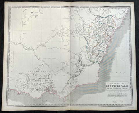
1845 Johnston Large Antique Map of New South Wales & Victoria, Australia Felix
Antique Map
- Title : Colony of New South Wales and Australia Felix
- Ref #: 35088
- Size: 25 1/2in x 21in (650mm x 535mm)
- Date : 1845
- Condition: (A+) Fine Condition
Description:
This large fine hand coloured original antique map of NSW & SE Australia stretching from the 10 year old Settlement of Melbourne in the south to the 31st parallel in the north, by W & AK Johnston, was published in the 1845 edition of the General Atlas.
A large, highly detailed regional map of New South Wales and Australia Felix the SE area which quickly became the state of Victoria. The map, with this title, lasted for only a few years, before both NSW and Victoria were quickly settled. The map provides a very early depiction of the region, pre-dating the discovery of gold.
Also of great interest are the exploration routes by Mitchell (1836) in Red, Tyer's & Townsend's (1840) in Yellow and Streletsky's (Strzelecki) (1840) in Blue.
The 18 counties of NSW are highlighted in beautiful hand colour with extensive detail of towns, tracks and rivers. Historical note included below the title.Decorative Piano Key border and a fine example, on thick heavy paper.
Johnston was one of the master publishers of fine engraved and lithographed maps during the 19th century - this map is no exception. (Ref: Tooley; M&B)
General Description:
Paper thickness and quality: - Heavy and stable
Paper color: - off white
Age of map color: - Original
Colors used: - Red, green, yellow
General color appearance: - Authentic
Paper size: - 25 1/2in x 21in (650mm x 535mm)
Plate size: - 25 1/2in x 21in (650mm x 535mm)
Margins: - Min 1/2in (12mm)
Imperfections:
Margins: - None
Plate area: - None
Verso: - None
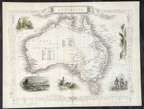
1851 John Tallis Antique Map of Australia
Antique Map
- Title : Australia
- Date : 1851
- Size: 14in x 11in (355mm x 280mm)
- Condition: (A+) Fine Condition
- Ref: 35511
Description:
This original hand coloured, steel plate engraved antique map of Australia with vignettes of Sydney Harbour, Aboriginals, Parrots and Kangaroos was engraved by John Rapkin and published by John Tallis in 1851.
General Definitions:
Paper thickness and quality: - Heavy and stable
Paper color : - off white
Age of map color: - Original
Colors used: - Blue
General color appearance: - Authentic
Paper size: - 14in x 11in (355mm x 280mm)
Plate size: - 14in x 11in (355mm x 280mm)
Margins: - Min 1/2in (12mm)
Imperfections:
Margins: - None
Plate area: - None
Verso: - None
Background:
The firm of Tallis & Company flourished from 1835 to 1860 with varying imprints. Their illustrated Atlas of 1850-51 was one of the last decorative atlases, all the maps being engraved on steel and all adorned with small vignettes. (Ref: Tooley; M&B)
1851 John Tallis Antique Map of New South Wales, Australia
Antique Map
- Title : New South Wales
- Date : 1851
- Size: 14in x 11in (355mm x 280mm)
- Condition: (A+) Fine Condition
- Ref: 1554
Description:
This original hand coloured, steel plate engraved antique map of New South Wales, Australia with vignettes of Sydney Harbour and The Murray was engraved by John Rapkin and published by John Tallis in 1851.
General Definitions:
Paper thickness and quality: - Heavy and stable
Paper color : - off white
Age of map color: - Original
Colors used: - Blue
General color appearance: - Authentic
Paper size: - 14in x 11in (355mm x 280mm)
Plate size: - 14in x 11in (355mm x 280mm)
Margins: - Min 1/2in (12mm)
Imperfections:
Margins: - None
Plate area: - None
Verso: - None
Background:
The firm of Tallis & Company flourished from 1835 to 1860 with varying imprints. Their illustrated Atlas of 1850-51 was one of the last decorative atlases, all the maps being engraved on steel and all adorned with small vignettes. (Ref: Tooley; M&B)
1851 John Tallis Antique Map of Van Diemens Land or Tasmania, Australia
Antique Map
- Title : Van Diemens Land or Tasmania
- Date : 1851
- Size: 14in x 11in (355mm x 280mm)
- Condition: (A+) Fine Condition
- Ref: 35519
Description:
This original hand coloured, steel plate engraved antique map of Tasmania, Australia with vignettes of Hobart and Tasmanian Tiger was engraved by John Rapkin and published by John Tallis in 1851.
General Definitions:
Paper thickness and quality: - Heavy and stable
Paper color : - off white
Age of map color: - Original
Colors used: - Blue
General color appearance: - Authentic
Paper size: - 14in x 11in (355mm x 280mm)
Plate size: - 14in x 11in (355mm x 280mm)
Margins: - Min 1/2in (12mm)
Imperfections:
Margins: - None
Plate area: - None
Verso: - None
Background:
The firm of Tallis & Company flourished from 1835 to 1860 with varying imprints. Their illustrated Atlas of 1850-51 was one of the last decorative atlases, all the maps being engraved on steel and all adorned with small vignettes. (Ref: Tooley; M&B)
1851 John Tallis Antique Map of Victoria or Port Phillip, Australia
Antique Map
- Title : Victoria or Port Phillip
- Date : 1851
- Size: 14in x 11in (355mm x 280mm)
- Condition: (A+) Fine Condition
- Ref: 35503
Description:
This original hand coloured, steel plate engraved antique map of Victoria, Australia with vignettes of Glenelg River, Aboriginals and Kangaroos was engraved by John Rapkin and published by John Tallis in 1851.
General Definitions:
Paper thickness and quality: - Heavy and stable
Paper color : - off white
Age of map color: - Original
Colors used: - Blue
General color appearance: - Authentic
Paper size: - 14in x 11in (355mm x 280mm)
Plate size: - 14in x 11in (355mm x 280mm)
Margins: - Min 1/2in (12mm)
Imperfections:
Margins: - None
Plate area: - None
Verso: - None
Background:
The firm of Tallis & Company flourished from 1835 to 1860 with varying imprints. Their illustrated Atlas of 1850-51 was one of the last decorative atlases, all the maps being engraved on steel and all adorned with small vignettes. (Ref: Tooley; M&B)
1851 John Tallis Antique Map of Western Australia or the Swan River Colony
Antique Map
- Title : Western Australia Swan River
- Size: 14in x 10 1/2in (355mm x 265mm)
- Condition: (A+) Fine Condition
- Date : 1851
- Ref #: 93056
Description:
This original hand coloured steel plate engraved antique map of Western Australia, the Swan River Colony with vignettes of Perth from Kings Park, Swan River, Aboriginals and Sheep Farming by John Rapkin and published by John Tallis in 1851.
General Definitions:
Paper thickness and quality: - Heavy and stable
Paper color : - off white
Age of map color: - Original
Colors used: - Yellow, green, blue, pink
General color appearance: - Authentic
Paper size: - 14in x 10 1/2in (355mm x 265mm)
Plate size: - 14in x 10 1/2in (355mm x 265mm)
Margins: - Min 1/2in (12mm)
Imperfections:
Margins: - Very light age toning in margins
Plate area: - None
Verso: - None
1851 John Tallis Antique Map of Western Australia or The Swan River Settlement
Antique Map
- Title : Western Australia Swan River
- Date : 1851
- Size: 14in x 11in (355mm x 280mm)
- Condition: (A+) Fine Condition
- Ref: 35523
Description:
This original hand coloured, steel plate engraved antique map of Western Australia or The Swan River Settlement, Australia with vignettes of Perth, Fremantle, Aboriginals and settlers was engraved by John Rapkin and published by John Tallis in 1851.
General Definitions:
Paper thickness and quality: - Heavy and stable
Paper color : - off white
Age of map color: - Original
Colors used: - Blue
General color appearance: - Authentic
Paper size: - 14in x 11in (355mm x 280mm)
Plate size: - 14in x 11in (355mm x 280mm)
Margins: - Min 1/2in (12mm)
Imperfections:
Margins: - None
Plate area: - None
Verso: - None
Background:
The firm of Tallis & Company flourished from 1835 to 1860 with varying imprints. Their illustrated Atlas of 1850-51 was one of the last decorative atlases, all the maps being engraved on steel and all adorned with small vignettes. (Ref: Tooley; M&B)
1851 John Tallis Beautiful Antique Map of Van Diemens Land or Tasmania Australia
Antique Map
- Title : Van Diemens Land or Tasmania...John Tallis
- Size: 14in x 11in (355mm x 280mm)
- Condition: (A+) Fine Condition
- Date : 1851
- Ref #: 93054
Description:
This original steel plate engraved beautifully hand coloured antique map Van Diemens Land or Tasmania, Australia with vignettes of Hobart, Circular Head and Tasmanian Tiger, by John Rapkin and published by John Tallis in 1851.
General Definitions:
Paper thickness and quality: - Heavy and stable
Paper color : - off white
Age of map color: - Original & later
Colors used: - Blue, pink, red, green, yellow
General color appearance: - Authentic
Paper size: - 14in x 11in (355mm x 280mm)
Plate size: - 14in x 11in (355mm x 280mm)
Margins: - Min 1in (25mm)
Imperfections:
Margins: - None
Plate area: - None
Verso: - None
Background:
The first reported sighting of Tasmania by a European was on 24 November 1642 by Dutch explorer Abel Tasman, who landed at todays Blackman Bay. More than a century later, in 1772, a French expedition led by Marc-Joseph Marion du Fresne landed at (nearby but different) Blackmans Bay, and the following year Tobias Furneaux became the first Englishman to land in Tasmania when he arrived at Adventure Bay, which he named after his ship HMS Adventure. Captain James Cook also landed at Adventure Bay in 1777. Matthew Flinders and George Bass sailed through Bass Strait in 1798–99, determining for the first time that Tasmania was an island.
Sealers and whalers based themselves on Tasmanias islands from 1798, and in August 1803 New South Wales Governor Philip King sent Lieutenant John Bowen to establish a small military outpost on the eastern shore of the Derwent River in order to forestall any claims to the island by French explorers who had been exploring the southern Australian coastline. Bowen, who led a party of 49, including 21 male and three female convicts, named the camp Risdon. Several months later a second settlement was established by Captain David Collins, with 308 convicts, 5 kilometres (3.1 mi) to the south in Sullivans Cove on the western side of the Derwent, where fresh water was more plentiful. The latter settlement became known as Hobart Town or Hobarton, later shortened to Hobart, after the British Colonial Secretary of the time, Lord Hobart. The settlement at Risdon was later abandoned. Left on their own without further supplies, the Sullivans Cove settlement suffered severe food shortages and by 1806 its inhabitants were starving, with many resorting to scraping seaweed off rocks and scavenging washed-up whale blubber from the shore to survive.
A smaller colony was established at Port Dalrymple on the Tamar River in the islands north in October 1804 and several other convict-based settlements were established, including the particularly harsh penal colonies at Port Arthur in the southeast and Macquarie Harbour on the West Coast. Tasmania was eventually sent 75,000 convicts—four out of every ten people transported to Australia. By 1819 the Aboriginal and British population reached parity with about 5000 of each, although among the colonists men outnumbered women four to one. Wealthy middle-class free settlers began arriving in large numbers from 1820, lured by the promise of land grants and free convict labour. Settlement in the islands northwest corner was monopolised by the Van Diemens Land Company, which sent its first surveyors to the district in 1826. By 1830 one-third of Australias non-Indigenous population lived in Van Diemens Land and the island accounted for about half of all land under cultivation and exports.
Van Diemens Land—which thus far had existed as a territory within the colony of New South Wales—was proclaimed a separate colony, with its own judicial establishment and Legislative Council, on 3 December 1825. Transportation to the island ceased in 1853 and the colony was renamed Tasmania in 1856, partly to differentiate the burgeoning society of free settlers from the islands convict past.
The Legislative Council of Van Diemens Land drafted a new constitution which it passed in 1854. The following year the Privy Council approved the colony changing its name from Van Diemens Land to Tasmania, and in 1856 the newly elected bicameral parliament sat for the first time, establishing Tasmania as a self-governing colony of the British Empire.
The colony suffered from economic fluctuations, but for the most part was prosperous, experiencing steady growth. With few external threats and strong trade links with the Empire, Tasmania enjoyed many fruitful periods in the late 19th century, becoming a world-centre of shipbuilding. It raised a local defence force that eventually played a significant role in the Second Boer War in South Africa, and Tasmanian soldiers in that conflict won the first two Victoria Crosses awarded to Australians.
In 1901 the Colony of Tasmania united with the five other Australian colonies to form the Commonwealth of Australia. Tasmanians voted in favour of federation with the largest majority of all the Australian colonies.
1852 John Arrowsmith Rare Antique Map The First Electoral Districts of Tasmania
- Title : Van Diemens Land Divided into Electoral Districts
- Size: 18 1/2in x 13 3/4in (470mm x 350mm)
- Condition: (A+) Fine Condition
- Date : 1852
- Ref #: 82040
Description:
This rare lithograph map of the electoral districts of Van Diemens Land (Tasmania) by John Arrowsmith was published in 1852 - 4 years prior to the first sitting of the state parliament in 1856 - for The Colonial Office Parliamentary Papers, London.
The rarity of this map cannot be overstated. Many of these maps by Arrowsmith were printed and published only for the British Colonial Office Parliamentary Papers and would have had very low numbers published and are very hard, if not impossible, to be be found for sale on the open market.
John Arrowsmith is considered one of the finest cartographers of the 19th century, famous for producing highly accurate and finely engraved maps in atlases, books & in sheet form, of all parts of the know world. Ironically he is less famous for producing many of the maps that accompanied the British Colonial Office Parliamentary Reports between 1817 to 1890, with two-thirds of the maps being produced by Arrowsmith. These maps were published solely for government review and not public sale. A few of these were subsequently published in Arrowsmiths Atlases and vice versa but a great number of them were not, making many of the maps published for the Parliamentary papers rare and rarely seen on the market. Many of them are not called for in Tooley, Clancy or other important reference material.
This is one of those maps, one of 27 we were fortunate to procure earlier this year. I have found very little historical sales data for these maps and so I have priced them based on what I feel is a fair market value for such a rare, scarce map.
General Definitions:
Paper thickness and quality: - Heavy and stable
Paper color : - off white
Age of map color: - Original
Colors used: - Blue, pink, yellow, green
General color appearance: - Authentic
Paper size: - 18 1/2in x 13 3/4in (470mm x 350mm)
Plate size: - 18 1/2in x 13 3/4in (470mm x 350mm)
Margins: - Min 1/2in (12mm)
Imperfections:
Margins: - None
Plate area: - Folds as issued
Verso: - Bottom left margin extended
Background:
The importance of John Arrowsmiths contribution to early Australian cartography cannot be stressed enough. He was responsible for producing many of the early exploration maps of Australia for the Colonial Offices & Government publications as well as the RGS.
Maps produced after the first settlement and into the 19th century came from varied sources, first published with the First Fleet Journals by Arthur Phillip, John Hunter and Watkin Tench. Numerous European publishing houses produced atlases which included maps of Australia. Many came out in several editions and were updated as new information became available. The Australian Colonies were administered by officials responsible to the British Colonial Office and all events of importance, often illustrated by maps, were published in the British Parliamentary Papers. There a rea prime source of maps from 1830 onwards, although one or two maps may be found in Parliamentary Papers prior to this time, such as one example of a rare map of the Swan River by Captain James Stirling.
During the 19th century, as the Australian colonies were progressively granted responsible government, Parliamentary Papers for each colony became an important source of maps. These maps sources have been a hidden and untapped resource. Another good source of early maps is published journals of the explorers; the explorers earliest maps often accompanied reports in the
Journal of the Royal Geographical Society in the UK. Parallel development of Australian scientific institutions along with an interest in exploration was a strong feature of 19th century Australia. The Royal Geographical Society of Australasia was established with branches in NSW, Victoria, South Australia and Queensland. A number of important maps were published as separate sheets, increasingly by Australian printers and engravers such as Carmichael, Sands & Kenny, and Higginbotham, Robinson & Harrison.
Australian atlases were produced and repeat editions of cadastral surveys and maritime chats became increasingly available. Specialist maps were published from official sources, including geological and mineral maps. Towards the end of the century a plethora of thematic maps were published through a verity of media such as advertisements for land sales, tourists maps and street directories.
Parliamentary Papers British Parliamentary Papers were a funnel for all significant colonial events in the 19th century. They included over one hundred maps with information on topography, exploration and lad survey published between 1817 and 1890., with two-thirds of the maps being produced by John Arrowsmith. Few maps are found after the early 1860s. The maps accompanying papers relevant to gold discovery (1851-55) are a particularly good resource, documenting an important time in the history of Australia. Perhaps the most neglected source of early Australian maps are those included in the Colonial Parliamentary Papers published locally after 1836. The NSW Parliamentary Papers published between 1836 and 1900 contain over 2700 maps on 129 topics, providing a unique record of events considered important by the colonial administration. Land ownership and land use dominate, followed by maps of services relevant to land use, such as railways, roads, water supply and sewerage. Public health issues are recorded in maps as are maps of gold& mineral leases reflected the expanding diversity of the economy. The first map published in the NSW Parliamentary Papers, of the site of the new Government House, was lithographed by W.R. Baker in 1836. The total number of maps over the same period from other colonies was less than 2000 but again each colonies priorities were reflected by in the subjects covered. Tasmania reflected mainly geological and early convict disciplinary maps; South Australia, land administration and pastoral development; Victoria, maps relating to the development; Victoria, maps relating to the colonies infrastructure, especially railway and harbour development; Queensland, railway and mineral leases; Western Australia, a broad range that included two important technological innovations that shortened the time, and therefore the cost, of printing maps. Firstly , John Osborn in 1859, developed the use of a transfer paper method in photolithography which reduced printing time from days to hours. Secondly, Alfred Selwyn in 1860 used a steam-driven power press to print seven colour geological maps.
Royal Geographical Society published its first journal in 1832. This journal was to become the leading scientific medium available for explorers to publish the first news of their discoveries. However, not all explorers were published here. Between 1832 and 1880, 25 maps recorded of inland Australia, illustrating the journeys of 27 explorers. John Arrowsmith compiled 22 of the 25 maps published by the RGS again illustrating the importance of Arrowsmith to the expansion of early colonial cartography in Australia.
1854 Arrowsmith Rare Antique Geological Map from Queensland to NSW Australia
- Title : Sketch of the Country bewteen The River Condamine and the Nandawah Mounatins
- Size: 26in x 12 1/2in (660mm x 315mm)
- Condition: (A+) Fine Condition
- Date : 1854
- Ref #: 82047
Description:
This rare, large lithograph hand coloured geological map from the Condamine River, Queensland south to the Nandewar Range, Warrabah NSW, Australia by John Arrowsmith was published in 1854 for The Colonial Office Parliamentary Papers, London.
A very important geological map illustrating coal deposits near the Horton River NSW and gold deposits north through to Queensland.
The rarity of this map cannot be overstated. Many of these maps by Arrowsmith were printed and published only for the British Colonial Office Parliamentary Papers and would have had very low numbers published and are very hard, if not impossible, to be be found for sale on the open market.
John Arrowsmith is considered one of the finest cartographers of the 19th century, famous for producing highly accurate and finely engraved maps in atlases, books & in sheet form, of all parts of the know world. Ironically he is less famous for producing many of the maps that accompanied the British Colonial Office Parliamentary Reports between 1817 to 1890, with two-thirds of the maps being produced by Arrowsmith. These maps were published solely for government review and not public sale. A few of these were subsequently published in Arrowsmiths Atlases and vice versa but a great number of them were not, making many of the maps published for the Parliamentary papers rare and rarely seen on the market. Many of them are not called for in Tooley, Clancy or other important reference material.
This is one of those maps, one of 27 we were fortunate to procure earlier this year. I have found very little historical sales data for these maps and so I have priced them based on what I feel is a fair market value for such a rare, scarce map.
General Definitions:
Paper thickness and quality: - Heavy and stable
Paper color : - off white
Age of map color: - Original
Colors used: - Green, pink, blue, red, yellow
General color appearance: - Authentic
Paper size: - 26in x 12 1/2in (660mm x 315mm)
Plate size: - 26in x 12 1/2in (660mm x 315mm)
Margins: - Min 1/2in (12mm)
Imperfections:
Margins: - None
Plate area: - Folds as issued
Verso: - None
Background:
The importance of John Arrowsmiths contribution to early Australian cartography cannot be stressed enough. He was responsible for producing many of the early exploration maps of Australia for the Colonial Offices & Government publications as well as the RGS.
Maps produced after the first settlement and into the 19th century came from varied sources, first published with the First Fleet Journals by Arthur Phillip, John Hunter and Watkin Tench. Numerous European publishing houses produced atlases which included maps of Australia. Many came out in several editions and were updated as new information became available. The Australian Colonies were administered by officials responsible to the British Colonial Office and all events of importance, often illustrated by maps, were published in the British Parliamentary Papers. There a rea prime source of maps from 1830 onwards, although one or two maps may be found in Parliamentary Papers prior to this time, such as one example of a rare map of the Swan River by Captain James Stirling.
During the 19th century, as the Australian colonies were progressively granted responsible government, Parliamentary Papers for each colony became an important source of maps. These maps sources have been a hidden and untapped resource. Another good source of early maps is published journals of the explorers; the explorers earliest maps often accompanied reports in the
Journal of the Royal Geographical Society in the UK. Parallel development of Australian scientific institutions along with an interest in exploration was a strong feature of 19th century Australia. The Royal Geographical Society of Australasia was established with branches in NSW, Victoria, South Australia and Queensland. A number of important maps were published as separate sheets, increasingly by Australian printers and engravers such as Carmichael, Sands & Kenny, and Higginbotham, Robinson & Harrison.
Australian atlases were produced and repeat editions of cadastral surveys and maritime chats became increasingly available. Specialist maps were published from official sources, including geological and mineral maps. Towards the end of the century a plethora of thematic maps were published through a verity of media such as advertisements for land sales, tourists maps and street directories.
Parliamentary Papers British Parliamentary Papers were a funnel for all significant colonial events in the 19th century. They included over one hundred maps with information on topography, exploration and lad survey published between 1817 and 1890., with two-thirds of the maps being produced by John Arrowsmith. Few maps are found after the early 1860s. The maps accompanying papers relevant to gold discovery (1851-55) are a particularly good resource, documenting an important time in the history of Australia. Perhaps the most neglected source of early Australian maps are those included in the Colonial Parliamentary Papers published locally after 1836. The NSW Parliamentary Papers published between 1836 and 1900 contain over 2700 maps on 129 topics, providing a unique record of events considered important by the colonial administration. Land ownership and land use dominate, followed by maps of services relevant to land use, such as railways, roads, water supply and sewerage. Public health issues are recorded in maps as are maps of gold& mineral leases reflected the expanding diversity of the economy. The first map published in the NSW Parliamentary Papers, of the site of the new Government House, was lithographed by W.R. Baker in 1836. The total number of maps over the same period from other colonies was less than 2000 but again each colonies priorities were reflected by in the subjects covered. Tasmania reflected mainly geological and early convict disciplinary maps; South Australia, land administration and pastoral development; Victoria, maps relating to the development; Victoria, maps relating to the colonies infrastructure, especially railway and harbour development; Queensland, railway and mineral leases; Western Australia, a broad range that included two important technological innovations that shortened the time, and therefore the cost, of printing maps. Firstly , John Osborn in 1859, developed the use of a transfer paper method in photolithography which reduced printing time from days to hours. Secondly, Alfred Selwyn in 1860 used a steam-driven power press to print seven colour geological maps.
Royal Geographical Society published its first journal in 1832. This journal was to become the leading scientific medium available for explorers to publish the first news of their discoveries. However, not all explorers were published here. Between 1832 and 1880, 25 maps recorded of inland Australia, illustrating the journeys of 27 explorers. John Arrowsmith compiled 22 of the 25 maps published by the RGS again illustrating the importance of Arrowsmith to the expansion of early colonial cartography in Australia.
1854 Handtke & Flemming Antique Map of Australia, New Zealand, Pacific
- Title : Australien
- Date : 1854
- Condition: (A+) Fine Condition
- Ref: 32163
- Size: 17in x 14in (430mm x 355mm)
Description:
This hand coloured original steel-plate engraved antique highly detailed map of Australia, New Zealand, & The Pacific by Friedrich Handtke in 1854, was published in the Complete hand atlas of the recent description of the earth over all parts of the earth, Carl Flemming, Glougau.
General Definitions:
Paper thickness and quality: - Heavy and stable
Paper color : - off white
Age of map color: - Original
Colors used: - Yellow, red
General color appearance: - Authentic
Paper size: - 16in x 14in (405mm x 355mm)
Plate size: - 16in x 14in (405mm x 355mm)
Margins: - Min 1/2in (12mm)
Imperfections:
Margins: - Light spotting
Plate area: - Light spotting
Verso: - Light spotting
Background:
Australia is a sovereign country comprising the mainland of the Australian continent, the island of Tasmania and numerous smaller islands. It is the largest country in Oceania and the world\'s sixth-largest country by total area. The neighbouring countries are Papua New Guinea, Indonesia and East Timor to the north; the Solomon Islands and Vanuatu to the north-east; and New Zealand to the south-east. The population of 25 million is highly urbanised and heavily concentrated on the eastern seaboard. Australias capital is Canberra, and its largest city is Sydney. The country\'s other major metropolitan areas are Melbourne, Brisbane, Perth and Adelaide.
Australia was inhabited by indigenous Australians for about 60,000 years before the first British settlement in the late 18th century. It is documented that Aborigines spoke languages that can be classified into about 250 groups. After the European discovery of the continent by Dutch explorers in 1606, who named it New Holland, Australia\'s eastern half was claimed by Great Britain in 1770 and initially settled through penal transportation to the colony of New South Wales from 26 January 1788, a date which became Australia\'s national day. The population grew steadily in subsequent decades, and by the 1850s most of the continent had been explored and an additional five self-governing crown colonies established. On 1 January 1901, the six colonies federated, forming the Commonwealth of Australia. Australia has since maintained a stable liberal democratic political system that functions as a federal parliamentary constitutional monarchy comprising six states and ten territories.
Being the oldest, flattest and driest inhabited continent, with the least fertile soils, Australia has a landmass of 7,617,930 square kilometres. A megadiverse country, its size gives it a wide variety of landscapes, with deserts in the centre, tropical rainforests in the north-east and mountain ranges in the south-east. A gold rush began in Australia in the early 1850s, which boosted the population of the country. Nevertheless, its population density, 2.8 inhabitants per square kilometre, remains among the lowest in the world. Australia generates its income from various sources including mining-related exports, telecommunications, banking and manufacturing. Indigenous Australian rock art is the oldest and richest in the world, dating as far back as 60,000 years and spread across hundreds of thousands of sites.
The first recorded European sighting of the Australian mainland, and the first recorded European landfall on the Australian continent (in 1606), are attributed to the Dutch. The first ship and crew to chart the Australian coast and meet with Aboriginal people was the Duyfken captained by Dutch navigator, Willem Janszoon. He sighted the coast of Cape York Peninsula in early 1606, and made landfall on 26 February at the Pennefather River near the modern town of Weipa on Cape York. The Dutch charted the whole of the western and northern coastlines and named the island continent New Holland during the 17th century, but made no attempt at settlement. William Dampier, an English explorer and privateer, landed on the north-west coast of New Holland in 1688 and again in 1699 on a return trip. In 1770, James Cook sailed along and mapped the east coast, which he named New South Wales and claimed for Great Britain.
With the loss of its American colonies in 1783, the British Government sent a fleet of ships, the First Fleet, under the command of Captain Arthur Phillip, to establish a new penal colony in New South Wales. A camp was set up and the flag raised at Sydney Cove, Port Jackson, on 26 January 1788, a date which became Australia\'s national day, Australia Day. A British settlement was established in Van Diemens Land, now known as Tasmania, in 1803, and it became a separate colony in 1825. The United Kingdom formally claimed the western part of Western Australia (the Swan River Colony) in 1828. Separate colonies were carved from parts of New South Wales: South Australia in 1836, Victoria in 1851, and Queensland in 1859. The Northern Territory was founded in 1911 when it was excised from South Australia. South Australia was founded as a free province—it was never a penal colony. Victoria and Western Australia were also founded free, but later accepted transported convicts. A campaign by the settlers of New South Wales led to the end of convict transportation to that colony; the last convict ship arrived in 1848.
1854 Handtke & Flemming Antique Map of Australia, New Zealand, Pacific
- Title : Australien
- Date : 1854
- Condition: (A+) Fine Condition
- Ref: 31975
- Size: 17in x 14in (430mm x 355mm)
Description:
This hand coloured original steel-plate engraved antique highly detailed map of Australia, New Zealand, & The Pacific by Friedrich Handtke in 1854, was published in the Complete hand atlas of the recent description of the earth over all parts of the earth, Carl Flemming, Glougau.
General Definitions:
Paper thickness and quality: - Heavy and stable
Paper color : - off white
Age of map color: - Original
Colors used: - Yellow, red
General color appearance: - Authentic
Paper size: - 16in x 14in (405mm x 355mm)
Plate size: - 16in x 14in (405mm x 355mm)
Margins: - Min 1/2in (12mm)
Imperfections:
Margins: - Light spotting
Plate area: - Light spotting
Verso: - Light spotting
Background:
Australia is a sovereign country comprising the mainland of the Australian continent, the island of Tasmania and numerous smaller islands. It is the largest country in Oceania and the world\'s sixth-largest country by total area. The neighbouring countries are Papua New Guinea, Indonesia and East Timor to the north; the Solomon Islands and Vanuatu to the north-east; and New Zealand to the south-east. The population of 25 million is highly urbanised and heavily concentrated on the eastern seaboard. Australias capital is Canberra, and its largest city is Sydney. The country\'s other major metropolitan areas are Melbourne, Brisbane, Perth and Adelaide.
Australia was inhabited by indigenous Australians for about 60,000 years before the first British settlement in the late 18th century. It is documented that Aborigines spoke languages that can be classified into about 250 groups. After the European discovery of the continent by Dutch explorers in 1606, who named it New Holland, Australia\'s eastern half was claimed by Great Britain in 1770 and initially settled through penal transportation to the colony of New South Wales from 26 January 1788, a date which became Australia\'s national day. The population grew steadily in subsequent decades, and by the 1850s most of the continent had been explored and an additional five self-governing crown colonies established. On 1 January 1901, the six colonies federated, forming the Commonwealth of Australia. Australia has since maintained a stable liberal democratic political system that functions as a federal parliamentary constitutional monarchy comprising six states and ten territories.
Being the oldest, flattest and driest inhabited continent, with the least fertile soils, Australia has a landmass of 7,617,930 square kilometres. A megadiverse country, its size gives it a wide variety of landscapes, with deserts in the centre, tropical rainforests in the north-east and mountain ranges in the south-east. A gold rush began in Australia in the early 1850s, which boosted the population of the country. Nevertheless, its population density, 2.8 inhabitants per square kilometre, remains among the lowest in the world. Australia generates its income from various sources including mining-related exports, telecommunications, banking and manufacturing. Indigenous Australian rock art is the oldest and richest in the world, dating as far back as 60,000 years and spread across hundreds of thousands of sites.
The first recorded European sighting of the Australian mainland, and the first recorded European landfall on the Australian continent (in 1606), are attributed to the Dutch. The first ship and crew to chart the Australian coast and meet with Aboriginal people was the Duyfken captained by Dutch navigator, Willem Janszoon. He sighted the coast of Cape York Peninsula in early 1606, and made landfall on 26 February at the Pennefather River near the modern town of Weipa on Cape York. The Dutch charted the whole of the western and northern coastlines and named the island continent New Holland during the 17th century, but made no attempt at settlement. William Dampier, an English explorer and privateer, landed on the north-west coast of New Holland in 1688 and again in 1699 on a return trip. In 1770, James Cook sailed along and mapped the east coast, which he named New South Wales and claimed for Great Britain.
With the loss of its American colonies in 1783, the British Government sent a fleet of ships, the First Fleet, under the command of Captain Arthur Phillip, to establish a new penal colony in New South Wales. A camp was set up and the flag raised at Sydney Cove, Port Jackson, on 26 January 1788, a date which became Australia\'s national day, Australia Day. A British settlement was established in Van Diemens Land, now known as Tasmania, in 1803, and it became a separate colony in 1825. The United Kingdom formally claimed the western part of Western Australia (the Swan River Colony) in 1828. Separate colonies were carved from parts of New South Wales: South Australia in 1836, Victoria in 1851, and Queensland in 1859. The Northern Territory was founded in 1911 when it was excised from South Australia. South Australia was founded as a free province—it was never a penal colony. Victoria and Western Australia were also founded free, but later accepted transported convicts. A campaign by the settlers of New South Wales led to the end of convict transportation to that colony; the last convict ship arrived in 1848.
1854 Handtke & Flemming Antique Map of Australia, New Zealand, Pacific
- Title : Australien
- Date : 1854
- Condition: (A+) Fine Condition
- Ref: 31988
- Size: 17in x 14in (430mm x 355mm)
Description:
This hand coloured original steel-plate engraved antique highly detailed map of Australia, New Zealand, & The Pacific by Friedrich Handtke in 1854, was published in the Complete hand atlas of the recent description of the earth over all parts of the earth, Carl Flemming, Glougau.
General Definitions:
Paper thickness and quality: - Heavy and stable
Paper color : - off white
Age of map color: - Original
Colors used: - Yellow, red
General color appearance: - Authentic
Paper size: - 16in x 14in (405mm x 355mm)
Plate size: - 16in x 14in (405mm x 355mm)
Margins: - Min 1/2in (12mm)
Imperfections:
Margins: - Light spotting
Plate area: - Light spotting
Verso: - Light spotting
Background:
Australia is a sovereign country comprising the mainland of the Australian continent, the island of Tasmania and numerous smaller islands. It is the largest country in Oceania and the world\'s sixth-largest country by total area. The neighbouring countries are Papua New Guinea, Indonesia and East Timor to the north; the Solomon Islands and Vanuatu to the north-east; and New Zealand to the south-east. The population of 25 million is highly urbanised and heavily concentrated on the eastern seaboard. Australias capital is Canberra, and its largest city is Sydney. The country\'s other major metropolitan areas are Melbourne, Brisbane, Perth and Adelaide.
Australia was inhabited by indigenous Australians for about 60,000 years before the first British settlement in the late 18th century. It is documented that Aborigines spoke languages that can be classified into about 250 groups. After the European discovery of the continent by Dutch explorers in 1606, who named it New Holland, Australia\'s eastern half was claimed by Great Britain in 1770 and initially settled through penal transportation to the colony of New South Wales from 26 January 1788, a date which became Australia\'s national day. The population grew steadily in subsequent decades, and by the 1850s most of the continent had been explored and an additional five self-governing crown colonies established. On 1 January 1901, the six colonies federated, forming the Commonwealth of Australia. Australia has since maintained a stable liberal democratic political system that functions as a federal parliamentary constitutional monarchy comprising six states and ten territories.
Being the oldest, flattest and driest inhabited continent, with the least fertile soils, Australia has a landmass of 7,617,930 square kilometres. A megadiverse country, its size gives it a wide variety of landscapes, with deserts in the centre, tropical rainforests in the north-east and mountain ranges in the south-east. A gold rush began in Australia in the early 1850s, which boosted the population of the country. Nevertheless, its population density, 2.8 inhabitants per square kilometre, remains among the lowest in the world. Australia generates its income from various sources including mining-related exports, telecommunications, banking and manufacturing. Indigenous Australian rock art is the oldest and richest in the world, dating as far back as 60,000 years and spread across hundreds of thousands of sites.
The first recorded European sighting of the Australian mainland, and the first recorded European landfall on the Australian continent (in 1606), are attributed to the Dutch. The first ship and crew to chart the Australian coast and meet with Aboriginal people was the Duyfken captained by Dutch navigator, Willem Janszoon. He sighted the coast of Cape York Peninsula in early 1606, and made landfall on 26 February at the Pennefather River near the modern town of Weipa on Cape York. The Dutch charted the whole of the western and northern coastlines and named the island continent New Holland during the 17th century, but made no attempt at settlement. William Dampier, an English explorer and privateer, landed on the north-west coast of New Holland in 1688 and again in 1699 on a return trip. In 1770, James Cook sailed along and mapped the east coast, which he named New South Wales and claimed for Great Britain.
With the loss of its American colonies in 1783, the British Government sent a fleet of ships, the First Fleet, under the command of Captain Arthur Phillip, to establish a new penal colony in New South Wales. A camp was set up and the flag raised at Sydney Cove, Port Jackson, on 26 January 1788, a date which became Australia\'s national day, Australia Day. A British settlement was established in Van Diemens Land, now known as Tasmania, in 1803, and it became a separate colony in 1825. The United Kingdom formally claimed the western part of Western Australia (the Swan River Colony) in 1828. Separate colonies were carved from parts of New South Wales: South Australia in 1836, Victoria in 1851, and Queensland in 1859. The Northern Territory was founded in 1911 when it was excised from South Australia. South Australia was founded as a free province—it was never a penal colony. Victoria and Western Australia were also founded free, but later accepted transported convicts. A campaign by the settlers of New South Wales led to the end of convict transportation to that colony; the last convict ship arrived in 1848.