Welcome to Classical Images!
Description:This fine, original copper-plate engraved antique map & views of Tierra del Fuego opposite the Magellan Straits as surveyed by Capt James Cook during his 2nd voyage of Discovery in 1769, by Jacques Nicolas Bellin in 1770 was published in Antoine François Prevosts 15 volumes of Histoire Generale des Voyages written by Prevost & other authors between 1746-1790.Tierra del Fuego Spanish for \"Land of Fire\" is an archipelago off the southernmost tip of the South American mainland, across the Strait of Magellan.The name Tierra del Fuego derives from the Portuguese explorer Ferdinand Magellan sailing for the Spanish Crown, in 1520 he was the first European to visit these lands. He believed he was seeing the many fires (fuego in Spanish) of the Yaghan, which were visible from the sea, and that the \"Indians\" were waiting in the forests to ambush his armada.In 1525 Francisco de Hoces was the first to speculate that Tierra del Fuego was one or more islands rather than part of what was then called Terra Australis. Francis Drake in 1578 and a Dutch VOC expedition in 1616 learned more about the geography. The latter expedition named Cape Horn.On his first voyage with the HMS Beagle in 1830, Robert FitzRoy picked up four native Fuegians, including \"Jemmy Button\" (Orundellico) and brought them to England. The surviving three were taken to London to meet the King and Queen and were, for a time, celebrities. They returned to Tierra del Fuego in the Beagle with FitzRoy and Charles Darwin, who made extensive notes about his visit to the islands.
General Definitions:Paper thickness and quality: - Heavy and stablePaper color : - off whiteAge of map color: - EarlyColors used: - Yellow, green, redGeneral color appearance: - AuthenticPaper size: - 15 1/2in x 13in (395m x 330mm)Plate size: - 15in x 12 /12in (380mm x 315mm)Margins: - Min 1/2in (12mm)
Imperfections:Margins: - NonePlate area: - Folds as issuedVerso: - None
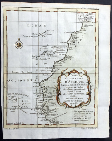
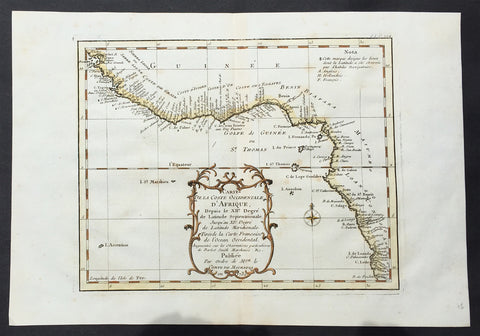
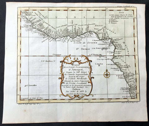
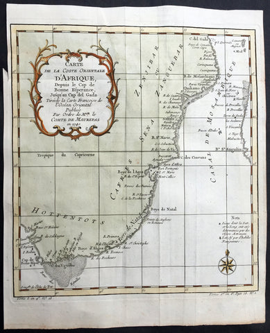
Background: One of Antoine Francois Prevosts monumental undertakings was his history of exploration & discovery in 15 volumes titledHistoire Générale des Voyages written between 1746-1759 and was extended to 20 volumes after his death by various authors.The 20 volumes cover the early explorations & discoveries on 3 continents: Africa (v. 1-5), Asia (v. 5-11), and America (v. 12-15) with material on the finding of the French, English, Dutch, and Portugese.A number of notable cartographers and engravers contributed to the copper plate maps and views to the 20 volumes including Nicolas Bellin, Jan Schley, Chedel, Franc Aveline, Fessard, and many others.The African volumes cover primarily coastal countries of West, Southern, and Eastern Africa, plus the Congo, Madagascar, Arabia and the Persian Gulf areas.The Asian volumes cover China, Korea, Tibet, Japan, Philippines, and countries bordering the Indian Ocean.Volume 11 includes Australia and Antarctica.Volumes 12-15 cover voyages and discoveries in America, including the East Indies, South, Central and North America.Volumes 16-20 include supplement volumes & tables along with continuation of voyages and discoveries in Russia, Northern Europe, America, Asia & Australia.