Welcome to Classical Images!
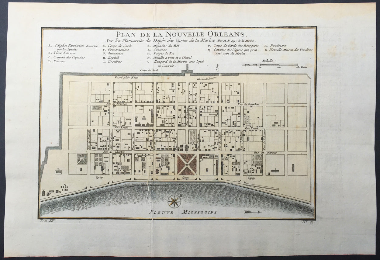
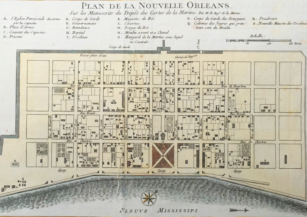
Description: This beautifully hand coloured original antique map* a scarce, early plan of the city of New Orleans, Louisiana by Jacques Nicolas Bellin was published in the 1757 French edition of Antoine-François Prevosts 20 volume L`Histoire Generale des Voyages published by Pierre de Hondt in the Hague between 1747 & 1785.
Background: This scarce 1757 map by Bellin is one of the earliest obtainable maps of New Orleans. Oriented to the east, Bellin's map covers the original settlement of New Orleans along the Mississippi River and inland as far theFosse plein d'eau (roughly translated: 'Pit full of Water') near modern day Dauphine Street, and from modern day Iberville Street (shown but not named) to modern day Barracks Street (shown but not named). The map shows some 100 buildings with some 18 specifically identified via an alphabetically coded table set just above the map. Among the locations noted in the key is one that provides an eerie echo of the slave trade. Item Q is identified as Cabanes des Negroes qui prennent soin Moulin or 'Cabins of Negros that care for mill.' Note how these cabins, as well as the adjacent mill, are both well outside the ordered structure of the city as well as conveniently located near the Corps de Garde des Bourgeois
Antoine François Prévost d'Exiles 1697 - 1763, usually known simply as the Abbé Prévost, was a French author and novelist. (Ref: Tooley; M&B)
General Description: Paper thickness and quality: - Heavy and stable Paper color: - off white Age of map color: - Original Colors used: - Yellow, green, red, brown. General color appearance: - Authentic and fresh Paper size: - 14 1/2in x 10in (360mm x 255mm) Plate size: - 11in x 8in (280mm x 205mm) Margins: - Min 1in (25mm)
Imperfections: Margins: - None Plate area: - Folds as issued, printers crease along left fold Verso: - None