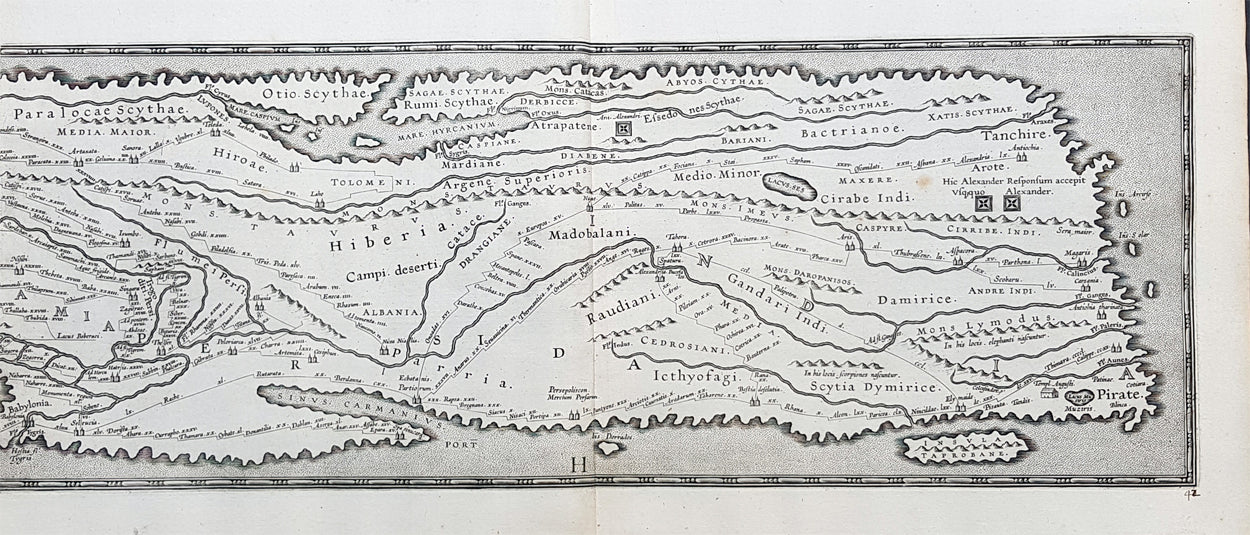
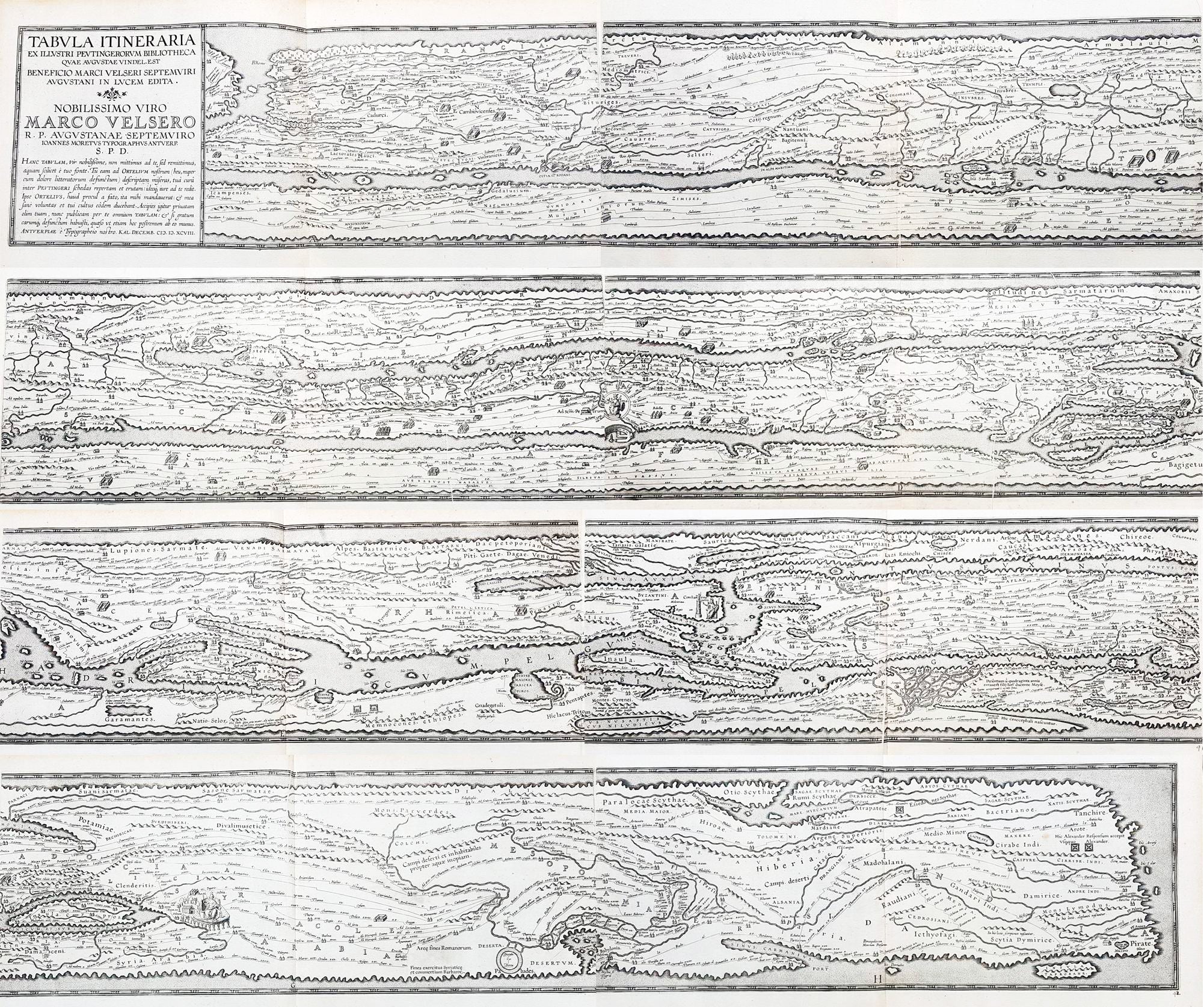
Welcome to Classical Images!
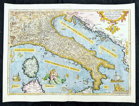
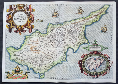
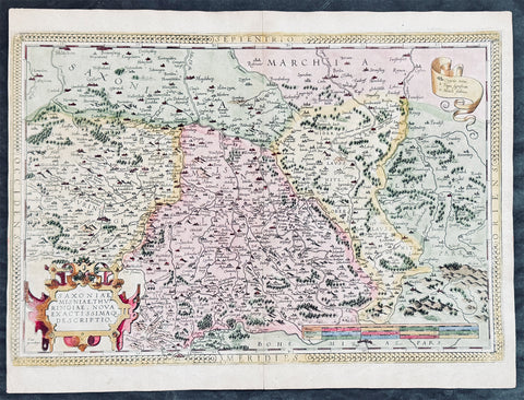
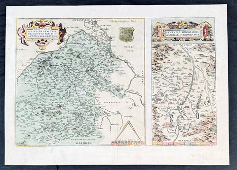
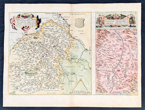
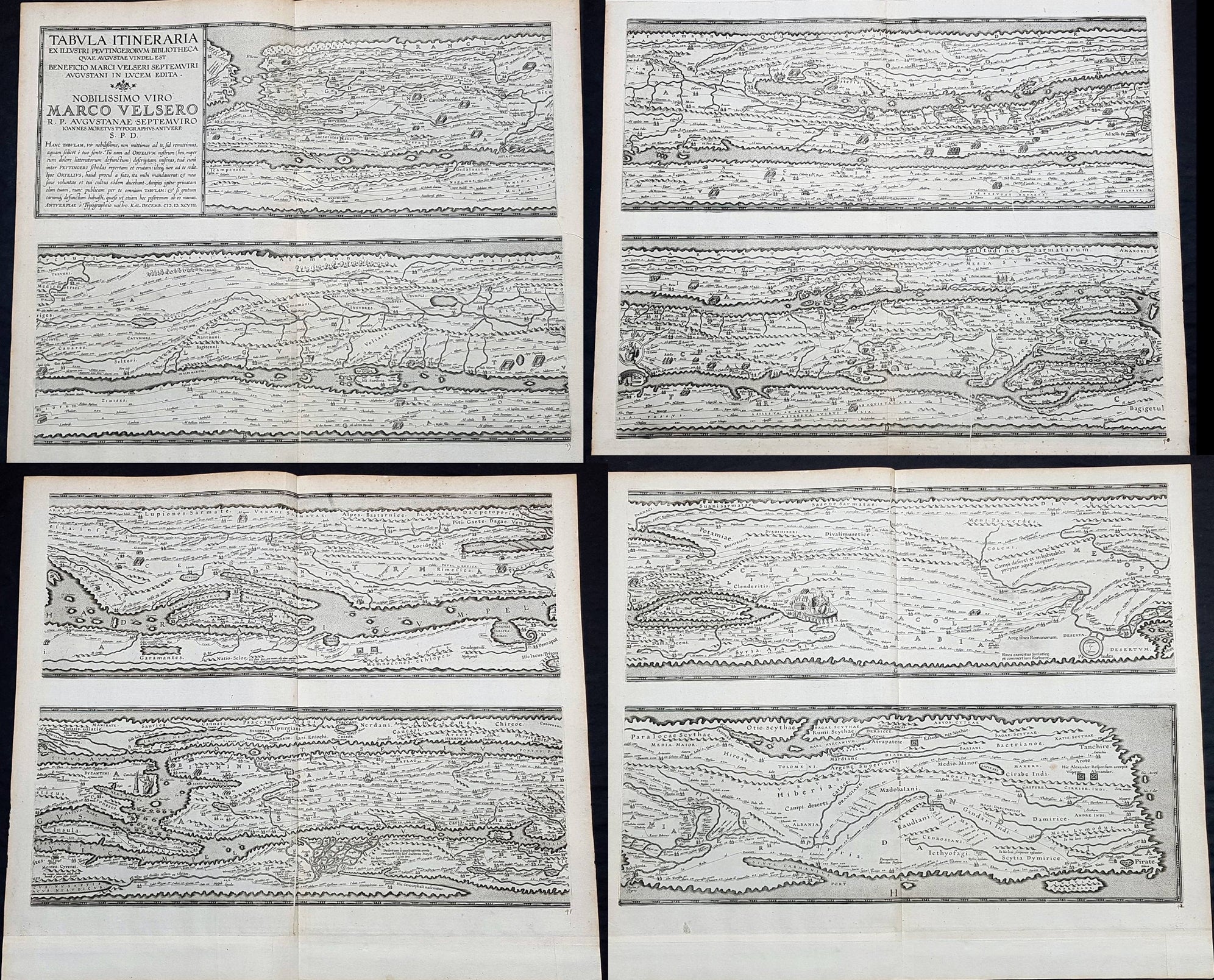
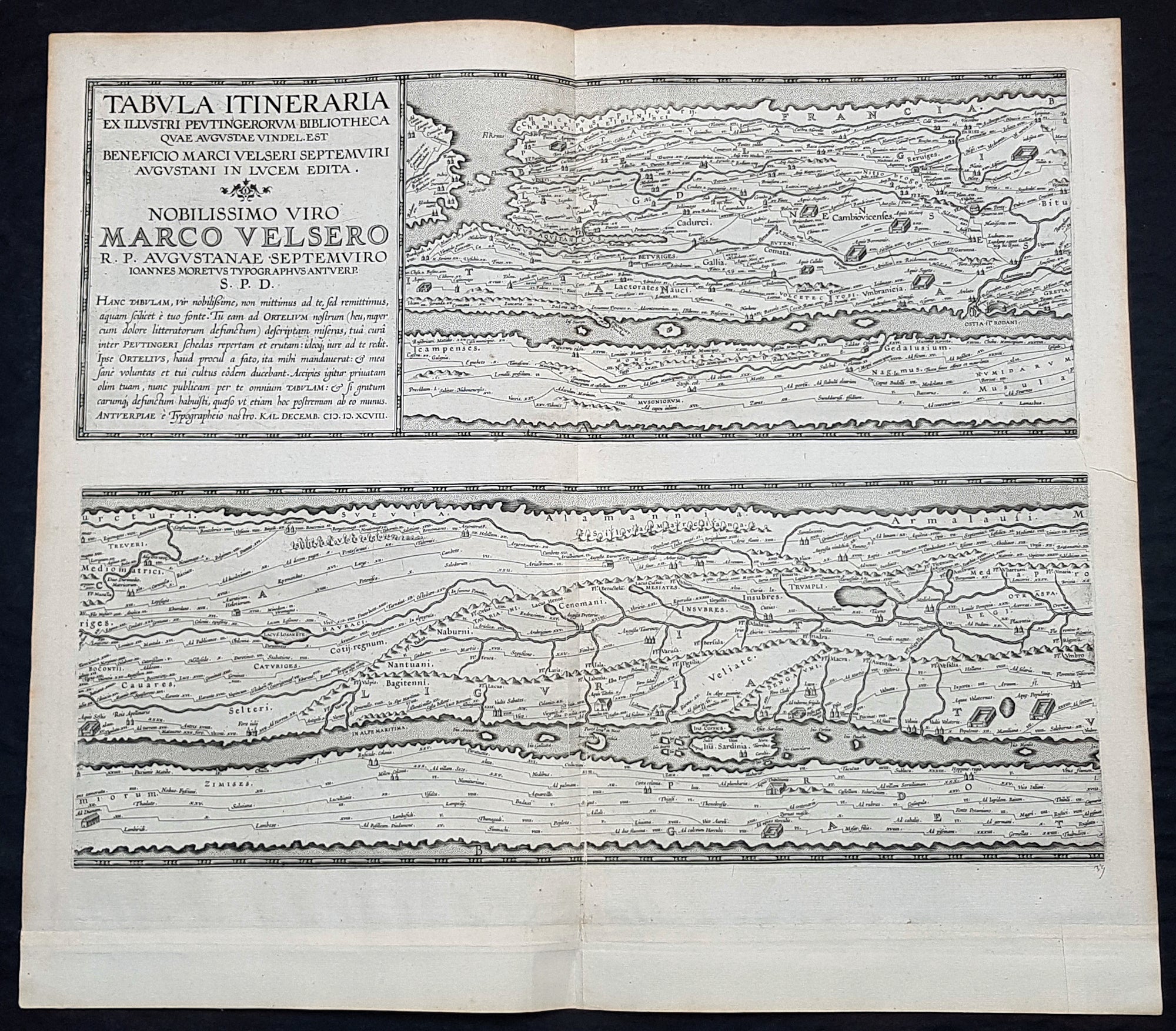
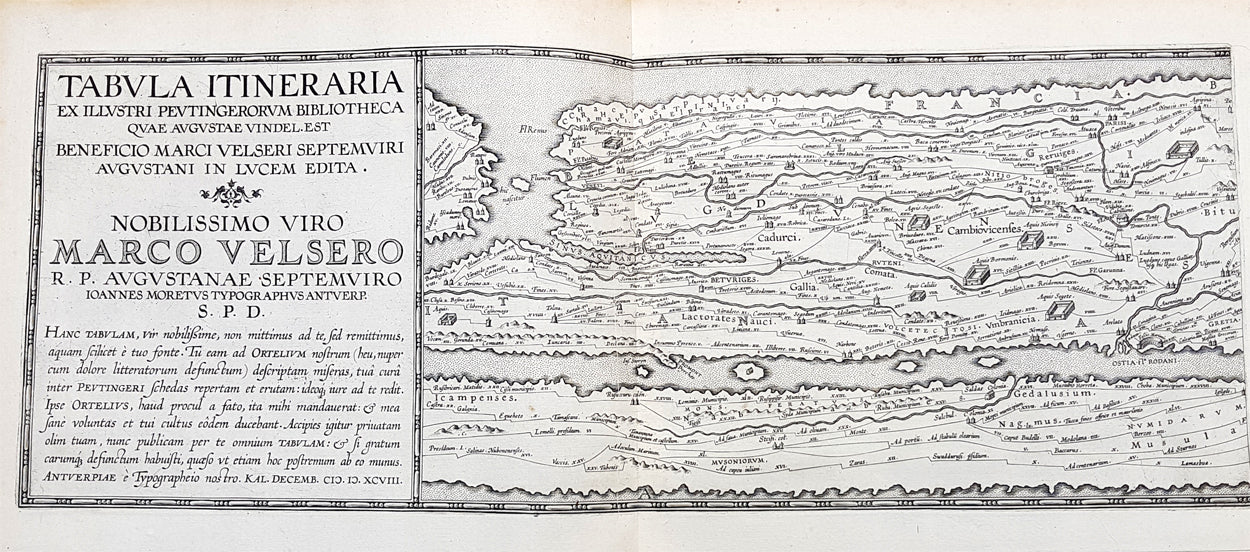
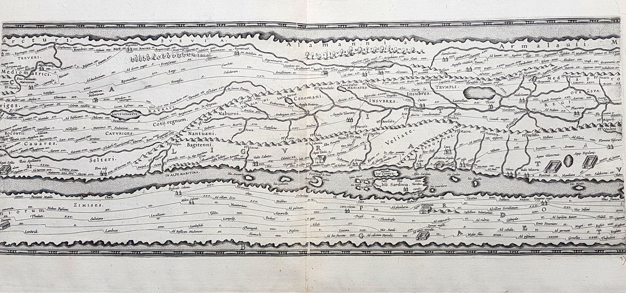
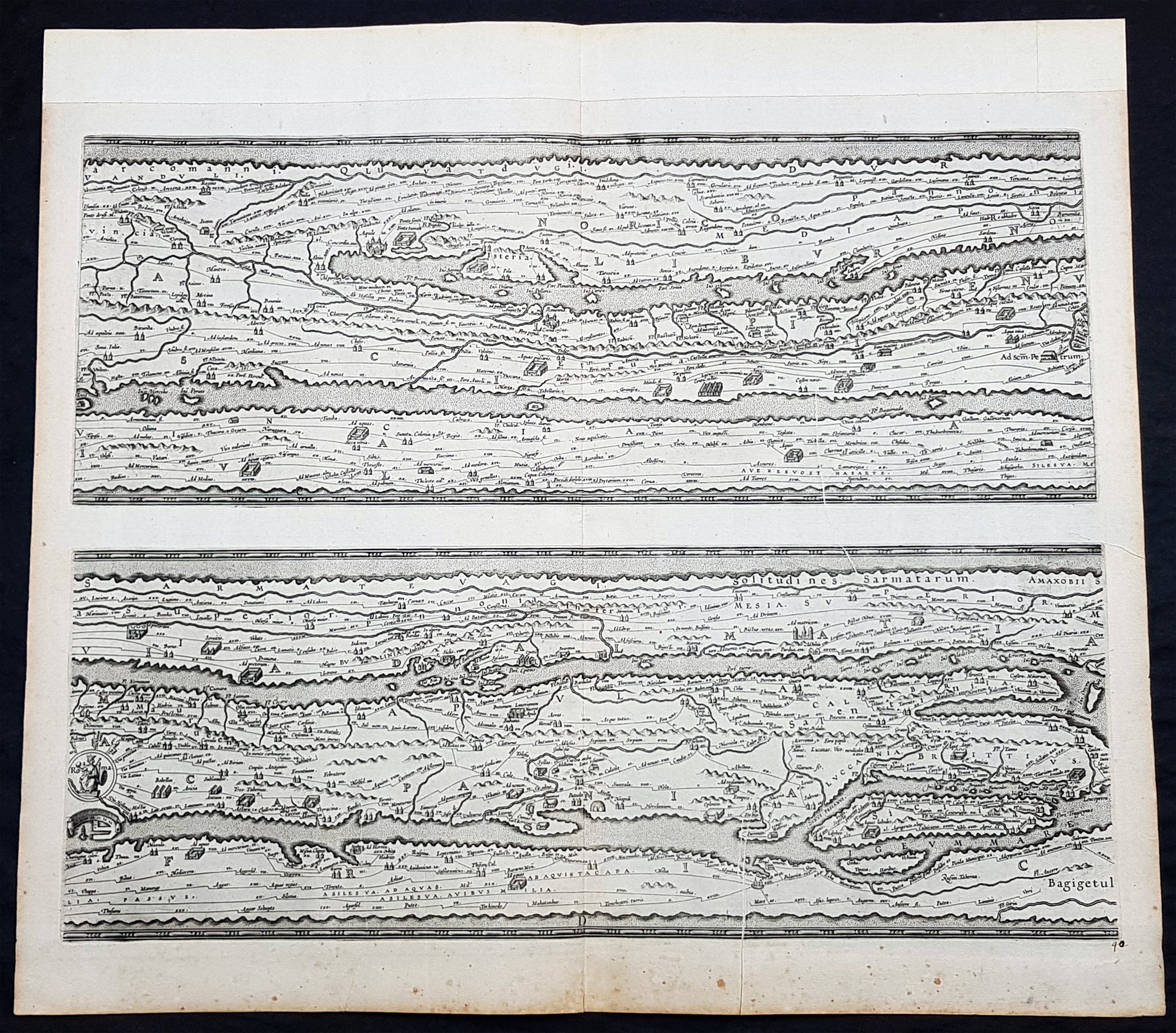
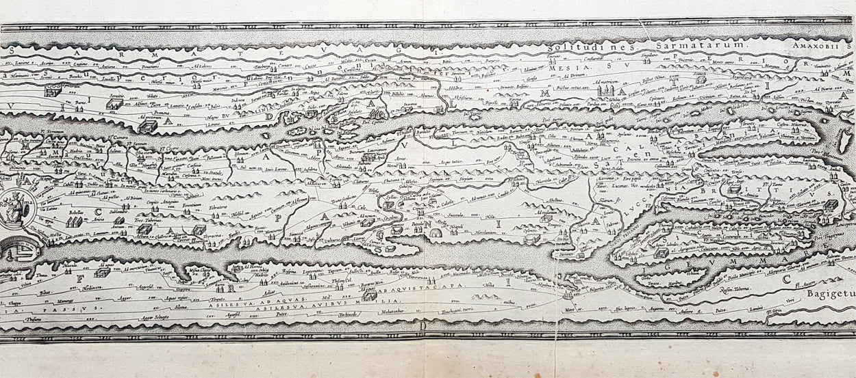
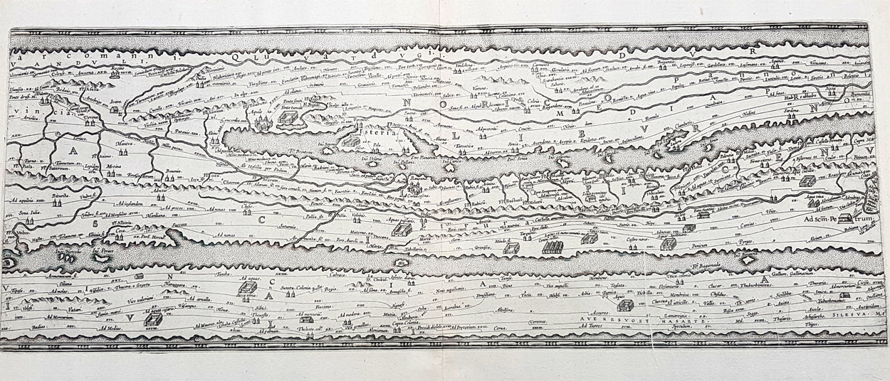
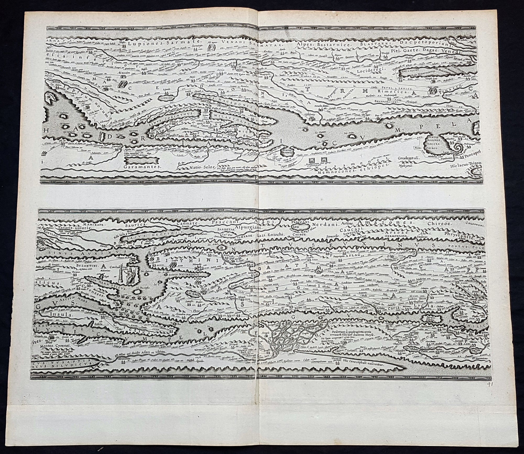
Description:For three decades, locating rare & unusual and maps has been one our main goals and I believe with the following maps we have reach a milestone. The following maps originate from the oldest direct linage of any maps we have offered, going back to the height of the Roman Empire. These are some of the rarest and most fascinating maps it has been my pleasure to offer.In 1265 a Monk, in the German city of Colmar produced a hand written map, on parchment, of the imperial highways and cities of the ancient Roman world. When joined, the result was a scroll measuring 6.75m long & 34cm wide, covering an area from southeast England to present day Sri-Lanka. That map of 1265 was copied from an earlier 4th or 5th century map, itself copied from a 2nd century map that originated from a 1st century BC map from Marcus Vipsanius Agrippa, a Roman General & architect. When Agrippa died in 12BC his map was engraved in marble and displayed in the Porticus Vipsania in the Campus Agrippae area in Rome.In 1494 the German Scholar, Conrad Celtes, discovered the Colmar scroll in a library, in the city of Worms. After his death in 1508, Celtes bequeathed the scroll to Konrad Peutinger, after whom the map is named. The scroll was kept in the Peutinger family until it was purchased by Prince Eugene of Savoy in 1714 and finally purchased for the Habsburg Imperial Court Library in Vienna, where it resides today.As early as 1577 Abraham Ortelius, the Flemish cartographer, was aware of the existence of the Peutinger Tables, at that stage owned by Mark Welser. In 1591 Welser had two sections of the scroll printed by Aldus Manutius in Venice. Ortelius thought these inadequate and so commissioned the scroll engraved onto 8 separate plates . Ortelius supervised the engraving of the plates but did not live to see the results. In December 1598 the first edition of the 8 plates were printed individually, in limited numbers, by Johannes Moretus in Antwerp and are today amongst some of the rarest sets of maps available. To save space for printing in the first & second atlases in 1619 & 1624, two plates were printed per page, thus saving space. At that point a change was made to each plate, the engraving of a descriptive title at the bottom of each plate.These maps we are offering are unique, being printed two per page but without the addition of the titles. So the conclusion we have come to is that these were prototypes printed to see if the printing of two plates per page were possible prior to the changes to the plates, making them unique.We know that there were a total of 300 sets of these tables published in 1619 & 1624 atlases Theatrum Geographiae Veteris & Parergon , of which very few have survived. As for the 1598 edition, we do not know the number published or how many have survived but there is no doubt the number is very low in the single digits. Also I can find no record of sale for this original 1598 1st Moretus edition.
General Definitions:Paper thickness and quality: - Heavy and stablePaper color : - off whiteAge of map color: -Colors used: -General color appearance: -Paper size: - 22in x 20in (560mm x 510mm) eachPlate size: - 20 1/4in x 7 1/2in (505mm x 195mm) eachMargins: - Min 1in (25mm)
Imperfections:Margins: - NonePlate area: - NoneVerso: - None
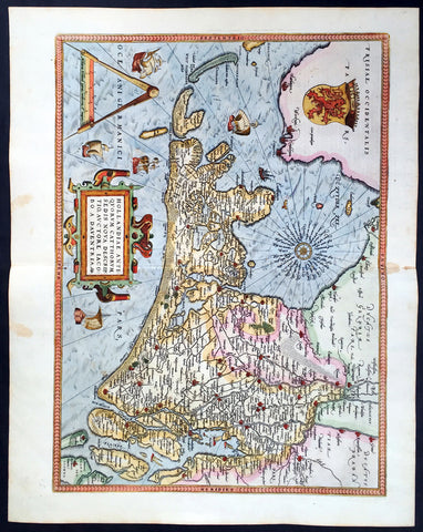
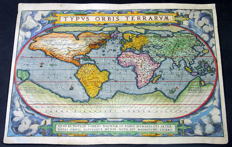
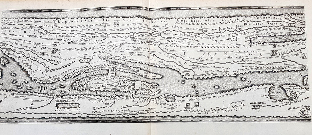
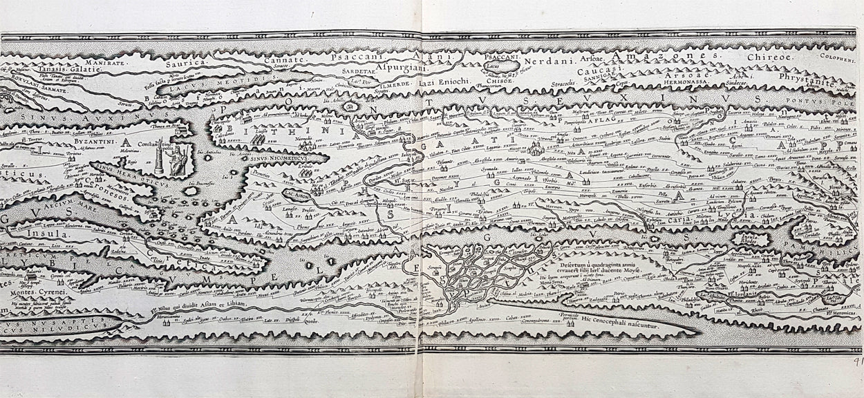
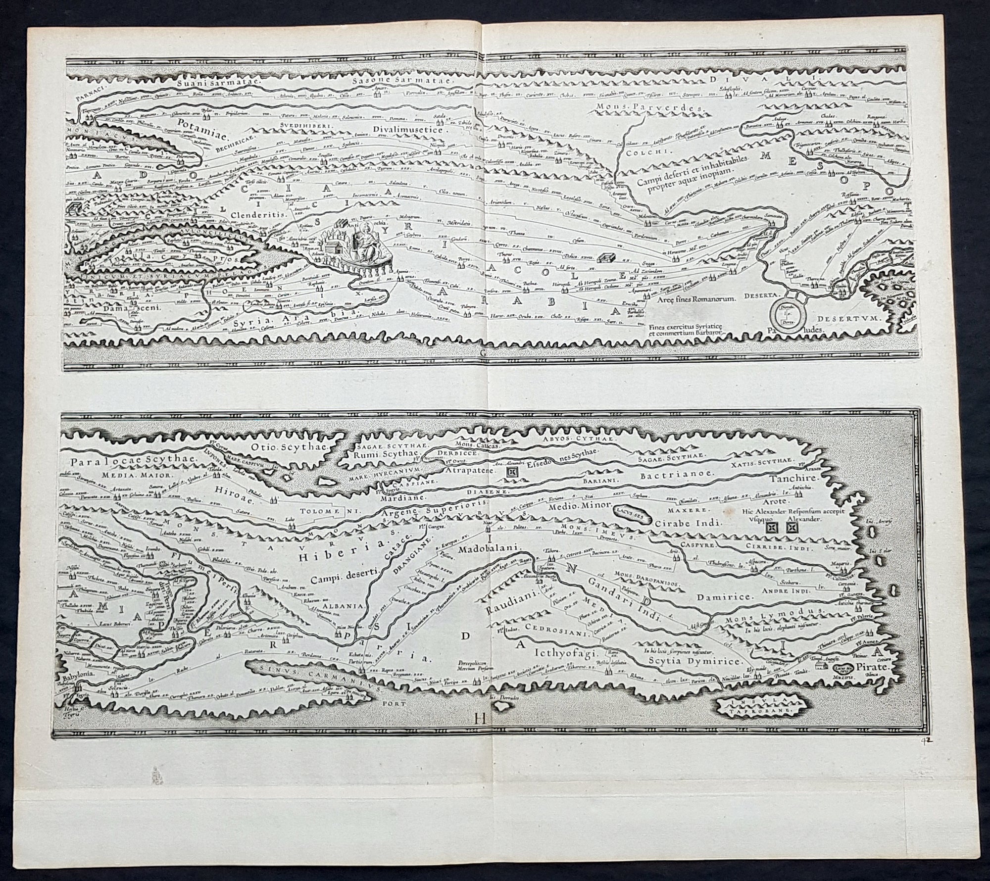
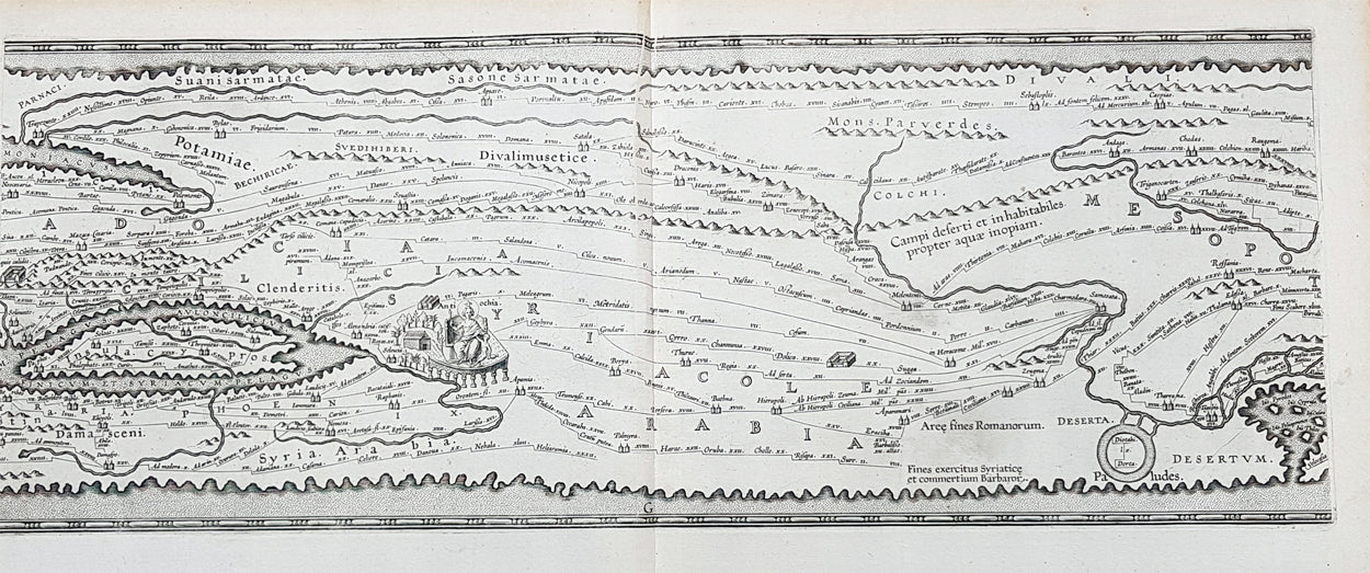
Background:Tabula Peutingerian also referred to as Peutingers Tabul or The Peutinger Table, is an illustrated itinerarium (ancient Roman road map) showing the layout of the cursus publicus, the road network of the Roman Empire. The map covers Europe, North Africa, and parts of Asia, including the Middle East, Persia, and India.The map was found as a 13th-century parchment copy based on a document from the 4th or 5th century, that contained a copy of the world map, originally prepared by Marcus Vipsanius Agrippa a Roman general & architect active during the reign of the emperor Augustus (27 BC – AD 14). After Agrippas death in 12 BC, that map was engraved in marble and put on display in the Porticus Vipsania in the Campus Agrippae area in Rome, close to the Ara Pacis building.The original Roman map, of which the 13th century parchment copy may be the only surviving copy, was last revised in the 4th or early 5th century. This is illustrated by the inclusion of the city of Constantinople, founded in 328, and the prominence of Ravenna, seat of the Western Roman Empire from 402 to 476, which suggests a fifth-century revision. The presence of certain cities of Germania Inferior that were destroyed in the mid-fifth century also provides proof or 4th or 5th century revision.The surviving 13th century map itself was created by a monk in Colmar in modern-day eastern France in 1265. It is a parchment scroll, 0.34 metres (1 foot 1 inch) high and 6.75 metres (22.1 feet) long, assembled from eleven sections, a medieval reproduction of the original scroll.The 13th century parchment map is very schematic, designed to give a practical overview of the road network, as opposed to an accurate representation of geographic features: the land masses shown are distorted, especially in the east–west direction. The map shows many Roman settlements and the roads connecting them, as well as other features such as rivers, mountains, forests and seas. The distances between settlements are also given. In total no fewer than 555 cities and 3,500 other place names are shown on the map. The three most important cities of the Roman Empire at the time – Rome, Constantinople and Antioch – are represented with special iconic decoration.Besides the totality of the empire, the map also shows areas in the Near East, India and the Ganges, Sri Lanka (Insula Taprobane), and even an indication of China. It even shows a Temple to Augustus at Muziris (present day Kodungallur) on the modern-day Malabar Coast, one of the main ports for trade with the Roman Empire on the southwest coast of India. On the western end of the scroll, the absence of Morocco, the Iberian Peninsula, and the British Isles indicates that a twelfth original section has been lost in the surviving copy; the missing section was reconstructed in 1898 by Konrad Miller.The map appears to be based on itineraries, lists of destinations along Roman roads, as the distances between points along the routes are indicated. Travellers would not have possessed anything so sophisticated as a modern map, but they needed to know what lay ahead of them on the road and how far. The Peutinger Table represents these roads as a series of stepped lines along which destinations have been marked in order of travel. The shape of the parchment pages accounts for the conventional rectangular layout. However, a rough similarity to the coordinates of Ptolemys earth-mapping gives some writers hope that some terrestrial representation was intended by the unknown original compilers.The stages and cities are represented by hundreds of functional place symbols, used with discrimination from the simplest icon of a building with two towers to the elaborate individualized portraits of the three great cities. Some conclud that the semi-schematic, semi-pictorial symbols reproduce Roman cartographic conventions of the itineraria picta described by 4th-century writer Vegetius, of which this is the sole known testimony.The 13th century copy map was discovered in a library in the city of Worms by German scholar Conrad Celtes in 1494, who was unable to publish his find before his death and bequeathed the map in 1508 to Konrad Peutinger, a German humanist and antiquarian in Augsburg, after whom the map is named. The Peutinger family kept possession of the map for more than two hundred years until it was sold in 1714. It then bounced between several royal and elite families until it was purchased by Prince Eugene of Savoy for 100 ducats; upon his death in 1737, it was purchased for the Habsburg Imperial Court Library in Vienna (Hofbibliothek). It is today conserved at the Austrian National Library at the Hofburg palace in Vienna.The map was copied for Dutch cartographer Abraham Ortelius by Johannes Moretus and published separetly, shortly after his death, in 1598. The maps were not published in an atlas until 1619 by Petrus Bertius and again in the Ortelius Parageon in 1624.A partial first edition was printed at Antwerp in 1591 (titled Fragmenta tabulæ antiquæ) , Johannes Moretus, printed the full Tabula in December 1598, in Antwerp. Johannes Janssonius published another version in Amsterdam, c. 1652.In 1753 Franz Christoph von Scheyb published a copy, and in 1872 Konrad Miller, a German professor, was allowed to copy the map. Several publishing houses in Europe then made copies. In 1892 publishers Williams and Norgate published a copy in London, and in 1911 a sheet was added showing the reconstructed sections of the British Isles and the Iberian peninsula missing in the original.