Welcome to Classical Images!
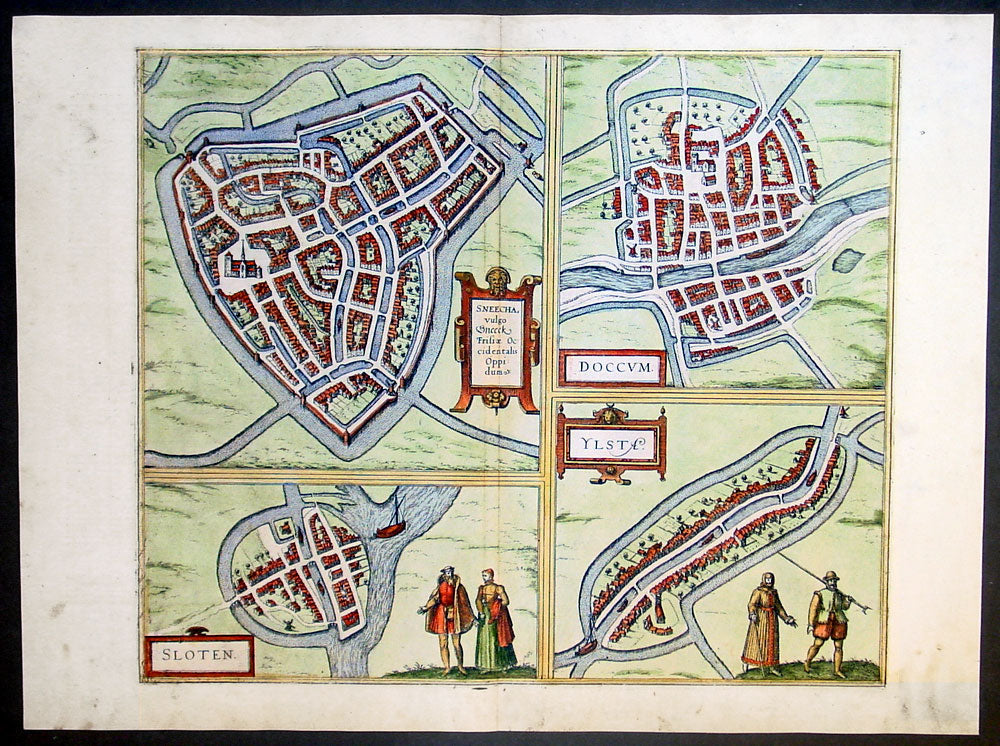
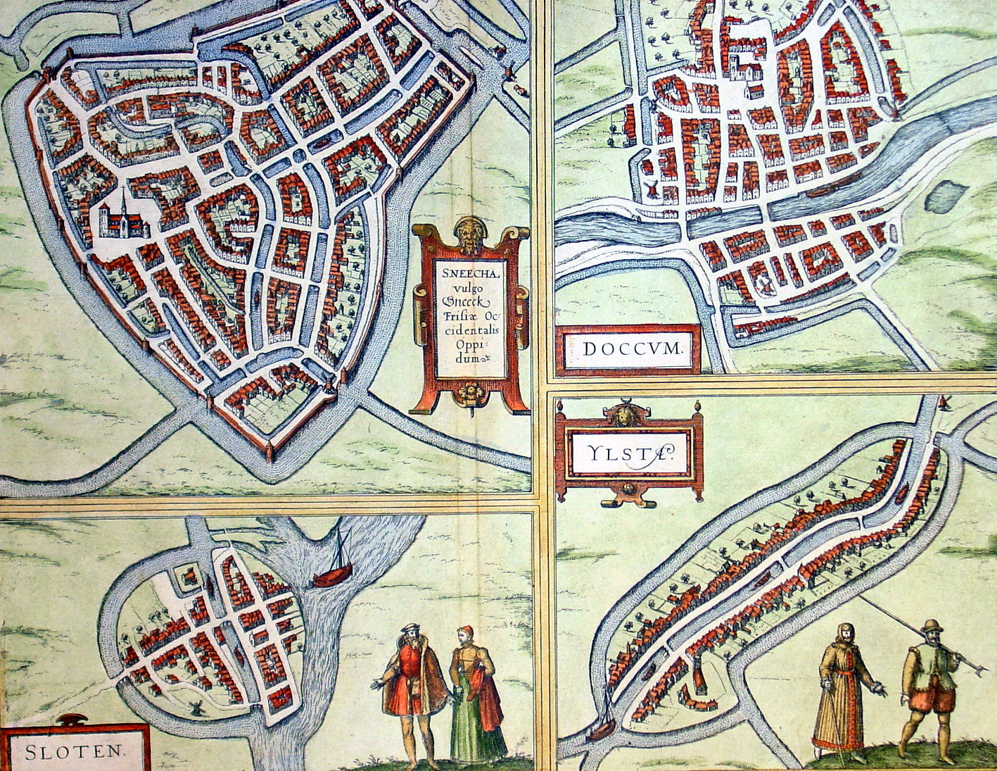
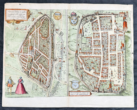
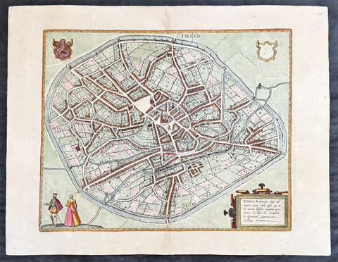
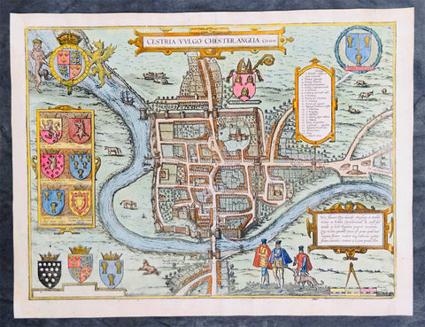
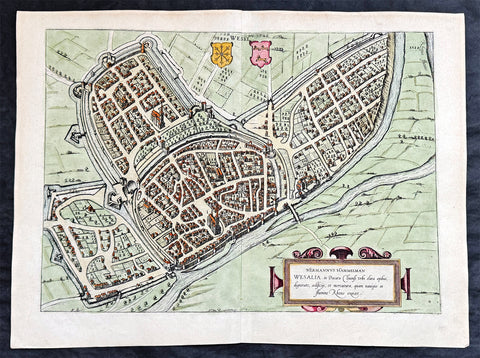
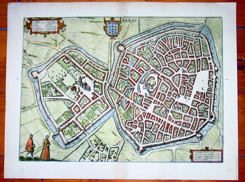
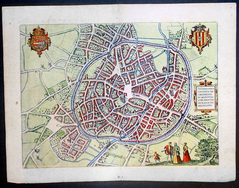
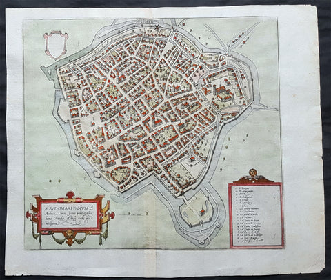
Description:This fine beautifully hand coloured original antique map a birds-eye view of the towns of Sneek, Dokkum, Ylst and Sloten in Frisia, the Netherlands was published by Georg Braun & Frans Hogenberg for the 1575 atlas of town plans Civiates Orbis Terrarum Vol II (1572-1612) intended as a companion to Abraham Ortelius's master Atlas Theatrum Orbis Terrarum published in 1570.
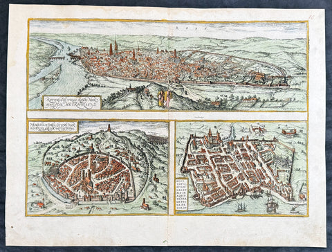
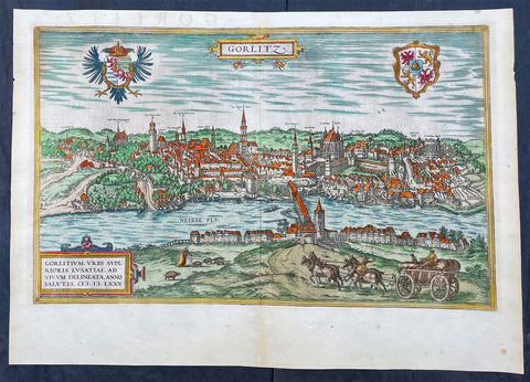
Background of Civitates Orbis Terrarum The first volume of the Civitates Orbis Terrarum was published in Cologne in 1572. The sixth and the final volume appeared in 1617. This great city atlas, edited by Georg Braun and largely engraved by Franz Hogenberg, eventually contained 546 prospects, bird-eye views and map views of cities from all over the world. Braun (1541-1622), a cleric of Cologne, was the principal editor of the work, and was greatly assisted in his project by the close, and continued interest of Abraham Ortelius, whose Theatrum Orbis Terrarum of 1570 was, as a systematic and comprehensive collection of maps of uniform style, the first true atlas.
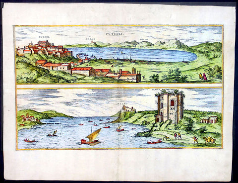
For a variety of reasons town plans were comparatively latecomers in the long history of cartography. Few cities in Europe in the middle ages had more than 20,00 inhabitants and even London in the late Elizabethan period had only 100-150,000 people which in itself was probably 10 times that of any other English city. The Nuremberg Chronicle in 1493 included one of the first town views of Jerusalem, thereafter, for most of the sixteenth century, German cartographers led the way in producing town plans in a modern sense. In 1544 Sebastian Munster issued in Basle his Cosmographia containing roughly sixty-six plans and views, some in the plan form, but many in the old panorama or birds eye view. (Ref: Tooley; M&B)
Condition Report: Paper thickness and quality: - Heavy and stable Paper color: - off white Age of map color: - Early Colors used: - Green, blue, red, yellow General color appearance: - Authentic Paper size: - 21in x 16in (535mm x 410mm) Plate size: - 16 1/2in x 14in (420mm x 355mm) Margins: - Min 1in (25mm)
Imperfections: Margins: - Light soiling in margins Plate area: - None Verso: - None