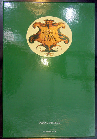
Walking Tree Press
Gerardi Mercatoris - Atlas Europae
- Title : Gerardi Mercatoris - Atlas Europae
- Date : 2000
- Condition: (A+) Fine Condition
- Ref: Merc1
- Size: Folio
Description:
Gerardi Mercatoris - Atlas Europae - In 1967, an anonymous buyer purchased a large, tattered book of maps in a second-hand bookshop in Belgium. He had unknowingly rediscovered a priceless and long-lost early atlas produced 400 years earlier by none other than Gerardus Mercator, the German mapmaker, whose cylindrical projection of the world revolutionized long-distance navigation, and who pioneered the practice of cutting wall maps into book pages and binding them. Mercator, in fact, coined the term "atlas" for such a book, and probably produced this one for a tour of Europe undertaken by the young Crown Prince of Cleves. His original maps are magnificently presented here, unbound in a foil-stamped, slipcased folio of 17 superb reproductions. Labeled in Latin, each map folds out flat to 21½" by 16", suitable for framing, and is printed in full color to reveal the master mapmaker's green and brown hills, sandy coastlines, and red cities and towns. The 17 replica maps are accompanied by an in-depth companion book, featuring essays by an international team of map scholars. This volume relates the historical significance of Mercator's atlas and how it influenced the politics and science of the day. It also examines the work of later cartographers, in more than 100 original-color illustrations. A must-have for collectors, this elegant edition combines the high art of antiquarian maps with exceptional scholarly analysis.
Published by Walking Tree Press, 2000. Softcover book and 17 loose maps in clothbound folio cover with cardboard slipcase. Approximate dimensions: 11 x 16 1/2 in. 94 pages

