Robert De Vaugondy (1688 - 1766) & Didier Robert de Vaugondy (c.1723–1786)
Profile :
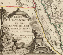
Gilles and Didier Robert De Vaugondy were father and son, respectively, and produced their atlas, globes and maps in concert with others such as Sanson, Jaillot and Bonne amongst others. In many cases they did not use the initials of their first names when signing their maps, so it can be unclear at times who made a given map. On some maps fils. or filio. follows the name, designating its author as the son. In other instances, the authorship can be determined by the distinctive way each signed his maps: the father normally used "M.Robert," leaving off the last name, and the son, "Robert de Vaugondy." The Atlas Universal [Paris, 1757] was one of the most important 18th century atlases and one of the great achievements of the French Enlightenment.
The Vaugondy's employed strict standards for including maps in this atlas and in many cases subjected them to astronomically derived readings for latitude and longitude. Moreover, 'their frequent use of eighteenth century sources, often from the 1740s, provided their atlas with up-to-date information. While their preference was for maps that bad been surveyed in the field and maps published in the region itself, they did not hesitate to turn to older sources when more recent maps were found to be lacking." (Pedley, p. 61)
For their maps of Canada and South America, the Vaugondy's had access to sources held by the Depot de la Marine, the official French repository for maritime-related information. Like Ortelius and Mercator before them, the Vaugondy`s listed the sources of their maps, which is of incalculable benefit to anyone seeking to understand not only their maps but also those of the period.
"A feature of the maps of the Atlas Universel which attracted unanimous praise from critics was the cartouches." (Pedley, p. 64) A number of artisans worked on their design and engraving; several cartouches were engraved and signed by the Haussard sisters. Among the most pictorial cartouches are the four found on maps showing the postal routes of Great Britain, France, Germany, Spain and Portugal. They depict postal carriers en route in richly detailed settings.
Robert De Vaugondy (1)
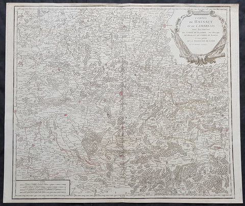
1757 Robert De Vaugondy Large Antique Map The County of Hainaut Belgium & France
- Title : Comte De Hainaut et de Cambres.......Par Le Sr. Robert
- Size: 23in x 19 1/2in (585mm x 495mm)
- Condition: (A+) Fine Condition
- Date : 1757
- Ref #: 41564
Description:
This large magnificent hand coloured original copper-plate engraved antique map of the Hainaut region of Belgium - centering on the city of Mons - by Robert De Vaugondy was published in the 1757 edition of De Vaugondys famous The Atlas Universel
General Definitions:
Paper thickness and quality: - Heavy and stable
Paper color : - off white
Age of map color: - Original & later
Colors used: - Blue, pink, red, green, yellow
General color appearance: - Authentic
Paper size: - 23in x 19 1/2in (585mm x 495mm)
Plate size: - 23in x 19 1/2in (585mm x 495mm)
Margins: - Min 1/4in (6mm)
Imperfections:
Margins: - None
Plate area: - None
Verso: - None
Background:
The County of Hainaut sometimes given the spelling Hainault, was a historical lordship within the medieval Holy Roman Empire with its capital eventually established at Mons (Dutch: Bergen), and named after the river Haine, both now in Belgium. Besides Mons, it included the city of Valenciennes, now in France. It consisted of what is now the Belgian province of Hainaut and the eastern part of the French département of Nord.
Originally a gau of Lotharingia, Hainaut was briefly a part of West Francia (911–25) before becoming definitively attached to Germany. The county was divided in 958 and only emerged in its more or less final form in 1071. Hainaut was culturally and linguistically French. In 1432, Hainaut was acquired by the House of Valois-Burgundy and in 1477 passed to the Habsburgs with the rest of the Burgundian Netherlands and became part of the Burgundian Circle in 1512. It was ruled by the Spanish branch of the Habsburgs from 1555 to 1714. In 1659 and 1678 southern Hainaut was acquired by France, and in 1797 the rest of the county was ceded to France by the Emperor Francis II, who was also count of Hainaut.