Welcome to Classical Images!
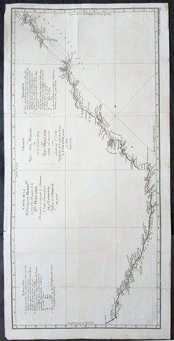
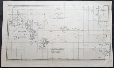
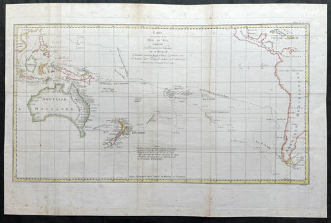
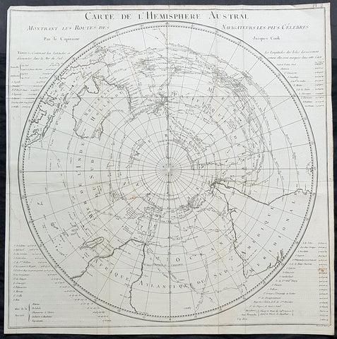
Description:This fine original copper-plate engraved antique map of the Port of Praia, on the Cape Verde Islands visited by Captain James Cook in 1772, in HMS Resolution & Adventure, during his 2nd Voyage of Discovery to the South Seas, was engraved by Robert Benard - after Thomas Bowen - and was published in the 1778 French edition of Capt. James Cooks 2nd Voyage of Discovery to the South Seas A voyage towards the South Pole, and round the World. Performed in His Majestys ships the Resolution and Adventure, in the years 1772, 1773, 1774, and 1775..... Paris : Hotel de Thou ......1778.Cooks Journal (1772)......Jul. 2 Thu. Sandwich and Palliser aboard. Cook reports favourably. Cook receives Admiralty Instructions and scientific instruments.3 Fri. Arrives Plymouth.13 Mon. Resolution and Adventure sail from Plymouth. (From hereon Cook’s dates, as in Journal, are used. )20 Mon. Off Cape Finisterre.22 Wed. Off Sisargas Islands.29 Wed. Anchors in Funchal Road, Madeira.30 Thu. Goes ashore. Provisions ships. Makes observations.Aug. 2 Sun. Sails from Madeira.4 Tue. Off Palma, Canary Isles.5 Wed. Off Ferro (Faro), (Hierro).9 Sun. Off Bonavista.10 Mon. Off Mayo.13 Thu. Anchors at Porto Prayo, Santiago, Cape Verde Islands. Provisions ships and makes observations.15 Sat. Sails from Porto Prayo and heads south.20 Thu. Henry Smock, Carpenter’s mate, lost overboard while at work.
General Definitions:Paper thickness and quality: - Heavy and stablePaper color : - off whiteAge of map color: -Colors used: -General color appearance: -Paper size: - 9in x 7in (230mm x 180mm)Plate size: - 9in x 7in (230mm x 180mm)Margins: - Min 1/2in (12mm)
Imperfections:Margins: - NonePlate area: - NoneVerso: - None
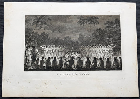
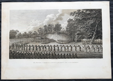
Background: Praia Harbor or Porto da Praia in the capital and largest city of Cape Verde, is the city\'s harbor located southeast of Praia and south of the island of Santiago, Cape Verde.In the 16th century, the small settlement was founded and was named Praia de Santa Maria (now Gamboa), later in 1612, another settlement was founded. It became a settlement, later town that would serve as a harbor and around the 19th century, it was the popular alternative to Cidade Velha due to its high harbour fees, in the mid 19th century, Praia became a city.Praia was raided for the only time in 1585 during the Capture of Santiago, his ships were stationed at the harbor and landed on the beach. Jacques Cassard arrived at Praia Harbour at Praia Negra on May 5, 1712 and brought with it 12 ships, where he led a huge attack on Ribeira Grande (now Cidade Velha) and conquered, sacked and destroyed it. After the Cassard expedition, the island capital was moved to Praia and several cannons were installed in the east of Plateau facing the harbour, one of them at the battery and barracks today where Quartel Jaime Mota is located, Praia became the chief port of Cape Verde and one of the main ports of the western portion of West Africa. The harbour as Porto Praya was mentioned in the 1747 French/Dutch map by Jacques Nicolas Bellin.The Battle of Porto Praya took place on April 16, 1781, part of the Anglo-French War of 1778-83 took place inside the harbor. Before the battle on 13 March 1781 Johnstone sailed from Spithead, England with a fleet of 37 ships, including five ships of the line, three frigates, and a large number of troop convoy ships. In early April the fleet anchored in the neutral harbour of Porto Praya in the Portuguese-controlled Cape Verde Islands to take on water and supplies. One of Suffren\'s ships, the Artésien, had originally been destined for America, and was in need of water, so the French fleet paused when it approached Santiago on 16 April, and Suffren ordered the Artésien to the harbour. The battle took part with Great Britain and France and began and later, the French won the battle, for a day the waters were either British or French.[4] As more ports were constructed in the west of West Africa, its port was not mainly used.Thomas Bowen (1767-1790) was an engraver and son of Emanuel Bowen, map and print seller, engraver to George II and to Louis XV of France who worked in London from 1714 producing some the best and most attractive maps of the 18th century. He had plans for completing a major County Atlas but, finding the task beyond his means, joined with Thomas Kitchin to publish The Large English Atlas. Many of the maps were issued individually from 1749 onwards and the whole atlas was not finally completed until 1760. With one or two exceptions they were the largest maps of the counties to appear up to that time (27 x 20) and were unusual in that blank areas around each map are filled with historical and topographical detail which makes fascinating and amusing reading. The atlas was reissued later in reduced size. Apart from his county maps and atlases of different parts of the world he also issued (with John Owen) a book of road maps based, as was usual at that time, on Ogilby but again incorporating his own style of historical and heraldic detail. Thomas helped his father during his lifetime and produced many fine maps in his own right after his fathers death.William Hodges RA 1744 – 1797 was an English painter. He was a member of James Cooks second voyage to the Pacific Ocean, and is best known for the sketches and paintings of locations he visited on that voyage, including Table Bay, Tahiti, Easter Island, and the Antarctic.Between 1772 and 1775 Hodges accompanied James Cook to the Pacific as the expeditions artist. Many of his sketches and wash paintings were adapted as engravings in the original published edition of Cooks journals from the voyage.Most of the large-scale landscape oil paintings from his Pacific travels for which Hodges is best known were finished after his return to London; he received a salary from the Admiralty for the purposes of completing them. These paintings depicted a stronger light and shadow than had been usual in European landscape tradition. Contemporary art critics complained that his use of light and colour contrasts gave his paintings a rough and unfinished appearance.Hodges also produced many valuable portrait sketches of Pacific islanders and scenes from the voyage involving members of the expedition..Robert Bénard 1734 – 1777 was an 18th-century French engraver.Specialized in the technique of engraving, Robert Ménard is mainly famous for having supplied a significant amount of plates (at least 1,800) to the Encyclopédie by Diderot & d\'Alembert from 1751.Later, publisher Charles-Joseph Panckoucke reused many of his productions to illustrate the works of his catalog.