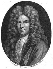
Claude Delisle (1644-1720)
Profile :
Claude Delisle, also known as Guillaume Delisle, was one of the most important and influential cartographers of the 18th century. His innovative approach to cartography, which was grounded in the latest scientific knowledge and measurement techniques, revolutionized the field and set a new standard for accuracy and precision in mapmaking.
Delisle's maps were known for their exceptional accuracy and detail, and they were widely used by governments, scholars, and explorers throughout Europe. He drew upon the latest astronomical and mathematical data to create maps that were more precise and reliable than those that had come before.
One of Delisle's most important contributions to cartography was his development of the "Delisle Method," which involved the use of triangulation to measure distances between points on the earth's surface. This method allowed for more accurate mapping of large areas and was widely adopted by other cartographers.
Delisle's maps were also notable for their use of shaded relief, which helped to convey a sense of three-dimensionality and depth. He was one of the first cartographers to incorporate this technique into his maps, and it became a hallmark of his work.
Delisle produced a number of important maps and atlases during his career, including the Atlas Nouveau, which was considered one of the finest atlases of the 18th century. He also produced maps of many regions of Europe, Africa, and the Americas, including detailed maps of France, Spain, Portugal, and the British Isles.
Delisle's work had a profound impact on the field of cartography, and his legacy as one of the greatest cartographers of all time continues to be felt today. His maps and atlases are highly valued by collectors and scholars, and his contributions to the field of geography and mapmaking have been recognized and celebrated for centuries.
Claude Delisle (1)
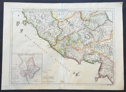
1711 Claude Delisle Large Antique Map of Rome and Regions, Italy
- Title : Regionum Italiae Mediarum Tabula Geographica Par Guill. Delisle.....1711
- Ref #: 31904
- Size: 28in x 21in (660mm x 535mm)
- Date : 1711
- Condition: (A+) Fine Condition
Description:
This large beautifully engraved hand coloured original antique map of Rome and the regions surrounding the ancient capital was engraved in 1711 - the date is engraved at the foot of the map - and was published by Guillaume Delisle in the Atlas Nouveau. (Ref: M&B; Tooley)
Condition Report
Paper thickness and quality: - Very heavy and stable
Paper color: - Off white
Age of map color: - Original
Colors used: - Yellow, green, pink
General color appearance: - Authentic
Paper size: - 28in x 21in (660mm x 535mm)
Plate size: - 24in x 18 1/2in (610mm x 470mm)
Margins: - min. 1in (25mm)
Imperfections:
Margins: - Repair to bottom margin
Plate area: - Light creasing and slight discolouration to bottom centerold
Verso: - None