Welcome to Classical Images!
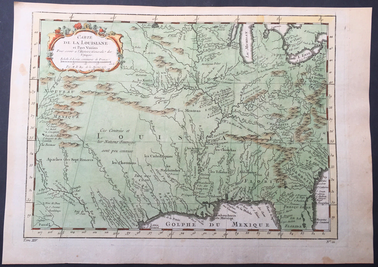
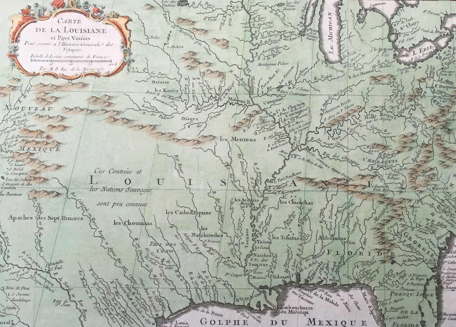
Description: This beautifully hand coloured original antique map of The Colonial United States, from the Great Lakes to Louisiana, Texas and New Mexico was engraved in 1757 - the date is engraved in the title cartouche - and was published in the 1757 French edition of Antoine-François Prevosts 20 volume L`Histoire Generale des Voyages published by Pierre de Hondt in the Hague between 1747 & 1785. Antoine François Prévost d'Exiles 1697 - 1763, usually known simply as the Abbé Prévost, was a French author and novelist. (Ref: Tooley; M&B)
General Description: Paper thickness and quality: - Heavy and stable Paper color: - white Age of map color: - Early Colors used: - Green, yellow, red General color appearance: - Authentic Paper size: - 14in x 10in (365mm x 260mm) Plate size: - 12 1/2in x 9 1/2in (320mm x 230mm) Margins: - min. 1/2in (12mm)
Imperfections: Margins: - None Plate area: - Folds as issued Verso: - None