Welcome to Classical Images!
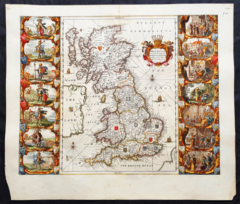
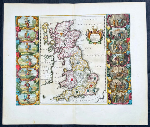
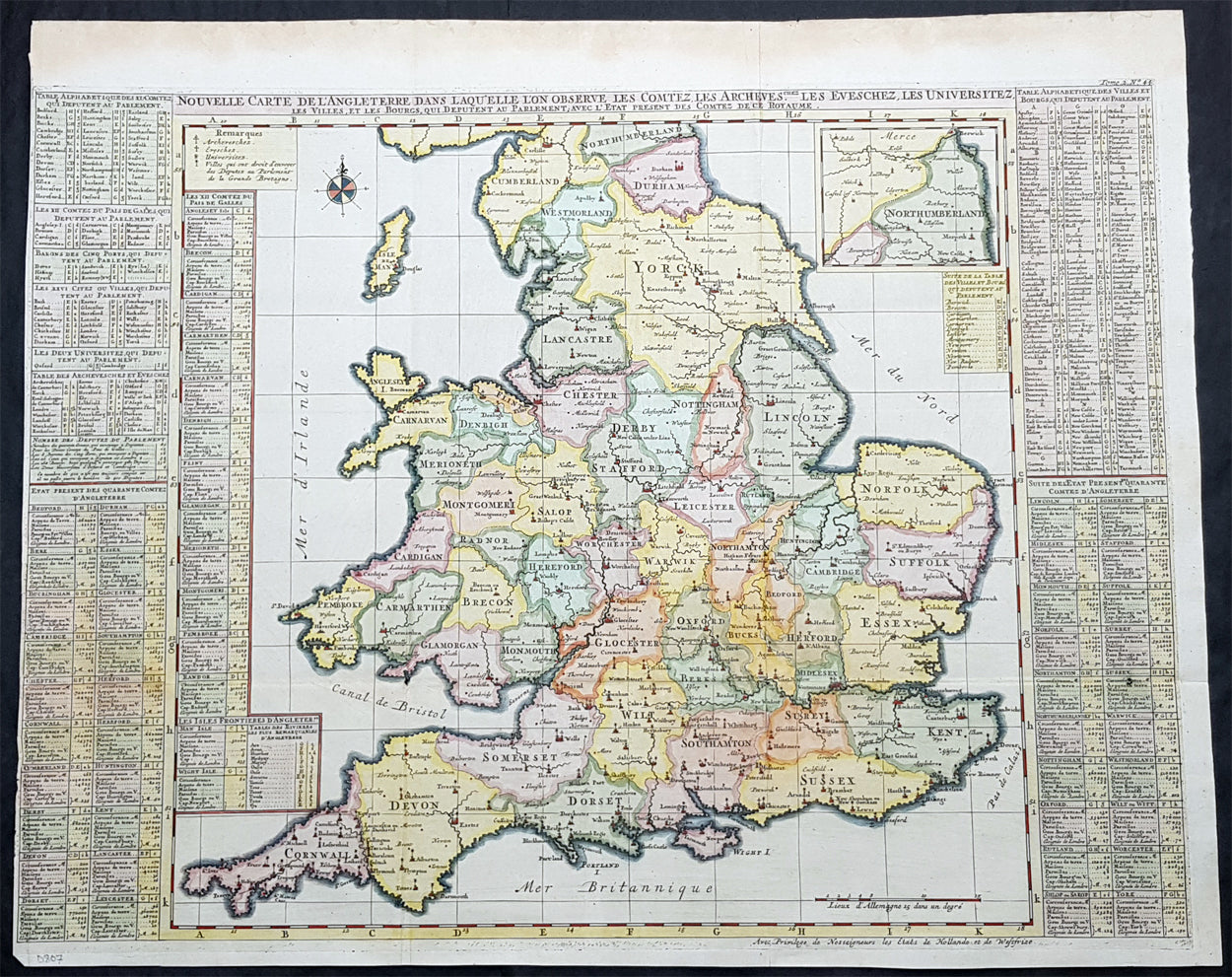
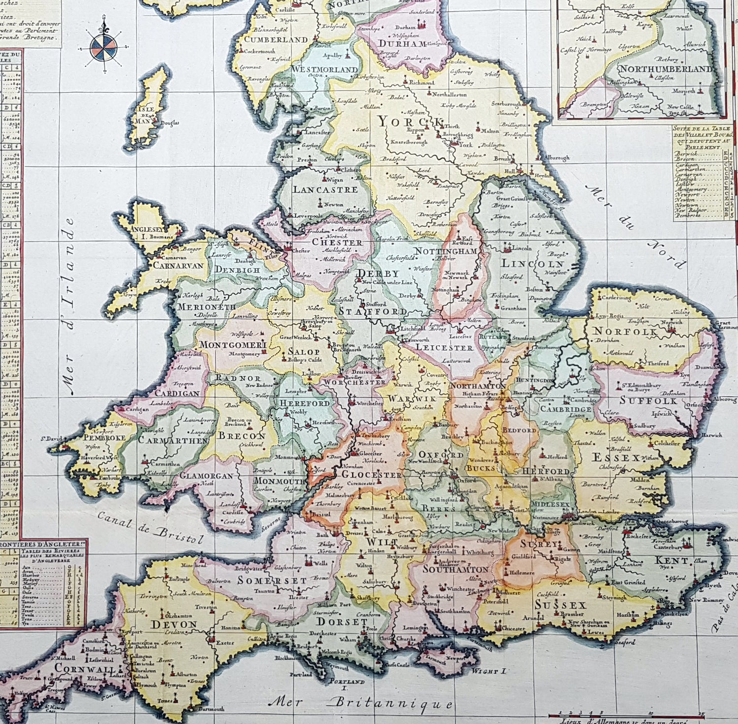
Description:This large beautifully hand coloured original copper plate engraved antique map of England & Wales was published by Henri Abraham Chatelain in 1719, in his famous Atlas Historique.
General Definitions:Paper thickness and quality: - Heavy and stablePaper color : - off whiteAge of map color: - EarlyColors used: - Yellow, green, blue, pinkGeneral color appearance: - AuthenticPaper size: - 25 1/2in x 21in (650mm x 535mm)Plate size: - 25in x 19in (635mm x 490mm)Margins: - Min 1/8in (3mm)
Imperfections:Margins: - Left margin cropped to plate-markPlate area: - Folds as issuedVerso: - Folds as issued