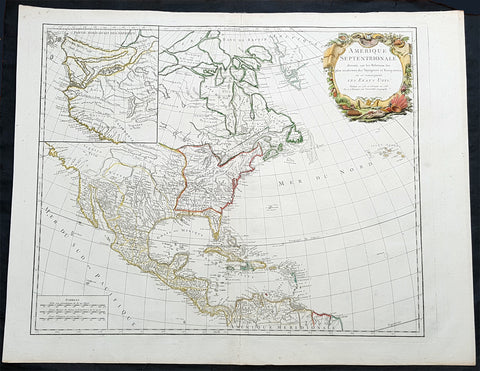
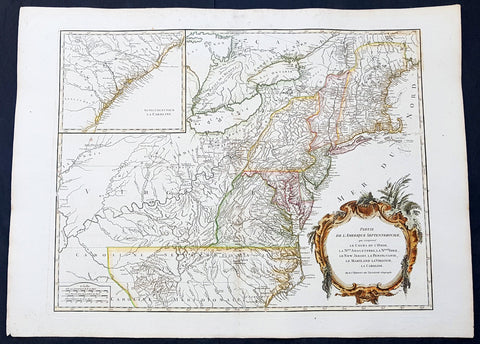
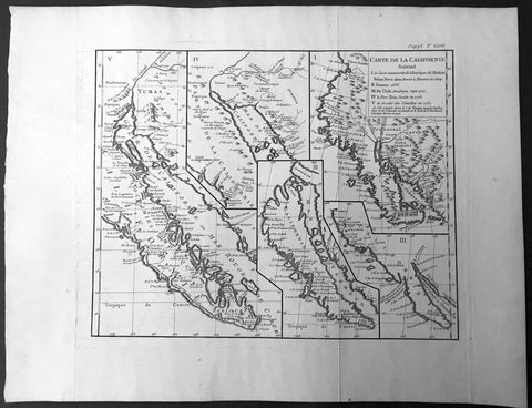
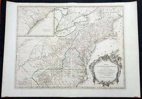
Welcome to Classical Images!
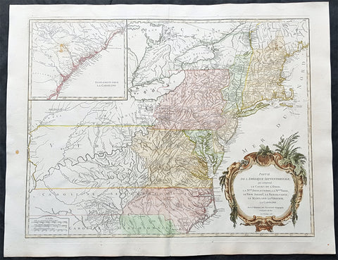
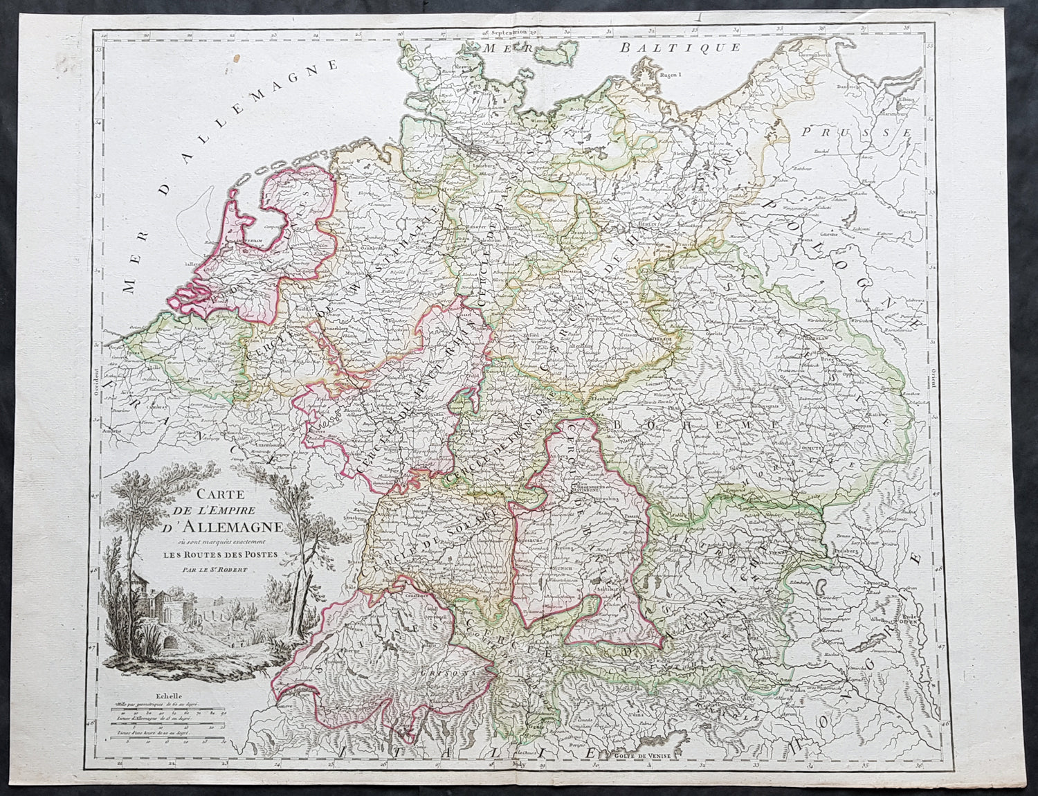
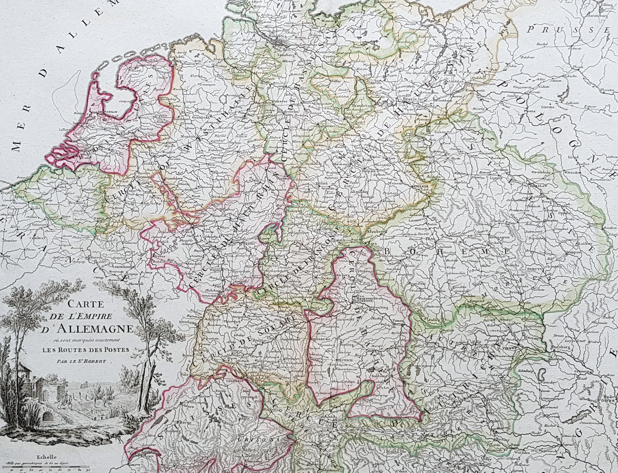
Description:This large magnificent hand coloured original copper-plate engraved antique map of various individual states of Germany including Austria, Bohemia, Switzerland & The Netherlands by Robert De Vaugondy was published in the 1757 edition of De Vaugondys famous The Atlas Universel
General Definitions:Paper thickness and quality: - Heavy and stablePaper color : - off whiteAge of map color: - Original & laterColors used: - Blue, pink, red, green, yellowGeneral color appearance: - AuthenticPaper size: - 26in x 19 1/2in (660mm x 495mm)Plate size: - 22 1/2in x 19 1/2in (570mm x 495mm)Margins: - Min 1/4in (5mm)
Imperfections:Margins: - NonePlate area: - NoneVerso: - None
Background: In the 18th century, the Holy Roman Empire consisted of approximately 1,800 territories. The elaborate legal system initiated by a series of Imperial Reforms (approximately 1450–1555) created the Imperial Estates and provided for considerable local autonomy among ecclesiastical, secular, and hereditary states, reflected in Imperial Diet. The House of Habsburg held the imperial crown from 1438 until the death of Charles VI in 1740. Having no male heirs, he had convinced the Electors to retain Habsburg hegemony in the office of the emperor by agreeing to the Pragmatic Sanction. This was finally settled through the War of Austrian Succession; in the Treaty of Aix-la-Chapelle, Charles VI\'s daughter Maria Theresa ruled the Empire as Empress Consort when her husband, Francis I, became Holy Roman Emperor. From 1740, the dualism between the Austrian Habsburg Monarchy and the Kingdom of Prussia dominated the German history.In 1772, then again in 1793 and 1795, the two dominant German states of Prussia and Austria, along with the Russian Empire, agreed to the Partitions of Poland; dividing among themselves the lands of the Polish–Lithuanian Commonwealth. As a result of the partitions, millions of Polish speaking inhabitants fell under the rule of the two German monarchies. However, the annexed territories though incorporated into the Kingdom of Prussia and the Habsburg Realm, were not legally considered as a part of the Holy Roman Empire. During the period of the French Revolutionary Wars, along with the arrival of the Napoleonic era and the subsequent final meeting of the Imperial Diet, most of the secular Free Imperial Cities were annexed by dynastic territories; the ecclesiastical territories were secularised and annexed. In 1806 the Imperium was dissolved; many German states, particularly the Rhineland states, fell under the influence of France. Until 1815, France, Russia, Prussia and the Habsburgs (Austria) competed for hegemony in the German states during the Napoleonic Wars