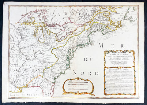
Welcome to Classical Images!
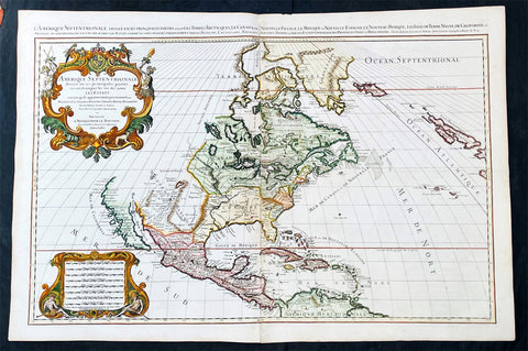
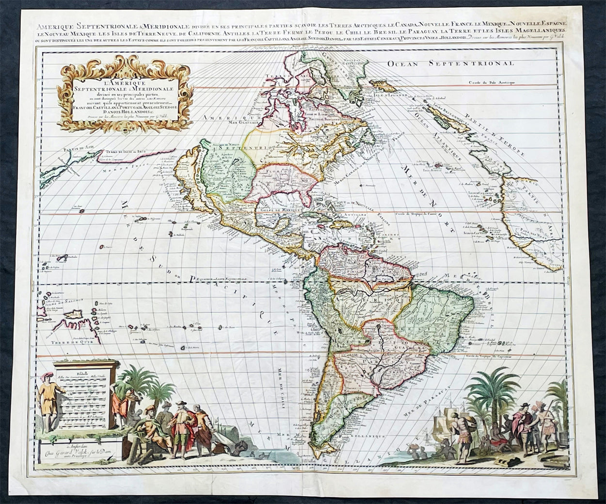
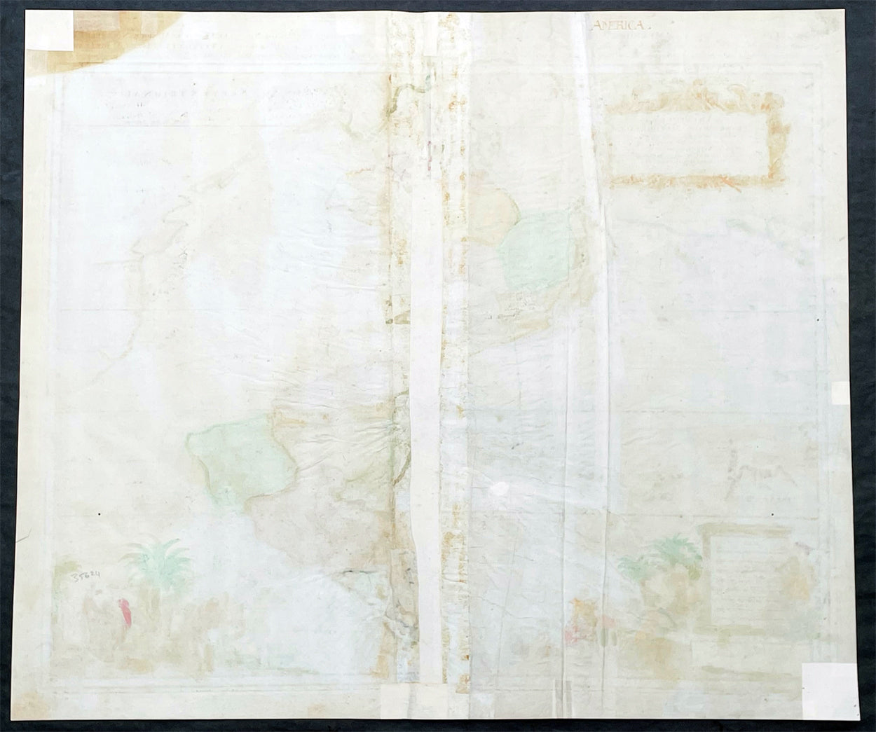
Description:This original, copper plate engraved scarce antique map of the Americas, showing California as an Island, was published in the last decade of the 18th century in ca 1695.This map is relatively rare as it was not included in any standard atlas but was optional, allowing the buyer to choose this along with other engraved map, to include in a bespoke atlas.This map has undergone some professional restoration, it is complete and has been re-enforced in places on the verso along existing creases to the left and right side center of the map (please see images) as well as re-enforcement along centerfold and corners. Please see images and description below. Priced with condition in mind.
General Definitions:Paper thickness and quality: - Light and stablePaper color : - WhiteAge of map color: - Original & laterColors used: - Yellow, green, blue, pinkGeneral color appearance: - AuthenticPaper size: - 24 1/4in x 20 3/4in (615mm x 530mm)Plate size: - 23in x 19 3/4in (590mm x 505mm)Margins: - Min 1/2in (12mm)
Imperfections:Margins: - Top right & bottom left corners of margins restored, age toning, several small repairs to margins not affecting the imagesPlate area: - Creasing to image, centerfold re-joinedVerso: - Old creasing re-enforced with archival tape to verso, creasing, age toning
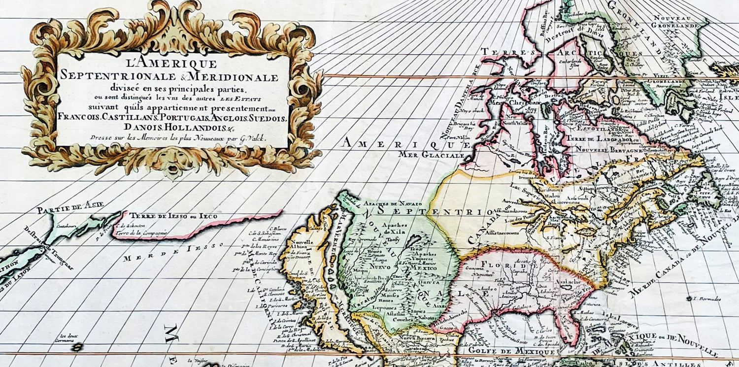
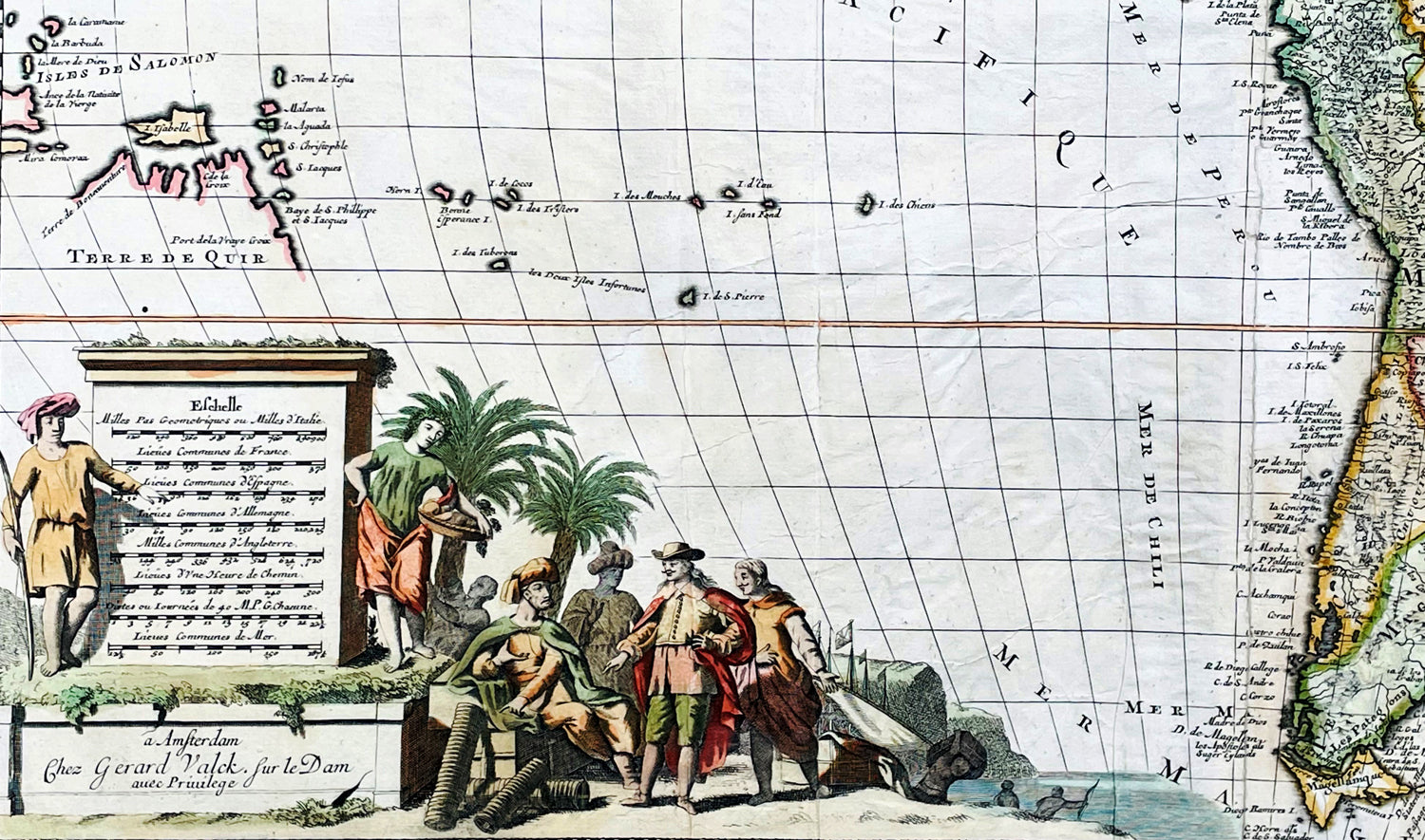
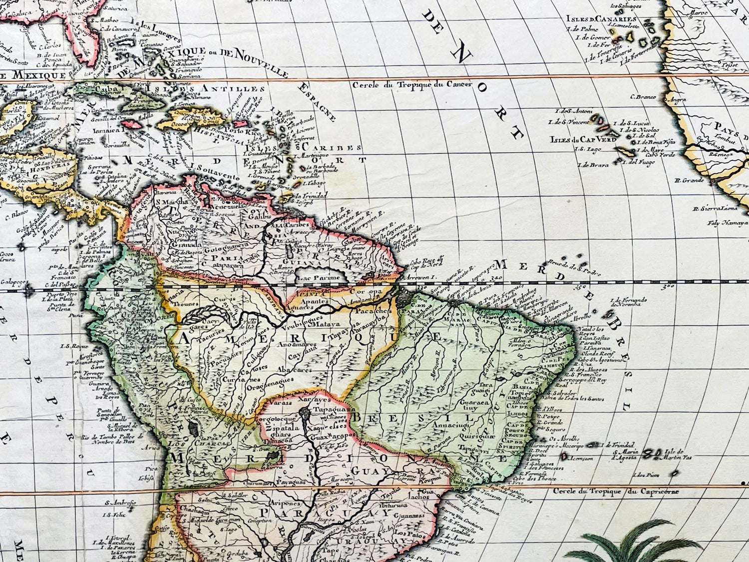
Background:Scarce map of America, published in Amsterdam by Gerard Valk. Valk's map of California shows many of the most fascinating myths of the 17th Century. California is shown as an island on the so-called "second Sanson Model." A massive land bridge extends from just west of Capo Blanco on the northern California coastline to Niphon, a curious adaptation of the legend of Compagnie Land (shown here as a place name -- Terre de la Compagne) and the continuous land bridge from America to Asia, although adding the Detroit de Tzungaar (Strait of Tzungaar), a very rarely mentioned mythical Strait between two islands of Japan.The Great Lakes are oddly configured, with Lake Superior and Lake Michigan open ended to the West. The Mississippi River is very ill conceived, pre-dating the radical improvements which would come with Guilluame De L'Isle's map of North America of 1700 and Carte du Mexique of 1703.The fine allegorical cartouches depict the booming trade then being conducted by Europeans in the New World.
Valk, Gerard 1651 - 1726Gerard Valk was a prominent Dutch engraver, publisher, and art dealer during the late 17th and early 18th centuries. He is best known for his contributions to the field of cartography and his collaborations with renowned artists and mapmakers of his time.Valk was born on April 6, 1651, in Amsterdam, the Netherlands. Little is known about his early life and education, but it is believed that he received training as an engraver, possibly under the tutelage of his father, Balthasar Valk, who was also an engraver and publisher.In the late 1670s, Gerard Valk established his own publishing firm in Amsterdam, specializing in the production of maps, atlases, and prints. He quickly gained recognition for his skill as an engraver and his ability to produce high-quality, detailed maps. Valk's maps were often based on the work of renowned cartographers of the time, such as Frederik de Wit and Nicolaes Visscher, whose plates he acquired and reprinted.Valk's maps covered a wide range of geographical regions, including Europe, Asia, Africa, and the Americas. His maps were meticulously crafted, featuring elaborate cartouches, decorative elements, and accurate geographic information. He also collaborated with notable artists and engravers, such as Jan Luyken and Romeyn de Hooghe, who provided illustrations and embellishments for his publications.Apart from cartography, Valk also published and sold prints of various subjects, including portraits, landscapes, historical scenes, and genre paintings. He catered to a diverse clientele, ranging from collectors and scholars to wealthy individuals and institutions.Valk's publishing business flourished, and he enjoyed considerable success and acclaim during his lifetime. His maps and prints were highly sought after for their quality and accuracy. He maintained a strong network of contacts throughout Europe, including fellow publishers, mapmakers, and merchants, which allowed him to expand his business and reach a wider market.Gerard Valk passed away on August 26, 1726, in Amsterdam, leaving behind a legacy as a skilled engraver, publisher, and contributor to the development of cartography. His work played a significant role in disseminating geographical knowledge and capturing the aesthetic beauty of maps during the late 17th and early 18th centuries. Today, Valk's maps and prints are considered valuable collectors' items, cherished for their historical and artistic value.