Year : 1786-1832
Profile : French publisher Adrien Hubert Brue (1786-1832) and other contemporaries such as Thomson, Arrowsmith & Hall reached a technical level of engraving not seen previously in the publication of cartographical material.
Profile : French publisher Adrien Hubert Brue (1786-1832) and other contemporaries such as Thomson, Arrowsmith & Hall reached a technical level of engraving not seen previously in the publication of cartographical material.
Hubert Brue
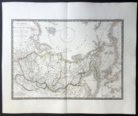
1821 Brue Large Antique Map of Siberia, Alaska, Behring Straits, North America
- Title : Carte Generale De La Russie D Asie et des Regions Polaris Borales...1821
- Ref #: 32455
- Size: 24in x 20in (610mm x 510mm)
- Date : 1821
- Condition: (A+) Fine Condition
Description:
This large beautifully engraved hand coloured original antique map of Siberia and more importantly an early mapping of Alaska and the Bering Straits - was engraved in 1821 - the date is engraved in the title - and was published in Adrien Brues (1786 - 1832) Universel de Geographie. (Ref: M&B; Tooley)
General Description:
Paper thickness and quality: - Heavy and stable
Paper color: - Off white
Age of map color: - Original
Colors used: - Yellow, pink, green, blue
General color appearance: - Authentic
Paper size: - 24in x 20in (610mm x 510mm)
Plate size: - 22in x 16in (560mm x 410mm)
Margins: - Min 1in (25mm)
Imperfections:
Margins: - None
Plate area: - None
Verso: - Bottom centerfold re-joined, no loss
$105.00 USD