Welcome to Classical Images!
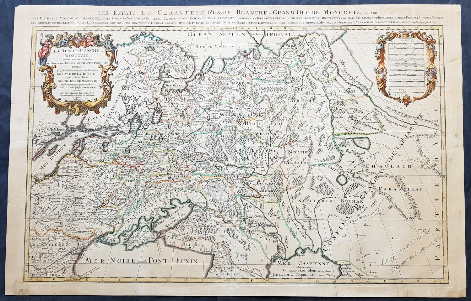
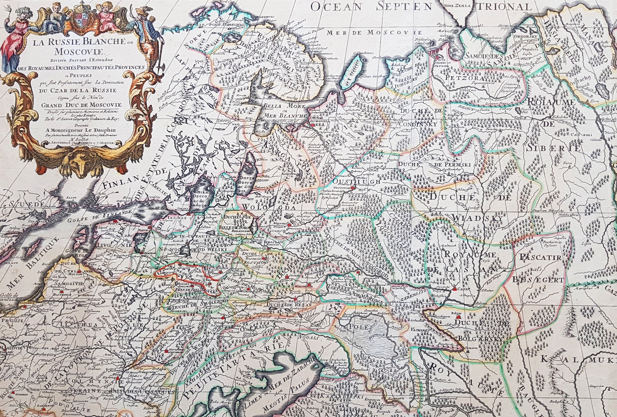
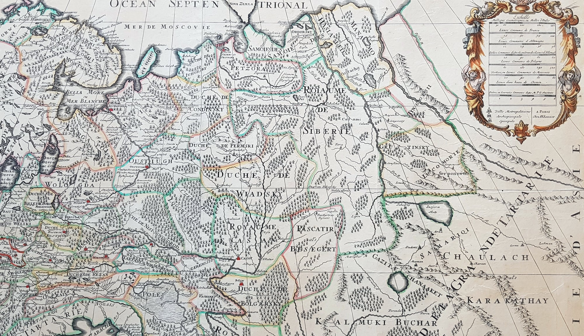
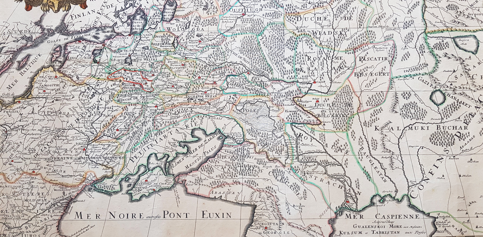
Description:This very large, beautifully hand coloured original copper-plate engraved antique map of European Russia was published by Alexis Hubert Jaillot in the 1698 edition of his monumental Atlas Nouveau.
General Definitions:Paper thickness and quality: - Heavy and stablePaper color : - off whiteAge of map color: - OriginalColors used: - Yellow, pink, green, blueGeneral color appearance: - AuthenticPaper size: - 37 1/2in x 24in (960mm x 620mm)Plate size: - 35in x 23in (890mm x 585mm)Margins: - Min 1in (25mm)
Imperfections:Margins: - Age toning, several small repairs in margins, no lossPlate area: - Age toningVerso: - Age toning, several repairs, no loss
Background: It is scarcely necessary to look at a map of Russia - with which we must include Siberia - to visualize the daunting task facing Russian map makers. Indeed, considering the vastness of their territory and the lack of skilled cartographers, it is surprising that relatively good maps were available for engraving and printing in most of the well known sixteenth and seventeenth century atlases. Generally, maps of that time were based on material brought back from Moscow by visitors from the West.