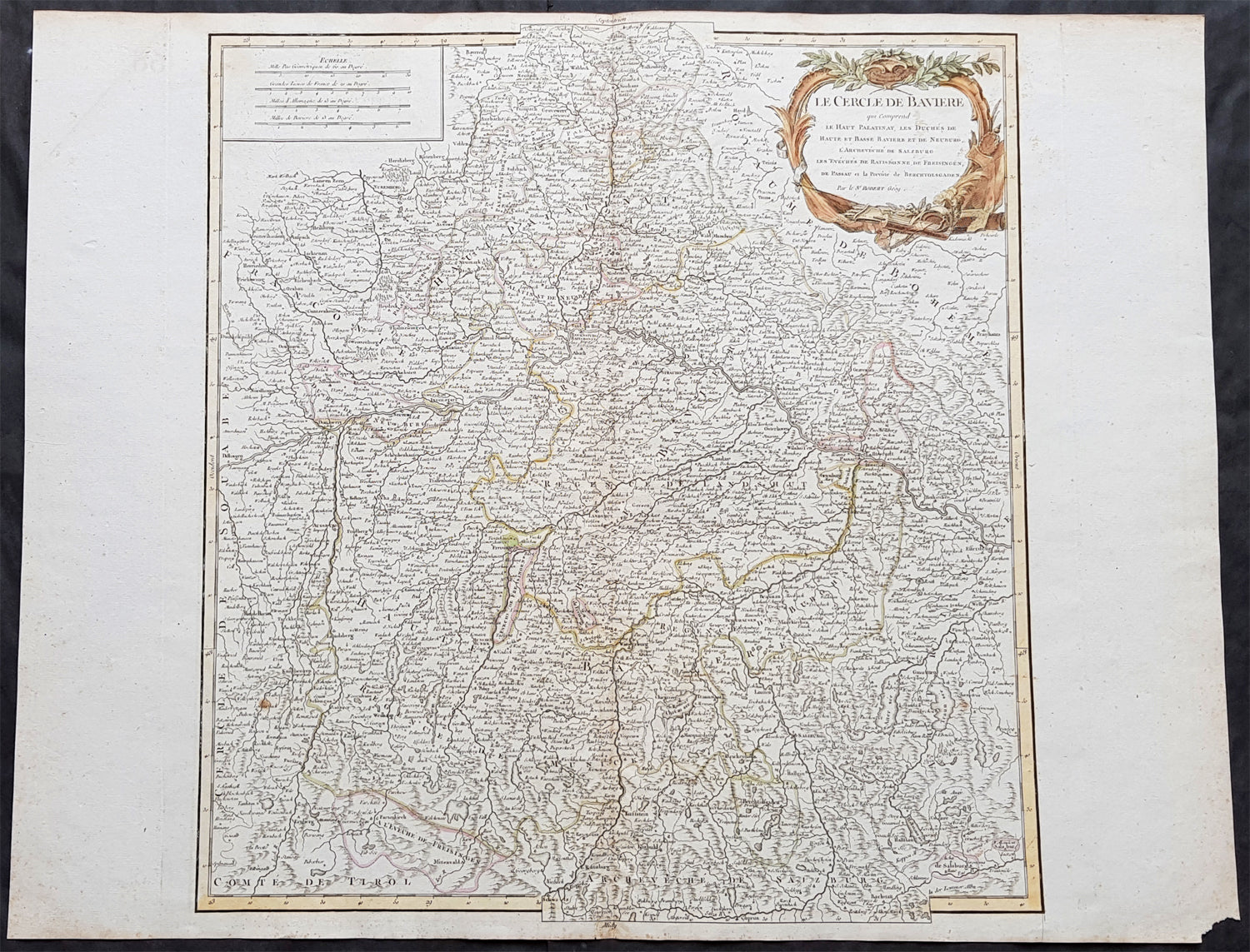
Welcome to Classical Images!
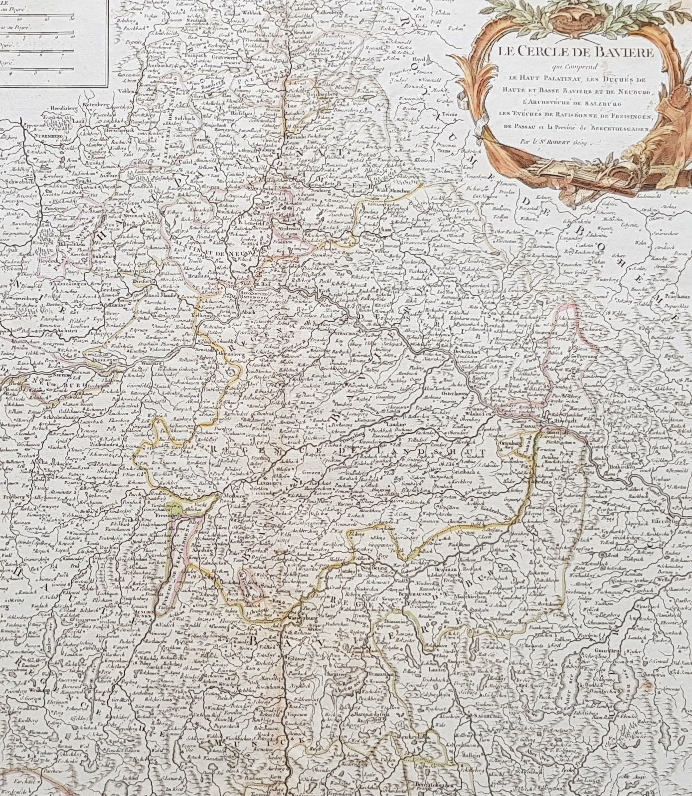
Description:This large magnificent hand coloured original copper-plate engraved antique map of Bavaria, Germany - centering on the River Danube - by Robert De Vaugondy was published in the 1757 edition of De Vaugondys famous The Atlas Universel
General Definitions:Paper thickness and quality: - Heavy and stablePaper color : - off whiteAge of map color: - Original & laterColors used: - Blue, pink, red, green, yellowGeneral color appearance: - AuthenticPaper size: - 26in x 20in (660mm x 510mm)Plate size: - 20in x 19 1/2in (510mm x 495mm)Margins: - Min 1/2in (10mm)
Imperfections:Margins: - NonePlate area: - NoneVerso: - None
Background: Bavaria officially the Free State of Bavaria is a landlocked federal state of Germany, occupying its southeastern corner. With an area of 70,550.19 square kilometres, Bavaria is the largest German state by land area. Its territory comprises roughly a fifth of the total land area of Germany. With 12.9 million inhabitants, it is Germany\'s second-most-populous state after North Rhine-Westphalia. Bavaria\'s capital and largest city, Munich, is the third-largest city in Germany.The history of Bavaria stretches from its earliest settlement and formation as a duchy in the 6th century CE through the Holy Roman Empire to becoming an independent kingdom and a state of the Federal Republic of Germany.The Duchy of Bavaria dates back to the year 555. In the 17th century CE, the Duke of Bavaria became a Prince-elector of the Holy Roman Empire. The Kingdom of Bavaria existed from 1806 to 1918, when Bavaria became a republic. In 1946, the Free State of Bavaria re-organised itself on democratic lines after the Second World War.