Welcome to Classical Images!
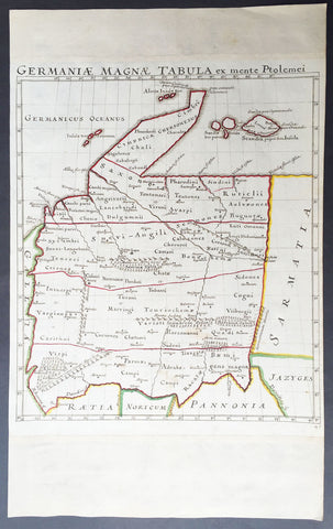
Description: This fine scarce beautifully engraved original antique map of central & western Roman Europe centering on what is today Belgium, the Southern Netherlands, Northern France and Western Germany - was engraved in 1647 - dated - and published by Olivarius Vredius (Olivier de Wree)in the 1652 edition of Historiae Comitum Flandriae
Historiae Comitum Flandriae was an important historical work on the origin and early history of Flanders by the well-known historian Olivarius Vredius - Olivier de Wree - (1596-1652) from Bruges. Vredius belongs to the most prominent representatives of late-Belgian humanism and his historical works are still considered to be of high value. (Ref: M&B; Tooley)
General Description: Paper thickness and quality: - Heavy & stable Paper color: - White Age of map color: - Colors used: - General color appearance: - Paper size: - 16 1/2in x 14in (420mm x 355mm) Plate size: - 12 1/2in x 11in (320mm x 280mm) Margins: - Min 1in (25mm)
Imperfections: Margins: - None Plate area: - Light blue underlining some names, light creasing Verso: - None