Welcome to Classical Images!
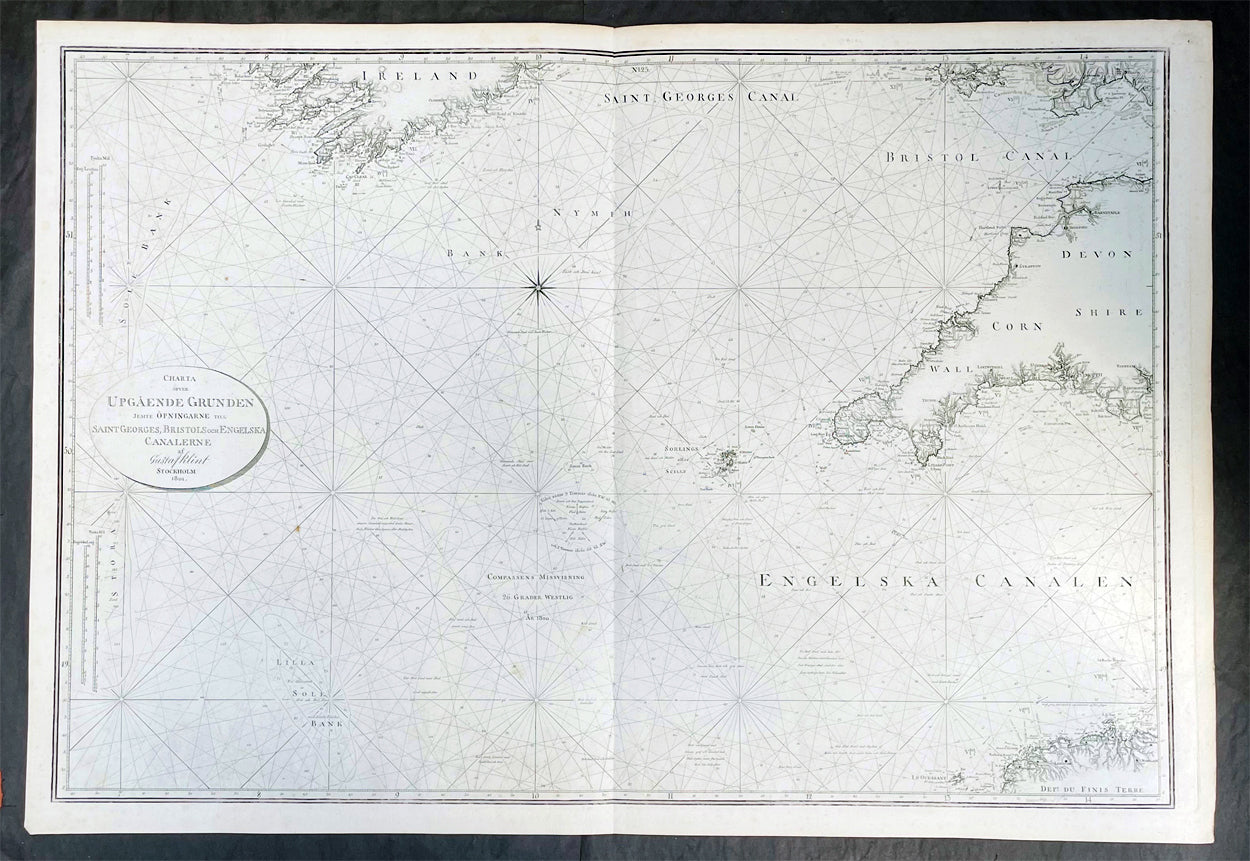
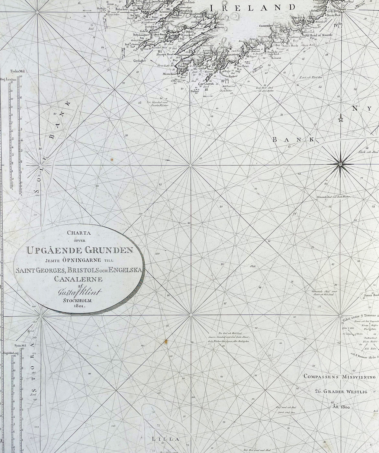
Description:This very large original copper plate engraved map a sea chart of The Celtic Sea, from southern Ireland to the Bristol Channel, Cornwall & The Scilly Islands was by the Swedish naval officer and cartographer Gustaf af Klint was engraved and published in 1801, dated.
General Definitions:Paper thickness and quality: - Heavy and stablePaper color : - off whiteAge of map color: -Colors used: -General color appearance: -Paper size: - 39 1/2in x 27in (990mm x 685mm)Plate size: - 39 1/2in x 27in (990mm x 685mm)Margins: - Min 1/2in (12mm)
Imperfections:Margins: - NonePlate area: - NoneVerso: - None
Background:The Celtic Sea is an area of the Atlantic Ocean that stretches from the southern coast of Ireland to the western coast of Brittany in France. It is named after the Celtic culture that was once dominant in the region. The sea is bordered by several countries including Ireland, the United Kingdom, and France. It is a busy shipping route, with commercial vessels transporting goods between ports in Europe and North America. The sea is also important for fishing, with a variety of fish species, such as mackerel, herring, and cod, found in its waters. Additionally, the Celtic Sea is known for its rich marine biodiversity, with numerous species of dolphins, whales, and seabirds inhabiting the area.
Klint, Gustaf af 1774 - 1840Gustaf af Klint was a Swedish naval officer born on September 14, 1772, in Örebro, Sweden. He began his naval career at the age of 16, joining the Swedish Navy in 1788. Over the years, he served in various positions and rose through the ranks, becoming a captain in 1801.In addition to his naval career, Gustaf af Klint was also a skilled cartographer. He produced several detailed maps of the Swedish coast and Baltic Sea, which were widely used by sailors and navigators at the time. His maps were known for their accuracy and attention to detail, making them an essential tool for safe navigation in the often treacherous waters of the Baltic Sea.One of Gustaf af Klint's most significant contributions to cartography was his work on the "Sea Atlas of the Baltic Sea," which he began in 1806. The atlas contained detailed maps of the entire Baltic Sea region, including the coasts of Sweden, Finland, Russia, Estonia, Latvia, and Lithuania. The maps were meticulously drawn, with precise soundings, navigational hazards, and coastal features clearly marked.Gustaf af Klint retired from the Swedish Navy in 1824, having reached the rank of Rear Admiral. He continued to work on his sea atlas until his death in 1840, leaving behind a lasting legacy as one of Sweden's most accomplished naval officers and cartographers. Today, his maps are considered a valuable historical record of the Baltic Sea region and are sought after by collectors and historians alike.
Please note all items auctioned are genuine, we do not sell reproductions. A Certificate of Authenticity (COA) can be issued on request.