Welcome to Classical Images!
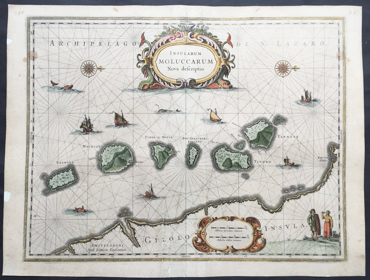
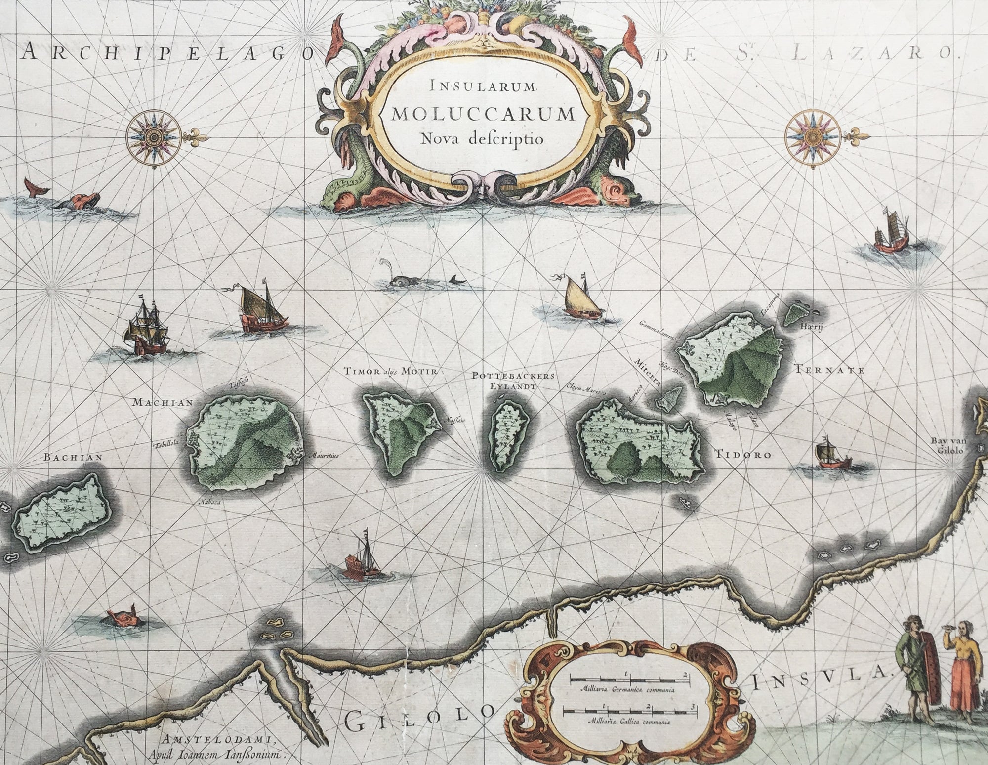
Description: This beautifully hand coloured original antique map* of the Maluku or Spice Islands of Indonesia was published by Jan Jansson in the 1633 edition of Atlas Novus.
Background: The Maluku Islands (also known as the Moluccas, Moluccan Islands, the Spice Islands) are an archipelago in Indonesia, and part of the larger Maritime Southeast Asia region. Geographically they are located east of Sulawesi (Celebes), west of New Guinea, and north of Timor. The islands were also historically known as the Spice Islands by the Chinese and Europeans, but this term has also been applied to other islands. (Ref: Suraz; Koeman; M&B; Tooley)
Condition Report: Paper thickness and quality: - Heavy and stable Paper color: - off white Age of map color: - Later Colors used: - Yellow, pink, green General color appearance: - Authentic Paper size: - 22in x 16 1/2in (560mm x 420mm) Plate size: - 20in x 15 1/4in (510mm x 390mm) Margins: - Min 1/2in (12mm)
Imperfections: Margins: - Repair to top and bottom margin, slight separation into border Plate area: - Repairs adjacent to bottom centrefold, slight separation Verso: - Map professionally backed onto archival paper