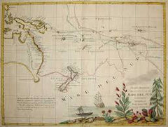
Antonio Zatta
Antonio Zatta (fl. 1757-1797) was a prominent Italian cartographer, engraver, and publisher in Venice during the late 18th century. He is best known for his series of maps and atlases of Italy, Europe, and the world, which were renowned for their high quality and accuracy.
Zatta was born in Venice around 1757 and initially trained as an engraver. He established his own printing and publishing company in Venice in the late 18th century and began producing maps and atlases. His first major work was the "Atlante Novissimo" in 1779, a comprehensive atlas of the world that contained 57 maps and was widely acclaimed for its accuracy and detail.
Over the next two decades, Zatta produced numerous other maps and atlases, including the "Atlante Veneto" in 1784, a comprehensive atlas of the Venetian Republic that included detailed maps of each province, and the "Atlante di Toscana" in 1792, a detailed atlas of the Tuscany region of Italy. Zatta's maps were known for their accurate depictions of geography, topography, and political boundaries, as well as their beautiful engravings and elaborate ornamentation.
Zatta's work was highly regarded by his contemporaries and he was awarded numerous honors and titles throughout his career, including being named an official geographer to the Republic of Venice. Today, his maps and atlases are highly prized by collectors and are regarded as some of the finest examples of cartography from the 18th century.
Antonio Zatta (1)
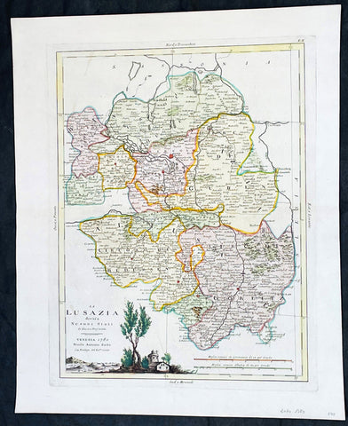
1780 Antonio Zatta Antique Map of The Lusatia Region Germany, Poland & Czech Rep
- Title : La Lusazia divisa ne suoi stati di nuova projezione
- Ref #: 35638
-
Condition: (A+) Fine Condition
- Size: 19in x 15 1/2in (485mm x 395mm)
- Date : 1780
- Price: $149US
Description:
This original hand coloured copper plate engraved antique map of the ancient central European region of Lusatia in between Poland and Germany, and in the south, the Czech Republic by Antonio Zatta (fl. 1775-97) in 1780 - dated - was published in his Atlas Atlante Novissimo
General Definitions:
Paper thickness and quality: - Heavy and stable
Paper color : - off white
Age of map color: - Original
Colors used: - Yellow, green, blue, pink
General color appearance: - Authentic
Paper size: - 19in x 15 1/2in (485mm x 395mm)
Plate size: - 16in x 12 1/2in (405mm x 315mm)
Margins: - Min 1in (25mm)
Imperfections:
Margins: - None
Plate area: - None
Verso: - None
Background:
Lusatia is a historical region in Central Europe, split between Germany and Poland. Lusatia stretches from the Bóbr and Kwisa rivers in the east to the Pulsnitz and Black Elster rivers in the west, and is located within the German states of Saxony and Brandenburg as well as in the Polish voivodeships of Lower Silesia and Lubusz. Lusatia's central rivers are the Spree and the Lusatian Neisse, which constitutes the border between Germany and Poland since 1945 (Oder–Neisse line). The Lusatian Mountains (part of the Sudetes), separate Lusatia from Bohemia (Czech Republic) in the south. Lusatia is traditionally divided into Upper Lusatia (the hilly southern part) and Lower Lusatia (the flat northern part).
Please note all items auctioned are genuine, we do not sell reproductions. A Certificate of Authenticity (COA) can be issued on request.