Welcome to Classical Images!
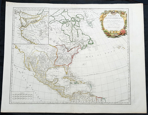
Description:This magnificent original copper-plate engraved antique map of the NW coast of America based upon the Thomas Jefferys map of 1768, by Robert De Vaugondy in 1772, by Robert De Vaugondy was engraved in 1772 - the date is engraved at the foot of the map - and published in the 1775 edition of Denis Diderots (1713-84) Encyclopédie, ou dictionnaire raisonné des sciences, des arts et des métiers (Encyclopedia, or a Systematic Dictionary of the Sciences, Arts, and Crafts).Denis Diderot 1713 – 1784 was a French philosopher, art critic, and writer, best known for serving as co-founder, chief editor, and contributor to the Encyclopédie along with Jean le Rond d Alembert. He was a prominent figure during the Enlightenment.Diderot began his education by obtaining a Master of Arts degree in philosophy at a Jesuit college in 1732. He considered working in the church clergy before briefly studying law. When he decided to become a writer in 1734, his father disowned him for not entering one of the learned professions. He lived a bohemian existence for the next decade. He befriended philosopher Jean-Jacques Rousseau in 1742.Though his work was broad as well as rigorous, it did not bring Diderot riches. He secured none of the posts that were occasionally given to needy men of letters; he could not even obtain the bare official recognition of merit that was implied by being chosen a member of the Académie française. He saw no alternative to selling his library to provide a dowry for his daughter. Empress Catherine II of Russia heard of his financial troubles and commissioned an agent in Paris to buy the library. She then requested that the philosopher retain the books in Paris until she required them, and act as her librarian with a yearly salary. Between October 1773 and March 1774, the sick Diderot spent a few months at the empress\'s court in Saint Petersburg.Diderot died of pulmonary thrombosis in Paris on 31 July 1784, and was buried in the city\'s Église Saint-Roch. His heirs sent his vast library to Catherine II, who had it deposited at the National Library of Russia. He has several times been denied burial in the Panthéon with other French notables. The French government considered memorializing him in this fashion on the 300th anniversary of his birth, but this did not come to pass.Diderot\'s literary reputation during his lifetime rested primarily on his plays and his contributions to the Encyclopédie; many of his most important works, including Jacques the Fatalist, Rameaus Nephew, Paradox of the Actor, and D Alembert\'s Dream, were published only after his death.
General Definitions:Paper thickness and quality: - Heavy and stablePaper color : - off whiteAge of map color: - OriginalColors used: - Yellow, green, blue, pinkGeneral color appearance: - AuthenticPaper size: - 16 1/2in x 13in (420mm x 330mm)Plate size: - 16in x 12 1/2in (405mm x 315mm)Margins: - Min 1/2in (10mm)
Imperfections:Margins: - NonePlate area: - NoneVerso: - None
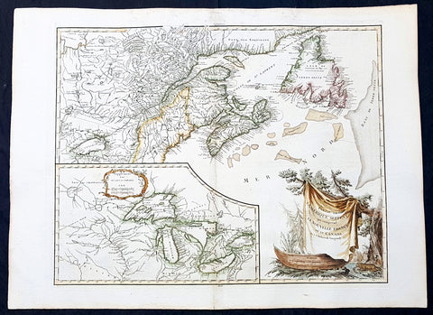
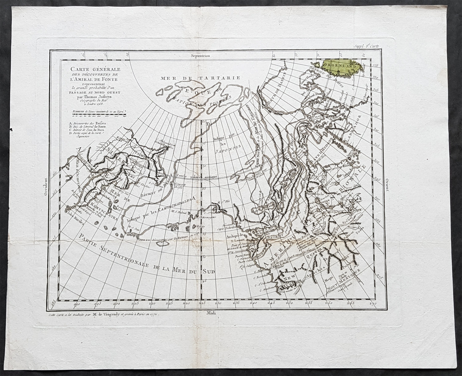
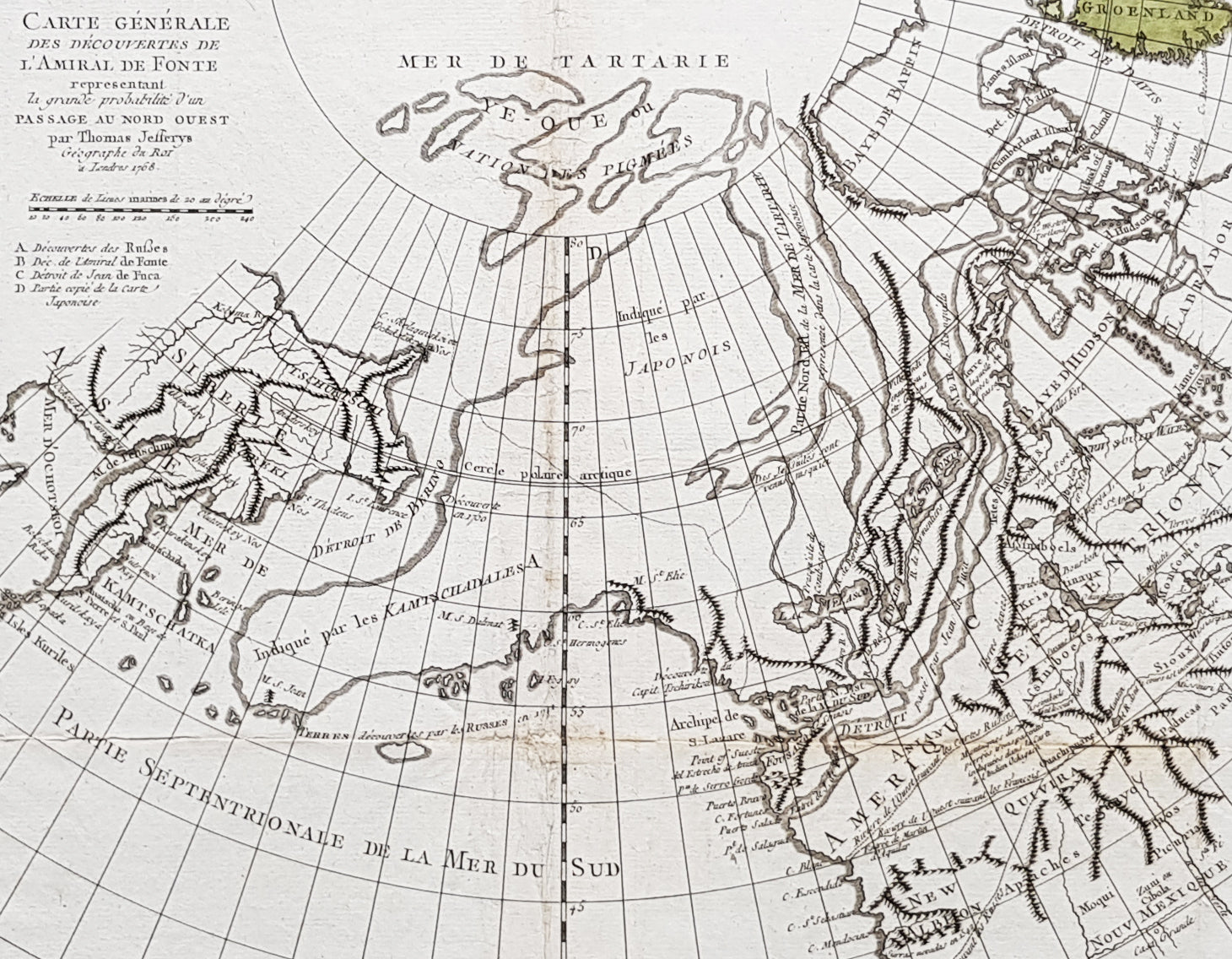
Background: Interesting map of the NW Coast of America and the NE Coast of Asia, based upon the Thomas Jefferys map of 1768.Prior to Cooks 1st Voyage, the English, French and Russians were actively debating the cartography of the region in the North Pacific between Asia and North America. The Russian explorations of the first half of the 18th Century, including those by Behring, Tchirikow and others, had been reported by JN De L Isle, who had worked with the Russians and was privy to their latest discoveries. The mythical voyages of De Fuca, d Aguilar and De Font were still very much in evidence in contemporary cartography, as were concepts of a NW Passage, the Sea of the West, River of the West and other vestiges of 16th and 17th Century conjectural/mythical cartography.Following the publication by Buache of his maps on the region, the debate between the French and English was quite fertile, so much so that Diderot dedicated most of his 10 map supplments to the region.This map shows the Jefferys model, including a wide De Fuca based River from Puget Sound to the Atlantic over Hudson\'s Bay, several significant rivers flowing from the Pacific to the middle of North America, and Jesuit based water passages from the Pacific to the Arctic Seas. A marvelous approximation of Alaskan Archipelago is shown, along with the Russian discoveries. (Ref: Tooley; M&B)