Welcome to Classical Images!
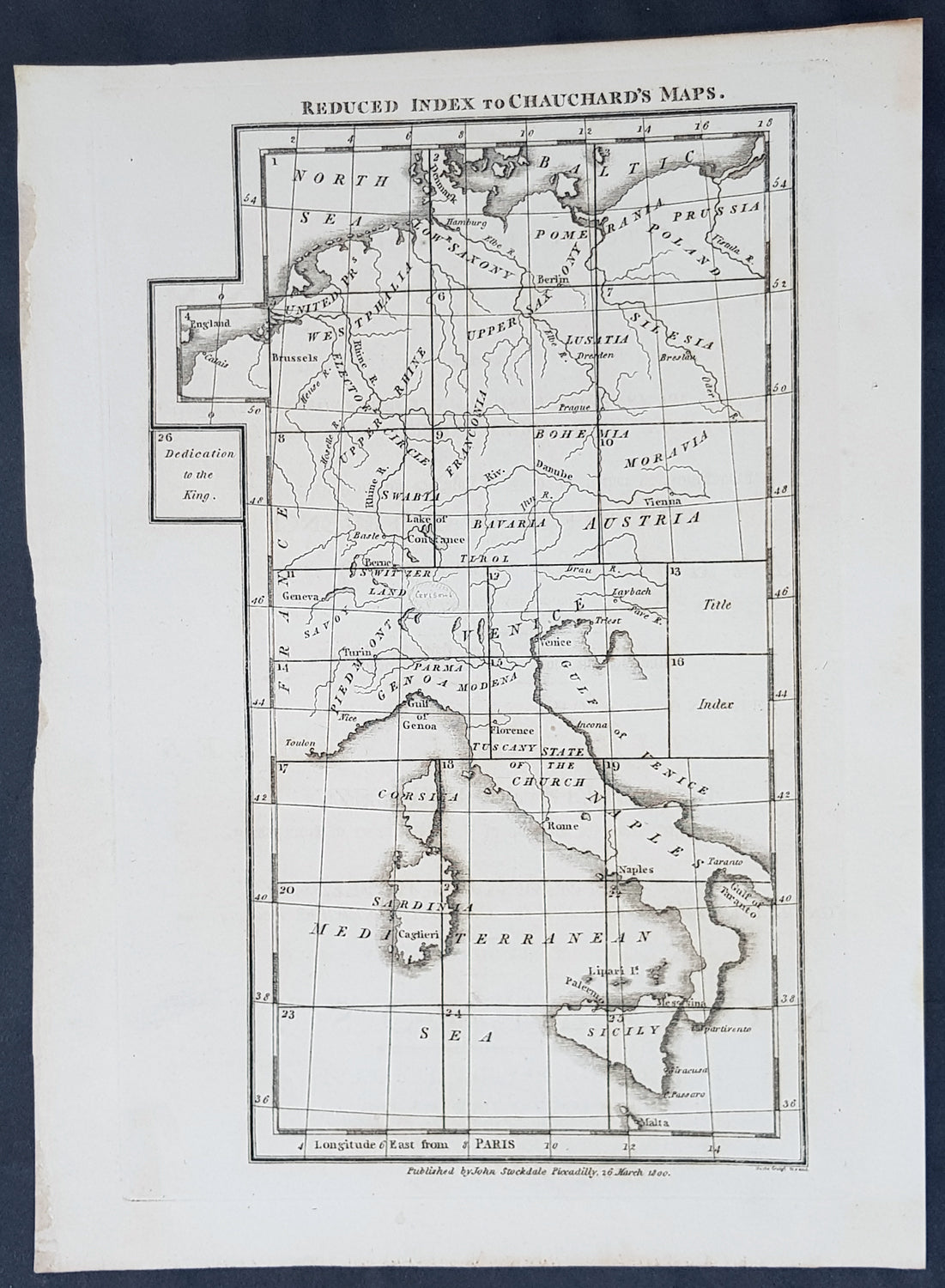
Description:This original copper-plate engraved antique index map to the 26 page map A general map of the empire of Germany, Holland, the Netherlands, Switzerland, the Grisons, Italy, Sicily, Corsica and Sardinia by Captain Chauchard published by John Stockdale in 1800 - dated. (Ref: Tooley; M&B)
General Definitions:Paper thickness and quality: - Heavy and stablePaper color : - off whiteAge of map color: -Colors used: -General color appearance: -Paper size: - 11 1/2in x 9in (290mm x 230mm)Plate size: - 10 1/2in x 7in (265mm x 180mm)Margins: - Min 1/2in (12mm)
Imperfections:Margins: - NonePlate area: - NoneVerso: - None