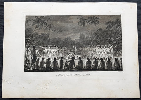
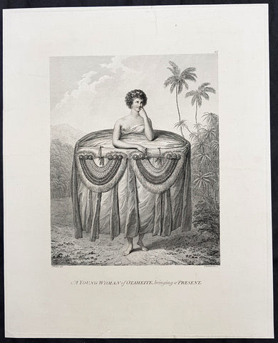
Welcome to Classical Images!
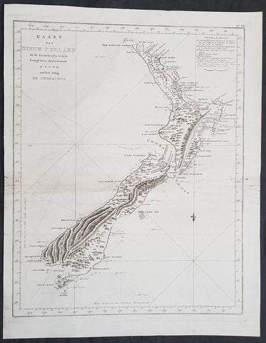
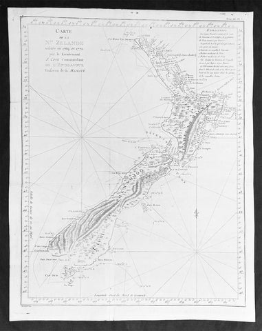
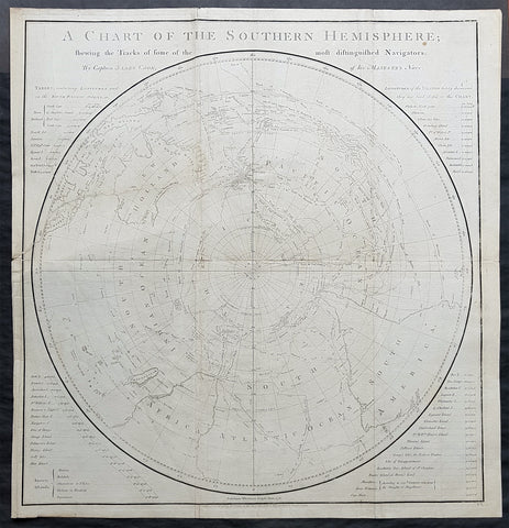
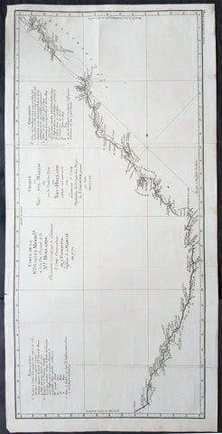
Description:This fine original copper-plate engraved antique print view of the settlement of Ust-Bolsheretsk on west coast of the Kamchatka Peninsula in Eastern Russia, visited by HMS Resolution & Discovery in December 1779, after the death of Cook, with Resolution under the command of Captain Clerk, during the 3rd & last Voyage of Discovery, was engraved by Robert Benard - after John Webber - and was published in the 1785 French edition of Capt. James Cook & Capt. James King publication A Voyage to the Pacific Ocean. Undertaken, by the Command of his Majesty, for making Discoveries in the Northern Hemisphere. To determine The Position and Extent of the West Side of North America; its Distance from Asia; and the Practicability of a Northern Passage to Europe. Performed under the direction of Captains Cook, Clerke, and Gore, In His Majestys Ships the Resolution and Discovery. In the Years 1776, 1777, 1778, 1779, and 1780. In Three Volumes. Vol. I and II written by James Cook, F.R.S. Vol. III by Captain James King, LL.D. and F.R.S. Paris, 1785.On May 13 1779, Capt. King recorded;We employd the afternoon in seeing the town & Country for many miles about is a low swamp....The Earth was in most parts cover\'d with snow;.....We saw I suppose 20 or 30 Milch Cows & the Maor [Behm} had 6 stout horses, all of which were in good Case; These & the dogs are the only domestic Animals ...The houses are all after the fashion, that is built of logs & thatch\'d. King/Cook Journals III, 667-8.Journal 1779Jan. 5 Tue. Passes south of Island, Kalae. Frequently visited by canoes with supplies.17 Sun. Anchors at Kealakekua Bay. Provisions ships and meets inhabitants who appear friendly and seem to reverence him.Feb. 1 Mon. William Watman, seaman, dies of a stroke and is buried near a chief\'s burial place.4 Thu. Ships sail north to investigate islands.6 Sat. Off Kawaihae Bay.8 Mon. Finds that the mast is sprung (it had been replaced in Nootka Sound) and decides to head back to Kealakekua Bay to replace it.11 Wed. Anchors in Bay.14 Sun. Cook along with Marines, Corporal Thomas, Privates Hinks, Allen and Fatchett are killed ashore near village of Kaawaloa, about 9 a.m. There had been ill feeling, menaces and theft - particularly Discovery\'s cutter - and Cook had gone ashore to settle the matter. Confusion, musket fire and mis-interpreted signals led to the tragedy and the resulting contemporary confusion of accounts and paintings of the scene. Clerke assumes command of Resolution and the voyage and Gore takes over the Discovery.20 Sat. Clerke demands and obtains Cook\'s remains from the natives. The disfigured head, unrecognisable, severed hands - one identified by distinctive scar between thumb and forefinger of right hand caused by explosion of powder horn, 6th. August 1764, Noddy Harbour, Newfoundland. Possible jawbone and feet later returned with shoes and damaged musket.21 Sun. Cook\'s remains are placed in coffin and he is buried at sea in the late afternoon.22 Mon. Sails for Kamchatka.24 Wed. Off Kahoolawe, Males Bay, sights Kekaa Point (W. tip of Maui).25 Thu. Sights Lanai, Cape Kaea.26 Fri. Off Molokai and Oahu.27 Sat. Goes ashore at Waimea Bay.28 Sun. Sights Kauai.Mar. 1 Mon. Goes ashore again, trouble. Remains until 8 March.8 Mon. Off Cape Kawaihoa (Niihau). Goes ashore. Trading & supplies.15 Mon. Sails, finally, for Kamchatka.Apr. 23 Tue. Kamchatka sighted.29 Mon. Anchors in Avacha Bay, about 7½ miles from Petropavlovsk. Several anchorages are then tried in Bay. Clerke decides to send letters to Major Behm, Governor. Gore, King and Webber sent by sledge. Also take Cook\'s Journal etc.; which arrive at the Admiralty, London, seven months later. Vessels provisioned etc. Visited by Russian soldiers, merchants and local priest. Observatory erectedMay 7 Fri. Above party, Russian merchants, Germans set off for Bolsherstsk where they are well received.
General Definitions:Paper thickness and quality: - Heavy and stablePaper color : - off whiteAge of map color: -Colors used: -General color appearance: -Paper size: - 14 1/2in x 10in (370mm x 255mm)Plate size: - 14in x 10in (365mm x 255mm)Margins: - Min 1/2in (12mm)
Imperfections:Margins: - Light soilingPlate area: - NoneVerso: - Light soiling
Background: The Kamchatka Peninsula is a 1,250 kilometer long peninsula in the Russian Far East.Politically, the peninsula forms part of Kamchatka Krai. The southern tip is called Cape Lopatka. The circular bay to the north of this on the Pacific side is Avacha Bay with the capital, Petropavlovsk-Kamchatsky.Captain James King FRS 1750 – 1784 was an officer of the Royal Navy. He served under James Cook on his last voyage around the world, specialising in taking important astronomical readings using a sextant. After Cook died he helped lead the ships on the remainder of their course, also completing Cooks account of the voyage. He continued his career in the Navy, reaching the rank of post-captain, commanding several ships and serving in the American War of Independence.King joined HMS Resolution as second lieutenant, sharing the duties of astronomer with Cook, taking astronomical observations on board by sextant and with Larcum Kendals timekeeper K1, to establish the Resolutions position at sea and on shore by sextant or by astronomical quadrant to establish the geographical position of salient points during the course of Cooks surveys. Thus Kings geographical positions were an important contribution to the accuracy of the various surveys carried out during the voyage and his use of the early chronometers helped prove their use at sea for calculation of Longitude. .Following the death of Cook, King remained in the Resolution but on the death of Charles Clerke, Cooks successor, King was appointed to command HMS Discovery, the Resolutions consort, remaining in her for the rest of the voyage. After his return to England King was very much involved in the publication of the official account of Cooks third voyage, writing the third volume at Woodstock, near Oxford, where his brother Thomas was rector of St Mary Magdalene. But shortly after his return King was promoted Post-captain and appointed commander of HMS Crocodile in the English Channel.John Webber RA 1751 – 1793 was an English artist who accompanied Captain Cook on his third Pacific expedition. He is best known for his images of Australasia, Hawaii and Alaska.Webber was born in London, educated in Bern and studied painting at Paris.His father was Abraham Wäber, a Swiss sculptor who had moved to London, and changed his name to Webber before marrying a Mrs Mary Quant in 1744.Webber served as official artist on James Cooks third voyage of discovery around the Pacific (1776–80) aboard HMS Resolution. At Adventure Bay in January 1777 he did drawings of A Man of Van Diemens Land and A Woman of Van Diemens Land. He also did many drawings of scenes in New Zealand and the South Sea islands. On this voyage, during which Cook lost his life in a fight in Hawaii, Webber became the first European artist to make contact with Hawaii, then called the Sandwich Islands. He made numerous watercolor landscapes of the islands of Kauai and Hawaii, and also portrayed many of the Hawaiian people.In April 1778, Captain Cooks ships Resolution and Discovery anchored at Ship Cove, now known as Nootka Sound, Vancouver Island, Canada to refit. The crew took observations and recorded encounters with the local people. Webber made watercolour landscapes including Resolution and Discovery in Ship Cove, 1778. His drawings and paintings were engraved for British Admiraltys account of the expedition, which was published in 1784.Back in England in 1780 Webber exhibited around 50 works at Royal Academy exhibitions between 1784 and 1792, and was elected an associate of the Royal Academy in 1785 and R.A. in 1791. Most of his work were landscapes. Sometimes figures were included as in A Party from H.M.S. Resolution shooting sea horses, which was shown at the academy in 1784, and his The Death of Captain Cook became well known through an engraving of it. Another version of this picture is in the William Dixson gallery at SydneyRobert Bénard 1734 – 1777 was an 18th-century French engraver.Specialized in the technique of engraving, Robert Ménard is mainly famous for having supplied a significant amount of plates (at least 1,800) to the Encyclopédie by Diderot & d Alembert from 1751.Later, publisher Charles-Joseph Panckoucke reused many of his productions to illustrate the works of his catalog.