Welcome to Classical Images!
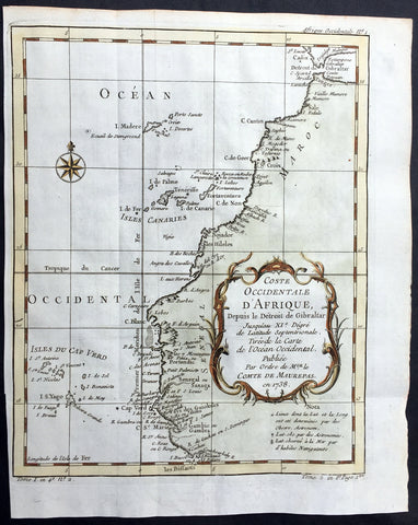
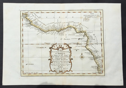
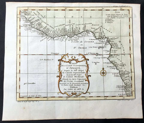
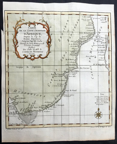
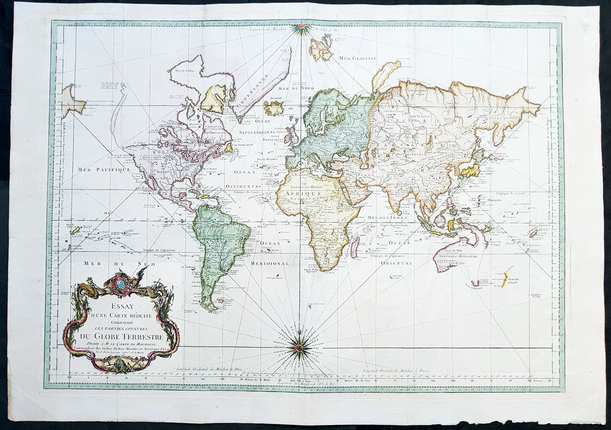
Description:This large beautifully hand coloured original copper-plate engraved antique World Map on Mercator\'s Projection was engraved in 1748 by Jacques Nicolas Bellin - dated in the title.
General Definitions:Paper thickness and quality: - Heavy and stablePaper color : - off whiteAge of map color: - EarlyColors used: - Yellow, pink, green, blueGeneral color appearance: - AuthenticPaper size: - 31 1/2in x 22 1/2in (850mm x 545mm)Plate size: - 28in x 20in (715mm x 510mm)Margins: - Min 1in (25mm)
Imperfections:Margins: - Light age toningPlate area: - Folds as issuedVerso: - Small re-enforcing of folds with archival tape
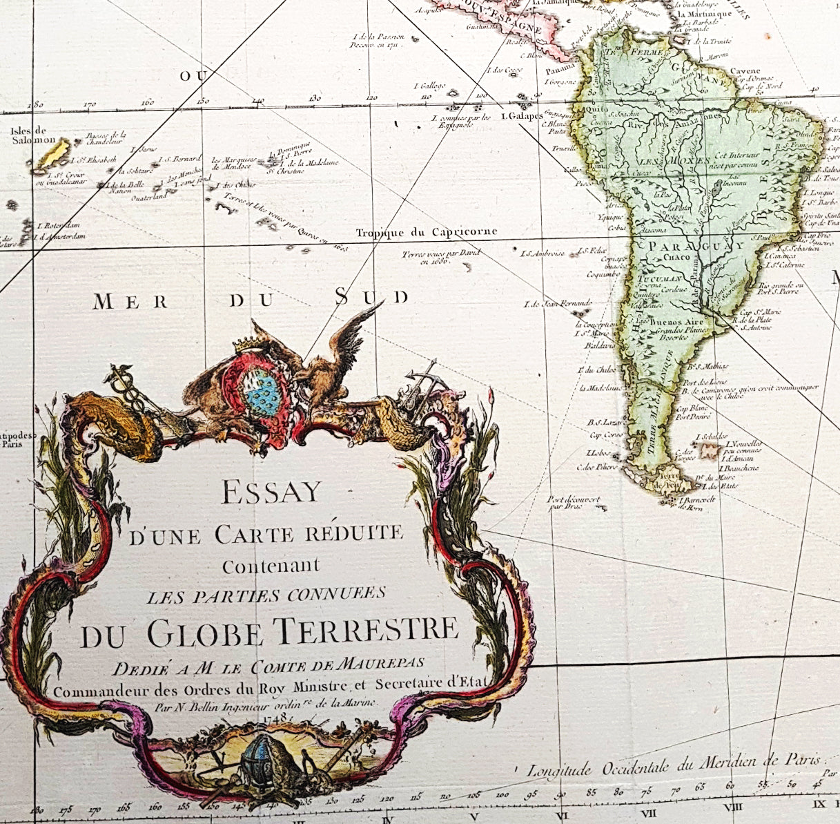
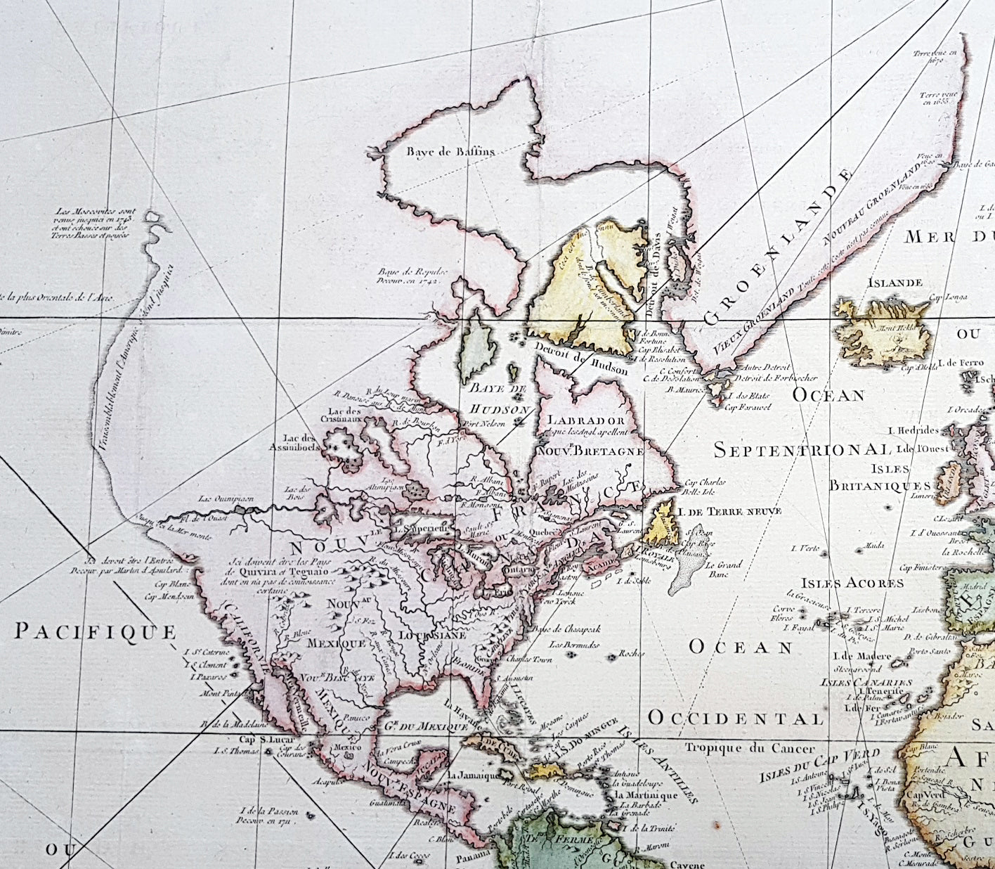
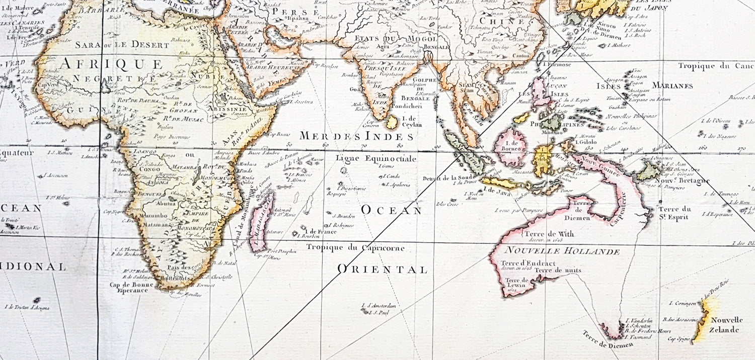
Background: First edition of Bellins large mid-18th century world map, published in Paris. This map pre-dates the major world discoveries of the late 18th century including the North West coast of America, the Sandwich Islands, and the Voyages of Capt Cook soon to map the East Coast of Australia & NZ.This edition is most noteworthy for its marvelous early projection of Australia and New Zealand, each with largely speculative coastlines. Australia is still attached to New Guinea and has several notes of early exploration shown. New Zealand is barely known and with only a portion of its western coastline.No sign of Antarctica and the NW Coast of America includes the first notes of Russian exploration.In North America Bellin identifies the semi-mythical civilizations of Quivira and Teguayo, both associated with legends of the Seven Cities of Gold, in what is modern day Utah, California, and Nevada. Along the western coast the strait discovered by Martin Aguilar is noted. Further north still the River of the West (Fl. de l’Ouest) extends from the west coast to the Lake of the Woods (Lac de Bois) and thence via additional waterways to the Great Lakes and the Atlantic. The River of the West appeared in many 18th century maps of the Americas and is reflective of French hopes for a water route from their colonies in Canada and Louisiana to the Pacific. Still further north the coastline becomes extremely vague, in places vanishing altogether. The Aleutians are vaguely rendered according to various sightings by Vitus Jonassen Bering and Aleksei Chirikov in the 1740s and identified as the “Archipel de Nord”.In the Pacific, various Polynesian Island groups are noted though many are slightly or significantly misplaced. The Solomon Islands are vastly oversized referencing the early 17th claims of Quiros. The other lands discovered and erroneously mapped by Quiros in 1606 and Davis in 1686 during their search of the great southern continent are also noted. Hawaii, as yet undiscovered, is absent. New Zealand is rendered twice though is accurate in its form and position. Australia, here labelled “Nouvelle Holland”, has part of its southern coastline ghosted in and Van Diemen’s Land (Tasmania) is attached to the mainland. The southern coast of New Guinea is similarly ghosted in, suggesting its unexplored state. (Ref: Tooley; M&B)