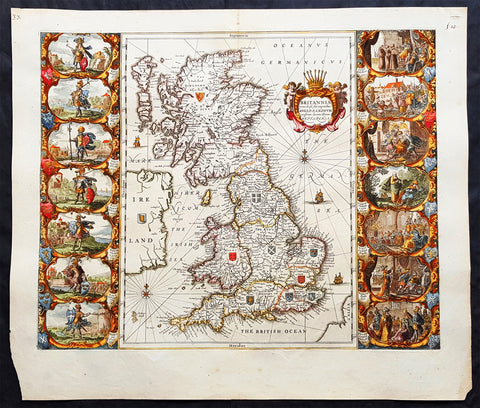
Welcome to Classical Images!
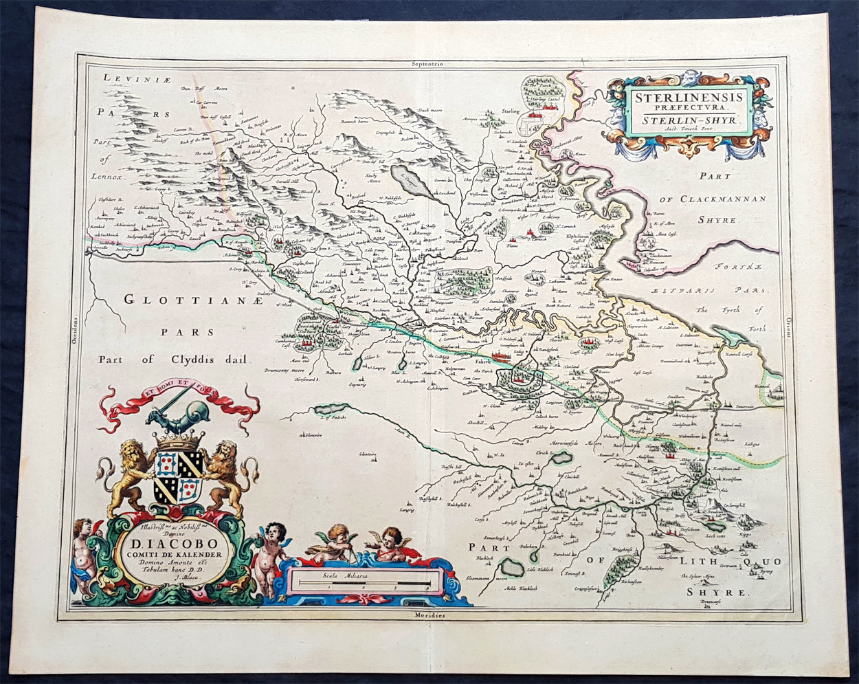
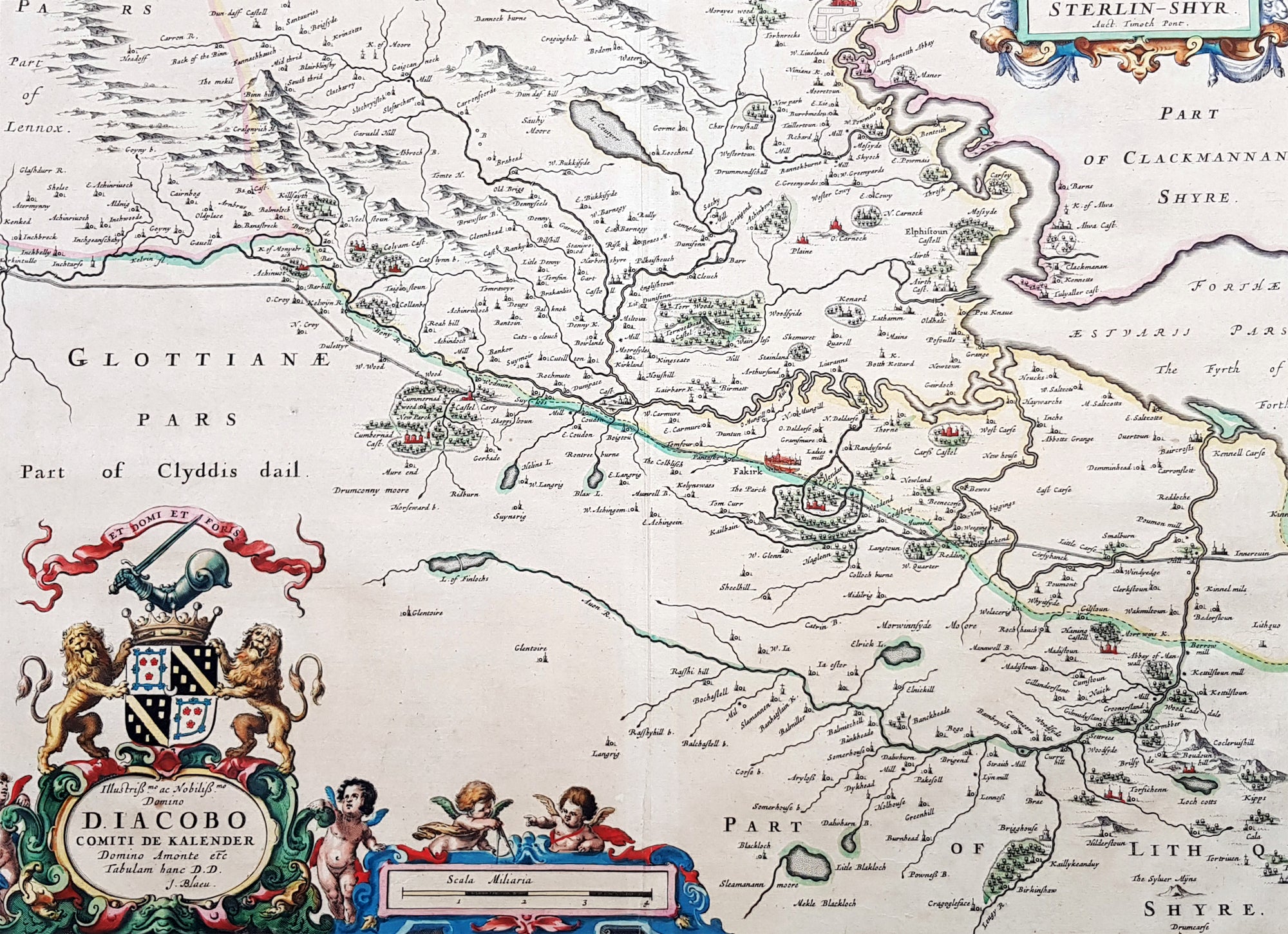
Description:This large original beautifully hand coloured copper plate engraved antique map of the Scottish County of Stirling, on the river Forth just north of Edinburgh, was published in the 1645 Latin edition of Joan Blaeus Atlas Novus..This is a beautiful map with magnificent original hand colouring, on clean paper with a heavy impression.When Blaeu published his volume of Great Britain & Ireland, Atlas Novus, Scotland became one of the best-mapped countries in the world. The atlas contained maps of forty-nine separate maps of Scotland (plus a map of Ptolemy GB and six maps of Ireland). The first two plates from the atlas show the entire country ancient and modern, whilst the remaining forty-six plates cover most Scotland in forty-seven regional maps. In total the regional maps locate some 20,000 different place names. A clue as to the reason for this extraordinary explosion of geographical information is to be found on thirty-six of the regional maps, which all carry engraved credits to Timothy Pont (1524-1606)Pont was responsible for surveying the greater part of Scotland between 1583-1600, the resulting Pont Manuscript maps were never published but were put to good use some fifty to seventy years later by Robert Gordon and Joan Blaeu. (Ref: Koeman; Tooley; M&B)
General Definitions:Paper thickness and quality: - Heavy and stablePaper color : - off whiteAge of map color: - OriginalColors used: - Blue, pink, red, green, yellowGeneral color appearance: - AuthenticPaper size: - 23in x 18 1/2in (585mm x 480mm)Plate size: - 20in x 16 1/2in (510mm x 420mm)Margins: - Min 1in (25mm)
Imperfections:Margins: - NonePlate area: - NoneVerso: - None
Background:Stirlingshire or the County of Stirling is an historic county and registration county of Scotland. Its county town is Stirling. It borders Perthshire to the north, Clackmannanshire and West Lothian to the east, Lanarkshire to the south, and Dunbartonshire to the south-east and south-west.In 1130, Stirling, one of the principal royal strongholds of the Kingdom of Scotland, was created a Royal burgh by King David I. On 11 September 1297, the forces of Andrew Moray and William Wallace defeated the combined English forces of John de Warenne, 6th Earl of Surrey, and Hugh de Cressingham near Stirling, on the River Forth, at the Battle of Stirling Bridge during the First War of Scottish Independence.On 22 July 1298 the Battle of Falkirk saw the defeat of William Wallace by King Edward I of England.On 24 June 1314 the Battle of Bannockburn at Bannockburn, (Blàr Allt a\' Bhonnaich in Scottish Gaelic) was a significant Scottish victory in the Wars of Scottish Independence. It was one of the decisive battles of the First War of Scottish Independence.On 11 June 1488 the Battle of Sauchieburn was fought at the side of Sauchie Burn, a stream about two miles south of Stirling, Stirlingshire, Scotland.[4] The battle was fought between the followers of King James III of Scotland and a large group of rebellious Scottish nobles including Alexander Home, 1st Lord Home, nominally led by the king\'s 15-year-old son, Prince James, Duke of Rothesay (reigned 1488–1513).In 1645 the Covenanter army under General William Baillie formed near Banton for their engagement with the Royalist forces under the command of Montrose at the Battle of Kilsyth, Kilsyth, on 15 August 1645; a major battle of the Wars of the Three Kingdoms.The Battle of Falkirk Muir on 17 January 1746 saw the Jacobites under Charles Edward Stuart defeat a government army commanded by Lieutenant General Henry Hawley.