Welcome to Classical Images!
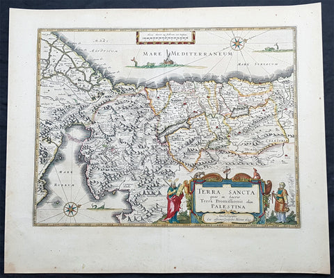
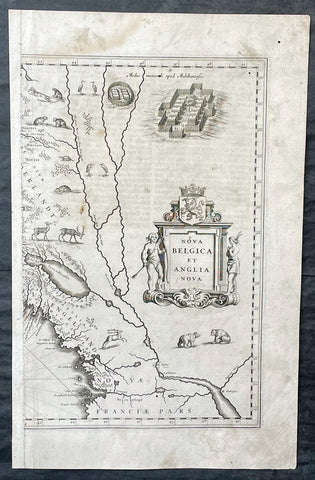
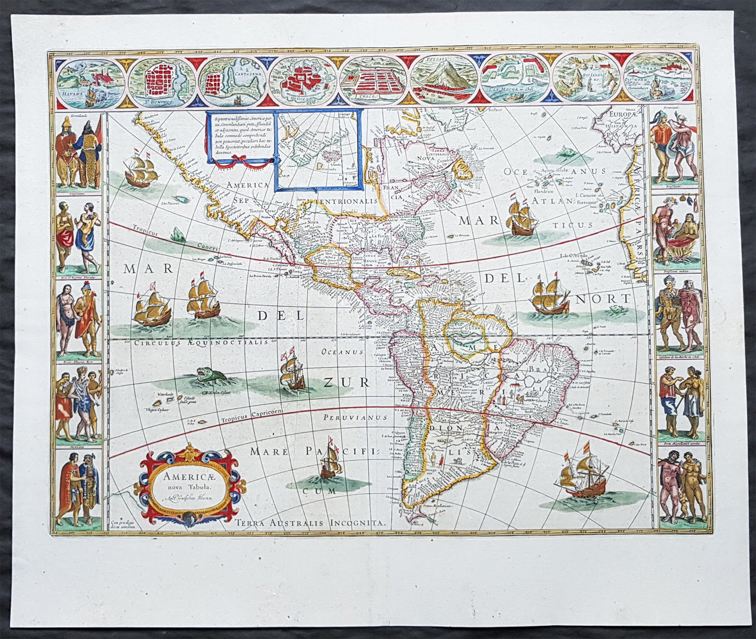
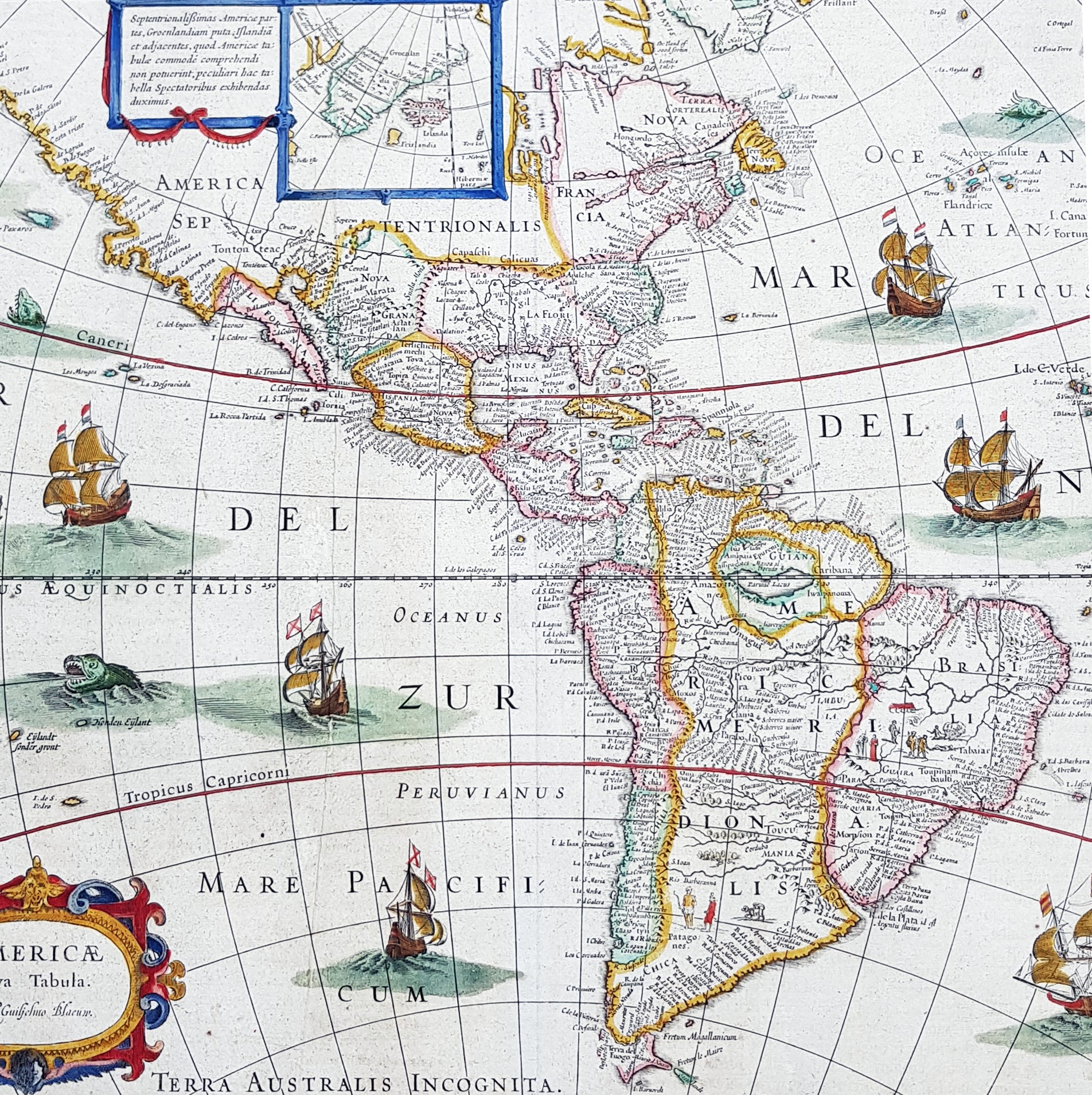
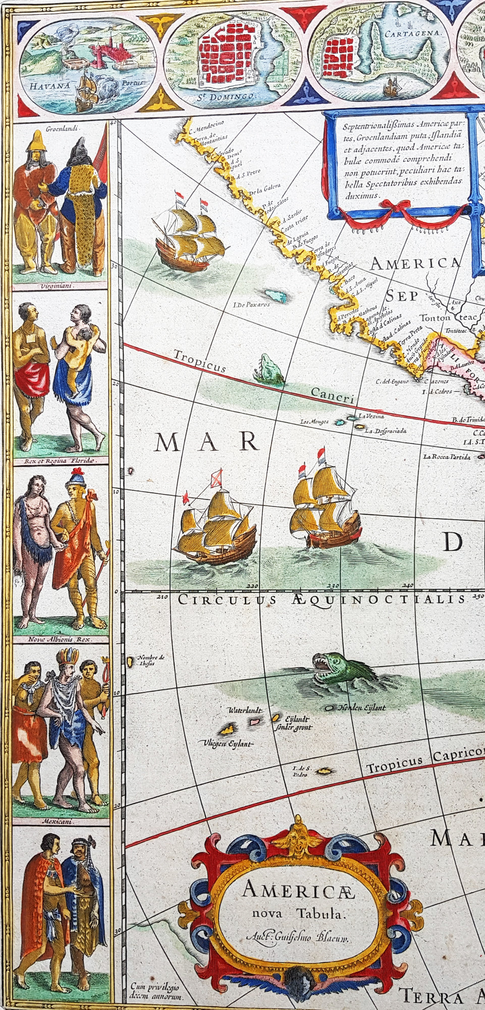
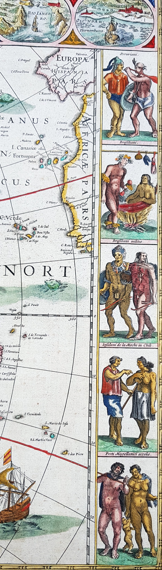
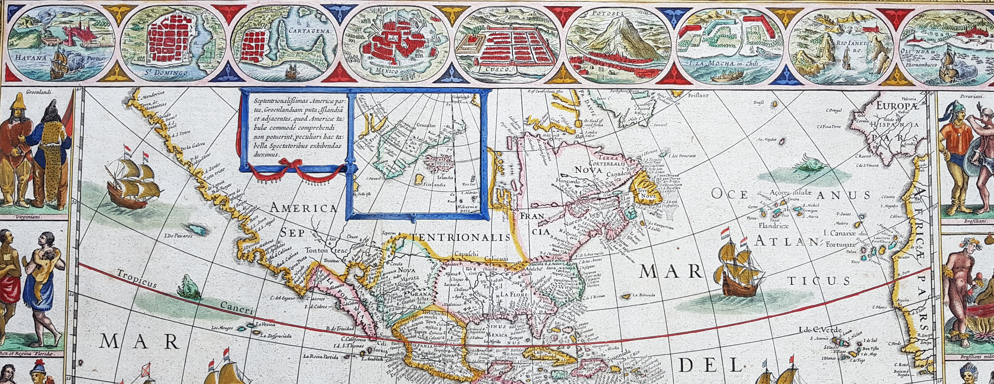
Description:This beautiful, original, hand coloured copper-plate engraved antique map, the quintessential 17th century image of America, The New World, was published in arguably the greatest atlas ever published, the 11th volume of Joan Blaeus 1662 edition of Atlas Major, or Great Atlas, Latin 1st edition.This map was printed from a plate first produced by Joan Blaeus father, Willem in 1617 and was published in Atlas Major for only 10 years, prior to the disastrous 1672 fire that wiped out the Blaeu publishing house. The original colouring is also extremely rare to find and this colouring is exceptional, along with heavy paper, a strong impression and original margins.The New World, originally issued by Joan Blaeus father, Willem,. as early as 1617, this general map of the Americas was one of the longest lived plates in all the Blaeu\'s atlases, having been used as an atlas map from 1630.Here is the general seventeenth century European view of the Western Hemisphere: the delineation of the coasts and the nomenclature of the Pacific as well as the Atlantic coasts are basically Spanish in origin and follow the maps of the Fleming Abraham Ortelius and his countryman Cornelis Wytfliet. To these, Willem Blaeu inserted, on the east coast, the English names given by the Roanoke colonists in Virginia, and by Martin Frobisher, John Davis and Henry Hudson in the far north. In Florida and along the St Lawrence, Blaeu added the names given by the French settlers, almost the only memorials to their ill-fated venture in Florida during the latter part of the sixteenth century.When Blaeu first made his map in the early years of the seventeenth century, Europeans still had no real knowledge of the nature of the Mississippi system. From the expedition journals of Hernando de Soto (1539 - 1543) they had inferred an extensive range of mountains trending eastwards to the north of the Gulf of Mexico in la Florida apparently precluding a great river system. The Great Lakes were as yet unknown although by the time Blaeu issued this map in its atlas form in the Huron region together with the hearsay accounts from Coral Indians were becoming well known through his 1632 map of the region. Evidently, this appears to have been unknown to Blaeu at the time, but surprisingly, he never incorporated the information on later printings of the map. The same applies to Manhattan and Long Island as well, despite the fact that only a short distance from Amsterdam, the Leiden academic Johannes D Late had published the first edition of his monumental work on the Americas which provided source material for any number of maps of the Americas throughout the remainder of the century and beyond. In common with the other general continental maps in Blaeus atlas\'s, he has provided perspective plans or views of settlements in the Americas, including Havana, St Domingo, Cartagena, Mexico, Cusco, Potisi, I.la Moca in Chile, Rio Janeiro and Olianda in Pharnambucco, as well as the vignette illustrations of native figures taken from the accounts of John White (Virginia) or Hans Staden (Brazil) and others. (Ref: Burden; RGS; Koeman; Tooley)
General Definitions:Paper thickness and quality: - Heavy and stablePaper color : - off whiteAge of map color: - OriginalColors used: - Yellow, green, blue, pinkGeneral color appearance: - AuthenticPaper size: - 24in x 20in (610mm x 510mm)Plate size: - 21 1/2in x 16 1/4in (545mm x 415mm)Margins: - Min 1in (25mm)
Imperfections:Margins: - NonePlate area: - Light printer crease along left side of page Verso: - Light age toning
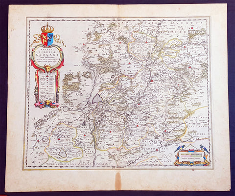
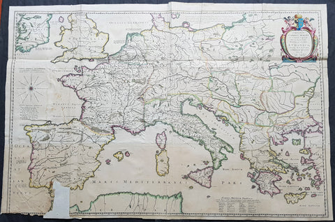
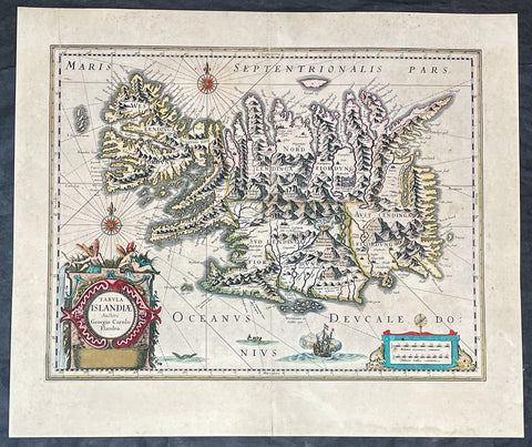
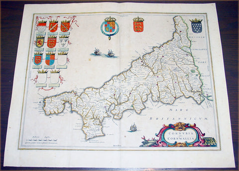
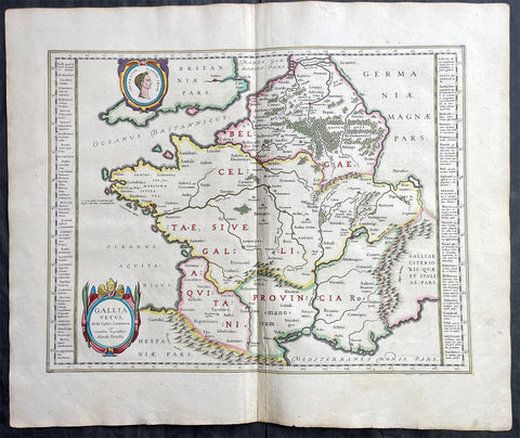
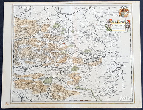
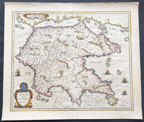
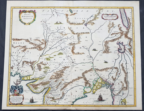
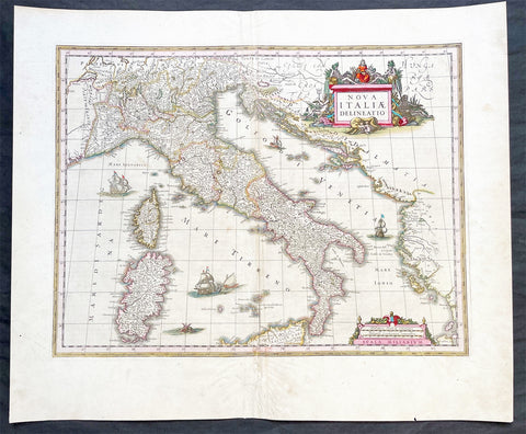
Background: Atlas Major or Great Atlas - During the early hours of the 23rd of February 1672, a fire broke out and engulfed a building on Gravenstraat, in the centre of Amsterdam. Such an event at the time was unremarkable, until it was recognised that the fire had brought to an end of one of the greatest publishing houses of all time. Dr Joan Blaeus family were responsible for printing and publishing some of the most important maps, atlases, religious and philosophical books, that are recognised even today, as remarkable. The fire was described in suitably vivid terms in the annual review publication, De Hollandtse Mercurius for 1672-1673.............the disaster occurred at 3.30 on the morning of the 23rd of February because of the dryness of the timbers, or perhaps the carelessness of the apprentices; the magnificent establishment caught fire, and with it printing type, presses, plates and paper, were all burnt and sparks were sent flying as far as the Tol-heck (Toll Gate). One report put the financial cost of the damage at fl. 27, 000 for the buildings and some fl 355,000 for the plate-stock in the printing works and shop premises, to give total estimated losses of fl. 382, 000 (or about $25milUS in modern terms) together with some four or five thousand reams of paper, five or six thousand sheets, 88 thousand kg. printing type and so on...................The fire precipitated the end of a publishing house established over 40 years before, and very probably contributed to the death of its proprietor, Alderman Dr Joan Blaeu, a year later, effectively ending the reign of one of the greatest producers of printed maps and atlases in publishing history. Only 10 years previously, in 1662, the house had reached its zenith with the publication of its greatest achievement, the Atlas Major or Great Atlas, containing 11 volumes with geographical detail reflecting many of the achievements of the Golden Ageof the United Netherlands. Joan Blaeus 11 volume Atlas Major is considered by many to be the greatest atlas ever published, both in its own time and even today. It excels in comprehensiveness, engraving, color, and overall production. The first Latin edition was published in 1662 and was subsequently published in French, Dutch, German, and Spanish.Most of the surviving copies of the Atlas Major are bound in what might be termed as Standard bindings, in other words, uniform cream-coloured vellum with gilt tooling and lettering. Wealthy clients for the atlas could commission a binder to bind their sets in morocco or even velvet, embellished with their crests of other decorative devices. Such bindings were carried out by the celebrated binder Albert Magnus, who flourished in Amsterdam from the 1660s to 1680. As it appears that Joan Blaeu had no bindery on his premises, it is very likely that Magnus also bound copies in the standard binding. Colour was also a very important consideration. Although the atlas was published in black and white, and could be bought so (without hand colouring) many clients buying the atlas for display in their houses proffered their copies illuminated with rich hand colouring and sometime with gold high lightening. This of course was considerably more expensive, and there were in Amsterdam at the time artists who carried out such work. One of these was Dirk Janszoon van Santen who coloured and gilded maps and atlases to order, examples of which have survived and may be seen in institutional collections.Blaeus atlas was the most expensive printed book in the 17th century. Blaeus catalogue of 1670, his Catalogue des Atlas, Theatre des Citez, quoted prices for the 12 volume French Text edition of the atlas at fl. 450 for a coloured set, and fl. 350 for a black and white set. This is the equivalent of paying around $70,000 today (although to purchase today at auction could be well over $250,000)The original 11 volumes of Atlas Majorcontained the following contents: v 1. Arctica --Europa, liber 1-2:. Norvegia. Dania. Sleswicv. 2. Europa, liber 3-7: Suecia. Russia. Polonia. Regiones orientales ultra Germaniam circa Danubium. Graeciav. 3. Europa, liber 8: Germaniav. 4. Europa, liber 9-10: Belgica regiav. 5. Europa, liber 11: Angliav. 6. Europa, liber 12-13: Scotia. Hiberniav. 7. Europa, liber 14-15: Gallia. Helvetiav. 8. Europa, liber 16: Italiav. 9. Europa, liber 17: Hispania. Africav. 10. Asia v. 11. America.